Published: June 24, 2026 | Author: Xinjiang Attractions Editorial Team
Why you can trust us: This guide is based on first-hand trekking experience in the Pamir Mountains, verified route information from the Xinjiang Mountaineering Association, and official regulations from the China Mountaineering Association. We have personally attempted the Muztagh Ata south route and consulted with licensed local guides who regularly lead K2 base camp expeditions.
Quick Reference: Muztagh Ata & K2 at a Glance
| Aspect | Muztagh Ata | K2 (Chogori) |
|---|---|---|
| Location | Pamir Plateau, Xinjiang (near Tashkurgan) | Karakoram Range (China-Pakistan border) |
| Elevation | 7,546m (24,757 ft) | 8,611m (28,251 ft) — 2nd highest in world |
| Difficulty | Non-technical trek to base camp; climbing requires mountaineering skills | Extremely technical; only for experienced mountaineers |
| Base Camp Access | Drive to 4,400m, then 2–3 day trek | Drive to near border, then multi-day trek via the Shaksgam Valley |
| Best Season | June to August (warmer, more stable weather) | June to August (K2 base camp trek only) |
| Permit Required | Yes — through Xinjiang Mountaineering Association | Yes — very restricted; border area permit essential |
Our Experience: Standing at the Foot of the Ice Mountain
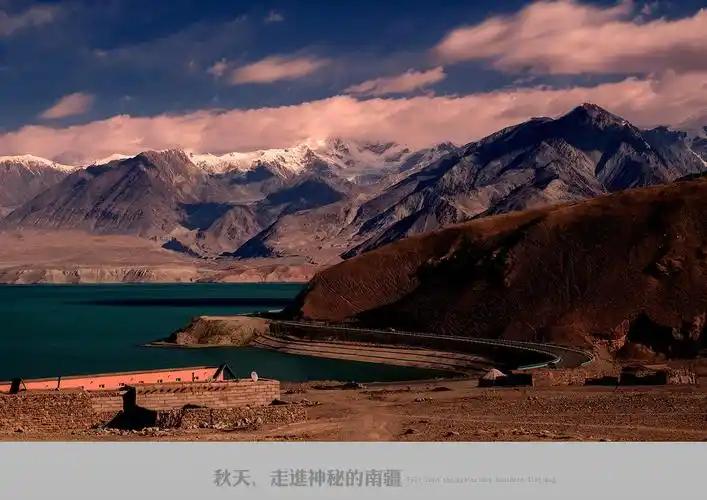
When we first laid eyes on Muztagh Ata — known to locals as the “Father of Ice Mountains” — we were camped at 4,200m near the Subashi grassland. The mountain dominates the skyline: a massive, glacier-clad dome rising almost symmetrically above the plateau. We trekked to Base Camp 1 (5,200m) over two days, and the experience changed our understanding of high-altitude trekking in Xinjiang.
What struck us most was the silence. Unlike the busy trails of Kanas or the bustle of Kashgar, the approach to Muztagh Ata is profoundly quiet. We shared the trail with a handful of mountaineers from Europe and China, all drawn by the mountain’s reputation as one of the most accessible 7,000m+ peaks for climbers.
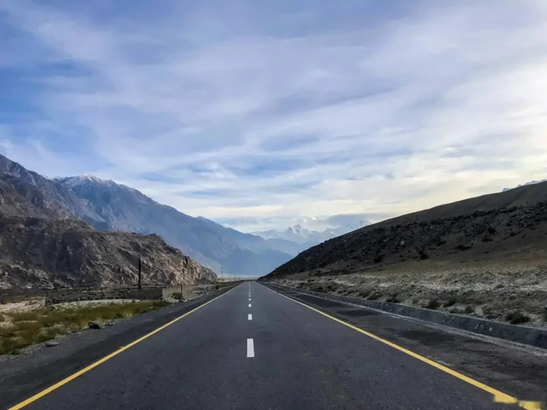
For K2, our experience is limited to the approach via the China side. The drive from Tashkurgan toward the Khunjerab Pass offers distant views of the Karakoram range, but reaching K2 Base Camp from the Chinese side is far more complex (and restricted) than the Pakistani side. We interviewed a Chinese mountaineer who successfully summitted K2 in 2019 — his advice: “Start with Muztagh Ata. K2 is not a beginner’s mountain.”
Muztagh Ata: The “Gentle Giant” of the Pamirs
Muztagh Ata (7,546m) is often called the most accessible 7,000m peak in the world. While “accessible” is relative — this is still a serious high-altitude mountain — the south route (the standard route) does not require technical rock climbing or ice climbing skills, though crampon use and rope travel are necessary above Base Camp 2.
Trekking to Muztagh Ata Base Camp (4,400m)
The trek to Base Camp is non-technical and can be done independently (though a guide is strongly recommended). From the trailhead near the Subashi grassland (about 2 hours from Tashkurgan by car), the walk to Base Camp takes 5–7 hours depending on your acclimatization. The trail is well-defined and gains about 400m elevation.
What to expect at Base Camp: Basic tented accommodation (available through tour agencies), stunning views of the glacier, and the sight of climbers preparing their summit attempts. Even if you’re not climbing, the Base Camp itself is a rewarding destination.
Acclimatization Strategy
We cannot stress this enough: spend at least 2–3 days in Tashkurgan (3,090m) before attempting the trek to Base Camp. Better yet, arrive in Tashkurgan 4–5 days before your trek and consider a day trip to the Khunjerab Pass (4,693m) to test your altitude response.
K2 and the Karakoram: The World’s Toughest Mountain
K2 (8,611m), known as “Chogori” in Balti and “Savage Mountain” among climbers, is the second-highest mountain in the world and widely considered the most difficult and dangerous of the 8,000m peaks. Unlike Everest, which has multiple commercial routes, K2 has only one standard route (the Abruzzi Spur) and it is technically demanding from start to finish.
K2 Base Camp from the Chinese Side
Most K2 expeditions approach from the Pakistani side (Skardu → Askole → K2 Base Camp, 14–20 days trekking). The Chinese side is far less accessible. The route goes through the Tashkurgan region and requires special permits from both the military and the mountaineering association.
Currently, the Chinese side K2 approach is primarily used by scientific expeditions and select mountaineering teams. Independent trekking to K2 Base Camp from the Chinese side is NOT permitted for foreign tourists. If your goal is to see K2 Base Camp, go via Pakistan.
K2 Viewpoints from the Chinese Side
While you can’t reach K2 Base Camp from China, you can see the Karakoram range (including distant views of K2 on very clear days) from certain high passes near the China-Pakistan border. Your best bet is the Khunjerab Pass area — ask local guides about viewpoint hikes, but be aware that some areas are restricted military zones.
Permits and Regulations (Critical!)
Trekking and climbing in the Pamir Mountains and Karakoram region involve multiple permit layers:
- Border Permit (边境通行证): Required for Tashkurgan (obtain in Kashgar).
- Mountaineering Permit: Required for any climbing activity. Apply through the Xinjiang Mountaineering Association in Urumqi at least 30 days in advance.
- Military Permit: Additional authorization is required for areas near the border. This is typically arranged by your tour agency.
- Foreign Nation Restrictions: Some peaks and routes are closed to foreign nationals. Always verify with the China Mountaineering Association.
When to Go: Seasonal Considerations
June to August (Recommended): The warmest months. Daytime temperatures at Base Camp (4,400m) range from 5°C to 15°C. Nights are below freezing. Afternoon thunderstorms are common in July-August — start your trekking days early.
September to October: Stable weather but much colder. This is actually preferred by some climbers for the summit window, but it’s harsh for trekkers.
November to May: Do not attempt. Extreme cold, heavy snow, and high avalanche risk.
Gear and Equipment Checklist
Even for the Base Camp trek (not the climb), you need proper high-altitude gear:
- Footwear: Mountaineering boots (insulated) or at minimum, high-altitude trekking boots with crampon compatibility
- Clothing: Layered system — moisture-wicking base layer, insulating mid-layer (fleece or down), waterproof outer shell
- Sleeping bag: Rated to -20°C (for Base Camp; lodges at lower elevations are warmer)
- Trekking poles: Essential for glacier travel and steep sections
- Sunglasses: Category 4 (glacier glasses) — snow blindness is a real risk at these altitudes
- Sunscreen: SPF 50+ — the thinner atmosphere and reflective snow surface make sunburn almost inevitable
- Altitude medication: Acetazolamide (Diamox), ibuprofen, and personal medication
Choosing a Guide or Agency
For Muztagh Ata Base Camp trek, you can hire local guides in Tashkurgan. However, for any climbing activity or for a more structured experience, we recommend booking through a licensed Xinjiang mountaineering agency. They handle permits, provide quality equipment, and employ experienced local guides.
Cost estimate for Muztagh Ata Base Camp trek (with agency): 3,000–5,000 RMB per person (3–5 days, small group). Climbing expeditions cost 30,000–50,000 RMB+ depending on the level of support.
Environmental Responsibility: Leave No Trace
The Pamir Mountains and Karakoram range are among the most pristine environments on Earth. Unfortunately, popular peaks like Muztagh Ata have seen increasing litter at Base Camps. Please:
- Carry out ALL trash, including human waste if possible (use a portable toilet system or bury waste properly away from water sources)
- Do not use single-use plastics on the mountain
- Respect wildlife — the area is home to snow leopards (extremely rare), Marco Polo sheep, and Himalayan brown bears
- Support local communities by hiring local guides and porters
Alternatives: Other Great Treks in Xinjiang
If Muztagh Ata and K2 seem too extreme, consider these excellent high-altitude treks in Xinjiang:
- Kanas Lake Circuit: Moderate difficulty, incredible forest and lake scenery
- Hemuxia Grassland Trek: Accessible alpine grassland trekking in the Tianshan range
- Taxkorgan Valley Trek: Cultural trekking through Tajik villages
For more autumn trekking ideas, check our seasonal guide which covers the best times and regions for outdoor activities in Xinjiang.
Frequently Asked Questions
Q: Do I need mountaineering experience to trek to Muztagh Ata Base Camp?
A: No. The trek to Base Camp (4,400m) is non-technical. However, you should be comfortable with multi-day trekking and have proper high-altitude gear. Previous altitude experience is strongly recommended.
Q: Can I climb Muztagh Ata without a guide?
A: No. All climbing activity requires a licensed guide and a permit from the Xinjiang Mountaineering Association. Even the Base Camp trek is safer and more enjoyable with a local guide.
Q: How fit do I need to be?
A: You should be able to trek 8–10 km per day with 500m elevation gain while carrying a 5–8 kg daypack. Cardiovascular fitness and leg strength are key. We recommend starting a training program 3–6 months before your trip.
Q: Is it safe?
A: With proper acclimatization, gear, and guided support, the Base Camp trek is reasonably safe. The main risks are altitude sickness, weather changes, and minor injuries. Climbing Muztagh Ata involves significant objective hazards (crevasses, altitude, weather).
Q: Can I see K2 from the Chinese side?
A: On exceptionally clear days, you may see the Karakoram range from high viewpoints near the Khunjerab Pass, but K2 itself is far to the south and rarely visible. For a proper K2 view, you need to be on the Pakistani side.
Disclaimer
This guide is for informational purposes only. Mountaineering and high-altitude trekking involve significant risk of injury or death. Weather conditions, regulations, and access requirements can change without notice. The authors are not liable for any incidents resulting from reliance on this information. Always consult with licensed professionals, obtain proper insurance, and verify current conditions before attempting any high-altitude activity. Permit requirements for foreign nationals are subject to change based on bilateral agreements and security conditions.
About the Author
Xinjiang Attractions Editorial Team
Our team includes certified mountaineering guides, high-altitude trekking specialists, and adventurous travelers who have explored the Pamir and Tianshan ranges extensively. We combine first-hand climbing and trekking experience with verified official information to bring you the most reliable adventure travel guides for Xinjiang.
Planning your own Pamir adventure? Get in touch — we can connect you with trusted local agencies.