Published: September 12, 2026 | Author: Karl Huang, travel writer based in Urumqi
Search for the Bayi Reservoir and you will mostly dig up Chinese-language dam safety paperwork, wire copy from 2004, and nothing that tells a traveller what to do. So here is the honest version: the Bayi Reservoir in Wujiaqu, Xinjiang is not a scenic lake, and it was never meant to be one. It is a flat, working irrigation reservoir on the southern lip of the Junggar Basin, run by a regiment of the Xinjiang Production and Construction Corps, and for most of two decades its water was poor enough that locals gave it a wide berth. I have been out to the 102nd Regiment’s ground twice, once in June and once under frost, and this page is what the documents say plus what the ground shows.
Why You Can Trust This Page
The engineering figures come from the reservoir’s own dam safety emergency plan, prepared by the regiment that manages it. The 2004 timeline is rebuilt from China News Service reporting filed at the dam during the emergency, plus a China National Radio follow-up that September. The water quality record comes from the Corps’ water resources bureau, which published a rectification disclosure in December 2020 after a central environmental inspection. The 2026 restoration contract appeared on the Sixth Division’s official broadcast platform in late July 2026. Where sources disagreed, I say so rather than picking the rounder figure.
Bayi Reservoir at a Glance
| Location | Wutong (102nd Regiment), Wujiaqu City, Sixth Division, XPCC; about 62 km north of Urumqi and 24 km north of Wujiaqu’s urban core |
| What it is | Mid-sized flatland irrigation reservoir and counter-regulation pond for the Mengjin (Qinggeli) Reservoir |
| Built | Construction from 1952; holding water by 1957; emergency reinforcement 2003 to 2005 after the January 2004 breach |
| Storage | Designed 30 million cubic metres, checked capacity 35 million, effective roughly 28.8 million |
| The dam | Homogeneous earth fill, just over 10 km long, at most 9 m high, 5 m wide at the crest |
| Water source | Deliveries from Mengjin Reservoir plus snowmelt from the Ganquanbao mountain front; inflows also arrive via the Laolong and Heigou channels |
| Visitor status | No gate, no tickets, no facilities as of September 2026; a “tourism zone” exists only on the town’s master plan |
| Coordinates | 44.2262 N, 87.6586 E |
A Dam First, a Destination Never
Every odd thing about this reservoir makes sense once you know who built it. In March 1952, Wang Zhen picked the site himself for the army’s first large mechanised state farm here, on scrubland called Wutongwozi. The farm took the name Bayi Farm that September, “Bayi” meaning August 1st, the army’s founding date, and in 1969 it was renumbered as the 102nd Regiment. The reservoir that fed its fields kept the farm’s name. Construction began in 1952 and water was impounded by 1957.
Hydraulically it plays second fiddle to Mengjin Reservoir upstream, the recreational water everyone calls Qinggeli Lake. Bayi sits lower in the system as its counter-regulating reservoir, one link in a chain of working dams most visitors never photograph. Water arrives through a dedicated channel from Mengjin, topped up by snowmelt off the Ganquanbao front, and in a normal year about 55 million cubic metres turn over for irrigation. This pond refills and drains again and again rather than sitting pretty.

The regiment’s street names still carry the history. The town government sits on Bayi South Road, and when the regiment was incorporated as the town of Wutong in August 2012, the approval’s boundary description ran “north along the Bayi Reservoir spillway.” For people here, the reservoir is not scenery. It is the reason the town exists.
The Night the Dam Failed, January 2004
The event that dominates every serious search result about this place deserves a straight telling. Wujiaqu City had been formally inaugurated on 19 January 2004. Three days later, on 21 January, Lunar New Year’s Eve, a patrolling technician spotted a leak at the spillway culvert outlet at about half past one, discharging around 50 litres per second. By five o’clock it pushed a full cubic metre per second, and rescuers could not reach the entrance because 60 centimetres of ice sealed the lake. By eight that night the flow hit 30 cubic metres per second and the embankment was caving.
The crest held overnight as a bridge of frozen soil, then collapsed at eleven the next morning. The breach grew past 30 metres with about 240 cubic metres per second pouring through, and stabilised at 45 metres along the crest. By 24 January the reservoir had effectively emptied, flooding six downstream company settlements, close to 30,000 mu of farmland, and collapsing 1,851 rooms for a reported loss above 13 million yuan. Over a thousand soldiers and police worked the gap far below freezing, one wire photograph showing water “like an unbridled horse” rolling through the ninth company. Investigators pinned the failure on uneven settlement of hastily placed fill around a culvert rebuilt only weeks earlier, refilled before the embankment had settled. Eight hundred ninety-three displaced households were in new houses by that September.

On my second visit I walked the repaired section and found no marker, no plaque, nothing to tell a passerby what happened in January 2004. The breach was rebuilt into the 10-kilometre embankment like any other segment. That absence says something about how regiment communities metabolise their own history.
The Water It Inherited
The breach was sudden; the slower problem was water quality. Two channels, the Laolong He and the Heigou He, feed the reservoir from the direction of Urumqi, and for years what came down them was largely the city’s wastewater. The Corps’ water resources bureau stated in its December 2020 disclosure that this inflow had run at worse than Grade V, the bottom of China’s scale, leaving the reservoir seriously polluted, and that the outflow then dragged the load onward into the Dongdaohaizi wetlands in Midong District.
For a traveller, this explains what you notice on the ground: no beaches, no swimmers, none of the fish restaurants you would expect beside a lake this close to a capital. The water was working water, and for a long time it was not even good working water.
What Changed After 2018
The clean-up has been incremental and bureaucratic, which is why I trust it more than a ribbon-cutting. In June 2018 the Sixth Division finished a “one lake, one policy” protection plan, and by late August, monitoring sections were running at both inflow channels and the outfall. Corps inspection teams followed up twice in 2019.
The newest round is why this page exists now. On 27 July 2026 a contractor won a 16.69 million yuan design-build contract for a water ecology upgrade on a 149-day schedule. The scope reads like a checklist of everything the inspection flagged: a 15,000 square metre constructed wetland to polish the inflow, two kilometres of ecological revetment, 150,000 square metres of lakeshore restoration, a sediment forebay and continuous online monitoring. Go in 2027 and the shoreline may differ from the one I saw.
What a Visitor Actually Finds
Set expectations properly. There is no gate, no ticket booth, no boardwalk, and no signposted viewpoint in any language. The town master plan nominates a “Bayi Reservoir tourism zone” as one of four development areas, but as of September 2026 that is zoning language. What exists is a long earth embankment, a concrete spillway, pumps, fences, and farmland to the horizon.
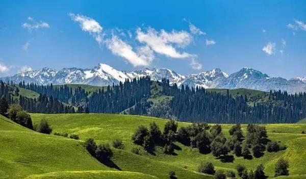
When I went in June the light did the work: green fields, a hard blue sky, the Bogda snow line sharpening the southern horizon. In the cold season the pond freezes across, and the ice fishing you might hope for does not exist because there is no fishery here. Local people walk the dam crown in the evening and nobody stopped me doing the same. Keep off the gated sections, and do not swim.
Getting There If You Have a Reason
The reservoir sits 62 kilometres from Urumqi and 24 kilometres north of central Wujiaqu by the dam plan’s own figures. Take the expressway up to Wujiaqu, about an hour, then continue north on the Ganmo Highway corridor toward Wutong town, a straight last stretch shared with slow farm traffic. Without a car, ride to Wujiaqu, then take a taxi for the final 20 to 30 minutes; no public transport reaches the embankment, so have the driver wait, since taxis back from Wutong are scarce outside school hours. Pair it with Qinggeli Lake in Wujiaqu, which our separate guide covers properly, since the two waters stack in one system and make a natural single outing.
Choosing a Month: Ice, Wind and Harvest
The plain runs hot in July and bitter in January, with spring winds that sandblast your patience. For comfort I would pick late May through June, when fields are green and the light stays late, or September into early October, when harvest turns the plots gold. August works if you want the canals running hard, because the counter-regulation cycle is at full tilt. Winter is historically the season that matters here, but for a visitor it is mostly black ice on the highway north.
Where to Sleep That Night
Wujiaqu’s urban core, half an hour south, is the sensible base: chain hotels near the civic centre, rooms from about 150 to 300 yuan, enough restaurants to fill two evenings. Urumqi is only an hour back, so most travellers sleep in the city and day trip it. Wutong town has a handful of basic guesthouses, adequate for a delay but not somewhere I would book ahead. Reserve before a summer weekend, because Urumqi families flood north to Qinggeli Lake and vacancy evaporates.
Eating in Wujiaqu After the Dam
Regiment-town cooking is Xinjiang farm cooking at its most direct. In Wujiaqu look for dapanji, big-plate chicken, hand-pulled laghman noodles, and samsa baked against a tandoor wall. Tomato and chili fields a few kilometres out supply the tables, and late-summer melons need no argument. One tip from my visits: eat lunch in Wutong rather than saving appetite for Wujiaqu, because the noodle shops around the regiment market close mid-afternoon.
A Half-Day Loop That Makes Sense
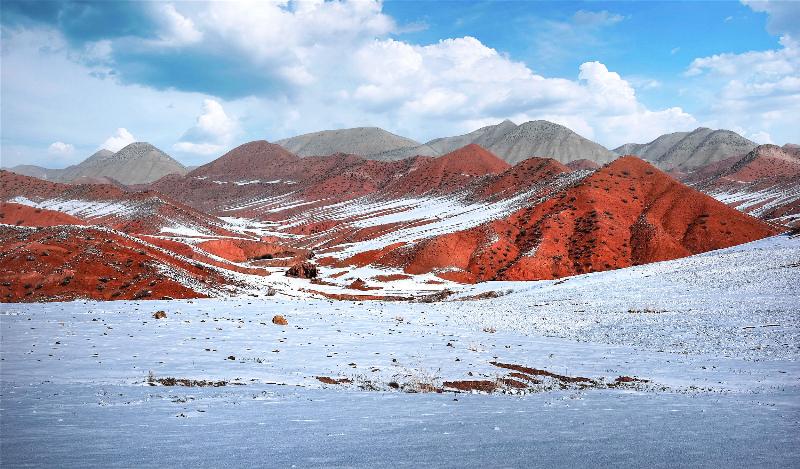
Leave Urumqi by eight and reach Qinggeli Lake’s shoreline by nine-thirty while the birds still work the reeds. Give the lake two hours, then drive north through Wujiaqu to Wutong town for an early lunch in the regiment market. Spend forty minutes on the embankment crown near the spillway, then swing back south. With energy left, bend west toward Changji, Urumqi’s quieter neighbour, whose red hills repay a detour on their own. You will be home before dusk.
Practical Tips
- Navigation: pin “Wutong Zhen” or coordinates 44.2262, 87.6586 rather than the reservoir’s Chinese name, which maps apps sometimes match to the wrong water body.
- Bring water and sun protection; there is no shade on the embankment and no kiosk for a very long way.
- Winter visitors: take a car with snow tyres or a driver who knows the road. The 2004 disaster began on an icy January afternoon.
Frequently Asked Questions
Is the Bayi Reservoir the same as Qinggeli Lake?
No. Qinggeli Lake is Mengjin Reservoir, the larger upstream water with the beaches and the tourist zone. Bayi is the smaller counter-regulation pond downstream, connected to it by a delivery channel, and it has none of the visitor facilities.
Why is it called Bayi?
From the Bayi Farm that built it in the 1950s, named for August 1st, the army’s founding day. The name survives in Bayi South Road and in the reservoir itself.
Can you fish or swim there?
No swimming, and I would not eat anything caught there either. There is no public fishery, and the water quality record gives pause even as it improves.
Is it dangerous?
The dam was rebuilt after 2004, instrumented with piezometers and settlement gauges since 2005, and has passed repeated inspections. The realistic hazards for a visitor are traffic, ice and sun, not the embankment.
Disclaimer
This page reflects conditions as of September 2026. Access rules, construction around the 2026 ecology project, and local regulations change without notice; verify on the ground and follow posted restrictions. Figures come from official documents and news reports, and honest corrections are welcome.
About the Author
Karl Huang is a travel writer based in Urumqi since 2017, mapping the working landscapes most guidebooks skip: irrigation oases, regiment towns and farm country between Urumqi and Shihezi that show how Xinjiang actually functions. His guide to Chaiwopu Lake and the rest of the northern waters appear across this site. He drives these routes himself and updates pages when conditions change.