Published: August 7, 2026 | Author: Nina Ostrowska, road-trip and mountain writer based in Beijing | Visited Kalajun in June 2023, July 2024 and June 2026
Most people picture a flat prairie when they hear the word “grassland.” Kalajun Grassland is not that. It is a ridgeline wilderness of rolling humps, cliff edges, and flower carpets that drops straight into the Koksu River canyon. The Kazakh name roughly translates as “the wilderness on the ridge,” and after three visits I still think that is the most accurate description anyone has found.
Kalajun sits in the Ili Valley, about three hours south of Yining and half an hour above the eight-trigram town of Tekes. In 2013 it became one of the four components of the Xinjiang Tianshan UNESCO World Natural Heritage site. This page explains what the two zones are, when the flowers actually peak, and how to avoid the mistake I made on my first trip: trying to see it all in one day.
Quick reference: Kalajun at a glance
| Item | Detail |
|---|---|
| Location | Tekes County, Ili Prefecture, Xinjiang |
| Elevation | 1,600–2,800 m |
| Two zones | Kalajun Grassland + Koksu Grand Canyon |
| Distance from Yining | ~150 km, 2.5–3 hours by road |
| Distance from Tekes | ~30 km, 45–60 minutes |
| Best months | Mid-June to mid-July for wildflowers |
| Entry ticket | Separate or combined scenic-area tickets |
| Internal transport | Mandatory shuttle; limited self-drive route |
Why Kalajun looks different from Nalati or Bayanbulak
The first time I drove up from Tekes I expected something like Nalati: wide river valley, gentle slopes, wooden walkways. Instead the road climbed onto a narrow ridge and the land folded away on both sides like a green duvet. That is the signature here. The meadows are not in a valley; they sit on a high mountain spine between the Ili basin and the Koksu River gorge.
The result is what locals call the “human-body grassland.” From the Falcon Terrace viewpoint the rolling slopes catch side-light at sunset and look like the curve of a back or a hip. It is not a gimmick. It is just what happens when glaciers, rivers, and grazing animals shape a ridgeline over thousands of years.
The grassland half: Flower Terrace and Falcon Terrace
Most visitors enter through the Bulake ticket station and take the shuttle to Shiquan, then on to Xianhuatai, the Flower Terrace. In mid-June the slope is a solid carpet of purple, yellow and white blooms. I have seen travel writers call it “breathtaking” so often that the word has lost its meaning. What struck me was the smell: wild thyme and something sweeter I could not name, rising off the grass after an afternoon shower.
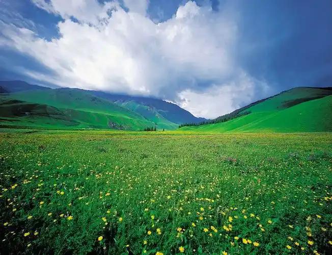
From the Flower Terrace a wooden walkway runs about 6 km toward Lieyingtai, the Falcon Terrace. You can walk it in under two hours if you stop for photos, longer if you do not. Kazakh herders rent horses at the upper end. On my second visit I rode a short loop with a guide whose grandfather still keeps eagles in the winter. The horses are small, calm, and used to beginners. If you want a multi-day trek toward Qiongkushitai, read our Xinjiang horse trekking notes before you book anything.
The canyon half: Koksu’s three viewpoints
The second zone is the Koksu Grand Canyon, and it feels like a different country. You descend from the grassland by cable car or shuttle to the river, then follow the canyon rim west. The three main stops are Crocodile Bay, the Human-Body Grassland viewpoint, and the Nine Bends of the Koksu River.
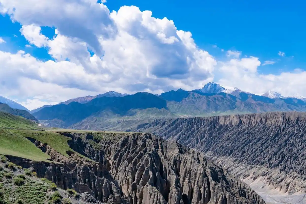
Crocodile Bay is named for a rock ledge that juts into the greenish river and, if you squint, resembles a crocodile snout. The water colour comes from copper minerals in the soil, not pollution, and it changes with the light. The Human-Body Grassland viewpoint is where you get the famous ridgeline curves. I took my best photo here at 20:15 in late June, when the low sun turned the grass gold against the shadowed canyon. The Nine Bends is a wide meander best shot with a drone or a long lens from the upper platform.
Getting there: the practical chain
The nearest airport is Yining. From there you have two options. The easiest is to hire a driver or rent a car and follow the G218 and X765 to Tekes, then continue south to the Bulake ticket station. The drive from Yining takes about three hours. The alternative is a long-distance bus from Yining to Tekes, then a local taxi or arranged transfer to the park gate. That second leg is only 30 km but can take an hour on rural roads shared with sheep trucks.
Once inside, private cars are restricted. The scenic area runs shuttles on fixed routes between the grassland and canyon gates. A separate self-drive ticket exists for a designated loop, but it sells out quickly in peak season and does not cover the canyon viewpoints. I tried it once and ended up parking halfway and taking the shuttle anyway.
The best months are narrower than the brochures suggest
Green-up starts in late May. By mid-June the Flower Terrace is in full bloom. July brings the deepest grass and the biggest crowds. August is still green but the main flower show is over. September gives golden morning light and fewer people, though you risk snow closing the upper ridge.
If I had to pick one window, it would be the last ten days of June. The flowers are still fresh, the herders have moved their summer camps up, and the thunderstorms have not yet turned the shuttle roads to mud. In July 2024 I arrived on the 15th and the main terrace was already trampled in places by domestic tour groups.
Sleeping inside the park versus sleeping in Tekes
There are two ways to do this. You can stay inside the scenic area in a Kazakh yurt or a wooden cabin, which puts you on the ridge for sunrise and sunset. Prices in summer run from 300 to 600 RMB per person including dinner and breakfast. The yurts are atmospheric but cold at night even in July. Bring a sleeping-bag liner.
Alternatively, stay in Tekes. The town has more hotels, better restaurants, and cheaper prices. The trade-off is the 30 km drive each morning. On my first trip I stayed in Tekes and regretted losing the golden hour. On my second trip I stayed in a cabin inside the park and regretted the dinner. My compromise now is one night on the ridge and the rest in town.
Food: what we ate and what we should have eaten
The yurt dinners are predictable: lamb pilaf, hand-pulled noodles, mutton soup, and milk tea. The quality depends on the family. One host near the Flower Terrace served us lamb so tender it fell off the bone; another gave us reheated rice and a packet of instant noodles. If you have dietary restrictions, carry snacks. There is no supermarket on the ridge.
In Tekes, the night market near the central roundabout does excellent grilled lamb skewers and fresh naan. The town also has a small shop selling Kazakh kurt, the dried yoghurt balls that work well as trail food. I now buy a bag on arrival and keep it in my daypack.
The three photography mistakes I made
First, I brought only a wide-angle lens. The ridgeline curves need a telephoto to compress the layers. Second, I scheduled the canyon for midday. The light is flat then; late afternoon is far better for the canyon walls. Third, I tried to fly a drone at the upper grassland without checking. The border zone rules change, and drone use is often restricted in the park. Ask at the ticket office and carry your passport.
Two ways to do it in two days
Plan A: two full days inside the scenic area
Day 1: Enter through Bulake, shuttle to the Flower Terrace, walk to Falcon Terrace, overnight in a ridge cabin or yurt. Day 2: Sunrise on the ridge, descend to Koksu Canyon, visit Crocodile Bay and the Nine Bends, exit from the canyon gate.
Plan B: combine with an Ili loop
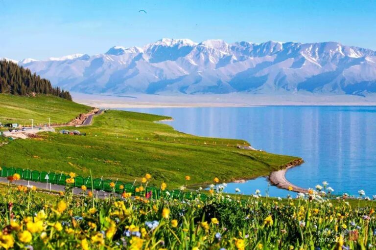
Day 1: Drive Yining to Sayram Lake, overnight. Day 2: Sayram to Kalajun via the G219, spend the afternoon on the grassland, sleep in Tekes. Day 3: Koksu Canyon in the morning, then continue south or return to Yining. This loop is the most efficient use of time if you are also visiting the Ili Valley.
Frequently asked questions
Do I need a guide for Kalajun?
No for the marked scenic routes. Yes if you want to trek into the backcountry toward Qiongkushitai or along the old nomad trails.
Is altitude a problem?
The ridge tops out around 2,800 m. Most people feel fine, but you will notice the thinner air if you run uphill. Take it easy for the first few hours.
Can I visit in winter?
The upper road and many facilities close from November to April. Late spring snow can also delay the opening. Check with the Tekes tourist office before planning a winter trip.
What is the difference between Kalajun and Qiongkushitai?
They sit on the same mountain chain but are reached by different roads. Kalajun is a managed scenic area with shuttles and ticket gates. Qiongkushitai is a village with dirt roads and a more remote feel. You can trek between them in two to three days.
Disclaimer
The information here comes from my own visits and from signage I photographed in the scenic area. Ticket prices, road conditions and shuttle schedules change. Confirm the latest details before you travel, especially the 2026 self-drive reservation rules. This article contains affiliate links to none; all recommendations are independent.
About the author
Nina Ostrowska is a Beijing-based travel writer who specialises in road trips and mountain regions of western China. She has driven the Duku Highway, the Pamir Highway and most of the Ili loop. Her work has appeared in travel guides and outdoor magazines across Asia.