Published: September 9, 2026 | Author: Karl Huang
Why you can trust this page: I have been through the gate at Jiangbulake Xinjiang three times, once in the green of June and twice after the harvest, and I slept at Banjiegou on the last trip to test whether staying close to the park is worth it. The figures below come from the scenic area’s posted tariff, the Xinjiang Institute of Cultural Relics and Archaeology’s excavation notes on the Shichengzi fort, the county government’s announcement of the airport opening, and my own ticket stubs. Where a claim is folklore rather than record, I say so.
The basics, in one table
| Item | Detail |
|---|---|
| Where | Banjiegou Town, Qitai County, Changji Hui Autonomous Prefecture, northern slope of the eastern Tianshan |
| Name | Kazakh for “source of the holy water” |
| Status | National 5A scenic area since July 2022 (4A from 2012) |
| Elevation | Most of the road sits between 1,700 and 2,200 m |
| Tickets | Peak 55 yuan (1 May to 15 Oct), off-season 25 yuan |
| Shuttle | 15 yuan one way, 30 yuan return |
| Self-drive | 100 yuan per car, seven seats or fewer |
| Hours | 09:30 to 20:00 daily in season |
| Nearest airport | Qitai Jiangbulake Airport (JBK), 15.7 km from the county town |
“Source of the holy water” is a promise this valley keeps
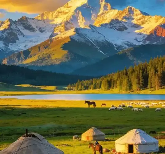
The name gets printed on every ticket and most visitors never think about it again. It is worth taking seriously, because water is the plot of this place. The Xinhu River runs the length of the valley: up top it feeds the spring pools and the yurt pastures, and downstream it gathers in Shengxian Lake, the reservoir that Qitai farmers call their insurance policy. From there the water is lifted into canals that reach the dryland wheat belt on the desert edge. When we walked the upper meadows in June the river was loud enough that we stopped talking, and by the time it leaves the park it has already done a day’s work.
The Han fort above the wheat
On a ridge at Magouliang, inside the scenic area, sit the tumbled walls of Shichengzi, which archaeologists now identify as the Han-dynasty fortress of Shule. In AD 75 General Geng Gong held this place through a winter siege with a few hundred men against the Northern Xiongnu, and the gully below the walls still carries the stream that the histories credit with keeping the garrison alive. The State Council listed the site in 2013. Excavation teams working from 2014 uncovered the gatehouse in 2018 and found the city had burned. It is an active dig, fenced and unlit, so you view it from the track; even so, standing on the rampart with wheat on three sides and snowline behind is the single most historical thirty minutes you can spend in this park.
Daotiaoling, the ridge with a knife in its name
Between the pastures and the peaks rises a crest that locals call Daotiaoling, the knife-handle ridge, because a long snowback stands up against the sky like a blade laid flat. Most day-trippers photograph it without learning the name. It marks the seam where the farmland stops and the Tianshan starts, and on clear June mornings the light hits it before anything else in the valley.
Two hundred and ninety metres of optical argument
The Tianshan Mystery Slope is the park’s oddest exhibit: a 290-metre stretch of road where a car in neutral appears to roll uphill. It is an optical illusion of the standard kind, a tilted horizon fooling your inner ear, but the certificate on the noticeboard says Guinness accepted it in 2005 as the world’s number one mystery slope, and operators rent out solo bikes for 20 yuan so you can feel the wrongness in your legs. We pushed a water bottle along the tarmac and watched it coast uphill for a good ten metres. Physics loses nothing by the explanation; the giggling from the bike riders is the real show.
The ponds that have never been recorded dry
High on the flank below the spruce line sit two pools, a big one and a small one, that Kazakh herders call the holy water and the park labels Hei Lao Ba. No stream feeds them from the surface. Water seeps up from below, beads all year, and the ponds have no recorded dry date in living memory, which in a county that measures rainfall in millimetres is close to a miracle. Even in the second week of August, when the meadow above was bleaching gold, the pool water stayed cold enough to numb a wrist in seconds.
How the park actually fits together
Signage talks about five zones and eighteen sights, which sounds like marketing until you realise the shuttle route simply reads them out in order: visitor centre, Tian Shan Wheat Sea, the mystery slope, Happy Valley, Huahaizi, the canyon, and on to Hei Lao Ba at the far end. The paved loop runs 51 kilometres. Traffic is one way for private cars, and self-drive vehicles exit by the west ring so the flow never tangles. If you ride the shuttle, treat the stops as a buffet rather than a checklist; the wheat-sea boardwalk and the canyon are the two you should not skip.
Walking instead of driving
There are more than 30 kilometres of timber boardwalk threaded through the park, and they change the character of a visit. The canyon walk follows a rift about 15 kilometres long at an average height of 1,900 metres, exactly where the low grassland hands over to forest, and cloud sits in it most mornings. From the Broken Bridge trailhead a path climbs through old spruce into genuine silence; we met four people in three hours. For a gentler option, the boardwalk that dives into the wheat sea itself lets you stand with the stalks at chest height, which is the photograph everyone is actually trying to take.

Three ways in, and what each really costs
A day ticket costs 55 yuan in peak season and 25 yuan from mid October through April. The shuttle adds 15 yuan each way, so 30 return, and it is the sensible choice if you are not confident on mountain switchbacks. Drivers can take their own car in for a flat 100 yuan per vehicle, seven seats or fewer, which works out cheaper than four shuttle returns and lets you chase light rather than timetables. Two quirks worth knowing: entry runs 09:30 to 20:00 in season, and through 2026 visitors with Fujian ID cards enter free under the province’s aid-Xinjiang partnership, which surprised a Xiamen couple we shared a table with at Banjiegou.
Flying to Qitai is now a real option
Until 2024 the standard route was three hours on a coach from Urumqi. That changed on 8 August 2024, when Qitai Jiangbulake Airport handled its first flight as the twenty-sixth civil airport in the region and the first in Changji Prefecture. The field sits 15.7 km from the county town and was built for around 470,000 passengers a year; the 2026 timetable already links Qitai with Xi’an, Lanzhou, Jinan, Yining, Aksu and Altay. For travellers stitching together a northern loop, you can now fly into Qitai, see the wheat, and fly on to the Altay mountains without touching Urumqi twice. Our Xinjiang airport guide covers the connections in detail.
Choosing a fortnight by crowd, not just colour
Most coverage ranks the weeks by wheat colour, so here is the crowd calendar instead. The Wheat Field Art Festival now lands in mid July and doubles local visitor numbers for about ten days. Weekends in late July and August run at capacity, with shuttle queues at the wheat-sea stop after 11:00. The quietest good-weather windows are mid June on weekdays and the second half of September, once the combines finish and the tour coaches move on. If your dates are fixed to the National Day holiday, arrive at the gate before 10:00 and walk the far end of the loop backwards, against the flow.
Sleeping at Banjiegou instead of commuting
The gateway settlement of Banjiegou sits a few minutes below the park gate and has quietly become a strip of family guesthouses, noodle shops and parking yards. Rooms are simple, heating is a stove, and prices roughly double during the festival fortnight. Inside the park the tourist distribution centre runs a hotel and there is a second property near the shuttle hub, convenient for dawn photography but booked out weeks ahead in August. The county town, 45 minutes away, has the proper chain hotels and better food, and suits people who would rather commute than compromise on the mattress. We tried the guesthouse first and would repeat it for the 07:00 light alone.
What reaches the table in Banjiegou
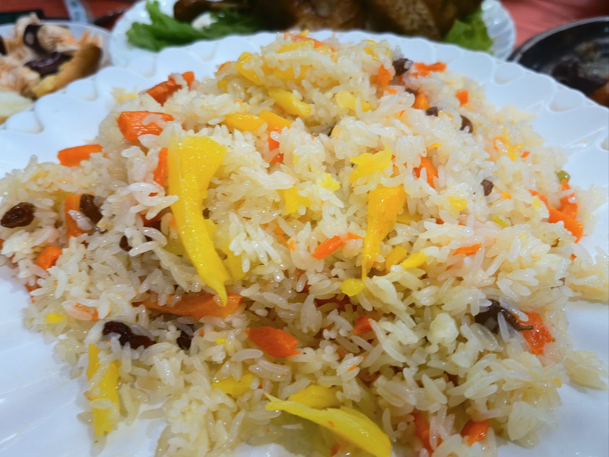
Qitai flour carries a national geographical-indication mark, and this is the county to eat noodles made from it: hand-pulled laghman with lamb and peppers, or a simple bowl of plain noodles that tastes of something, which is not a sentence I write often. Around it sit the usual northern-Silk-Road plates, roast lamb, baked buns blistered in a tandoor, and pilaf heavy with carrot and mutton fat for cold evenings. Guesthouse dinners cost more than the town restaurants two minutes away and are not always better; we ate our best meal of the trip, a 40-yuan plate of noodles, at a counter next to the hardware store.
Mistakes I made so you do not have to
First, dress for autumn even in summer: the valley sits near 2,000 metres, the temperature dropped about ten degrees the evening we stayed, and I had packed for Urumqi. Second, the UV at this elevation is fierce behind cloud; a hat is not optional. Third, fill the tank in Qitai town, because the park has no petrol station and the detour back down the hill costs an hour. Fourth, phone signal holds on the loop but thins on the hiking trails, so download an offline map before the gate. Finally, if you plan to photograph the fort, bring a long lens; the fence keeps you a fair distance out, and rightly so.
A two-day plan at a slower pace
Day one: leave Urumqi after breakfast, check into Banjiegou by mid afternoon, then ride the shuttle straight to the wheat-sea boardwalk for the warm light, and stay for the sky show after dinner, which out here means more stars than you can count. Day two: enter at 09:30 when the gate opens, drive or ride to the fort viewpoint while the light is still low, then work back along the loop through the mystery slope, break for noodles, walk the first two kilometres of the canyon trail in the early afternoon, and finish at Hei Lao Ba before the 17:00 tour-coach wave. If you have a third day, the silicified wood and dinosaur geopark on the desert side of the county pairs strangely well with all this green.
Frequently asked questions
Is Jiangbulake a grassland or farmland? Both, and that is the point. The park protects natural meadow and spruce forest up high, but the famous golden waves below them are a working dryland wheat crop, planted and harvested every year. If you want pure grazing country instead, our Nalati vs Bayanbulak comparison sorts out the options, and the spruce valleys of neighbouring Mulei sit one county west.
Can you drive your own car inside? Yes, for 100 yuan per vehicle with seven seats or fewer, and for photographers it is worth every yuan. The loop is one way and exits by the west ring.
How much time do you need? A rushed loop takes four hours; a good visit is one night and two half days, which lets you catch both the early light on the fort ridge and the boardwalk without the midday coaches.
Disclaimer
Verified against the scenic area’s posted tariff, the Qitai county government announcements on the airport opening, the Xinjiang Institute of Cultural Relics and Archaeology’s published notes on Shichengzi, and visits in 2024, 2025 and 2026. Prices, shuttle routes, festival dates and flight schedules change often; confirm with the park or your hotel before a long detour. The author has no commercial relationship with any business named.
About the author
Karl Huang is a Xinjiang-based travel writer living in Urumqi who has covered the northern slope of the Tianshan for over a decade. His series on Changji’s small counties includes the Qitai wheat calendar and the Mulei forest guide, and he has walked the Jiangbulake boardwalks in three different seasons.