Published: September 5, 2026 | Author: Karl Huang
Why you can trust this guide: I drove the G7 from Urumqi to Qitai county Xinjiang in mid-August last year, walked a kilometre into the Tianshan wheat at sunrise, and have been back twice since — once in late July for the green window, once in early September after the harvest. The figures below come from county-government briefings, the Ministry of Agriculture agricultural-heritage register, the regional price bureau’s 2024 ticket notice (新发改服价〔2024〕751号), and the 2026 Changji Prefecture rural-revitalisation report.
| Qitai county Xinjiang at a glance | |
|---|---|
| Location | South-east edge of the Junggar Basin, northern slope of the eastern Tianshan, Changji Hui Autonomous Prefecture |
| Distance from Urumqi | About 195 km via the G7 Beijing–Xinjiang expressway to the Qitai exit; around 3 hours by coach |
| County seat | Qitai Town (奇台镇); the main scenic areas sit 35–65 km further east toward the mountains |
| Population / area | Around 220,000 people across roughly 16,600 km² (5 townships, 9 towns) — a long, thin county running from desert edge to snowline |
| Grain role | Around 830,000 tonnes of grain in a strong year — about 1/7 of Xinjiang’s commercial grain and 1/2 of Changji Prefecture’s output. Qitai flour carries a national geographical-indication mark. |
| Signature site | Jiangbulake (江布拉克) — 51-km scenic loop, 1,700–2,200 m elevation, about 48 km², national 4A scenic area; the wheat fields inside it sit within a designated National Important Agricultural Heritage System (2015, Ministry of Agriculture) |
| Best time to visit | Late July to early September for the wheat colour calendar; December to February for snow scenery |
A county that feeds a region: reading the numbers
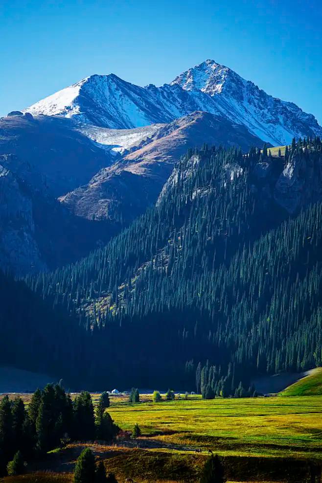
Stand on the edge of the county town at dusk and the noise you notice first is the flour mill beside the rail siding. Qitai has been a grain county since the Han dynasty, when soldiers of the Western Han protectorate first broke the dryland with ox-drawn ploughs along the Tianshan northern slope. Two thousand years later the ploughs are satellite-guided, but the basic picture has not changed: a long county, running from the Gurbantünggüt desert in the north to snowline at roughly 3,800 m in the south, with wheat and barley planted in a 100-km band along the foothills.
The figures come from the Changji Prefecture 2026 rural-revitalisation report and the Ministry of Agriculture’s 2026-02 green-grain-base round-up. The county plants more than one million mu (about 67,000 ha) of wheat each year, with grain output around 830,000 tonnes in a strong year — about half of the prefecture’s grain and one-seventh of Xinjiang’s commercial grain. Qitai is also home to Xinjiang’s largest flour-milling base: 800,000 tonnes of annual processing capacity, more than 400,000 tonnes of packaged flour under the umbrella brand Qitai flour (奇台面粉), a national geographical-indication product and the only one in the country whose county has been designated a demonstration county for that mark.
What “dryland” actually means here
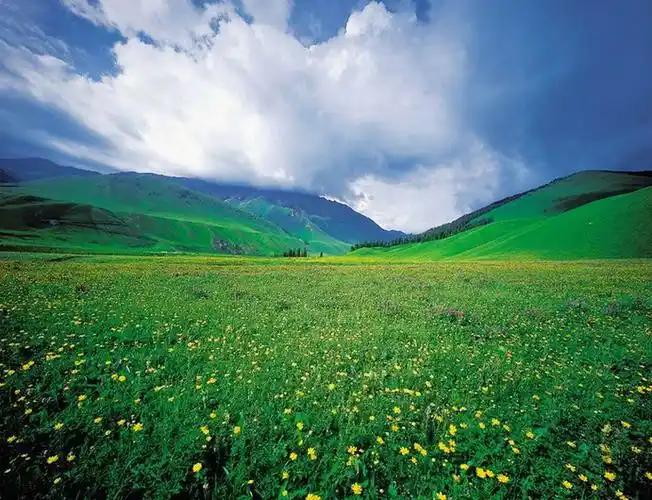
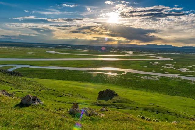
The wheat at Jiangbulake is not irrigated. When we first walked up the slope above the Tian Shan Mai Hai viewpoint, I expected to find sprinkler lines — every green field I had seen in Xinjiang up to that point was drip-irrigated. There were none. The system works because the elevation sits inside a temperature-inversion belt: cool air pools along the foothills, rainfall is unusually high for the northern slope, and snowmelt from the spruce forests above seeps slowly down through the soil. The heritage register calls it a snow-mountain-to-forest-to-grassland-to-rainfall-to-wheat-field chain. Farmers here call it 旱地 — dryland. The fields are not rectangular but carved into the contours, which is what creates the three-dimensional wheat-field look on the loop: instead of one flat gold carpet, you get layer on layer of gold stacked up the valley walls.
Timing a trip to the wheat fields
Most guidebooks say “June to September” and leave it at that. After three visits I would narrow it down to a colour calendar:
- Late May to mid-June: Jointing and heading. The fields are deep green; the air is cool and the snow on the peaks above is still thick. Good for photographers who like contrast, weaker for harvest-watchers.
- Late July: Grain-filling. The lower slopes start to yellow on the south-facing side; the higher slopes stay green. This is the most underrated week — fewer coach tourists, the light stays warm until about 21:00, and you can catch combine harvesters working the lower terraces first.
- Mid-August to early September: Full golden. Most combines move in around 20 August and most fields are cut by the end of the first week of September. This is the peak photo week, and also the busiest.
- Mid-September to mid-October: Post-harvest. Straw rolls dot the fields, cattle graze the stubble, and the Tianshan poplar forest begins to turn at the lower edge of the park. Fewer crowds, warm light, but the wheat itself is gone.
If you can only spare two days, aim for the third week of August. We went in 2024 on 22–23 August and watched combines work their way up the valley from about 11:00 to 17:00 each day; the wheat colour was almost uniform gold across the lower two-thirds of the loop, and the spray behind each combine caught the late sun for a few perfect minutes.
Getting to Qitai county and into the park
There is no passenger rail into Qitai town. The public option is a coach from Urumqi’s High-Speed-Rail Bus Station (高铁汽车站) or the North Suburb Bus Station (北郊客运站). Tickets were 51 yuan one-way on every departure I checked in 2025; the journey takes around three hours along the G7. Departures run roughly every 15–30 minutes between about 10:30 and 19:20, but check the latest schedule on the county transport bureau’s website before you go. From the Qitai county bus station, the scenic area runs its own shuttle down to Jiangbulake — about an hour through the foothills. Self-driving is the most flexible option: take the G7 to the Qitai exit, then the S303 toward Ban Jie Gou (半截沟) township; the scenic-area gate is signed and the 51-km loop is paved the whole way round. Fill the tank before you enter — there is no fuel station inside the park.
Inside the park: the 51-km loop
The loop is signed in two directions and has fourteen named shuttle stops (游客中心 → 天山麦海 → 天山怪坡 → 欢乐谷 → 花海子 → 天山大峡谷 → 江布拉克集散中心 → 合兴酒店 → 松翠谷 → 断桥 → 三道扁子 → 马鞍山风情园 → 新户河 → 黑涝坝). Self-drivers cover it in 4–6 hours at a relaxed pace, stopping for photographs, a horse ride in the 欢乐谷 section, and the mandatory test at 天山怪坡 — a 290-metre optical illusion where a car in neutral rolls visibly uphill; it has held a Shanghai Da Shi Ji Guinness record since 2005. The shuttle bus is compulsory if you do not want to drive yourself in, and runs one-way, so plan to return on the same shuttle rather than trying to circle back.
Buy tickets in advance on the WeChat mini-program 江布拉克旅游. Real-name booking is required and there is a daily cap. As of 1 July 2025 the official ticket prices are: 55 yuan per person in peak season (1 May to 15 October) and 25 yuan in low season; shuttle bus 15 yuan one-way / 30 yuan round-trip; private cars under 7 seats 100 yuan per vehicle; motorhomes 150 yuan. The reservation system opens about 14 days ahead.
Where to stay: county town or inside the park
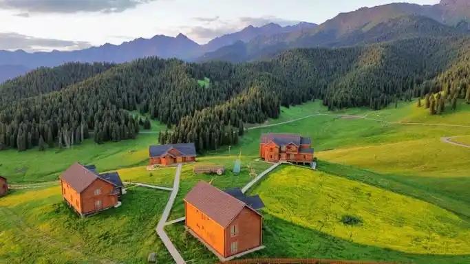
For most foreign travellers I would stay in the county town. Standards are basic but rooms are clean, and you get air-conditioning, hot water, and reliable wifi — which you cannot always rely on inside the park in shoulder season. In the 2025 high season I paid 180 yuan for a clean twin near the bus station, 240 yuan for a slightly better room near the town square. Hotels inside the park — the 合兴酒店 and a handful of newer boutique stays such as 麦浪里民宿 and 问野·麦峰山房 — run 600–1,200 yuan in peak season, with the trade-off that you are inside the gate and can catch sunrise over the wheat without driving anywhere. Bring a real jacket either way: the park sits at 1,700–2,200 m, and even in August the night temperature can drop below 10 °C.
What Qitai puts on the table: flour first
In a county whose identity is built on wheat, you eat wheat. The local answer to laghman is 过油肉拌面 — wide hand-pulled noodles tossed with stir-fried lamb, tomato, and greens in a glossy oil sauce. Order it by portion size: a 小盘 (small) is enough for most appetites, a 大盘 (large) is for two people or one very hungry traveller. The other signature is 羊肉焖饼子 — slow-cooked lamb under a thin sheet of layered bread that soaks up the broth. For the most local lunch, head to the 腰站子 (Yaozhanzi) village brand restaurants inside the county: the village runs a co-op whose own flour is on the table. For a wider take on Xinjiang dishes beyond wheat, our regional guide to Laghman noodles covers the broader hand-pulled tradition.
Practical tips before you go
- Book in advance. The WeChat mini-program 江布拉克旅游 opens about 14 days ahead and slots fill on golden-weekends in August.
- Do not walk on the wheat. The park signage is strict and the local rule is real — these are working fields, not a backdrop.
- Bring a real jacket, even in August. At 1,700–2,200 m, nights drop below 10 °C and the wind off the snow peaks is sharp.
- Fill the tank before the gate. No fuel station inside; the next one is in the county town, 45 km back.
- Carry cash and passport. Real-name booking requires a passport. Mobile signal is unreliable in the canyon section of the loop — download an offline map.
- Sun protection is not optional. UV at 2,000 m in the Junggar Basin is brutal; SPF50, hat, and sunglasses are the minimum.
- Allow two days if you can. Day 1: drive the loop, watch sunset. Day 2: revisit your favourite stop in the early-morning light, then drive back. The same wheat looks like a different landscape an hour after sunrise.
A two-day sample itinerary
Day 1 (Urumqi → Qitai → Jiangbulake): Catch the 10:30 coach from Urumqi High-Speed-Rail Bus Station to Qitai (3 h, 51 yuan). Drop bags at your county-town hotel, eat a quick 拌面 lunch, then take the scenic-area shuttle or a hired car the 45 km up to the gate (arrive by 15:00). Drive the loop counter-clockwise from 天山麦海, stop for the 天山怪坡 test and the 疏勒城 hilltop view, finish at the western end near 黑涝坝 for sunset over the wheat and the snow peaks. Stay overnight either at 合兴酒店 inside the gate or back down in Qitai town.
Day 2 (early morning → return): Up at 06:00 for sunrise. Drive back to your favourite stop from the day before — the lower terraces near 天山麦海 are usually the best in first light. Have a late 烤包子 breakfast in the park, then either drive the second half of the loop (you have only seen one direction) or head out by 10:00. If you have a hire car, ask the driver to swing by the 腰站子 (Yaozhanzi) cooperative village on the way back to Qitai town for a late flour-themed lunch, then catch the 14:40 or 16:30 coach back to Urumqi.
FAQ
Is Qitai county Xinjiang worth a stop if I am short on time?
If you are heading to the eastern Tianshan or the Silk Road sites around Jimsar and Turpan, yes — the wheat fields are unique and the county town is an easy add-on. If your route is north to Kanas or south to Kuqa, it is too far out of the way.
Can I do Jiangbulake as a day trip from Urumqi?
Technically yes, with a private car. You will leave Urumqi at 06:00 and return around 23:00, and you will spend around 8 hours in the car. You will not enjoy the sunrise.
Is the park open in winter?
Yes, the scenic area and shuttle are open in low season (16 October to 30 April), but the wheat is cut, snow closes some side roads, and shuttle stops at the eastern end of the loop may be suspended. It is a snow-scenery destination in winter, not a wheat-fields destination.
Where else in the same prefecture is worth pairing with Qitai?
For the eastern Tianshan corridor, our guides to Jimsar, Qitai Silicified Wood and the Dinosaur Geopark, Changji prefecture, and the wider Jiangbulake scenery are the natural next reads.
Disclaimer
Prices, schedules, and entry rules in this article were checked in early 2026 against the Changji Prefecture price bureau notice 新发改服价〔2024〕751号, the Jiangbulake scenic-area official notice, and the Qitai County Transport Bureau’s published coach schedule. Conditions can change without notice — always confirm on the WeChat mini-program 江布拉克旅游 within 14 days of travel. The author was not compensated by any scenic-area operator, hotel, or restaurant mentioned here.
About the author
Karl Huang has been writing Xinjiang travel guides for XinjiangAttractions.com since 2024. He drove the G7 to Qitai three times between 2024 and 2025, and lives part of the year in the Changji Hui Autonomous Prefecture. He prefers September post-harvest evenings to August peak colour, but understands he is in a small minority on that point.