Published: September 8, 2026 | Author: Karl Huang | Category: Xinjiang Cities
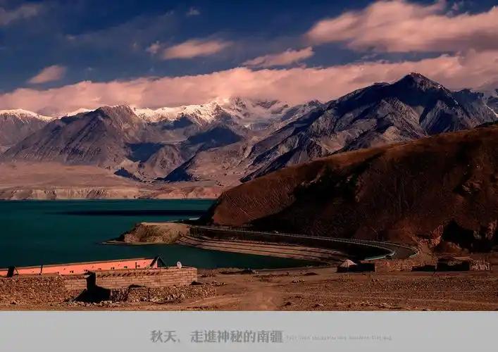
The first thing anyone in Qiemo Xinjiang tells you, usually with pride, is that the town sits about two kilometres from the nearest dune. I checked the claim in April on a borrowed e-bike, riding north until the asphalt thinned into sand. The number holds: fields one side of a fence, rippled dunes the other. Only Ruoqiang next door is bigger among Chinese counties. What makes this one worth a stop is a story about water, where it comes from, who moves it, and what changed here once the country started watching desert edges.
What the numbers say about Qiemo Xinjiang
A few figures I re-check against the county government’s own releases before every trip south:
| Item | Detail |
|---|---|
| Location | Southeast rim of the Tarim Basin, southern Bayingolin Mongol Autonomous Prefecture; about 430 km from Korla by road |
| Size | 138,600 sq km, China’s second-largest county; roughly 45% mountains, 39% desert, 16% plains |
| People | About 70,000 permanent residents in six towns and seven townships, plus two Corps regiments |
| Climate | Averages 11.5 degrees; 24.5 mm of rain a year against 2,499 mm of evaporation |
| River | The Qarqan (Che’erchen) River, about 813 km, fed by snow and ice on 6,973 m Muztagh |
| Transport | G315, the G0612 expressway, the Hotan-Ruoqiang railway, two desert highways and Yudu Airport |
| Green belt | The shelterbelt ring around the Taklamakan closed on 28 November 2024; Qiemo held one of the last gaps |
| Good months | April to May and late September to October; spring dust peaks between March and May |
Two kilometres of fence, then the dunes start
The strip of green holding the town is narrower than the map suggests. Irrigated farmland along the river runs a few kilometres wide at most; everything beyond is gravel fan or moving sand. Driving in from the west on the G315 you cross a hundred kilometres of nothing before the first shelterbelt appears. What changed the odds is a belt of trees and shrubs stretching more than twenty kilometres along the town’s northern and eastern flanks, planted by everyone: offices get quota days, school kids plant on Arbor Day, retired soldiers do it full time. Stand on that belt in April, with the wind picking grit off the dunes a few hundred metres away, and you understand why nobody here treats a tree as scenery.
The Qarqan: eight hundred kilometres off one peak
Every drop in the tap comes from the Qarqan River, which begins in the ice fields of Muztagh, a 6,973-metre massif on the Kunlun frontier where the county touches Tibet. The water gathers above five thousand metres, vanishes briefly into the gravel of the Tula basin, then turns north and runs about 813 kilometres to a lake most maps marked dead for three decades. County hydrology puts the annual flow at the gauging station near town at a bit over five hundred million cubic metres, rising toward eight or nine hundred in wet years. Glaciers act as a battery, so the flow peaks in summer exactly when the fields are thirstiest, which is why an oasis survived here when neighbours with bigger rivers did not.
Dashimen: the dam that retired a flood ritual
Spring in the riverside villages used to mean sandbag duty. The Qarqan arrives steep and silt-heavy, and floods overtopped channels every few years, so bankside households kept an annual appointment with shovels. That ended when the Dashimen project, a national key water conservancy work forty-odd kilometres upstream, closed its gates on 20 September 2021 after six years of construction and about 1.9 billion yuan. The reservoir holds roughly 117 million cubic metres, lifted flood protection from under a three-year return period to a twenty-year one, runs a 60-megawatt plant for the county grid, and irrigates about 341,000 mu downstream. Farmers I spoke to in Akekandun village cared most about something plainer: the water in their ditches finally runs clear, so they stopped digging silt out after each watering.
The lake at the end of the river came back
Taitema Lake, where the Qarqan and the Tarim used to meet, sat dry from 1971 until the early 2000s while upstream farms drank the basin empty. Since 2000 an ecological water conveyance program has pushed pulses down the lower Tarim each year, and one hydrological review credited the Qarqan with more than half of the lake’s modern inflow. Reeds and delta wetlands came back, then the fish and the deer. The lake itself is restricted Ruoqiang territory and no practical stop, but driving east you can see the change in the green along the old riverbed. My Ruoqiang guide covers that side of the lake and the Lop Nur wilderness beyond it.
Closing the ring: the belt that reached Qiemo near the end
In November 2024 the last gap in a 3,046-kilometre shelterbelt around the Taklamakan was planted shut at Yutian, closing a ring that took more than forty years to build. The final 285-kilometre gap ran through six counties, Qiemo among them, with some of the worst terrain on the circuit. By late 2025 the campaign had added another 9.3 million mu and widened the belt by 110 metres to 7.5 kilometres in places. The county’s best contribution is a veterans’ crew, former soldiers who began planting on the windward side years before it was fashionable, put in over ten thousand mu of saxaul and calligonum, and now earn a living from cistanche, a parasitic herb that grows on those roots and sells as tonic medicine. Ask at the forestry station ahead and you can usually join their spring planting day.
Ninety-six dusty days: what the air actually does
The county’s own weather summary for 2023 counted 96 days of floating dust, 31 of blowing sand and 15 full sandstorms, the worst dust year in a decade. Floating dust days are liveable: the sky goes the colour of skimmed milk and the mountains vanish. Blowing sand is different, arriving as a wall of orange that drops visibility to a few hundred metres and closes the desert highways until it passes. Storms cluster in spring, which is why I stopped scheduling rigid April trips. Carry a buff or a mask and check the forecast before a long drive; the airports wait out weather well, the roads do not.
Two thousand years on one strip of green
The name shows up early. Han court records list a kingdom pronounced roughly Jumo here, small but placed on the southern route between Khotan and Loulan, and a second pocket kingdom called Xiaowan also fell inside today’s borders. A Sui commandery ran the oasis briefly around 609, the Tang turned it into a garrison called Boxian, and when the monk Xuanzang passed through in 644 on his way home from India he noted the place in his travel account. Sand did the rest: the river changed course three times and the old town is believed to have been swallowed twice, which is why the county museum’s best rooms hold excavation reports rather than glory objects. The present county dates from 1914; before that the Qing called it Kaqiang.
Two desert roads, one railway and a small airport
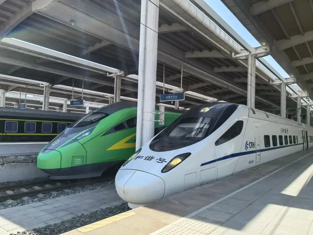
Four ways in. The G315 remains the classic southern-route drive, straight and dull in stretches, then suddenly dramatic where the road threads between dune fields, and the G0612 expressway between Ruoqiang and Hotan has been shaving hours off it since 2017. Two desert highways branch north, one to the Tazhong oilfield and one to Yuli, both open to ordinary cars under the fuel and paperwork rules in my Tarim Desert Highway guide. Since June 2022 the Hotan-Ruoqiang railway has run along the desert’s southern rim, and the slow train is still my favourite arrival: cheap, rarely full, dunes sliding past the window for hours. Yudu Airport links to Urumqi, Korla, Hotan and Ruoqiang on small aircraft, schedules shifting seasonally. Heading west, the next oasis is Minfeng and the Niya ruins.
Picking a month at the desert edge
May is the best compromise: green fields, dust season easing off, warm but not ferocious days. September and October bring the jujube harvest and the year’s most reliable skies, though nights turn cold fast. Summer is genuinely hot, with the county record above 41 degrees, but the river runs fullest and the mountain valleys stay workable. Winter is flat, cold to minus 27 in hard years, and strangely beautiful on clear days, snow on the far peaks, the town in coal smoke at dusk. For a desert-and-dates trip I aim for mid-October and keep a buffer day either side of any plan, because one sandstorm can strand a tight schedule.
Beds: three thousand of them, and how to choose
Accommodation is modest and functional: the county lists 24 hotels with about 1,700 rooms and 3,100 beds, from the three-star Muztagh Hotel down to ordinary business chains. Nothing is bookable on international platforms, so use a Chinese app or phone ahead, and expect little English at the front desk. Rooms are clean and cheap by coastal standards; the better places fill during the October jujube season and conference weeks. There is no hostel scene, and campervans should fill water in Korla or Hotan first. I have stayed near the bus station twice and once above a restaurant on the river road, and the difference mattered less than being within walking distance of the night market.
Jujubes, pilaf and what the river gives the table
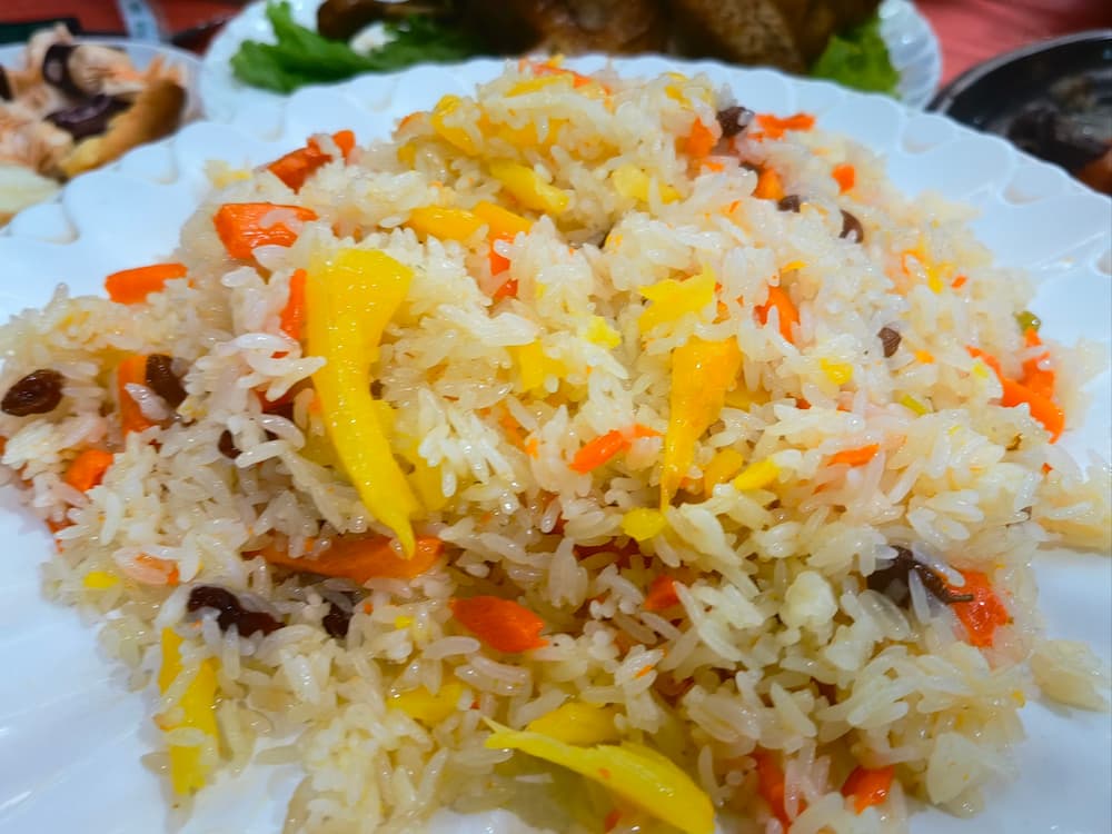
Qiemo is a date county first, a national base for green-food jujubes that produced about sixty thousand tonnes of fresh dates in 2023. The local variety runs sweeter and denser than the Ruoqiang fruit that dominates the export trade, and in October the sidewalks around the bazaar become a drying floor. The wider trade is covered in my piece on Ruoqiang jujubes and the dried date business. Restaurant food is southern-Tarim cooking done honestly: lamb pilaf at midday until it sells out, hand-pulled noodles in the evening, baked buns from the tandoors near the mosque. In season the small places along the Qarqan road grill river fish hard and salted, a welcome change after a week of lamb.
What I would tell you before you book
Documents first: police checkpoints are routine on every road out of town, so carry your passport and expect a ten-minute stop, sometimes at midnight. Cash still moves at the date stalls and some tandoor counters, though QR payment covers nearly everything else. The museum closes Mondays, and the county’s two best sights need wheels: the Zagunluk tombs with their 3,000-year mummies sit within a taxi ride, while the Molech River rock paintings want a hired car and half a day. Fuel up before any desert-highway run. To understand the sand fight rather than photograph it, ask the forestry station about a planting day; it earns better stories than any viewpoint.
Two days at the end of the water
Day one, stay in town: the county museum in the morning, pilaf two streets over at lunch, the Zagunluk tombs in the softening afternoon light, then the night market for grilled fish and fruit by the kilo. Day two, go up or sideways, either a hired car into the foothills toward Kunlun Ancient Village or east along the G315 to the wetlands, stopping wherever a track reaches the riverbank. If a third day appears, drive the desert highway north toward Tazhong until the shelterbelt gives up and the dunes take over, which is the whole point of coming here. My Taklamakan and Gurbantunggut comparison helps with route planning.
Frequently asked questions
Is Qiemo worth stopping for, or just a fuel stop? Two nights is enough for the museum, the tombs and the shelterbelt, and you will understand this stretch of the Tarim better than the highway lets on.
How bad is the dust really? On roughly a quarter of spring days the air carries enough grit to bother your throat. It is a nuisance rather than a danger for healthy adults; mask up, keep plans flexible in March to May.
Can I visit the old buried city? No. It is unexcavated, unmarked and inside controlled land; the museum’s excavation exhibits are the closest you can get.
Is the train useful? Very. The Hotan-Ruoqiang line links Qiemo with Hotan, Ruoqiang and Korla connections at low fares, usually with seats days out.
Disclaimer
This article reflects conditions as of September 2026 and my own visits. Schedules, fares, checkpoint procedures and hotel availability in southern Xinjiang change without much notice; verify current details locally or with official county sources before you travel. Nothing here is sponsored and no business mentioned knew it would be reviewed.
About the author
Karl Huang has spent eight years travelling and writing about Xinjiang, with a weakness for the small county towns of the Tarim Basin that most itineraries drive past. He has crossed the desert’s southern rim by road and rail and keeps returning to the places where the map turns to sand. Reach him through the contact page on this site.