Published: August 11, 2026 | Author: Karl Huang
I drove the Tarim Desert Highway once, in October 2023, on my way back from Hotan to Korla. At the time I treated it as a connector — something to get through between two more interesting destinations. That was a mistake. The road turned out to be one of the most memorable stretches of pavement I have driven in Xinjiang, not because of what you see at either end, but because of what happens when you put 522 kilometers of asphalt between you and anything that resembles a town.
Quick reference: Tarim Desert Highway at a glance
| Item | Detail |
|---|---|
| Official name | Tarim Desert Highway (塔里木沙漠公路) |
| Total length | About 522 km (324 mi) |
| Desert section | About 446 km of active dunes |
| Northern terminus | Luntai County (轮台), near Korla |
| Southern terminus | Minfeng County (民丰), near Hotan |
| Mid-point settlement | Tazhong (塔中), ~km 250 |
| Fuel stations | Luntai, Tazhong, Minfeng only |
| Speed limit | 60–80 km/h |
| Typical drive time | 7–9 hours non-stop |
| Best months | March–May, September–November |
What the drive actually feels like
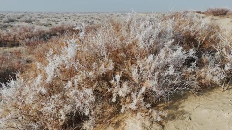
You leave Luntai on a two-lane paved road that looks like any rural highway for the first forty minutes. Then the cultivated strips narrow. Then they stop. What replaces them is a corridor of green — haloxylon trees and tamarisk bushes in rows on both sides, maybe thirty meters wide each. Beyond those rows: sand. Nothing but sand.
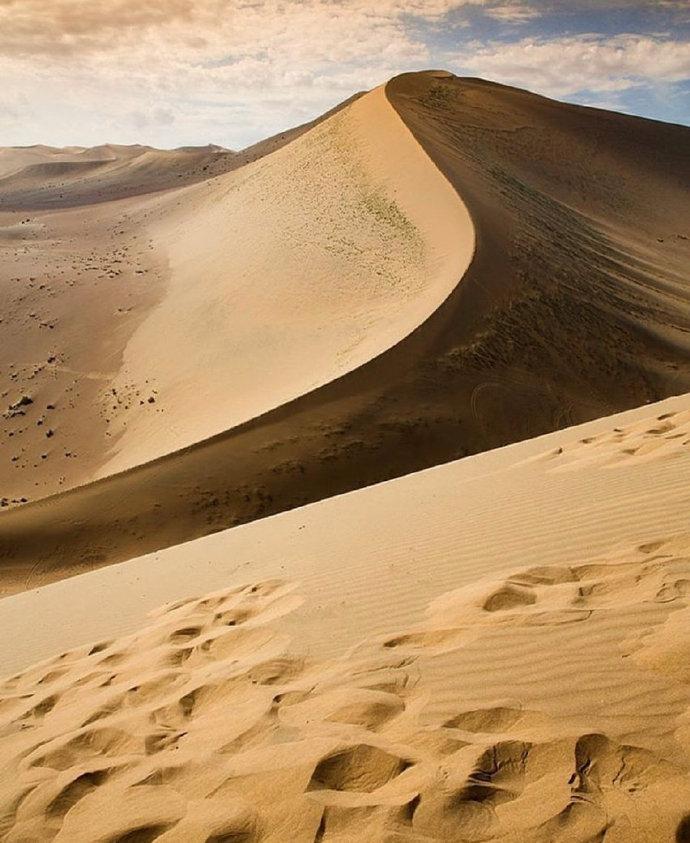
The first hour inside the dunes is disorienting in a good way. Your GPS shows you moving, but visually nothing changes. The dunes roll past in slow motion, their crests shifting color as the sun angle shifts. I kept expecting the view to break open into an oasis or mountain range, like it does on every other road in Xinjiang. It does not. For four hours, the desert is the entire world.
I stopped three times. Once to photograph the shelterbelt where it crosses a low saddle between two dune systems. The trees there lean hard into the prevailing wind, trunks bent about fifteen degrees, which tells you everything about how much force moves through this corridor every afternoon. A second stop was at a wellhouse — a small concrete building with solar panels on the roof and a pipe out of the ground. No one was home, but you can see drip irrigation lines running from the wellhead into the shelterbelt. Those lines are the only reason the road still exists. Without them, sand would bury the asphalt in one wind season.
The third stop was just to stand in the middle of the road. There was no traffic in either direction for six minutes. In Xinjiang, that counts as solitude.
How the highway works: three sections
North section (Luntai to Tazhong, roughly km 0–250). This half has taller dunes on average and more dramatic shapes. The shelterbelt here is mature — some haloxylon trees are twenty years old and look like small forests rather than a protective strip. You will pass several wellhouses, each marked by a small sign giving its number. Wellhouse #56 is a common photo stop because the dunes behind it form an amphitheater shape. Fuel up in Luntai before you start; there is nothing until Tazhong.
Middle zone (Tazhong area, km 240–260). Tazhong is not a town in the normal sense. It is an oil-field service base with a gas station, two canteens, a basic hotel (clean but simple; book ahead in season), and a police checkpoint. This is your only chance to refuel, use a real toilet, and buy water between the two ends of the highway. If you are driving southbound, fill your tank here even if the gauge says half-full. The next pump is 260 km away in Minfeng, and headwinds south of Tazhong burn fuel faster than you would guess.
South section (Tazhong to Minfeng, km 260–522). The dunes here are lower and more spread out, so the sky feels larger. The road surface can be rougher where sand has blown across and been scraped off. There are fewer wellhouses because groundwater is deeper. As you approach Minfeng, cotton fields appear, then poplar windbreaks, then county-seat outskirts. The transition from pure sand to farmland happens over about fifteen kilometers, and it is stranger than it sounds.
Fuel strategy: the rule that matters most
This is the single most important practical point about the Tarim Desert Highway: there are exactly three places to buy gasoline on the entire route, and the middle one closes early.
- Luntai (north end): Sinopec station, regular hours, accepts cards.
- Tazhong (mid-point): PetroChina station, usually open 09:00–20:00, cash preferred.
- Minfeng (south end): Multiple options, standard city service.
If you arrive at Tazhong after 8 p.m. with less than a quarter tank, you have a problem. Carry a spare five liters if your vehicle allows it (jerry cans attract attention at checkpoints; keep it in the trunk). My SUV used about 35 L/100 km on this stretch — worse than the manufacturer rating because of soft-surface drag from sand drifts on the shoulder and occasional headwind segments.
The shelterbelt system: how the road survives

When the highway opened in 1995, engineers knew flat asphalt across the Taklamakan would not last a year without protection. Sand moves here. Starting in 2003, crews planted a 436-kilometer shelterbelt along both sides — haloxylon (saxaul), tamarisk, and calligonum, chosen because their roots reach deep brackish groundwater without fresh irrigation.
To water that green strip, they drilled 108 wells along the route, spaced about four kilometers apart. Each feeds a network of drip lines. Originally each wellhouse had a caretaker couple living onsite year-round — one of the loneliest jobs on Earth. Since 2022 most converted to solar power and remote monitoring. When you drive past a wellhouse and see wet ground under the trees, that is why the road beneath your tires is not already buried.
The shelterbelt also creates the only shade on the highway. In July and August, when surface temperatures hit 65°C (150°F), pulling over under a mature haloxylon grove drops the felt temperature by about fifteen degrees. Use it.
When to drive (and when not to)
| Season | Pros | Cons |
|---|---|---|
| Mar – May | Mild temps, fewer tourists, stable sand | Occasional dust storms in April |
| Jun – Aug | Long daylight, clear skies | Extreme heat (40°C+), sandstorms possible |
| Sep – Nov | Best overall: comfortable, poplars turn gold | Shorter days after October |
| Dec – Feb | No crowds, stark beauty | Cold nights, some services reduced |
I drove in mid-October and would pick that window again. The heat had broken, poplars along the approach roads were turning yellow, and light stayed usable for photography until 6:30 p.m. In summer, start by 6 a.m. from Luntai to cover the north section before midday heat builds. The south section gets afternoon crosswinds that push sand onto pavement; driving after 3 p.m. in July means watching road workers clear drifts off the asphalt every few kilometers.
Sleeping: Tazhong or bust
Your realistic overnight option on the highway itself is Tazhong. The driving distances between Luntai and Minfeng make a single-day crossing feasible if you leave early, but many prefer to split the drive. Tazhong has one main guesthouse (often listed as 塔中宾馆) with basic rooms — electric heat, shared bathrooms on some floors, no elevator. Book through your hotel app; availability tightens in October during poplar season. Price range: 200–350 RMB/night.
If you push through to Minfeng or Luntai, you will find proper hotels at county-seat standards. Neither is remarkable, but both have reliable hot water and internet, which feels like luxury after eight hours of dunes.
Food on the highway
Tazhong’s canteens serve Uyghur-style laghman (hand-pulled noodles with meat and vegetables), fried rice, and basic grilled meat. Do not expect variety. It is functional food for oil workers and truck drivers. If you have dietary restrictions, bring supplies from Korla or Hotan. The gas-station convenience store stocks water, instant noodles, cookies, and not much else.
One thing worth trying: fresh naan baked in the back kitchen at the larger canteen. It comes out of a traditional clay oven, thick-crusted and slightly smoky from tamarisk wood fuel. Eat it with tea and pretend you are on a caravan from a century ago. The illusion lasts ten minutes before a tanker honks past, but it is a good ten minutes.
Practical tips I learned the hard way
- Check the wind forecast. A strong northerly means sand drift on the road south of Tazhong. Delay departure if gusts above 30 km/h are predicted.
- Carry more water than you think you need. Five liters per person minimum. Dehydration creeps up fast in dry air.
- ID registration at checkpoints. You will pass at least two (one near the north desert entrance, one at Tazhong). Have your passport ready. Foreigners must register; process takes five to ten minutes.
- Tire pressure. Run door-spec or slightly higher. Low pressure increases contact patch and makes soft-shoulder recovery harder. I ran 2.4 bar front / 2.6 bar rear with no issues.
- No mobile signal for long stretches. Intermittent coverage near wellhouses only. Download offline maps before leaving Luntai or Minfeng.
- Other cross-desert highways exist. Three highways now cut across the Taklamakan. This one (Luntai–Minfeng) was the first and longest. The second runs Aral–Hotan (~424 km, opened 2007). The newest goes Yuli–Qiemo (334 km, opened Dec 2022). All follow the same shelterbelt logic, but this original route has the most developed mid-point services.
A sample two-day itinerary
Day 1 — Luntai to Tazhong (~250 km, 4–5 hrs driving)
- 07:00 Depart Luntai with full tank. Buy breakfast/lunch supplies in town.
- 08:30 Enter desert section. Stop at Wellhouse #56 for photos if light is good.
- 12:00 Picnic lunch at a shelterbelt pull-off (no formal rest areas; use wide shoulders).
- 14:00 Arrive Tazhong. Refuel, check in, walk around the base.
- 18:00 Sunset from observation deck west of Tazhong (ask locally; short dirt track off main road).
Day 2 — Tazhong to Minfeng (~272 km, 4–5 hrs driving)
- 07:30 Breakfast at canteen, final fuel top-up.
- 08:30 Head south. First ninety minutes have best dune scenery on this half.
- 11:30 Pass southern edge of active dunes. Watch for first cotton fields.
- 13:00 Arrive Minfeng. Lunch, hotel, shower that means something after desert dust.
- Afternoon: visit the Minfeng (Niya) museum, or continue toward Hotan (2 hrs further south).
Frequently asked questions
Can I cycle the Tarim Desert Highway? Technically yes, and people have done it. It is grueling. No shade except the shelterbelt, no shops, shoulders are soft sand in many places. Plan for two to three days, carry all your own water and food, arrange resupply at Tazhong. Wind is the biggest variable — a headwind turns an easy day into an eight-hour suffer-fest.
Is the road safe for a sedan? I would not recommend it. Asphalt is narrow, large trucks use it, and running onto the soft shoulder in a low-clearance vehicle risks getting stuck. An SUV or crossover with reasonable ground clearance is the safe choice.
Do I need a permit? Foreigners do not need a special travel permit for this highway specifically, but must carry passport and register at checkpoints. Verify with your Korla or Hotan hotel before setting out — policies can shift.
What if my car breaks down? Traffic is sparse but not nonexistent — oil-field trucks, supply vehicles, and travelers pass regularly during daylight. Cell coverage is unreliable. Flagging down a truck is the most realistic rescue method. Carry a reflective triangle, flashlight, and warm clothing even in summer.
How does this compare to the Duku Highway? Completely different. The Duku Highway is mountains, passes, grasslands, altitude. The Tarim Desert Highway is empty space, sand, scale. If Duku is a roller coaster, this is a meditation retreat on wheels. Drive both if you can — they show opposite faces of Xinjiang.
Disclaimer
Road conditions, checkpoint policies, and fuel station hours in the Taklamakan region can change without notice. This guide reflects conditions observed during a trip in October 2023 and publicly available information current as of August 11, 2026. Verify critical details with local sources before traveling. The author and website accept no liability for decisions made based on this article.
About the author
Karl Huang has traveled extensively in Xinjiang since 2019, focusing on self-drive routes and off-the-beaten-path destinations. He crossed the Taklamakan via the Tarim Desert Highway in October 2023 as part of a southern Xinjiang loop covering Korla, Hotan, Kashgar, and the Pamir region. Karl writes about logistics that guidebooks tend to skip — fuel gaps, checkpoint realities, and what a road actually feels like at wheel level.