Published: July 27, 2026 | Author: Nils Aaberg, self-drive traveler (approx. 8,000 km across Xinjiang, 2023 and 2025)
If you are planning a road trip out here, the single thing that trips people up most is Xinjiang driving distances. This region is bigger than most people picture. It covers roughly one sixth of China, and a line that looks short on a phone map can turn into a ten-hour day behind the wheel. I rented an SUV in Urumqi on my first visit in autumn 2023, then came back in summer 2025 to drive the southern loop, and both times my daily plans needed rewriting once I saw the real numbers. This guide is the mileage sheet I wish someone had handed me on day one, plus honest notes on what the roads actually feel like.
Everything below comes from my own odometer and trip logs, cross-checked against the road signs and toll receipts I kept. Where a road closes seasonally or a checkpoint slows you down, I say so, because that is the part the glossy itineraries leave out.
Quick reference: Xinjiang driving distances and drive times
These are point-to-point figures for the main routes, driving a normal car at a steady pace and stopping only for fuel and checkpoints. Add buffer for photos, meals, and the occasional livestock crossing.
| Route | Distance | Typical drive time | Road type |
|---|---|---|---|
| Urumqi to Turpan | 190 km | 2.5 hours | Expressway (G30) |
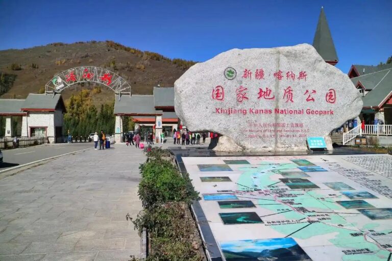
| Urumqi to Kanas / Burqin | 700 km | 9 to 10 hours | Expressway + national road |
| Urumqi to Yining (via Sayram Lake) | 690 km | 8 to 9 hours | Expressway + mountain section |
| Urumqi to Kashgar | 1,470 km | 16 to 18 hours | Expressway (G3012) |
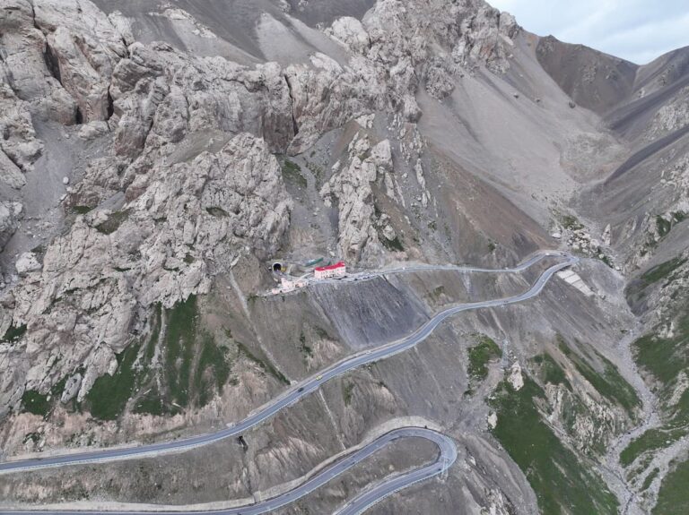
| Dushanzi to Kuqa (Duku Highway, S101) | 561 km | Full day, 10 to 12 hours | Mountain road, seasonal |
| Kashgar to Tashkurgan (Karakoram Hwy) | 295 km | 5 to 6 hours | Mountain highway (G314) |
| Kashgar to Hotan | 510 km | 6 to 7 hours | Expressway + national road |
| Luntai to Minfeng (Tarim Desert Hwy) | 446 km | 6 hours | Desert highway |
Two takeaways from that table. First, the big cities are now linked by genuinely good expressways, so covering ground is easier than it was a decade ago. Second, the moment you leave the expressway for a mountain or desert route, your speed drops by half, so never chain two hard routes in one day.
What the roads actually feel like
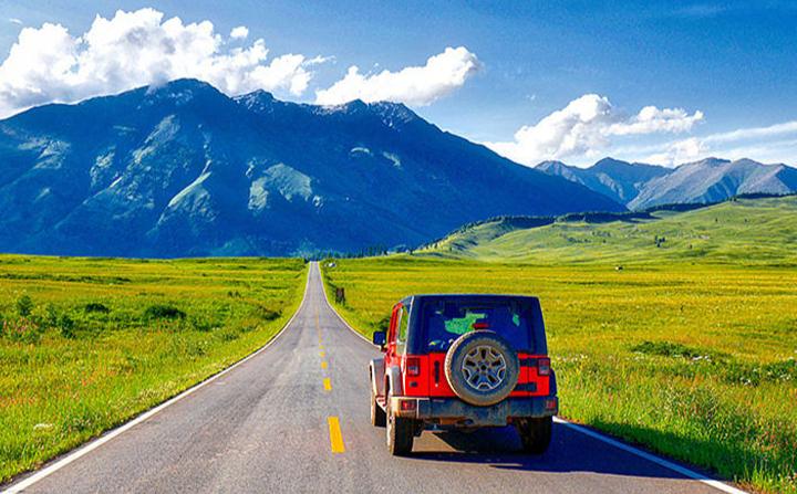
The expressways surprised me. Between Urumqi, Turpan, Korla and Kuqa the surface is smooth, well marked, and mostly empty by European standards. I cruised at the posted limit for hours with maybe a truck or two for company. Fuel and rest areas are spaced sensibly on these corridors, though the toilets get rough the further from a city you go.
National roads, the ones with a G prefix and three digits, are the mixed bag. G217 and G216 through the mountains were fine when I drove them, but there were unpaved patches near construction, and after rain a couple of low sections were slick with runoff mud. On the Karakoram Highway south of Kashgar I hit landslide-repair stretches where traffic was single file and slow, and the altitude climb to Tashkurgan sits above 3,000 meters, so the car felt sluggish and so did I.
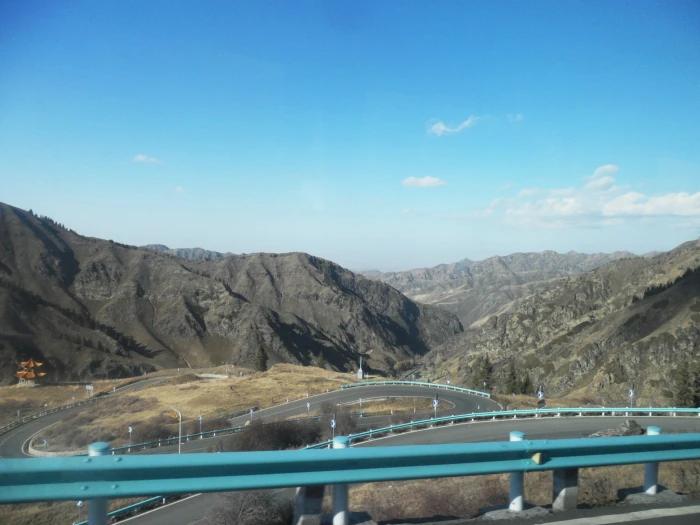
The Duku Highway deserves its own warning. It is one of the most beautiful drives I have ever done, but it is only open roughly June through October, it is narrow, and weekend traffic in July can jam the switchbacks for an hour at a time. Budget a whole day and start early. If you want the full picture of that road and the passes it crosses, it pairs well with a desert-crossing route through the Tarim Basin for a contrast of landscapes.
Best time to drive
My honest pick is late May to early July, and then September. In that window the mountain roads including the Duku are open, the grasslands are green or turning gold, and daytime temperatures are comfortable. July and August are peak season, so the scenic roads clog and hotel prices jump. Winter driving is possible on the main expressways around Urumqi and to the ski areas, but many mountain and desert routes close, and black ice on the passes is a real hazard I would not tackle without winter tires and local experience.
One quirk worth planning around: Xinjiang officially runs on Beijing time, but daily life follows the sun about two hours behind. That means summer daylight stretches past 10 pm, which is a gift for long drives. I regularly rolled into a town at 9 pm with the sky still bright.
Getting a car and driving logistics
Here is the catch foreign drivers need to know early: a foreign license alone does not let you legally drive in China, and international driving permits are not recognized. On my trips I used a rental company that provided a driver-guide for the sections where I did not hold a valid Chinese license, and self-drove only where I was properly covered. Sort this out before you arrive rather than at the rental counter. Check the current rules alongside your visa and permit requirements, because both can change.
Fuel is the other planning point. Petrol stations in Xinjiang have a security setup where you often park, hand over ID, and let staff pump for you, which adds a few minutes each stop. On remote stretches like the Tarim Desert Highway, stations can be 150 km apart, so I filled up whenever the tank hit half rather than waiting for the warning light. Keep your passport handy at all times, since checkpoints between prefectures ask for it and will log your details.
Where to stay along the routes
For a driving trip I mixed city business hotels with rural guesthouses. In Urumqi, Kashgar, Yining and Kuqa the mid-range chain hotels are reliable, have parking, and can register foreign guests, which not every small guesthouse can legally do. In the mountains and grasslands, family-run guesthouses and yurt stays were the highlight, but I always confirmed by phone that they could take foreign passports before committing to a long drive there. Twice I had to reroute at dusk because a village place could not register me, so I learned to book the day before and ask directly.
Food on the road
Roadside food in Xinjiang is a genuine reason to slow down. My standard driving lunch was a plate of laghman hand-pulled noodles, which costs around 20 to 30 yuan and is filling enough to skip an afternoon stop. Kebabs, samsa baked lamb pastries, and naan bread from a roadside oven travel well and kept me going between towns. In the melon regions near Turpan and Hami I bought fruit straight from the stalls. If you are watching the budget across a long trip, my full notes on daily spending are in the Xinjiang cost breakdown.
Practical driving tips I learned the hard way
- Download offline maps before you go. Mobile signal drops for long stretches on desert and mountain routes.
- Start early. Checkpoints and mountain traffic are lighter in the morning, and you want daylight in reserve.
- Carry cash. QR payments failed on me at a couple of remote fuel stations, and small guesthouses sometimes preferred cash.
- Never fully trust the map’s arrival time on national roads. I routinely added 30 to 40 percent for the mountain and desert sections.
- Keep water, snacks and a warm layer in the car even in summer. Passes get cold fast and breakdowns mean a long wait.
A realistic sample driving loop (northern Xinjiang, 8 days)
- Day 1: Urumqi to Turpan, 190 km. Easy warm-up drive, afternoon at the Grape Valley.
- Day 2: Turpan back toward Urumqi and north to Fukang, short day, evening near Tianchi.
- Day 3: Long haul north to Burqin, around 620 km, an early start day.
- Day 4: Burqin to Kanas and Hemu, short distances but slow scenic roads.
- Day 5: Kanas region, no long driving, rest the legs.
- Day 6: South to Sayram Lake, a big driving day of roughly 550 km.
- Day 7: Sayram Lake to Yining, 130 km, plus Ili valley detours.
- Day 8: Yining back to Urumqi, around 690 km, or fly to save the day.
If you would rather not drive the big days yourself, a hybrid trip works well, and I compare that choice honestly in my piece on group tours versus independent travel. Two wheels are an option too, though for the road conditions here I would only recommend it to experienced riders, as covered in the motorcycle guide.
Frequently asked questions
How long does it really take to drive from Urumqi to Kashgar? On the expressway it is about 1,470 km and 16 to 18 hours of driving, which almost everyone splits over two days with a stop in Korla or Kuqa. Many travelers simply fly this leg and drive the shorter regional loops instead.
Are Xinjiang roads in good condition? The expressways between major cities are excellent. National roads and mountain highways range from good to patchy, with construction and seasonal closures, so check locally before committing to a route.
Can I self-drive as a foreign tourist? Not on a foreign or international license alone. You need a valid Chinese license or you use a driver-guide. Arrange this before your trip.
When does the Duku Highway open? Roughly June to October, weather depending. It closes with the first heavy snow, so it is not a reliable early spring or autumn route.
Disclaimer
The distances and drive times here are my own logged figures rounded for planning, and road conditions change with construction, weather and season. Fuel prices, rules on foreign drivers, and checkpoint procedures can all shift, so treat this as a planning reference rather than a guarantee and confirm current conditions locally before you set out.
About the author: Nils Aaberg is an independent self-drive traveler based in Gothenburg. He has driven roughly 8,000 km across Xinjiang over two self-funded trips in 2023 and 2025, keeping detailed odometer and fuel logs. He does not accept sponsored placements and writes only about roads he has driven himself.