Published: August 19, 2026 | Author: Karl Huang
Why you can trust this guide
When we first saw Kongur Tagh, it was from the shore of Karakul Lake at roughly 3,600 meters, and the western wall of the mountain caught a flat orange light in the last hour before sunset. I had read the elevation figures months before the trip, but reading a number and standing under the thing are not the same experience. This guide is built from what we learned driving the Karakoram Highway, talking with Kyrgyz herders near the lake, and sorting out the permit and timing details that actually decide whether a visit works. I have also cross-checked the practical facts against the regional tourism office and the China Mountaineering Association’s foreign-expedition rules, which I link where they matter.
Kongur Tagh at a glance
| Fact | Detail |
|---|---|
| Elevation | 7,719 m (25,325 ft) — the highest summit of the Pamir range that lies within China |
| Location | Akto and Wuqia counties, Kizilsu Kyrgyz Autonomous Prefecture, far southwestern Xinjiang |
| Nearest landmark | Karakul Lake, about 30 km north; the peak towers above the Karakoram Highway corridor |
| First ascent | 1981, by a British expedition — the first foreign climbing team permitted on the mountain |
| Climbing status | Serious expedition peak, not a trek; needs permits, glacier travel, and fixed-rope experience |
| Best viewpoint | Karakul Lake north shore and the Bulunkou (布伦口) stretch of the G314 |
What it felt like standing below the massif
We reached Karakul Lake on a Tuesday in early October, after leaving Kashgar before sunrise. The road climbs steadily and the air gets thin in a way you notice when you step out of the car. Kongur Tagh does not sit alone — it shares the skyline with Muztagh Ata to the northeast, and together they close off the western end of the lake like two shoulders. What surprised me was the scale: from the shore the base looked close, but the herder we spoke with estimated a full day on foot just to reach the lower moraine, and that is before any real climbing begins.
The lake itself was half-frozen, with a skin of ice at the edges and open water in the middle picking up the grey-blue of the late afternoon. A few yurts near the shore were still open for the season. We paid a small entry fee at the gate and walked out onto the gravel beach, and for maybe twenty minutes the only sound was wind moving across the water. That quiet is the part I would not have traded for a busier, more famous stop.
We slept in one of those yurts and woke to frost on the inside of the felt wall. The herder’s daughter brought hot milk tea before the sun was over the ridge, and we sat watching the shadow pull back down the face of Kongur Tagh until the whole western wall turned gold. That slow reveal is exactly why I tell people to stay the night rather than treat the lake as a two-hour photo stop on the way south.

Getting to Kongur Tagh base
Almost everyone approaches the mountain the same way: by road from Kashgar south along the G314, the Karakoram Highway, toward Tashkurgan. The Karakoram Highway is paved and in good condition for the most part, but it is a high mountain road with long sections above 3,000 meters, so altitude affects most travelers whether they expect it or not. Karakul Lake is roughly 190 km from Kashgar, about a 3.5 to 4.5 hour drive depending on how many photo stops you take and how the border checkpoints are running.
If you are not driving yourself, the realistic options are a private car with a driver arranged in Kashgar, or a seat on one of the long-distance buses that run south to Tashkurgan and will drop you at the Karakul turnoff. Renting a car gives you the freedom to wait for light, which matters here — the mountain changes completely between flat noon light and the long shadows of late day. If you want the full loop rather than a single stop, our Pamir Plateau Circuit write-up lays out the borderland drive in more detail.
When to go
The short answer is late spring through early autumn, with a narrow sweet spot in September and early October. Summer (July to August) is warmest and the access road is least likely to be affected by snow, but it is also the busiest and the lake shore gets crowded with tour groups. We went in early October and would do it again: cold mornings, clear skies, and almost nobody at the viewpoint by late afternoon.
Winter closes the higher sections and makes the G314 unpredictable, and spring (April to May) can still bring snow at altitude and blowing dust on the plains below. If your goal is photography, plan to be at the lake for both the early and late light — the difference is large.
Where to sleep
Most visitors sleep either at Karakul Lake itself, in a lakeside yurt or the small guesthouse near the shore, or push on to Tashkurgan for more choice. The yurts are basic: a bed, heavy blankets, and not much else, but waking up at the lake with the massif outside the door is the point. Tashkurgan, about 90 minutes further south, has proper hotels with heating and reliable hot water, which is worth it if the altitude is already wearing on you.
If you want to stay closer to the mountain and farther from the crowds, ask your driver about the Bulunkou area, where a few family-run places open in season. Book ahead in July and August; in the shoulder months you can usually just arrive.
What to eat on the plateau
Food near the lake is simple and that is fine. At the yurt camps you will get noodles, flatbread, and weak but welcome milk tea; in Tashkurgan there is a proper mix of Uyghur, Kyrgyz, and Tajik cooking, including hand-pulled laghman and mutton cooked with carrots and onion. We ate a late dinner in Tashkurgan of kebab and naan after the drive down from the lake, and it was exactly the kind of meal that resets you after a cold day at altitude.
Carry your own water and some snacks for the lake itself — there is little for sale at the shore outside peak season, and the altitude makes dehydration come faster than you expect.
Practical tips before you set off
Permits are the first thing to understand. Casual visitors do not need a special climbing permit just to view the mountain from the lake or the highway; that is ordinary tourism. Attempting the summit, however, is a different matter and requires going through an authorized expedition operator and the mountaineering association well in advance. Do not count on arranging that on the spot.
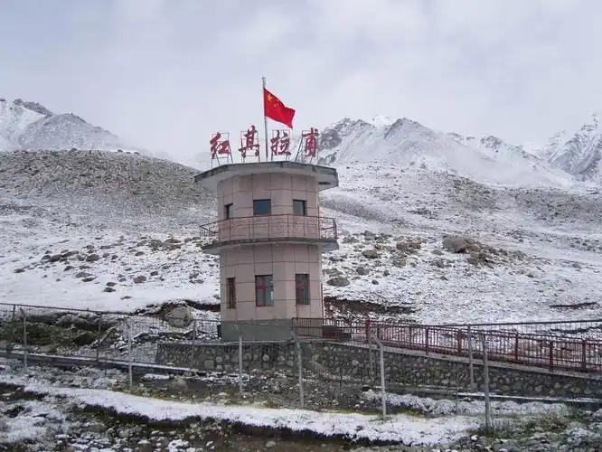
Bring layers even in summer — the temperature swing from midday to night at 3,600 meters is severe. A border permit (the same one used for the Khunjerab corridor) is checked on the G314 south of Kashgar, so sort that in Kashgar before you leave if Tashkurgan or the border is part of your plan. And give yourself a day to acclimatize in Kashgar before driving this high; it made the difference between enjoying the lake and just feeling rough.
A 3-day sample plan
Day 1: Spend the day in Kashgar, collect your border permit, and walk the old city so you are not rushing. Sleep low to start acclimatizing.
Day 2: Leave Kashgar early and drive the G314. Stop at Baisha Lake for the white-sand shoreline, then continue to Karakul Lake and the Kongur viewpoint. Sleep in a lakeside yurt or push to Tashkurgan.
Day 3: Photograph the early light on the massif, then decide: return to Kashgar, or continue south toward the Khunjerab Pass. If climbing is your aim rather than viewing, this same route is the approach to the longer Muztagh Ata expedition logistics, and you should already have your operator lined up.
Frequently asked questions
Can I climb Kongur Tagh as a tourist? Not casually. It is a 7,700-meter expedition peak requiring permits, a recognized operator, and real mountaineering experience. Most visitors come to see it, not summit it.
Do I need a border permit just to see the mountain? Viewing from Karakul Lake or the highway does not need a climbing permit, but the G314 south of Kashgar checks a border permit at the Tashkurgan control point, so carry it if you go that far.
Is Karakul Lake the best place to see it? For most travelers, yes. The north shore gives the clearest sightline of the massif and is easy to reach by road.
How does it compare with Muztagh Ata next door? Muztagh Ata is the more climbed of the two and has more expedition traffic; Kongur Tagh is higher and sees far fewer teams, which is part of its appeal as a backdrop.
Disclaimer
This article reflects our own travel experience and research at the time of writing; road conditions, permit rules, and accommodation availability on the Pamir change, and the China Mountaineering Association and regional tourism office set the binding requirements. Always confirm current permit and access rules with an authorized operator or the official tourism channels before you travel, and assess your own fitness and altitude tolerance honestly. Nothing here is professional mountaineering or medical advice.
About the author
Karl Huang is a travel writer who has driven and trekked across Xinjiang for several years, with a focus on the Pamir and Tianshan corridors. He writes practical, first-hand guides for visitors to Karakul Lake and the wider region, and works with local drivers and guesthouse owners to keep the information current. He is not a professional mountaineer and does not lead climbs.