Published: September 5, 2026 | Author: Karl Huang
Why you can trust this Mulei guide: I’ve driven into Mulei county Xinjiang three times in the last two years — once in late August on the G7 expressway to chase the spruce belt above the county town, once in October to walk the Banshan tourist road after the harvest, and once in February when the snow was sitting on the lower slopes. The numbers below come from the county-government official site (mlx.gov.cn, March 2026 overview), the Xinjiang forest-research bulletin on Schrenk’s spruce, and the 4A scenic-area lists published by the regional tourism authority in 2020 and 2022. Any ticket price, road closure or festival date can shift; double-check on the ground before you go.
| Mulei county Xinjiang at a glance | |
|---|---|
| Location | Easternmost county of Changji Hui Autonomous Prefecture; on the northern slope of the eastern Tianshan, edge of the Junggar Basin |
| Distance from Urumqi | About 270 km east along the G7 Beijing–Xinjiang expressway, then 6 km on G335 into the county seat — roughly 3.5 to 4 hours driving |
| Distance from Qitai | Around 70 km east; Qitai’s eastern townships already touch the same eastern-Tianshan spruce belt |
| Area / population | About 22,171 km², population 89,000 (15 ethnic groups, 4 towns, 7 townships, 1 ethnic township) |
| Terrain | Three-sided by mountains — Bogda range (2,500–5,000 m) to the south, Beitashan to the north, Mongoluk and Qingjulushan to the east — with the Huojingengisin desert (700–1,000 m) in the middle |
| Two 4A scenic areas | Tianshan Mulei China Agricultural Park (568 km², the largest agricultural park in China, awarded 4A in January 2020) and the Shuimohe Summer Resort (4A, in Xijir Town) |
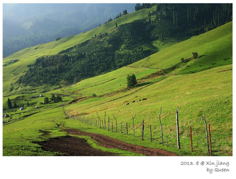
| Signature ecosystem | Eastern Tianshan Schrenk’s-spruce belt on the south-facing slopes between about 1,800 m and 2,500 m — the easternmost continuous spruce forest on the Chinese side of the range |
| Best time to visit | June to mid-October for the spruce belt and the Banshan road; December to February for snow scenery and Kazakh New Year (Nauryz) in the high pastures |

Where I’m coming from: three trips into Mulei’s south
Visitors usually remember Mulei for two landscapes that pull in opposite directions: the desert poplar forest north of the county town (covered separately in Mulei Populus Forest), and the spruce belt clinging to the southern mountains. This guide is about the second one. Mulei’s south feels like a different county: 35 km away, by road, the landscape was still dry juniper, camel thorn and the kind of flat sand you’d see in Turpan.
The “pines” are spruces, and that changes everything
The locals call them songshu, pine trees. Botanically, they are Schrenk’s spruce — Picea schrenkiana, in Chinese 雪岭云杉. The distinction matters. Schrenk’s spruce is the Tianshan’s signature conifer: tall, narrow, with side branches hugging the trunk so tightly that mature trees look like green obelisks. The Xinjiang forest-research bulletin says around 90% of Tianshan forest land in China carries this one species, mostly on shady slopes between 1,500 and 2,800 m. The oldest living tree-ring dated in Xinjiang — 651 years — was taken from one.
Two practical consequences. First, Schrenk’s spruce is a water engineer, not just a tree. Researchers have measured a single mature spruce storing roughly 2.5 tonnes of water in its root system, re-evaporating about 50% more moisture than the same area of open sea. Walk into a spruce valley after a hot afternoon and the air feels ten degrees cooler — because of what the trees are breathing out. Second, the belt is fragile. Slow-growing, thin-barked, very flammable in drought years, and absolutely dependent on the snowmelt from the Bogda range above.

Shirenzigou: the spruce valley 24 km from the county seat
Shirenzigou (石人子沟, “Stone-Man Valley”) is the closest forest valley to the county town and the one I’d send a short-stay visitor to first. The valley mouth, marked by an oddly shaped human-form boulder, sits roughly 35 km by road and 24 km in a straight line from Mulei Town, climbing from about 1,400 m at the gate to 2,460 m at the upper meadows. Schrenk’s spruce climbs both walls of the ravine from roughly 1,800 m upward; above that, sub-alpine pasture and then snow.
What Shirenzigou has going for it is access without a tour. The county has graded a single-lane paved road to the upper parking area, and on most summer days you can drive yourself up in a normal sedan. What it lacks is a developed trail system: no official loop, no boardwalk, no English signage. Bring a paper map or a downloaded offline track.
Majuanwan: spruce ringing a high pasture, 28 km south
Majuanwan (马圈湾, “Horse-Pen Bay”) is the second valley you’d drive into and the one most visitors photograph. From the county seat it’s about 28 km south on the Banshan tourist road, a 70-km scenic byway linking the county town, four townships and seven national-level traditional villages. The valley is a high-mountain basin: mountains all around, a flat grassy bottom, mountain springs everywhere, and a horseshoe of spruce pressing in from the rim. The core section here is also Xinjiang’s first musical road — drive at a steady 40 km/h and your tyres play “Xinjiang is a good place” through the rumble strips.
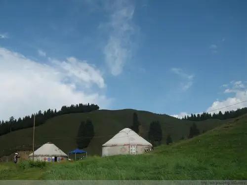
The reason to come is the light. In late July the spruce ring holds mist until about 10 a.m., then the sun pours in and the basin turns green-and-gold. I once spent three nights at the upper yurt site with a Kazakh family still bringing sheep down from the high meadows — kettle on the brazier, girls sorting yesterday’s milk, the grandmother rolling dough for baursak. Most travellers pairing Mulei with the neighbouring dry-farm belt fit both into one Changji loop; see Qitai county Xinjiang for the dry-field half.
The Shuimohe valley and the Banshan road
If you keep going west from Majuanwan along the Banshan tourist road, you drop into the Shuimohe valley (水磨河避暑休闲度假区, “Water-Mill River Summer Resort”), one of Mulei’s two 4A scenic areas. The valley got its name from a single watermill built in the Qing dynasty — you can still see the stone base on the east bank. Today the resort is a small grid of guesthouses, a couple of Chinese-medicine rest houses, and a string of family-run barbecue stalls. From here it’s a 30-to-40-minute drive through farmland to Yinggepu Township and then east again to the Caizigou artist village — a Han-migrant settlement that became an artists’ colony in the 2010s and now hosts the Liu Liangcheng Literature Museum. Compare the spruce ecology with Kuerdening farther west in the Tianshan and you’ll see why Mulei’s is sometimes called the dry-end spruce forest.
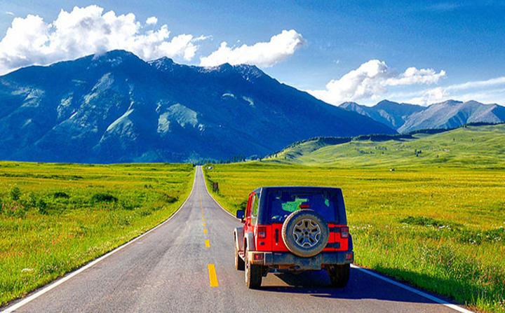
The 70-km Banshan tourist road itself is the connective tissue of the whole southern Mulei experience. Fully paved but slow (40 km/h recommended, real average around 30 with photo stops), it threads through the Pingdingshan dry-field area, where wheat, peas, millet and rapeseed colour the hills month by month. Upgraded between 2019 and 2024; before that, most of this loop was a graded dirt track passable only in summer.
Best months, by week of the season
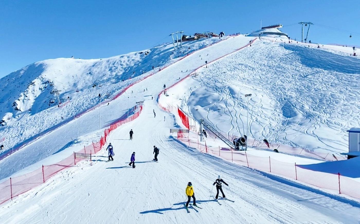
Mulei’s south has a short, sharp season. Mid-April to mid-May is the grey window — snow has melted below 1,800 m but the spruce hasn’t leafed out. By late May the first wildflowers (Primula, Trollius) come into bloom around Majuanwan. June is the greenest, wettest month and the one with most road closures after thunderstorms. Late July to mid-August is the prime window for the spruce belt: stable weather, long days (sunset after 9:45 p.m.), and the high meadows still in flower. By late August the harvest starts in the Pingdingshan dry fields. October is the photographer’s month: larches turn gold at the upper edge of the spruce belt and the Bogda peaks take their first snow. December through February is a different trip — bring real winter gear; the county town can drop to −25 °C, and the upper valleys are closed by snow.
Where to sleep up in the spruce belt
Mulei doesn’t have a tourist hotel stock in the European sense. In the county town (木垒镇) the practical options are the Hongfu Hotel (人民中路 1810号) and the Sunshine Haiyue Hotel (迎宾路 2828号) — both Chinese three-star level, around ¥280–400 a double in summer, both with hot water and parking. On the mountain, the Shuimohe resort area has family guesthouses at ¥120–220 per person per night including breakfast. In Yinggepu Township’s Yueliangdi village (the 拔廊房 colonnaded-house village, designated a national traditional village in 2020), homestays cluster around the old courtyard houses: ¥136–220 per room, basic plumbing, lots of character. Booking through the homestay by phone (the county tourism board publishes a list) is more reliable than global OTAs, which often show half the rooms sold out when they are not.
What to eat around Mulei
Food in Mulei is county-simple and almost entirely local. Three things to try. First, the chickpea (鹰嘴豆, “eagle-beak pea”) — Mulei has carried the “China’s chickpea hometown” designation since the early 2000s. The local variety is a small, hard, beige legume that shows up roasted as a snack, in salads, and in a chickpea stew with chunks of mutton on the menu at small restaurants on Hehao Street (和好街). Second, camel milk from the long-eyelash-camel (长眉驼) dairy line at the Xinjiang Changmeituo Camel Milk company on the southern edge of town — Mulei holds the national certification for the breed. Third, the Kazakh table: boiled mutton with onions, hand-pulled noodles, baursak (fried dough squares), and salty milk tea. The Hebao night market on Hehao Street is the most reliable one-stop for all three.
Practical notes that aren’t obvious
A few things worth knowing. The G7 expressway runs straight through Mulei; the Mulei exit (around the 2,900-km mark from Beijing) is the one to take, not the Qitai exit further west. There is no passenger railway station serving Mulei; the nearest high-speed rail stops are Shanshan North and Hami on the Lanzhou–Xinjiang high-speed line. Intercity coaches run from Urumqi’s Nianziguan bus station to Mulei roughly six times a day, journey time 4 to 4.5 hours, fare around ¥85; the timetable thins out in winter. Mobile signal is reliable in the county town and on the Banshan road; in the upper valleys (above 2,200 m) expect to drop to 3G or nothing. Cash is still useful for homestays and herder camps. And the road sign on the highway approach — “长眉驼之乡, 木垒欢迎你” — sets the tone before you’ve even parked.
A two-day route through the southern forests
Day 1. Drive the G7 from Urumqi (around 3 hours with a coffee stop at Wujiaqu). Exit at Mulei, check into a hotel in the county town, eat lunch on Hehao Street (try the chickpea-mutton stew at Heilanxiang Restaurant, 和好街6号楼04商铺). Mid-afternoon drive 35 km south to Shirenzigou; walk 2 to 3 km into the valley floor, turn back before dusk.
Day 2. Early breakfast and 30-km drive south to Majuanwan. Spend the morning on the musical road and the upper pasture; lunch with a Kazakh family at the yurt camp if you’ve arranged it the night before (¥80–120 per person for boiled mutton, baursak, milk tea). Afternoon drive the Banshan road west to Shuimohe (about 40 minutes). Sunset walk along the old watermill trail. Day 3 (if you have it) — drive east to Yinggepu and Yueliangdi village for the colonnaded houses and the Liu Liangcheng museum; the broader Jiangbulake grassland loop across the watershed is also a feasible detour on the way back.
Frequently asked questions
Do I need a permit to visit the spruce belt? No special permit for Shirenzigou, Majuanwan or Shuimohe. The whole area is open-access; there are no border checkpoints in the spruce valleys. The county does sit on the China–Mongolia border in its northern desert section, so carry your passport if you plan to walk anywhere north of the G7.
Is the Banshan road safe for a normal sedan? Yes in dry weather from late May to mid-October. After rain the unpaved shoulders get slippery; in winter the road is officially closed above 1,800 m. The single-lane sections around Majuanwan require you to use the horn at every blind curve — Kazakh herders move cattle on this road.
Are there English-speaking guides? Very few. The county tourism board can occasionally arrange a Mandarin–English guide for a day or two, but the price (¥600–800 per day in 2026) is steep for what you get. Most independent travellers drive themselves and use a translation app.
Where can I see Kazakh yurts in summer? Majuanwan (mid-June to late August) and the upper meadows of Shirenzigou. The family we camped with at Majuanwan in late July 2025 had been on that pasture for four generations; visitors are welcome for tea if you walk up and ask politely. For broader Kazakh herder context across the Tianshan, see Kazakh culture: nomads of the Tianshan.
Disclaimer
This guide is based on personal travel and publicly available county and regional government information current as of early September 2026. Road conditions, ticket prices, opening hours and festival dates in Xinjiang change frequently; please reconfirm through the Mulei county tourism board (service line 0994-6849777) before setting out. We are not affiliated with the Xinjiang Tourism Bureau. The author has no commercial relationship with any lodging, restaurant or tour operator mentioned above.
About the author
Karl Huang runs the Xinjiang travel programme at this site. He first visited Mulei in 2019 on a forestry-research trip, and has returned most years since. He is based in Urumqi.