Published: October 6, 2026 | Author: Karl Huang, Xinjiang travel writer
We came to Zhaosu in the middle of January expecting a quieter July. What we found was a different county. The town sits at 2,018 m in a basin ringed on the south by the high Tianshan, and the local accounting of the year has no summer in it at all. Snow arrives in the last days of October and does not clear the fields until the end of March. In January this is a working place: horses in the stables, oil in the presses, a Mongolian monastery with a caretaker and buses near empty. This page is for the small number of people who book Zhaosu in the cold half of the year. It is not a repeat of the summer county guide, the horse festival page or the rapeseed pages.
What follows is our own reading of two winters. Where a number comes from a road bulletin, a county notice or a heritage register rather than from us, we mark it.
The winter version of Zhaosu is a different county
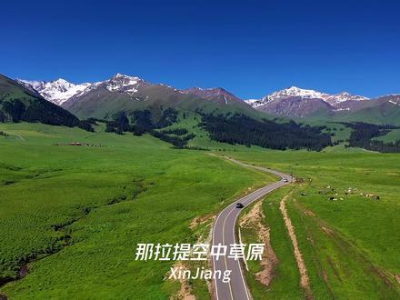
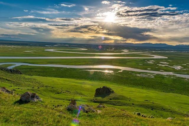
Zhaosu fills the western end of the Tekes basin. The county covers 11,200 km² of grassland, wetland and mountain between 1,323 m and 6,995 m. Its southern rim is the main Tianshan range, where Khan Tengri stands at 6,995 m on the China–Kazakhstan border and sheds the water that feeds the Tekes River. The county’s own climate record puts the annual mean at 2.9 °C, the record high at 33.5 °C and the record low at −32 °C, with about 98 frost-free days and 511.8 mm of rain a year, the most of any county in Xinjiang. It is also the only county in the region with no desert in it.
That arithmetic sets the calendar more firmly than any signboard does. July brings the rapeseed and the horses in the river. January brings the same roads with a fraction of the traffic, a river that keeps open water where the banks freeze solid, and a county that carries on anyway. The county town is 879 km by road from Ürümqi, which in winter means one long day’s drive in good conditions and two in bad ones.
Zhaosu in winter at a glance
| Item | What to expect |
|---|---|
| County town altitude | 2,018 m; the county itself spans 1,323 m to 6,995 m |
| Snow on the fields | Usually from late October to the end of March |
| Temperatures | Mean 2.9 °C, record low −32 °C, about 98 frost-free days |
| Road from Yining | S237 (Yizhao Highway), K35–K72, closed to all vehicles in winter |
| Detour in winter | Official advice is to route via G577 |
| Normal opening of that road | Mid-June to early October |
| Open in January | Shenyou Temple, the Gedeng Stone, the Tekes River wetland |
| What to carry | Tyre chains, a shovel, cash, warm layers for standing still |
The road to Zhaosu closes, and it decides the whole trip
This is the fact that breaks most Zhaosu plans, and it is missing from the tourism pages. The Yizhao Highway is S237, from Yining over the Wusun Mountains and down into Zhaosu. The section from kilometre 35 to kilometre 72, the Nulahong to Zhaosu stretch, is shut to every vehicle in winter. The road authority announced the closure on 14 October at 10 am, citing snow and ice, severe blowing snow and avalanche risk, and told vehicles bound for Zhaosu to go around via G577. The reopening date is published separately each spring. In a normal year that stretch carries traffic from mid-June to the beginning of October.
In practice a January visit means the long way round, or arriving from the Tekes side instead of Yining. Our page on the Yizhao Highway from Yining to Zhaosu covers the kilometre by kilometre and the seasonal dates, because that page has the summer case in full.
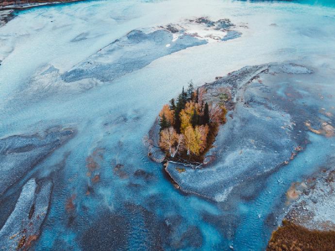
Rime on the Tekes River, the sight with no summer version
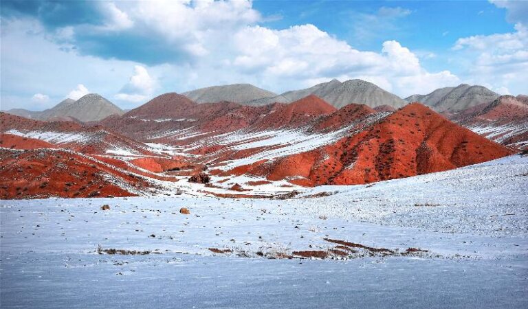
Visitors who only come in July never see the reason locals talk about January. When the valley air swings back above freezing for a few hours and the river still carries open water, the moisture freezes onto the birch and spruce along the bank and the whole stretch turns to a white crust that rings underfoot. We hit the best of it on the run past the wetland park outside the county town, on a morning the dashboard thermometer held around −19 °C.
It is a short season inside the season. Three or four cold nights followed by one sunny day is what does it, which is why the same stretch looks plain two days later. The sensible version of the local advice is to be at the river an hour after sunrise rather than at midday, when the thaw rubs the rime off the pine tops.
The two places that keep a year-round door
Zhaosu’s quiet half is two sites, both nationally protected as heritage, which is why they survive the winter. Shenyou Temple stands 1.5 km north-west of the county town on the Hongna Hai river at 1,895.4 m. In Mongolian it is Bogda Shagesong, in Tibetan Jijinling, and the town still calls it the lamasery. Craftsmen came down from Beijing in 1883 and the work ran from 1888 to 1898. Eleven halls were put up; eight remain, on an 11,900 m² site, with a two-storey main hall on the central axis and an eight-sided bell and drum pavilion either side. It was listed as a National Key Cultural Relic on 25 June 2001. Six spruces were moved into the courtyard from the southern slope of the Wusun Mountains in 1889 and are still there. A magnitude 6.1 earthquake struck in December 2003 and brought down part of the front and rear halls, which were rebuilt. It is a working monastery. Holders of a Zhaosu ID walk in free; everyone else buys at the gate, and the caretaker will let you into the courtyard in January.
The second is further out. The Gedeng Stone, formally the tablet of the pacification of Dzungaria, was raised on Gedeng Mountain about 60 km south-west of the county town in 1760. Qianlong wrote the text himself: four-character lines, about 240 Chinese characters on the front face next to the Manchu, with Mongolian and Tibetan on the back. The granite stone is 0.83 m wide and 0.27 m thick. Qing negotiators cited it in 1881 when the frontier was redrawn under the Ili treaties, and the 2003 earthquake tilted it and brought the old pavilion roof down. The red walls and yellow tiles standing now were rebuilt in 2005. It is an open site with a small car park; we went on a clear afternoon when the wind had dropped.
Horses in January, not the July version
Zhaosu has been known as the home of the heavenly horse since 2003 and keeps around 120,000 horses, mostly Ili horses. July shows them in the river. January shows them in the stable yards and the feed sheds, and out on the short winter pasture near the village roads where the snow is trampled thin enough to graze. Riding outfits run reduced services in the cold months, and the trips are shorter, which is worth knowing before you book a half-day that turns out to be an hour. The Zhaosu horse county guide covers the stables and the festival dates in detail.
Where we stayed in a town that empties
The guesthouses in the county town divide cleanly in winter. The ones that close shut a door and leave a number on the gate. The ones that stay open keep one or two rooms warm and one caretaker, and they are the only options on the plateau. We took a room with a working heater and a thick wall, which sounds like a warning and is not: the heating is fine, the cold arrives through standing still rather than through the building. Ask what time the boiler is lit, because at 2,018 m the difference between a room heated till midnight and one heated till ten is the difference between a good night and a long one. Bring a sleeping bag liner. A handful of hotels keep a front desk manned through the winter.
What the kitchen does with a field under snow
The menus shorten. The mutton stays, because the county raises sheep and cattle through the cold, and fried lamb with pepper and a bowl of hand-pulled noodles with tomato and mutton broth are still the two things worth ordering. What changes is the vegetables, which arrive from the lower valleys. Look for the local oil, pressed in the county from the rapeseed that turns yellow on those same fields in July; it is the one edible thing we carried home. The six-clove red garlic from the same black calcareous soil is another local claim you can taste. A couple of cafes on the main street keep a stove on through the winter and cook on order, which is worth asking about by phone before you turn up at nine at night.
Driving the last stretch to the Gedeng Stone
The 60 km out to the stone is a different road from the mountain pass. It stays in the basin and it is ploughed, but it is also the road where you will want chains, because the shade on the cut banks holds ice long after the middle of the road has cleared. There are no services on that stretch: no shop, no toilet block, no fuel. Fill up in the county town. Tell someone at the hotel where you are going and when you expect back, which is not a formality at a heritage site 60 km from anywhere, and set off at the middle of the day rather than in the last hour, when the light goes quickly behind the ridge.
Three days on the plateau when everything is white
Arrive via the G577 detour and stop at the wetland park on the way in, at first light, for the rime and the open water. Day two is the temple in the morning, then the town: the horse stables on the edge of the grassland, a bowl of noodles, and the horse park, which keeps shorter winter hours. Day three is the Gedeng Stone, with the return run stopping at the viewpoint above the basin where all of Zhaosu lies under snow and the Tianshan ridge holds the sky. With a fourth day, the Kalajun meadow above Tekes is the summer version of the same hills, though the road up is seasonal and worth checking first.
Questions people actually ask us
Is Zhaosu worth visiting in winter at all? Yes, if what you want is an empty county, a working grazing landscape and the rime on the river. No, if you want hotel facilities or the horse festival.
Is the road from Yining closed right now? S237 between kilometre 35 and kilometre 72 closes every winter, usually from mid-October until the middle of June. Check the current year’s bulletin before you commit, because the dates move.
Do I need chains? For the long detour and the road out to the Gedeng Stone, yes. The plough clears the middle of the road and leaves the banks. Snow tyres are not the same thing.
Disclaimer
Climate figures, the closure of the Yizhao Highway and the listing dates of the two heritage sites come from county, road and state heritage publications, not from our own instruments. The rime we describe was present on the days we visited and is not guaranteed on any given date; it depends on cold nights and a short thaw, and it can rub off within hours. Nothing here is a health claim. Check the road and the weather the same morning you leave.
About the author
Karl Huang writes about Xinjiang for visiting travellers, with a focus on the small counties of the Ili valley in the season nobody photographs. He has spent two Januaries in Zhaosu and missed the rime once by leaving the river too late in the morning.
Related reading:
the Zhaosu horse county guide,
Xiata pass and hot springs above Zhaosu,
Kalajun grassland above Tekes,
the Yizhao Highway from Yining to Zhaosu, and
winter driving rules in Xinjiang.
References:
Zhaosu County government ·
Khan Tengri, Wikipedia ·
Shenyou Temple, Wikipedia
Questions travelers ask about Zhaosu in winter
Is Zhaosu worth visiting in winter?
Yes, if you like quiet snow scenery; the grassland and the heavenly-horse pastures turn white, and although the rapeseed is gone the winter light is clean.
How do I get to Zhaosu in winter?
By road from Yining (about 2-3 hours); the Yizhao highway can close after heavy snow, so check conditions and allow extra time.
What should I pack?
Real cold-weather gear: insulated boots, a windproof jacket and layers, since temperatures drop well below zero.