Published: 01 September 2026 | Author: Karl Huang | Last updated: 01 September 2026
If you only have time for one mountain drive in Xinjiang, the Yizhao Highway is the one I would save a holiday for. I have crossed it three times since 2017, twice as a self-drive and once on a rented car from Yining, and every trip the Wusun Mountains threw something new at me: a wall of fog on Angelete Daban, a clear dawn over Baishi Peak, once even a wet August snowfall that turned the road into a postcard for half an hour. The route is short, but it concentrates nearly every kind of landscape the Ili Valley can offer into 122 kilometres, and it is closed for most of the year. That brevity is the point.
Quick reference: the Yizhao Highway at a glance
| Detail | What you need to know |
|---|---|
| Official road number | S237 (Provincial Road 237) |
| Length | About 122 km from Yining to Zhaosu |
| Highest point | Angelete Daban, above 3,000 m (Baishi Peak at 3,475 m is the Wusun main peak beside the road) |
| Counties crossed | Yining City, Qapqal Xibe Autonomous County, Zhaosu County |
| 2026 opening | 1 June – planned closure 10 October (snow closure can come sooner) |
| Daily driving hours | 09:00 to 21:00; closed overnight |
| Vehicles allowed | 7-seat cars and under; SUVs strongly recommended |
| Toll | Free, no reservation |
| Nickname | “Little Duku” (小独库) |
Why the Yizhao Highway is not the Duku Highway
Tourists mix the two up all the time, and even some guidebooks call Yizhao a “Duku side trip”. The roads are cousins, not twins. The Duku Highway runs about 560 km across the central Tianshan between Dushanzi and Kuqa, crossing multiple passes above 3,000 m. The Yizhao Highway is a single 122 km valley-to-valley connector climbing one pass between two inhabited basins. You can finish Yizhao in a half-day if you do not stop; you cannot do that on the Duku.
The “Little Duku” label exists for two specific reasons. The Baishi Peak section is the only part of S237 with the steep drop-offs, hairpin bends, and cliff-edge driving that make the Duku famous, and the open season is similarly short, so travellers have to time it like a flower bloom.
What the Yizhao Highway actually is
S237 starts at the Yili River Number-Two Bridge on the south side of Yining city and runs south through Bayandai before turning into the foothills. The road climbs the northern flank of the Wusun Mountains, threads through Qapqal county, and drops back down to the Zhaosu basin. About 23 km at the south end overlap with the older G219, and at Zhaosu town you pick up G577 east toward Tekes.
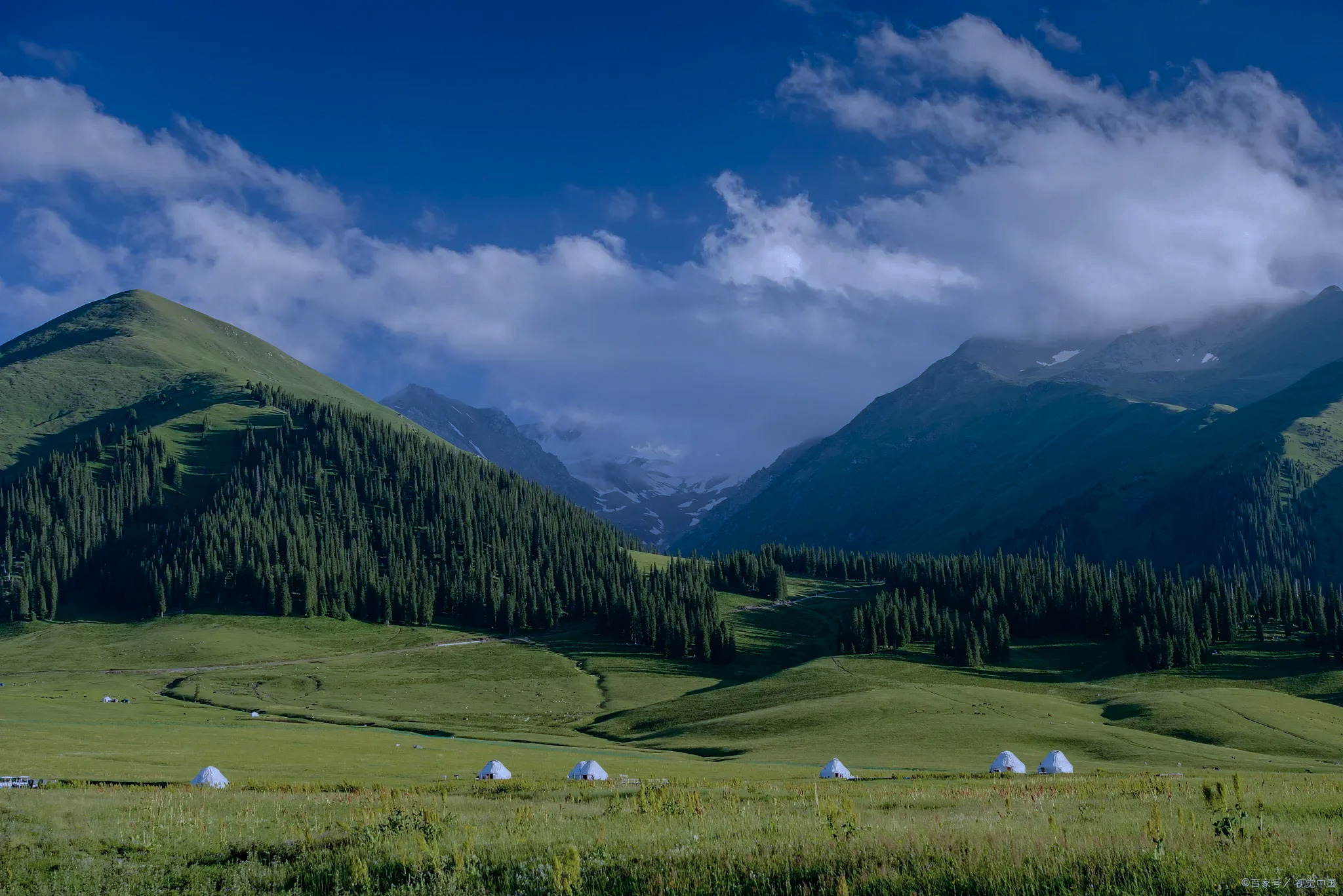
The Wusun Mountains are a long, lower ridge that separates the Ili Valley from the Zhaosu basin. The main summit is Baishi Peak, a 3,475 m granite tooth with a pale grey-white face. The road peaks a few kilometres east of it, at Angelete Daban, where there is a viewpoint, a small stupa, and a paved pull-off for ten cars.
When you can drive the Yizhao Highway
For 2026 the official opening is 1 June and the planned winter closure is 10 October, with daily driving hours from 09:00 to 21:00 only. In practice I would plan around mid-June to mid-September. Earlier than mid-June the spring snowmelt work is still finishing and a small slide can trigger a temporary closure. Later than mid-September, any cold snap dumps early snow on the Baishi Peak section and the road shuts down with two days’ notice. If you arrive in winter, the detour is G577 east through Tekes, but that adds 90 km and loses you the point of S237.

The route, kilometre by kilometre
I keep a hand-drawn map on the passenger seat because there is no good English signage and a wrong turn in Qapqal will cost you an hour. Here is how I break the day down.
- K0–K10 Yining Number-Two Bridge to Bayandai. Suburban four-lane. Refuel and stock water here; nothing on the mountain.
- K10–K30 Qapqal county seat. Rolling farmland, Xibe villages, the first look at the Wusun foothills. Expect tractors.
- K30–K47 North Wusun slopes. Spruce forest closes in on both sides. First proper photo stop.
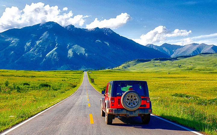
- K47–K72 Baishi Peak section. The famous 25 km. Hairpins, drop-offs, four lookout platforms.
- K72–K85 Angelete Daban. The road crests above 3,000 m. Cloud sea on a still morning.
- K85–K110 South Wusun descent. Spruce and birch, then long switchbacks. Watch for cattle after dusk.
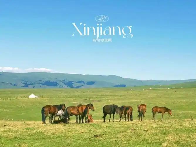
- K110–K122 Zhaosu county town. Straight prairie road, rapeseed or wheat fields, horses on the shoulder.
Why the Baishi Peak section is the money stretch
Outsiders assume the highest point is the highlight. It is not. The Baishi Peak section, the 25 km before the actual pass, is where the road has been cut into the cliff face and the spruce trees grow right down to the asphalt. In July the alpine meadows on the uphill side are full of edelweiss and yellow poppies. In October the same slopes turn rust and gold. This is the part where I park the car and walk.
I keep my eyes out for three things. Marmot colonies around K55 whistle and dive into their burrows. Kazakh family apiaries near K60 sell small jars of wild flower honey from fold-out tables. Lookout platform 3 has a paved path to a granite slab that drops 200 m straight down. If you fly a drone, this is the place to launch it, although the air is thin up here and the wind funnels in surprising ways.
Crossing Angelete Daban
Angelete Daban is the pass proper, just above 3,000 m. On a still morning the viewpoint fills with photographers chasing the cloud sea, and the prayer flags snap in slow motion. On a windy afternoon you may see nothing but a grey wall. I prefer the cloud sea, but the wind has its uses: it clears the road of slow tourist traffic and you get a lonely 20-minute stretch where the only sound is the engine note bouncing off the cliff.
The descent from the pass is faster than the climb. The road drops in long S-curves with spruce on one side and a widening valley on the other. After about 12 km the trees open up and the Zhaosu basin appears on the horizon. It looks closer than it is. Budget 45 minutes from the pass to the county town even when the road is dry.
The rapeseed and wildflower window in Zhaosu
The Zhaosu basin is most famous in July for the rapeseed flowers that cover the lower hills east of the town. The flowering peak usually lands in the second or third week of July, shifting by ten days either way. From late August the same fields turn gold-coloured wheat. By late September the first frosts come and the colour is gone. If you want bright yellow, plan July; if you want warmer tones, plan September.
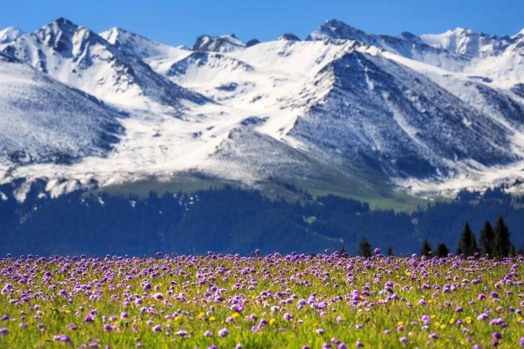
There is a separate wildflower window on the Wusun slopes themselves. From mid-June to early July the alpine meadows at the back of the Baishi Peak section put on a short, vivid show of yellow, purple, and white. I caught it once on a 28 June crossing and it was the most photographed hour of my year.
Where to stay and eat on either side
In Yining, base yourself inside the city proper. I like the small boutique hotels near Kazanqi because the evening light is good and dinner is a ten-minute stroll. In Zhaosu the practical base is the county town. There are half a dozen clean three-star options within walking distance of the bus station; book ahead in July because the rapeseed window fills the town.
The food is the point. In Qapqal, look for Xibe restaurants serving shanshui doufu, a clear broth of vegetables and tofu thickened with cornstarch, plus hand-pulled noodles. In Zhaosu, eat horse sausage at the night market and ask for mare’s milk in the morning. Zhaosu is a Kazakh county, so the dairy is central to every meal.
Driving rules, fuel and common mistakes
Three mistakes I see every season. First, drivers refuelling in Yining and assuming they will find a petrol station on the Wusun slopes. They will not. The road has no fuel stations between Yining and Zhaosu, so top up in Bayandai before you leave. Second, drivers without a buffer day. The road closes on short notice when the weather turns, so treat the Yizhao drive as a flexible item in your plan, not a fixed one. Third, drivers in low-clearance cars. The route is paved but the cliff sections have deep gutters on the inside of every bend and a small sedan can scrape its sump. A small SUV is the practical minimum.
You need no border permit; S237 sits entirely within the Ili Kazakh Autonomous Prefecture with no checkpoints. Carry your passport, driver’s licence, and the vehicle papers. Renting a car in Yining is straightforward; most agencies hand you a clean SUV for a daily rate that includes basic insurance, and fuel station rules on a self-drive trip are simple once you know that mountain passes have none.
Extending the trip: Zhaosu, Tekes, and the Ili ring
Almost no one drives the Yizhao Highway just to turn around. The honest reason to do it is to chain it with the rest of the Ili loop. From Zhaosu, drive east on G577 to Tekes and the Bagua City street grid, then south to Kalajun Grassland, then west toward Xinyuan and the Nalati side of the Tianshan. That makes a four- to five-day loop with the Yizhao crossing as the single most intense half-day.
Another useful extension is to push on into the Wusun Mountains from Zhaosu to the Xiata Ancient Pass. The road is rougher and the gravel starts at the trailhead, but the high pastures above the glacier are among the least crowded in Xinjiang. Budget an extra day if you go that far. The Yili travel guide has a longer seven-day version of the same loop, and the self-drive planning guide covers the rental side in more depth.
FAQ
Is the Yizhao Highway really open in 2026?
Yes. The official 2026 opening ceremony was held on 1 June at the Qapqal Yuntuo service area, with daily driving hours 09:00 to 21:00. The planned closure is 10 October, but snow or slides can shut it down earlier.
Can I do the Yizhao Highway in a normal car?
Technically yes, the road is fully paved. Practically, a small SUV is much more comfortable on the Baishi Peak section, where the gutters and drop-offs punish low-clearance cars.
Do I need a border permit for the Yizhao Highway?
No. The road sits inside the Ili Kazakh Autonomous Prefecture and there are no border checkpoints. You only need your passport, licence, and rental paperwork.
What is the best month for rapeseed flowers in Zhaosu?
The second or third week of July in a normal year. Late June is too early; early August is past peak. Plan your Yizhao crossing for the same week so the drive south lines up with the flowers.
Can I drive Yizhao in one day from Yining?
Yes, the drive is 2.5 to 3 hours each way. Add stops and the day becomes long but doable. Most travellers stay a night in Zhaosu and return the next morning.
Disclaimer
Open and closure dates for the Yizhao Highway are set by the Ili Kazakh Autonomous Prefecture Highway Authority and can change on short notice. Always check the latest notice on the Ili Prefecture Transport Bureau’s official channels, the Ili Traffic Police WeChat account, or your hotel front desk before setting out. Road conditions, vehicle rules, and border policies can also change between seasons. This article is a personal route report based on trips in 2017, 2019, and 2024, plus current public information as of late August 2026.
About the author
Karl Huang has driven the Yizhao Highway three times since 2017, once in late June during the wildflower window, once in mid-July for the Zhaosu rapeseed, and once in early September for the autumn colours. He writes practical destination guides based on first-hand route research, current opening data from the Ili Prefecture Transport Bureau, and conversations with local drivers.