Published: September 9, 2026 | Author: Karl Huang | Category: Xinjiang Cities
If you have crossed the Taklamakan from Korla to Hotan and wondered where all that water comes from, drive 70 km west of Aksu and stand on the bridge over the Tarim. The river under you is the youngest stretch of China’s longest inland river. Four rivers built it; they converged a few kilometres upstream at Xiaojiak, ‘a place where four waters cross like a cattle pen’ in the Qing-era Heyuan Jilue. That bridge is in Awat county. Xayar sits 200 km downstream on the river’s loose middle course, holding the largest stand of natural Populus euphratica on earth. Together, Xayar Awat Xinjiang frame the Tarim from cradle to canopy.
Xayar and Awat at a glance
One-screen summary, cross-checked against the Aksu travel guide and the 2024 statistical communiques.
| Item | Xayar (Shaya) | Awat |
|---|---|---|
| Prefecture | Aksu | Aksu |
| Area | 31,848 sq km (about 84% desert) | 12,500 sq km |
| Population | 278,500 (Sept 2024) | 253,600 (2025) |
| Townships | 7 towns + 4 townships | 7 towns + 2 townships |
| River in county | Tarim, 266 km (2025 advisory) | Headwaters; Xiaojiak confluence |
| Poplar forest | 4.7 million mu (2008 Guinness) | Aksu River poplar belt |
| Cotton | 1.7 million mu in 2024 | 1.42 million mu in 2020 |
| Rail | No passenger rail | Awat station (A-A line, 2022) |
| Signature drink / dish | Tongrangrou, walnut cakes | Museles wine, baked buns |
Awat: where the Tarim River officially begins
The Tarim main stem is the 1,249-km line that starts at Xiaojiak and ends at Taitema Lake. Xiaojiak sits in Awat county, where the Aksu, Yarkand and Hotan rivers converge within a few kilometres. The Qing Heyuan Jilue called the spot ‘a place where four waters cross like a cattle pen’ (“会处四水交贯,形若牛栏”), and the description still works on a satellite image. Below the confluence the river is named Tarim; above it, those are three separate rivers.
From the G580 bridge, the water is a wide, slow, tan sheet. You are looking at the birth certificate of China’s longest inland river, plus the irrigation source that keeps 1.7 million mu of cotton and the world’s largest populus forest alive.
Awat covers 12,500 sq km, sits at 1,049 m and counted 253,600 residents in 2025, most Uyghur. The economy is anchored by long-staple cotton (Awat is officially ‘China’s long-staple cotton capital’), pomegranates, melons and a grape-wine tradition called Museles brewed here since the Han dynasty. The A-A railway opened in 2022 and the G580 expressway reached full operation in 2023, putting Awat 50 minutes from Aksu.
Xayar: 266 km of the river’s loosest middle course
Once you leave Awat, the Tarim runs east through widening basins the forestry bureau calls the river’s ‘natural lake belt’. Xayar sits squarely in this stretch. The river enters from the west near Tuohai ranch and exits east near Qunke after 266 km (2025 county advisory; older surveys say 220 km).
What makes Xayar special is not the river but what surrounds it. Between the Weigan alluvial fan and the Taklamakan, the Tarim breaks into dozens of unnamed lakes and marshes the locals call haizi. The shallow water table supports the poplar forest; the forest stops the desert sliding north over the county seat. Without the river, no forest; without the forest, no county.
Xayar covers 31,848 sq km, holds 278,500 residents as of September 2024, and runs seven towns and four townships. The 2023 GDP was 13.35 billion yuan. Average annual temperature 10.7 degrees, rainfall 47 mm and evaporation 2,000 mm.
The 470-mu poplar forest, decoded
The headline number is 4.7 million mu. The county portal says 4.7; an older Xinhua and Economic Daily survey says 3.2; a 2016 forestry survey breaks the 3.4 million mu total into 1.98 million mu of canopy cover above 0.2. The 4.7 million mu figure was certified as a Guinness record in 2008 and remains the marketing figure. None are wrong, but they are not the same number.
The Xayar forestry station runs nineteen substations and 283 rangers, each responsible on average for 13,000 mu. An 800-mu nursery in Gaizikumu produces poplar seedlings at roughly 40 percent strike rate. The county also runs a national desert park (41,700 mu) and a Tarim River upper-reach wetland reserve (3.85 million mu). The poplar is the barrier between the Taklamakan and the Weigan River oasis.
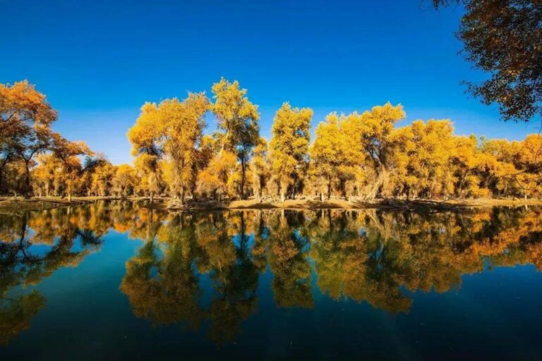
Most-visited core areas are Shayan Zhou (wetland poplar island), Moon Bay (Yueliang Wan) and the 139 km Poplar Secret Drive. The tourism bureau lifted the closure of non-core forest trails in 2025 but kept the strict ‘no unannounced entry’ rule. October is gold season: leaves turn between roughly 10 October and 5 November.
The 2019 poplar rescue and the flood-irrigation trick
For two decades the forest was losing ground: river channels shifted, upstream irrigation take rose, and the water table dropped by enough that older trees stopped regenerating. In January 2019 the Xinjiang Party committee launched a ten-year ‘Tarim Poplar Forest Rescue Action’: refill soil moisture, replant degraded patches, stop illegal logging. The principle was simple: in flood season, divert water from the Tarim into the forest floor and let poplars root from seed. By 2023 the county had restored 85,700 mu of forest and lifted cover to 9.1 percent. Xayar recorded 96 dust days, 31 blowing-sand days and 15 sandstorm days in 2023, the kind of figure that explains why the rescue is paid for by the central budget and not by ticket sales.
Cotton and the honest answer on rice
Drive the G580 or the S108 through Awat in October and the landscape is white. Awat planted 1.42 million mu of cotton in 2020 (190,037 tonnes); the Aksu prefecture planted 7.31 million mu in 2024 (1.0856 million tonnes, up 12% year-on-year). Xayar planted about 1.7 million mu in 2024. Cotton is what these two counties actually do, and what most of the irrigation water is really for.
Rice is the surprising twist. Ask a farmer in Shayan Zhou whether they grow rice and they laugh: the water is too scarce. The Aksu prefecture planted only 107,500 mu of rice in 2024, down 3,000 mu on the year, and most of that rice sits upriver in Wensu. If you are travelling specifically to see paddies, look upriver.
The honest map is cotton dominating the south bank of the Tarim in both counties, long-staple varieties especially in Awat, and rice pushed into the mountain valleys to the north. The single image of what the irrigation grid actually does is a sea of white cotton bolls under the poplars in October.
Wildlife, oil and what you actually see
Three Tarim species show up in real driving logs. The Tarim red deer (Cervus elaphus yarkandensis) is a national class-II protected animal and Xayar’s signature mammal; the forestry bureau hand-rears orphaned calves before release. The wild Bactrian camel (class-I) is rarer and lives deeper in the desert. You will also see storks, ducks, foxes and wild boar along the river bank.
The less romantic story is oil. Xayar hosts the Hade Oilfield (about 1.5 million tonnes a year), the Shunbei Oilfield (1-billion-tonne reserve, 2010s) and the Fuman block (1-billion-tonne reserve, 2021). The same truck convoys that ship cotton north in October will, on certain days, be carrying diesel and drilling pipes south.
Getting there
Neither Xayar nor Awat sits on the Lhasa-Xinjiang rail line. The closest rail head for Awat is Aksu station on the Nanjiang line (about 70 km north), reachable by intercity bus in 90 minutes for 25 to 30 yuan. The A-A railway opened in 2022 and runs daily passenger trains to Awat station; the G580 expressway makes Awat a 50-minute drive from Aksu.
Xayar has no passenger rail. From Aksu, the Xayar long-distance bus station runs coaches roughly hourly between 09:00 and 19:00 (2.5 to 3 hours, 50 yuan). From Korla, an intercity bus runs about five times a day and takes roughly six hours. Driving on the G3012 / G580, allow 2.5 hours from Aksu and 5.5 hours from Korla. There is no airport in either county; the closest active airports are Aksu Wensu (AKS), Alar and Kuqa (KCA), each 90 minutes to two hours away.

Best time to go
Three windows matter. First, late September to mid-October for the poplar gold: leaves turn between roughly 10 October and 5 November depending on September rainfall and the first frost. Second, late November through February for clear-sky photography and prices 30 to 40 percent below peak. Third, avoid July and August: the Tarim is in flood season, river crossings are dangerous, and the Shayan Zhou wetland core area is closed.
Where to stay
In Awat, the practical base is the county seat. Two mid-range hotels on Renmin Road (200 to 350 yuan) and a couple of Uyghur-run guesthouses near the bazaar (120 to 220 yuan) cover the budget. In Xayar, the Shaya town hotel cluster along Beijing West Road and the renovated hotels near the bus station are the main options; budget rooms start around 150 yuan. For the poplar forest, the only in-park accommodation is at Shayan Zhou (300 to 500 yuan, bookable through the forestry bureau).
What to eat
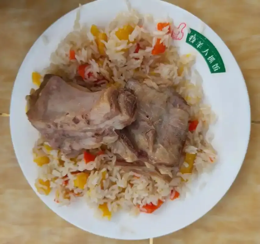
Two dishes are non-negotiable. Museles (慕萨莱思) is the local fermented grape wine, often called ‘Uyghur grape beer’, brewed in vats and served warm. Awat is officially ‘China’s Museles capital’, and a cup in the bazaar costs 5 to 10 yuan. Tongrangrou (馕坑肉) is lamb roasted in a tandoor-style pit, sold by the skewer with flatbread; the Awat night market on Qingnian Road is the safest pick. The Xinjiang pilaf (zhuafan) you will be served is made with carrots, onions, lamb and a small amount of long-grain rice from upriver Wensu.
Rules and safety
Read the Shaya tourism advisory before you go. The August 2025 notice is blunt: the Tarim is in flood from July to August and dangerous; the original poplar forest has no mobile signal and houses wild boar, wolves and foxes; the Taklamakan covers 84 percent of the county; ancient sites are off-limits without permit; any tour operator running trips without prior registration with the cultural-tourism bureau is operating illegally and rescuers will bill the organiser. Report numbers: 0997-8322409, 0997-8312123.
A three-day sample itinerary
This is the route we ran on our last trip. Assumes you start in Aksu and have a driver.
Day 1, Aksu to Awat to Xayar. Leave Aksu after an early breakfast and drive the G580 to Awat (50 minutes). Visit the Awat bazaar for Museles and dried dates, then continue east on the G580 through the Tarim bridge at Xiaojiak (the four-river view is best in late afternoon). Push on to Xayar (2.5 to 3 hours total from Awat). Stay in Shaya town.
Day 2, Xayar poplar core. Sunrise at Shayan Zhou wetland, drive the 139 km Poplar Secret Drive loop, lunch in Gaizikumu township, afternoon at Moon Bay. Stay a second night in Shaya or, if booked in advance, in-park at Shayan Zhou.
Day 3, Xayar to Kuqa. Drive west on the S108 to Kuqa (about three hours), detour to the Kuqa Grand Canyon for two hours, then continue to Kuqa city for the night. The Aksu travel guide and the Xinjiang autumn foliage calendar are useful cross-references.
FAQ
Is Awat worth a stop on the Tarim Desert Highway? Yes. The highway crosses the Taklamakan from Luntai to Minfeng; Awat is the closest comfortable base before the Luntai entrance, with full hotels, fuel and a real bazaar. Allow one night each side.
Is Xayar dangerous? No, but only if you respect the rules. The county is safe; the Taklamakan itself is not. Stay on the marked forest tracks, register with the tourism bureau before any deep-forest trip, and never cross the Tarim on foot between July and August.
Can I see rice paddies here? Do I need a permit? Not really. Local irrigation water is allocated to cotton, dates and walnuts; for paddies head upriver to Wensu. Foreign visitors still need the standard Xinjiang tourist permit (apply via a registered tour company); the poplar forest does not require an additional permit but the Taklamakan south of the forest does.
Disclaimer
This article is based on four trips to Xayar and Awat between 2022 and 2025, cross-checked against the county portals (xjsy.gov.cn, xjawt.gov.cn), the 2024 statistical communiques and the 2025 Shaya tourism advisory. Figures on river length, forest area, cotton planting and railway opening dates may shift slightly as the next census comes out. Confirm flood-season advisories and road closures with the local cultural-tourism bureau before you travel.
About the author
Karl Huang has driven the Tarim basin five times since 2018, mostly for cotton and poplar fieldwork. He edits Xinjiang Attractions and has written the Xinjiang autumn foliage calendar, the Aksu travel guide and the Luntai Tarim Poplar Forest post.