Published: August 26, 2026 | Author: Karl Huang, Xinjiang Attractions
The first time I stood at the centre of Tekes, I thought my map app had broken. Eight streets run straight out from a single round plaza, each one named for a trigram of the I Ching: Qian, Dui, Li, Zhen, Xun, Kan, Gen, Kun. Four ring roads wrap around them like ripples in a pond. There is no traffic-light grid in the old core; drivers simply flow around the roundabouts and let the geometry do the work. This is Tekes Bagua City, the county town of Tekes in the Ili Valley of Xinjiang, and it is one of the strangest city plans I have walked through in China.
Why you can trust this: I have driven the Ili loop three times in the last three years and stayed in Tekes twice, once in late May and once in early October. This guide is built from what I saw on the ground, from getting lost in the ring roads to asking hotel owners how the no-light system actually works.
Tekes Bagua City at a Glance
| Aspect | Details |
|---|---|
| Location | Tekes County, Ili Kazakh Autonomous Prefecture, Xinjiang |
| Claim to fame | World’s largest intact Bagua-pattern city; no fixed traffic lights in the historic core |
| Altitude | Town ~900–1,200 m; surrounding peaks to 4,900 m |
| Best time | May to early October; June for wildflowers, September for clear skies |
| Recommended stay | 1–2 nights as a base for Kalajun and Qiongkushitai |
| Key sites | Central Bagua Tower, Li Street heritage lane, I Ching Cultural Park, county museum |
What Walking the Eight Trigrams Actually Feels Like
Most Chinese towns feel like grids. Tekes feels like a diagram that someone decided to live inside. I arrived from Yining after a two-hour drive, dropped my bag at a small hotel on Kan Street, and immediately went for a walk. Within ten minutes I understood the basic idea: every road has a trigram name, a compass direction, and a number. Kan Street is north. Li Street is south. The rest fan out from there.
But the part that surprised me was how easy it is to get turned around. The ring roads look similar, the buildings are low, and the mountains sit in every direction. I tried to walk straight from the centre to the third ring and ended up on the wrong spoke twice. A local baker finally explained it: think of the town as a target, not a grid. Identify the ring, then identify the spoke. Once I did that, navigation clicked.
The scale is also smaller than the diagrams suggest. You can cross the inner ring on foot in under twenty minutes. That intimacy is what makes the place work as a visitor: you can cover the central tower, the heritage lane, and a decent meal in a single relaxed afternoon.
Reading the Map: How the Street Grid Works
The layout was planned in 1937 by Qiu Zongjun, then the Ili Reclamation Commissioner, and the street pattern was ploughed into the farmland by county magistrate Ban Jichun using twenty teams of oxen in 1939. The city was officially moved to this site on 22 October 1939. The design is based on the Later Heaven Bagua arrangement from the Zhouyi.
From the central Taiji altar, eight main streets radiate outward. Each one is roughly 1.2 to 1.6 km long and named for a natural force: heaven, marsh, fire, thunder, wind, water, mountain, earth. Four concentric ring roads connect them. Local counts say the first ring has 8 blocks, the second 16, the third 32, and the outer ring 64, mapping onto the 64 hexagrams of the I Ching. Whether you buy the numerology or not, the result is a city where every intersection is a roundabout and every address is relative to a trigram.
Why a City Built Without Traffic Lights Still Flows
The claim that Tekes has no traffic lights is almost true. In the historic Bagua core, roundabouts handle every crossing. Drivers slow down, merge, and exit. It is slower than a signalised intersection but keeps moving. On my first evening there I stood at a busy roundabout for ten minutes waiting for a friend and watched the rhythm: cars yield to each other, pedestrians cross in short bursts, nobody honks much.
That said, the no-light rule applies mainly to the old city. As car ownership has risen, mobile or temporary signals have appeared on the outer arterial roads, especially near the bus station and the highway approach. If someone tells you there is literally not a single traffic light in the whole county, they are exaggerating. But the historic core still runs on geometry, and that is the real experience.
Climbing the Central Tower for the Full View

The observation tower at the central plaza is the obvious first stop. Originally built in 1968 and rebuilt as a viewing platform in 1993, the climb is straightforward. The top gives you the view that makes the whole concept click: eight streets shooting out like spokes, four rings holding them together, and low buildings keeping the pattern visible. It is not tall, but it is tall enough.
I went up twice. Midday gives sharp shadows and colour; sunset turns the Ili Valley hazy. Go about an hour before dusk. The platform can get crowded with tour groups in July and August.
Li Street and the Old Town Beyond the Geometry
Li Street, the southern spoke, is the best-preserved heritage lane. It is also where the town stops feeling like a maths puzzle and starts feeling like a place people actually live. The walls are painted with murals, small shops sell felt crafts and honey, and the side alleys lead to courtyards where families grow grapes and roses.
I spent a slow hour there one morning, drinking black tea in a courtyard that doubled as a souvenir stall. The owner told me the street had been renovated in the 2010s, but the layout was original. What matters is that the lane feels coherent and local, not like a theme-park rebuild. It is the easiest place in Tekes to photograph daily life.
The Wusun Backstory Most Visitors Miss
Tekes sits in a valley that was once the summer capital of the Wusun kingdom, a nomadic confederation that allied with the Han dynasty through the famous princess marriages. The name Tekes is said to come from a Dzungar word meaning “place with many wild goats.” Kazakh and Han communities have shared the valley for generations.
This history matters because it explains why a town in the far west of China adopted a classical Han planning text. The 1937 design was a deliberate statement about order, settlement, and cultural connection at a tense frontier moment. The county museum has a small collection of Wusun-era artefacts and photos of the 1939 street-ploughing; I spent about forty minutes there and left with a better sense of why the place looks the way it does.
Getting to Tekes and Moving Around
The nearest major city is Yining, about 116 km north on G577 and the Yidun Expressway. Driving takes roughly two hours, though the tunnel section and the final mountain approach can slow you down. I came by rental car from Yining airport; the road is paved and easy to follow, but I still downloaded an offline map because mobile signal drops in the passes.
Buses run from Yining’s long-distance station to Tekes throughout the day, taking two to three hours and costing roughly ¥50. Once you are in town, you do not need a car for the city itself. The central tower and Li Street are walkable from most hotels. For side trips to Kalajun Grassland or Qiongkushitai, you will want a private driver or a tour shuttle; public transport to the villages is thin.
Best Time to Visit: The Ili Valley Inversion Window
Tekes sits in a mountain basin with an inversion climate: cold air gets trapped in winter, but summers stay mild. July averages only about 18 °C, which is why it became a summer retreat. The frost-free period is short, roughly 118 days, so the green window is narrow.
I visited in late May and early October. May was cold at night and bright green by day, with wildflowers starting in the nearby grasslands. October was crisp and almost empty of visitors, but some guesthouses had already closed. My recommendation is late June to early September for the most reliable weather and open facilities. Winter is quiet and atmospheric, but many rural roads close and some hotels shut down.
Where to Stay
Accommodation in Tekes is practical rather than luxurious. The town has a mix of small hotels, inns, and a few family guesthouses. I stayed in a simple hotel on the second ring for ¥180 a night; it was clean, had fast Wi-Fi, and the owner helped me book a driver to Kalajun. In peak summer, prices can double and rooms sell out, especially when tour buses roll in.
If you are using Tekes as a base, I would pick somewhere inside the first or second ring for walkable dinners. The outer rings are newer and more spread out, with bigger hotel chains, but you lose the convenience of strolling to the tower at dusk. For a more local experience, look for a Kazakh-run guesthouse on the edge of town; they often serve better breakfast than the mid-range hotels.
What to Eat
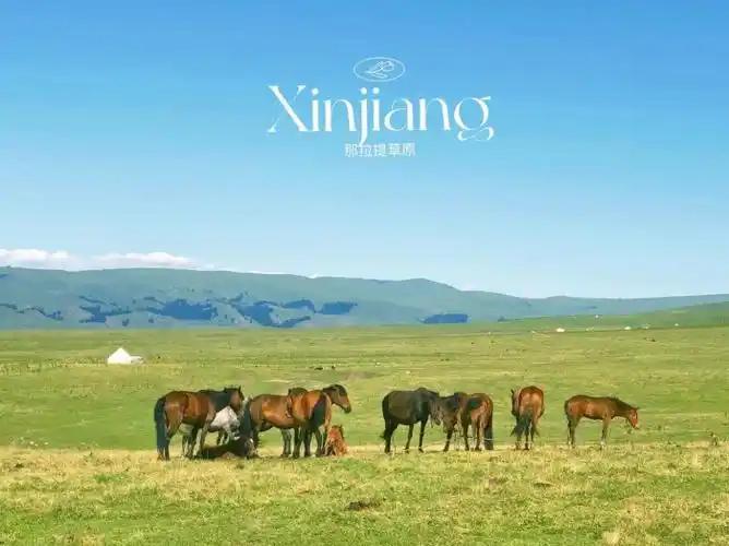
The food scene is standard northern Xinjiang: hand-pulled noodles, lamb skewers, pilaf, and local breads. I had the best meal of my stay at a small restaurant on Li Street, where the owner grilled lamb ribs over charcoal at the door and served them with yoghurt and flatbread. Prices were lower than in Yining and the portions were generous.
There is also decent dairy. Kazakh families sell fresh milk, yoghurt, and simple cheese at the morning market near the bus station. If you are heading out to Kalajun or Qiongkushitai, stock up here; food options thin out quickly once you leave town. One practical note: not every small stall takes mobile payment, so carry a little cash.
Two Mistakes We Made
My first mistake was assuming the tower would be best at midday. The light is flat then, and crowds peak around lunch. Sunset and early morning are better for photographs.
My second mistake was trying to drive straight from Tekes to Qiongkushitai without checking the road status. The mountain road is narrow and occasionally closed. I turned back after an hour. Treat Qiongkushitai as a full-day commitment unless you have a local driver.
A Two-Day Itinerary
Day 1: Arrive from Yining by early afternoon. Walk the central tower, then stroll Li Street before dinner. Stay inside the second ring.
Day 2: Take an early shuttle or driver to Kalajun Grassland, returning to Tekes for the evening. Alternatively, use the day for a relaxed loop through the Wusun museum, a market visit, and a late-afternoon climb of the tower for a second look.
If you have a third day and a reliable driver, add Qiongkushitai village or head toward Qapqal for a different side of the Ili Valley.
Frequently Asked Questions
Do I need a guide for Tekes?
No. The tower, Li Street, and the central plaza are easy to explore on foot. A guide helps if you want detailed background on the I Ching layout or Wusun history.
Is Tekes worth a stop on its own?
As a standalone destination, one afternoon is enough. Its real value is as a base for Kalajun, Qiongkushitai, and Huiyuan Ancient City.
How long does the tower take?
Plan thirty to sixty minutes, including the climb, the view, and the inevitable photo attempts of the full Bagua pattern.
Are the ring roads hard to drive?
Not hard, but they require attention. Signage is decent in Chinese and English, and most roundabouts are marked with the trigram names. The trick is not to assume you can cut straight across.
Can I visit in winter?
Yes, but many grassland roads close and some hotels shut down. If you mainly want the town and tower, winter is quiet and scenic.
Disclaimer
This guide is based on my own visits and ongoing research. Road conditions, hotel availability, and opening hours change with the season. Check local sources before setting out, especially if you plan to drive mountain roads or visit during winter.
About the Author
Karl Huang, Xinjiang Attractions
I am a travel writer based in China with a focus on Xinjiang and the Silk Road. I research on the ground, verify details with local sources, and update guides when conditions change.