Published: September 6, 2026 | Author: Karl Huang, founder of Xinjiang Attractions
Wenquan usually shows up in English itineraries as one line under Sayram Lake, and the line undersells it. The county’s Chinese name means “hot spring,” it holds two-thirds of Bortala’s frontier with Kazakhstan, and it keeps a Bronze Age stone complex that made China’s national top-ten archaeology list. We drove in from Bole in late June 2025 expecting a quick soak and left with a notebook full of things no day trip covers. Everything below was re-checked in August 2026 against county and prefecture sources; numbers we could not pin down, we leave out.
| Quick facts | Detail |
|---|---|
| Where | Western end of Bortala Mongol Autonomous Prefecture, northern Xinjiang |
| Size and border | About 5,885 sq km; roughly 276 km of boundary with Kazakhstan across 33 mountain passes |
| County seat | Bogedar town, elevation about 1,359 m |
| Distance | About 90 km west of Bole; roughly 625 km by road from Urumqi |
| Known for | Three named spring fields, the Adunqiaolu Bronze Age site, the Ranodon salamander reserve |
| Green season | Late May to mid-September; wildflowers peak around late June |
| Getting in | Road from Bole; Bole rail station and Bole Airport (BPL) upstream |
| Paperwork | Passport required; parts of the county are closed military zones |
Wenquan county Xinjiang: a valley boxed in by three ranges
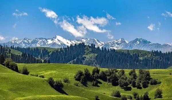
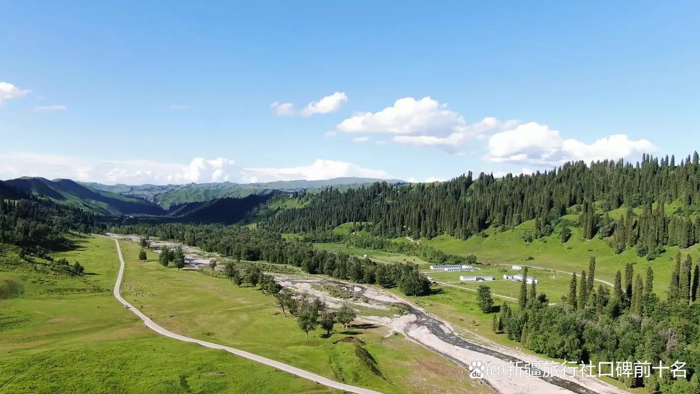
The county occupies the upper trough of the Bortala River, and the shape explains everything about the place. Mountains cover about 68 percent of its 5,885 square kilometres: the Alatau wall runs along the north, the Biezhentao range separates the county from Huocheng in the south, and the Kongguoluo’ebo mountains close the west against Kazakhstan. Between them the valley floor stretches about 148 km from west to east, opening gradually like a funnel toward Bole. About 73,000 people live here across 24 ethnic groups, many descended from Mongol herders resettled by the Qing court, and the county seat of Bogedar sits at 1,359 m, high enough that July nights call for a jacket.
How a Mongolian word for healing water named a whole county
Locals called the place Arixang in Mongolian, and the town’s older name, Bogedar, is usually glossed as “behind the sacred mountain.” The area was split from Bole county in 1938 as a temporary administration and became Wenquan County in 1941, joining the new Bortala prefecture in 1954. It remains the only county in China named after a geothermal resource, a fact the Ministry of Land and Resources made official in 2012 when it designated Wenquan “China’s hometown of hot springs.” Three fields carry the fame: Shengquan, the Holy Spring, now the county’s only national 4A scenic area beside the town; Tianquan in the Otokesar valley to the southeast; and Xianquan up at Arxiati in the northeast. If soaking is the priority, our pool-by-pool hot spring guide covers temperatures, prices and bathhouse etiquette.
The 276-kilometre question: life along the Kazakhstan line
Wenquan controls about 276 km of the China–Kazakhstan boundary, two-thirds of Bortala’s total, threaded by 33 passes that herders once used like village lanes. That history is still visible in the rules. Large parts of the high country sit inside military control zones, which is why the Arxiati grassland and its fairy spring remain closed to tourists despite appearing in older articles, and why drivers carry border-area paperwork as a matter of routine. Assume three things: carry your passport, expect checkpoints on western and northern roads, and leave the drone packed away, since flying near the boundary is effectively prohibited. Trade that once crossed these passes now funnels to Alashankou, the rail port two counties east.
Where the Bortala River learns to flow
The prefecture’s namesake river is born here, rising at Honglin Daban in the western mountains and collecting 26 of the 75 or so mountain streams that drop off the surrounding ranges. By the time it leaves the county it has run about 150 km, settling into an average flow near 10 cubic metres per second, steady across seasons because springs share the load with snowmelt. The Otokesar, Arxiati and Mirqik tributaries all join inside the county. For travelers the payoff is the riverside: the forest strip beside town is a national wetland park with a 38 km greenway, and we walked a stretch of it one June evening while herds crossed the shallows behind us.
Adunqiaolu: a Bronze Age stone maze above the river
Forty-one kilometres west of town, where the Alatau’s southern foothills flatten into steppe, granite boulders lie scattered across the grass in drifts that the Mongolian name compares to a herd of horses. Archaeologists from the Chinese Academy of Social Sciences began surveying in 2010 and uncovered something rarer: eleven grouped stone compounds circling a low hill, including Building F1, a double-walled rectangle about 22 by 18 metres with a projecting entrance passage, plus a cemetery of more than 60 stone slab graves and 30 cairns about 1.8 km south. Charcoal dates the complex between roughly 1900 and 1700 BC, early Bronze Age, and it was named one of China’s top ten archaeological discoveries of 2012. The slab-grave tradition matches finds at Begazy across the border in Kazakhstan, evidence that the Seven Rivers world reached this far east. Nearby, a granite formation called the Mother Stone and scattered carved stone figures draw local pilgrims. There is no ticket booth or fence; we visited with a local driver and treated it as an active research site, which means no climbing on the walls.
The salamander next door, and why its creeks stay closed
The strangest resident of the county is about 20 centimetres long. The Semirechensk salamander, known in China as the Xinjiang salamander, was described by the Russian naturalist Kessler in 1866 and then went unrecorded for more than a century until 1989, when a student from Wenquan brought a “four-legged snake” to Xinjiang Normal University. The species survives only in a narrow band of spring creeks around 2,100 to 3,200 m on both sides of the border, listed as Endangered on the IUCN Red List and protected at China’s national class-two level since 2021. A reserve created in 1997 became a national nature reserve in 2017, and counts have climbed from about 1,700 individuals in the 1990s to roughly 3,300 in recent surveys. Don’t plan a hike to see one: the reserve is closed under a strict access regime, and the place to learn the story is the salamander centre in town.
Chahar garrisons, a white temple and a county of short songs
After the Qing court pacified the Dzungar region in the 1750s it moved Chahar Mongol banner households from the Inner Asian frontier to garrison this valley, and their descendants still herd here, joined later by Torghut returnees whose journey we traced in our Bole and Bortala guide. The community’s monument is Jifu Temple, first built in 1770 with the Ili general’s approval and nicknamed the White Temple; damaged and moved repeatedly, it was rebuilt on the present site in 1909 and restored from 1988. At about 4,875 square metres it counts as the largest Mongol Buddhist temple in northern Xinjiang, and its new-year gathering still pulls hundreds of worshippers. Outside the temple: Wenquan’s Mongol short-tune folk songs were added to the national intangible heritage list in May 2021, the sawurden dance runs on tobshuur strings, and a Naadam sports park 2 km south of town hosts wrestling and horse events each summer.
Getting there: a valley road, a branch line and a new airstrip
Most arrivals come the way ours did, by road from Bole about 90 km east, a valley highway of about 90 minutes through thinning farmland. Shared taxis and scheduled coaches make the run daily, and your own car or driver matters more here than in most of Xinjiang, because the sights pull in different directions. Bole itself is plugged into the rail network through the prefecture branch line that opened in 2019, and Bole Airport handled around 570,000 passengers in 2025 with the Urumqi flight taking about 75 minutes. A general-aviation airfield with an 1,800 m runway was also built at Angelege southeast of town and was slated for trial flights from late 2025, so check its current status rather than planning around it. From Urumqi, budget a full 625 km driving day.
An official summer refuge, and a winter that clears the streets
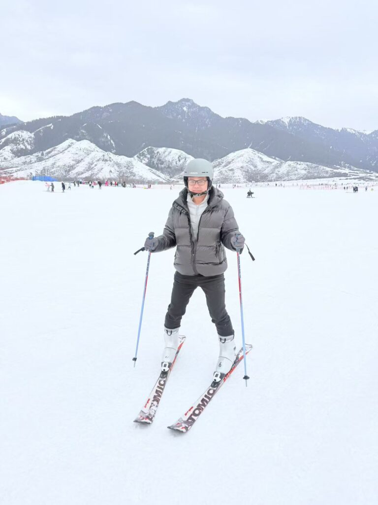
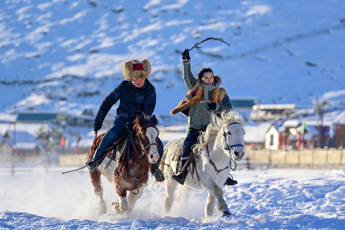
In December 2018 the national meteorological authority formally designated Wenquan a summer refuge, and the numbers back the plaque. The annual mean is about 4.1°C, with recorded extremes of 37.2°C and minus 35.9°C, frost-free days run 144 to 166, and sunshine totals around 2,800 hours a year. Precipitation averages 254 mm on the plain but closer to 450 mm in the mountains. Winter is the sharper season: a temperature inversion means the valley floor often runs 4 to 5°C milder than Bole, yet snow seals the high country from November into April, and the county keeps a cross-country ski venue that winter teams use. Because the county sits near 80°E but runs on Beijing time, midsummer daylight lingers past ten at night.
The county table: cold-water fish and Chahar dairy
Wenquan eats from cold water and pasture. Trout farming in the county’s spring-fed ponds produces the rainbow and golden trout sold dried as a local specialty, and the hatchery centre at Bure village breeds whitefish stock that seeds Sayram Lake; county figures credit the industry with about 468 tonnes of processed output in 2022, including caviar shipped as far as Finland. Menus lean on the Bortala trio: hand-grabbed mutton boiled plain and cut at the table, a braised meat dish the county calls its own, and dairy in every form, from salted milk tea to dried curd. Our best meal was a whole trout near the wetland, costing less than either bathhouse ticket.
What pays the bills besides soaking
It helps to know what a county lives on before you read its townscape. Wenquan’s 2024 GDP was about 4.6 billion yuan, roughly half of it services, a quarter farming: nearly 520,000 crop mu dominated by corn, and more than half a million head of livestock on the summer pastures. Underfoot the geology matters too, because the county holds about 56 percent of Xinjiang’s proven tungsten reserves among 27 identified minerals, a quiet mining economy you can read in the wide streets and new school buildings.
Three days in the valley without repeating yourself
Day one belongs to town. Walk the riverside greenway in the late light, spend an hour at the salamander centre, and finish with an evening soak the way local families have for a century. Day two goes west and north: the drive out to Adunqiaolu takes about an hour, and we paired it with the Mother Stone and a roadside lunch on the Mirqik grassland. Day three points southeast on the X210 county road, 25 km to the Otokesar valley, where a five-kilometre boardwalk climbs past rocks carved with Sui-and-Tang-era petroglyphs toward the Narinsala waterfall.
Frequently asked questions
Do foreign travelers need permits inside Wenquan county?
The county town, the spring areas and the Otokesar valley are open, and your hotel registers your passport as anywhere in Xinjiang. The high border zones, including Arxiati, are closed military areas, so follow road signs rather than map pins.
Is it worth visiting if I only care about hot springs?
If pools are the whole agenda, a day trip from Bole covers the Holy Spring comfortably. The county earns a second night with the Adunqiaolu stones and the river valley.
When is the valley at its greenest?
Pasture colour holds from late May to mid-September. Wildflowers peak around late June and the Otokesar gorge turns gold toward the end of September.
How cold does winter actually get?
January nights in town average near minus 15°C and have touched minus 36°C. The inversion effect keeps the valley floor noticeably milder than the open plain east of Bole.
Disclaimer
This article reflects our own trip in June 2025 and desk research re-verified in August 2026. Prices, opening status and border regulations in frontier counties change without notice; confirm current conditions locally before you travel. We paid our own costs and no business named here sponsored this coverage.
About the author
Karl Huang has been traveling and writing about Xinjiang since 2019 and founded this site to document the places between the headline sights. His field notes from Bortala and the Ili valley anchor most route guides here.