Published: August 21, 2026 | Author: Karl Huang
Most people treat Hutubi as a blur on the way somewhere else. The G30 expressway drops you past it in under an hour out of Urumqi, and the train barely slows. We had crossed the county a half-dozen times before we actually stopped, drawn off the highway by a sign for the Kangjia Shimenzi rock art that none of our guidebooks had bothered to mention. What we found was a working farm county with a genuine archaeological surprise cut into the southern mountains, and it has become one of our favorite low-effort detours on the northern Xinjiang corridor.
Hutubi at a Glance
| Plan for | Hutubi County |
|---|---|
| Region | Changji Hui Autonomous Prefecture, northern foot of the Tianshan |
| Distance from Urumqi | About 70 km west; roughly 40 minutes by car or an hour by rail |
| Known for | The Kangjia Shimenzi petroglyphs, cotton and corn farmland, southern Tianshan foothills |
| Main gateway | Hutubi Station on the northern Xinjiang rail line; G30 exit for the county |
| Best months | May to June for green fields and foothill grass; September to October for harvest |
| Suggested stay | Half a day to one full day; easy as a stop between Urumqi and Shihezi |
Hutubi wears its working character openly. This is not a scenic town that has been polished for visitors. It is a place where the fields matter more than the photo ops, where the river that runs north out of the mountains still decides what gets planted, and where the headline sight is a few thousand years old and halfway up a cliff. That combination is exactly why we like it.
The petroglyphs we almost missed
The Kangjia Shimenzi carvings sit about 78 kilometers southwest of the county seat, tucked into the foothills where the road climbs toward the southern Tianshan. We drove out one clear morning, past the last of the wheat fields and then up a narrowing valley through what locals call Shitizi, the stone-gate township. The site itself is a weathered rock face on a hillside, protected behind a fence, with a viewing platform built so you can see the figures without touching them.
What is carved there stopped us cold. Dozens of human figures march across the stone, and the largest are tall nude female forms with deliberately exaggerated features, surrounded by smaller dancers and what look like hunting scenes. Archaeologists read the panel as a fertility and worship site made by the nomadic peoples who moved through these valleys more than two thousand years ago. Standing in front of it, with the wind coming down off the snow line, the abstraction of “ancient Silk Road cultures” became something you could actually see. A caretaker told us the site is closed on some weekdays for conservation work, which is worth knowing before you commit the drive.
Getting to Hutubi
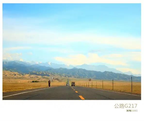
Hutubi is about as easy to reach as anywhere on the corridor. By car, the G30 Lianhuo Expressway runs straight from Urumqi to the county in well under an hour, and the exit puts you onto the main road without drama. By rail, the northern Xinjiang line has a stop at Hutubi Station, roughly an hour out of Urumqi and a convenient way to arrive without a vehicle. Our self-drive logistics guide covers the toll and fuel practicalities if you are building a longer northern loop, and the high-speed rail guide lays out the timetables for the Urumqi-side stations.
The petroglyphs are not reachable by rail. From the county town it is a self-drive or hired-driver trip of about ninety minutes each way on paved but climbing roads. We treated it as a half-day outing from a Urumqi base and were back in time for a late dinner.
Farm country and the southern foothills
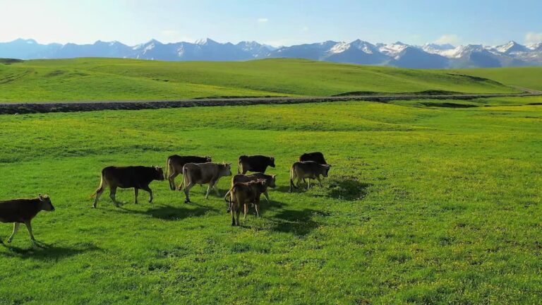
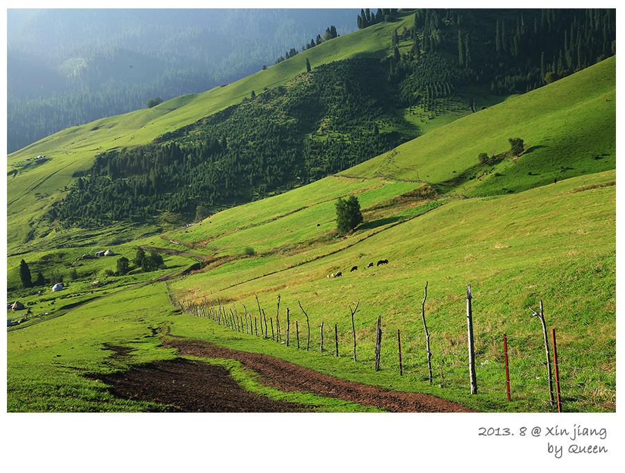
The flat land north of town is the reason Hutubi exists. The Hutubi River, fed by the Tianshan snowmelt, spreads across a wide fan of fields that grow cotton, corn, tomatoes, and sugar beet in rotation, with grape rows and melon patches where the microclimate allows. In late summer the fields run to the horizon in stripes of green and gold, and the harvest brings trucks onto every road. We pulled over once just to watch a mechanical picker work a cotton field, which is a dull sentence to write and a strangely satisfying thing to watch.
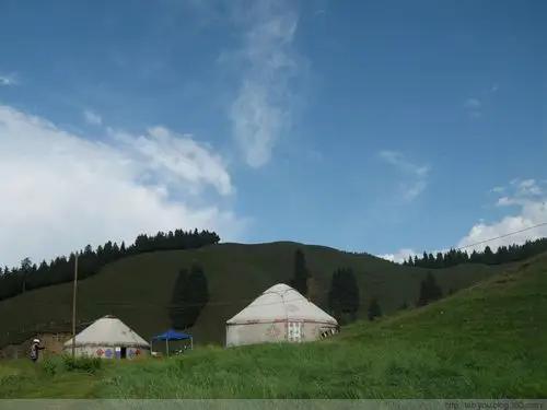
South of the farmland the ground rises into the Tianshan foothills, spruce on the higher slopes and grass below, with a few small reservoirs and picnic spots where the county families go on weekends. It is the same range that backs Urumqi’s own southern mountains, and our Tianshan Grand Canyon guide describes the terrain and access rules for the wider range if you want to go deeper into the hills.
When to go
The best window depends on what you came for. Late spring, May into early June, is when the fields are green and the foothill grass is at its softest, and the valley road to the petroglyphs is clear of any late snow. Autumn, September and October, is harvest season, when the farmland turns gold and the light goes long in the late afternoon. Winter is quiet and cold, good for empty roads but poor for the mountain drive. We have been in June and in September and would pick either over midsummer, when the fields are at their dustiest and the midday heat sits on the plain.
If your trip is built around fall color, our autumn foliage calendar tracks when the northern corridor typically turns, though Hutubi’s draw is the fields more than the poplars.
Where to sleep
The county town has a solid range of mid-price hotels, clean and functional, with the usual breakfast buffet. Urumqi, less than an hour east, has every chain and budget you could want if you would rather base there and make Hutubi a day trip. Shihezi, about forty kilometers west, is the other easy base and has a slightly wider dinner scene. We have done both: based in Urumqi for the petroglyphs day trip, and once stayed in town after a late harvest-market wander. Either works; book ahead in October, when the harvest brings out-of-town crews into the hotels.
What to eat
Hutubi eats like the rest of northern Xinjiang, which is to say generously. The county town runs the full set: hand-pulled laghman noodles, dai pai dong style stir-fries, charcoal lamb, samsa baked in the tandoor, and the stuffed flatbread that vanishes before it cools. A market cook we traded jokes with made us a plate of cold-skin noodles (liangpi) with just enough chili to be interesting, and sold us a bag of locally grown melon that tasted like the field it came from. None of it is destination dining, and that is the point: this is where the region actually eats, not where it performs for cameras. The Urumqi guide and the Changji guide cover the wider food scene if you want more range.
Practical tips
- The petroglyph site is a protected monument. Stay behind the fence and the platform, do not try to trace or touch the carvings, and leave drones packed. Recreational drones need Civil Aviation Administration registration in China, and a fragile rock-art panel is the worst place to test that.
- Check the site’s open days before you drive out. Conservation closures hit weekdays, and we have arrived to a locked gate.
- Fuel and cash: fill up before leaving the highway, and carry some cash for the small roadside vendors who do not run card readers.
- The mountain road is paved but climbs steeply. In spring or after rain, ask locally about conditions before you commit the ninety-minute drive.
- Pack a layer you can add. The foothills are cooler than the plain, and the wind off the snow line cuts through a light jacket.
A day trip from Urumqi
Morning. Leave Urumqi after breakfast and drive the G30 west to the Hutubi exit, about seventy kilometers. Coffee and a snack in the county town, then head south toward Shitizi and the petroglyph site, arriving mid-morning when the light sits on the carving panel.
Midday. Walk the platform, talk to the caretaker if they are about, then drive back down and find a roadside lunch in town. If the season is right, detour through a stretch of farmland or up to a foothill reservoir for an hour.
Afternoon. Either return to Urumqi in time for dinner, or continue west on the G30 to Shihezi and the next leg of your loop. For a fuller northern Xinjiang plan, the Changji guide connects Hutubi to the rest of the prefecture.
Frequently asked questions
Is Hutubi worth a stop? If you like archaeological sites, quiet farm country, or an easy break on the Urumqi-Shihezi drive, yes. If you only have time for the headline destinations, it is an easy skip.
Can I see the petroglyphs without a car? Not easily. The rail gets you to Hutubi town, but the site is ninety minutes farther into the foothills by paved road. Hire a driver from the county, or join a Urumqi-based day tour.
When is the site open? It runs most days in season but closes some weekdays for conservation. Confirm before you drive, because the gate is real and the drive is long.
How long do I need? Half a day from Urumqi for the petroglyphs alone, or a relaxed full day if you add the farmland and a foothill stop.
Any permits? No special permit for the county or the site. The monument asks only that you follow its access and preservation rules.
Disclaimer
This article reflects our visits and research as of August 2026. Opening hours, rail and road timetables, site access rules, and conservation closures change without notice. Confirm details with official sources such as the Xinjiang Tourism Bureau (xinjiangtour.gov.cn) and the China Meteorological Administration before you travel. Nothing here is professional legal, medical, or veterinary advice, and archaeological and wildlife conditions can never be guaranteed. Travel responsibly and follow all local rules.
About the author
Karl Huang is a travel writer who has driven and ridden the rail lines across northern Xinjiang for over a decade, with a soft spot for the unglamorous counties that turn out to have something old and unexpected. He would rather find a two-thousand-year-old carving than a five-star view.