Published: August 8, 2026 | Author: Xinjiang Attractions Editorial Team
Most visitors arrive in Xinjiang chasing lakes and old town lanes, and they leave without ever seeing the single feature that quietly shapes the whole region. Tomur Peak is the highest summit of the Tianshan Mountains, and after three days on its southern flank in Wensu County we came away certain it belongs on any serious Xinjiang plan. This page pulls together what we learned on that trip and the hard details we confirmed with the reserve office and the UNESCO file, so you can stand beneath the mountain without repeating our early mistakes.
At a Glance: Tomur Peak Quick Reference
| Fact | Detail |
|---|---|
| Elevation | 7,443 m (24,459 ft) — highest in the Tianshan |
| Location | China–Kazakhstan border; south face in Wensu County, Aksu Prefecture, Xinjiang |
| Status | Component of the Xinjiang Tianshan UNESCO World Heritage Site (inscribed 2013) |
| Nearest city | Aksu, about 70 km southeast of the Wensu Grand Canyon entrance |
| Best viewing season | June to September, when access roads are snow-free |
| Climbing | Expedition only; requires mountaineering and border permits |
| Tourist access | Viewing platform inside the Tomur National Nature Reserve, reached via the Wensu Grand Canyon scenic area |
Tomur carries a second name you will see on older maps: Pobeda, or Victory Peak. Whatever you call it, the number that matters is 7,443 metres. It is the tallest point across the entire Tianshan and the northernmost peak above 7,000 metres anywhere on Earth. The summit straddles the China–Kazakhstan line, and its southern glaciers drain into Xinjiang.
Why Tomur Peak Earned Our Respect
We left Aksu at first light, chasing a forecast that promised clear air. The road northwest toward Wensu first runs through flat farmland, then the land starts to buckle. By the time we reached the entrance of the Wensu Grand Canyon, the red rock walls had given way to a wide gravel riverbed flanked by snow-streaked ridges. Our driver, a man who had made this run for a decade, kept repeating one word: patience.
The viewing platform for Tomur is not a short walk. You ride a scenic-area shuttle partway, then transfer to a 4WD that crawls up a side valley. At roughly 3,000 metres the trees stop. Above that, the world is scree, glacier-milk-grey rivers, and suddenly, filling the windscreen, the white massif. We had seen photos; none prepared us for the scale. The peak hides behind a nearer ridge until the last bend, then it is simply there, bigger than the frame can hold.
What stayed with us was not the height but the silence. No cable car, no souvenir stall at the top, no fence. Just wind and the sound of meltwater. On the way down we spoke with a reserve ranger who had worked the valley for fifteen years; he told us the platform gets maybe a few hundred visitors a week in peak season, against the tens of thousands who crowd Tianchi. If you want a mountain that still feels unexploited, this is the one.
Getting to the Tomur Region
Aksu is the real gateway. Flights from Urumqi land at Aksu Hongqiao Airport several times a day, and the Duku Highway — which opens roughly from June to September — passes through the Tianshan not far north of here, making a Tomur stop logical on a longer loop. If you prefer the train, the Southern Xinjiang railway line reaches Aksu, and long-distance coaches connect it with Kashgar and Korla. From Aksu city it is about an hour and a half by car to the Wensu Grand Canyon ticket gate.
Inside the scenic area you cannot self-drive to the platform in a rented sedan. The reserve runs shuttles to a transfer point, and from there only the area’s own 4WD vehicles continue up the valley. Budget half a day each way if you want to reach the upper viewpoint and actually walk a short distance for a clear look.
Two practical notes. First, the last shuttle down leaves well before dark, and there is no lighting on the mountain road, so start early. Second, foreign passport holders should carry their border-region paperwork; Wensu sits close enough to the frontier that checks are routine, and arguing at the gate wastes the one resource you cannot buy back: daylight.
When to Go
Timing decides everything here. The best window for Xinjiang generally runs June through September, and Tomur is no exception. In those months the access road is clear of snow and the platform is open. July and August bring the warmest days and the fullest blue-ice exposure on the glaciers, but also the biggest crowds and the occasional afternoon thunderstorm that swallows the summit for hours.
We went in early September and would do it again. The light was cleaner, the shuttle queues shorter, and on our second morning the peak stayed visible for nearly three hours. October is a gamble; some years the first snow closes the upper road by mid-month, and then the mountain is viewable only from lower viewpoints.
Where to Sleep
Aksu city has the widest choice, from international-brand hotels near the airport to quiet courtyard guesthouses in the old Uyghur quarter. Stay there the night before so you can reach the canyon early. Inside the reserve itself there is no hotel at the platform; the nearest rooms are basic lodges near the canyon entrance, fine for a single night if you want to catch first light but thin on heating outside summer. We slept in Aksu both nights and treated the drive as part of the experience rather than a chore.
What to Eat
Aksu and Wensu feed you well. Start with laghman, the hand-pulled noodle tossed with tomato, pepper and mutton — we found the version at a corner canteen near the Aksu bus station beat anything at the hotels. Samsa, the baked meat pastry sold from roadside tandir ovens, makes a good breakfast before the drive. In autumn the local apples deserve attention; Aksu sits in one of Xinjiang’s best apple belts, and a bag of the small sour-sweet ones cost us less than a bottle of water.
Bring your own water and snacks up the mountain. Past the canyon entrance there is nothing to buy, and the altitude turns a normal hunger into a real problem faster than you expect. We packed three litres per person and finished most of it.
Practical Tips Before You Head Up
- Altitude is real. The platform sits around 3,000 m and the walk above it higher; if you felt winded at Bogda Peak or Tianchi, move slowly here too.
- Dress in layers. Sun at the base, near-freezing wind at the top, sometimes in the same hour.
- Carry your passport and any border permit at all times; the checks are not theater.
- Download offline maps. Signal dies a few kilometres past the entrance.
- If you intend to climb rather than view, start the permit process months ahead — this is expedition terrain, not a day hike.
A Three-Day Sample Itinerary
Day 1 — Arrive in Aksu. Fly in from Urumqi, pick up a car or driver, and spend the afternoon walking the old quarter and the regional museum’s glacier exhibits. Eat laghman, sleep early.
Day 2 — Tomur viewing. Leave by 7 a.m. for Wensu Grand Canyon. Take the shuttle, transfer to the 4WD, and reach the platform mid-morning. Walk the short ridge path for a clear sightline, photograph from both sides, and be back at the gate by late afternoon.
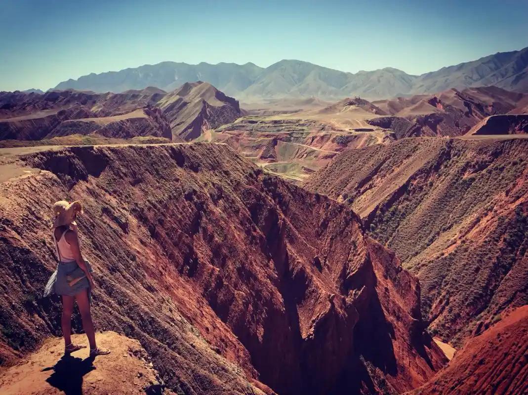
Day 3 — Canyon and return. Spend the morning inside the Wensu Grand Canyon itself, where the red strata and side tributaries are worth a few hours, then drive back to Aksu for an evening flight out or an onward leg on the Duku Highway.
Frequently Asked Questions
Can ordinary tourists climb Tomur Peak? No. The summit requires a full mountaineering expedition with Chinese and border-region permits, plus a qualified guide and logistics. Tourists view it from the reserve platform.
Do I need a special permit just to see it? Access to the viewing platform is through the managed scenic area, but because Wensu is near the frontier, foreign visitors should carry valid border paperwork and their passport for the routine checks.
Is the Wensu Grand Canyon the same as Tomur? The canyon is the scenic corridor you drive through to reach the mountain; the peak stands at the head of the valley. Plan them as one trip.
How cold does it get at the platform? Even in July the wind at 3,000 m can drop near freezing, especially in the morning. Bring a real jacket, not just a fleece.
Disclaimer
This article is based on a visit in 2026 and publicly available official information, including the UNESCO Xinjiang Tianshan World Heritage documentation and the Tomur National Nature Reserve guidelines. Access rules, road openings, permit requirements, and shuttle schedules change, and border policies can shift without notice. Always confirm the current status with the Aksu tourism office or the reserve management before you travel, and hire a licensed local operator for the mountain approach. We are not responsible for changes that occur after publication or for any decisions made using this guide.
About the Author
The Xinjiang Attractions Editorial Team is a small group of travel writers and China-based guides who have spent years driving, hiking, and fact-checking across the region. We visit every place we write about, verify details with local authorities, and update our guides when conditions change. When we say a road is open or a permit is needed, it is because we have stood there or confirmed it directly.