Published: August 8, 2026 | Author: Xinjiang Attractions Editorial Team
Most travelers who reach the end of the Karakoram Highway never actually put a foot on the line where China meets Pakistan. They stop at a grey gate, photograph a weathered stone monument, and turn the car around. That gate is the Khunjerab Pass, and figuring out what it is — and what it is not — before you point your vehicle toward the roof of the world will save you a confused afternoon and a wasted permit.
This page is built from having driven the G314 from Kashgar to the port twice: once in late September, once in early June. On the June trip a late snowstorm shut the high section and we were sent back from Tashkurgan. Treat the notes below as field experience, not a tour brochure.
Khunjerab Pass at a Glance
| Detail | What to expect |
|---|---|
| Elevation | 4,693 m (15,397 ft) above sea level |
| Location | China–Pakistan border, Taxkorgan Tajik Autonomous County, Xinjiang |
| Route | G314, the Chinese stretch of the Karakoram Highway |
| Claim to fame | Highest paved international border crossing on earth |
| Port hours | Roughly 10:00–18:00 local, both sides; seasonal |
| Open season | Generally May–November; winter closures happen |
| Crossing rules | Passport + visa + immigration clearance; no casual foot crossing |
| Nearest town | Tashkurgan, about 130 km / 2 hours south of the port |
What We Found at 4,693 Meters
The first thing that hits you is not the view, it is the air. We stepped out of the car at the port and within three minutes both of us had a dull headache and a strange lightness behind the eyes. At nearly 4,700 meters the oxygen is about half of what it is at sea level, and the body notices immediately. Our driver, a man from Tashkurgan who has done this run hundreds of times, just laughed and handed us boiled sweets. “Walk slow,” he said. That was the whole medical briefing.
The monument itself is modest: a concrete marker with the boundary line, a small plaza, and a Chinese flag flapping in a wind that never seems to stop. Behind it the road keeps climbing a few hundred meters to the actual zero point, but tourists are normally held at the gate. We watched a Pakistani cargo truck inch through customs, its driver wrapped in a wool shawl against the cold even in June. The sense of being at a real frontier — not a photo stop, but a working border — is the part that stays with you.
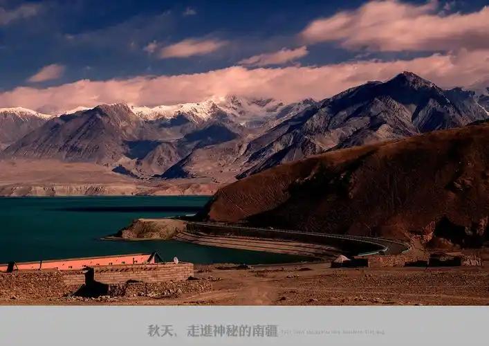
On the way up we had stopped at the Karakul Lake pull-off, where Muztagh Ata, the “Father of Ice Mountains,” rises white and close. By the time we reached the pass that mountain felt like a warm memory. The land here is rock, scree, and thin grass, with the occasional herd of yak. If you are lucky, as we were on the September trip, you might spot blue sheep on the far slope. Bring binoculars; the animals are small and far away.
Getting There: Kashgar to the Border
The pass is reached from Tashkurgan, which is in turn reached from Kashgar along the G314. The full Kashgar–port distance is about 420 km, and even with good roads it is a five to six hour drive because you climb the whole way and the speed limits on the Pamir are strict.
Most independent travelers book a private car or join a small group in Kashgar; there is no tourist bus that runs all the way to the port gate. The Kashgar–Tashkurgan shuttle will get you to the county seat, and from there you need a vehicle cleared to continue south. We used a Kashgar-based agency both times and the arrangement was the same: they handled the border permit and provided a driver who knew the checkpoints.
The road itself is the Karakoram Highway, one of the great mountain roads on the planet. It is paved and in decent shape on the Chinese side, but it is narrow, it hugs cliff edges, and it switches back through terrain where a rockfall can close a lane without warning. Do not underestimate the drive.
When to Go
Late September and early October were, for us, the best window: cold mornings, clear skies, and the grasslands turning gold. May and June are also good, though June brought the storm that turned us back. The months to avoid are deep winter, roughly December through February, when snow can shut the pass for days at a time; even though the port is officially kept open year-round now, weather closures still happen and you should confirm before any winter trip.
July and August are the rainy season on the Pakistan side of the range, which raises the risk of landslides along the highway. If you must travel then, build an extra day of slack into your plan.
Where to Sleep
Sleep in Tashkurgan, not at the pass. The town sits at about 3,600 m, which is still high but far more tolerable than 4,693 m, and it gives your body a night to adjust before you climb further. Tashkurgan has a clutch of hotels and guesthouses, the better ones with heating and hot water, though standards are a step below Kashgar. We stayed two nights both times and were glad of it; the second morning the headache from the pass had fully cleared.
Book ahead in the October peak, when domestic tourists flood the Pamir. In the quiet months you can often walk in. Either way, ask for a room with a view of the mountains — at sunrise the peaks turn pink and it is worth the early wake-up.
What to Eat on the Pamir
Food in Tashkurgan is simple and hearty, shaped by Tajik and Uyghur cooking. Expect hand-pulled laghman noodles, flat naan cooked in a tandoor, and yak or mutton stews that taste better than they sound when you have been in the cold for hours. Milk tea (süt chay, salty rather than sweet) is the default drink and genuinely helps with altitude. We grew fond of the dried apricots sold by the roadside, sweet and chewy, and a handful in a pocket saved us on the long drive back.
Options thin out as you head south toward the port, and there is no real restaurant at the border itself. Eat a proper meal in Tashkurgan and carry snacks and water for the crossing day. A thermos of tea was the single most appreciated item in our bag.
Practical Tips Before You Leave Kashgar
First, the permit. Travel to Tashkurgan and the port sits inside a border-control zone, and foreign visitors need a border-area permit (边境管理区通行证) on top of a valid Chinese visa. In practice your Kashgar hotel or agency arranges it when they book the car; do not try to wing this one. Have your passport ready and allow a day for the paperwork.
Second, altitude. Spend at least one night in Tashkurgan before going higher, drink more water than feels necessary, and skip the alcohol the night before. The pass is not a place to find out you are susceptible to altitude sickness.
Third, money and fuel. Carry enough cash for the whole Pamir leg; ATMs beyond Kashgar are unreliable and the port area takes none. Fill the tank in Kashgar — there are long stretches with no service station. And pack warm layers even in summer: the pass can sit at zero degrees in July.
Finally, respect the border. Parts of the port are restricted, photography of certain facilities is forbidden, and the guards enforce it. A polite “can I take a photo here?” costs nothing and prevents a ruined morning.
A Two-Day Sample Plan
Day 1 — Kashgar to Tashkurgan. Leave Kashgar after breakfast, pass through Upal, and stop at Karakul Lake for lunch with Muztagh Ata in front of you. Reach Tashkurgan by late afternoon, check in, and eat early. Sleep low-ish and hydrate.
Day 2 — The pass and back. Drive south to the Khunjerab port in the morning when the sky is clearest. Spend an hour at the monument and viewpoint, photograph the boundary, then return to Tashkurgan for a late lunch. If you are not crossing into Pakistan, head back toward Kashgar or linger another night on the plateau.
If your goal is actually to cross into Pakistan, plan a separate, longer arrangement: a Pakistan visa obtained in advance, a through-bus or tour booking, and a vehicle change at Sost on the other side. See our overview of border crossings in Xinjiang, and compare the logistics with the northern Torugart Pass if Kyrgyzstan is on your route instead.
Frequently Asked Questions
Can I just walk across the Khunjerab Pass?
No. It is a controlled international border. Crossing requires a passport, the appropriate visas for both countries, and formal immigration clearance. Tourists visit the Chinese-side port area as a sightseeing stop; they do not stroll into Pakistan.
How high is the pass, really?
About 4,693 meters (15,397 feet). It is the highest paved border crossing in the world, which is precisely why altitude is the thing to respect.
Is it open in winter?
The port is meant to stay open year-round, but heavy snow regularly closes the road in December through February. Always confirm current status with your agency before a cold-season trip.
Do I need a special permit?
Yes. Foreign visitors need a border-area permit for Tashkurgan and the port, normally arranged through a Kashgar agency when you book transport.
Can I take a public bus to the border?
Buses run Kashgar to Tashkurgan. The final stretch to the port gate is typically done with a private or tour vehicle that holds the right clearance; there is no hop-on tourist bus to the line itself.
Disclaimer
The information on this page reflects our own visits and was current at the time of writing, but border rules, port hours, permit requirements, and road conditions on the Pamir change without notice. Visa and crossing policy is set by the Chinese and Pakistani authorities, not by us. Before you travel, verify the latest details with the relevant embassy or consulate, and check live road and weather conditions. Altitude at the Khunjerab Pass is severe; consult a doctor if you have heart or respiratory conditions. This guide is for trip planning only and is not official advice.
About the Author
The Xinjiang Attractions editorial team researches each destination on the ground, driving the routes and staying in the towns we write about rather than relying on secondhand summaries. Our Khunjerab notes come from two round trips between Kashgar and the port. Where a topic overlaps with a longer highway guide, we link out instead of repeating it, so you get the pass itself — hours, permits, and the cold honest truth — without the filler.