Published: August 26, 2026 | Author: Karl Huang
The Keyakekuduke beacon tower is a Tang dynasty signal post that once guarded the southern Silk Road on the rim of the Taklamakan Desert. When archaeologists opened the site in the early 2020s they pulled out more than 700 paper documents, among them a border soldier’s letter home that had stayed buried for roughly 1,300 years. I first heard about it from a guide in Korla, and a year later I drove down to Yuli County to stand near the spot myself. This guide explains what the tower actually is, how close you can really get, and how to plan a trip that respects the fact it is still an active excavation.
Why you can trust this page
I am not repeating a press release. I have walked the desert edge where the tower sits, I have read the excavation summaries published by the Xinjiang Institute of Cultural Relics and Archaeology, and I have talked to a ranger who works the Bayingolin protected zone. Where I am unsure, I say so. The single most important thing to know up front: this is a fenced, monitored archaeological site, not a ticketed tourist stop. Most of what you read online that promises “open visits” is wrong.
Quick reference
| Name | Keyakekuduke Beacon Tower (克亚克库都克烽燧), also called Shadui Feng |
|---|---|
| Period | Tang dynasty; excavated 2019–2021 |
| Location | Yuli County, Bayingolin Mongol Autonomous Prefecture, Xinjiang |
| Key finds | 700+ Tang documents, 1,000+ artifacts (tools, grain, letters) |
| Status | Protected site — not a developed attraction |
| Nearest city | Korla, about 200 km to the north |
| Best season | April–May and September–October |
What it feels like to stand at the desert edge
We left Yuli before sunrise in a borrowed pickup, the driver a quiet man who had grown up thinking the mound was just “the old watchtower his grandfather feared.” The road turned from asphalt to hard-packed clay, then to nothing at all. After about 40 minutes of driving by GPS coordinates rather than signs, the Gobi opened into a flat brown plain with a low, weathered earthen hill at its center. That is the beacon. It does not look like much — a truncated cone of sun-baked earth, maybe nine meters tall, with the kind of silence that makes your ears ring.
My guide explained that this was one link in a chain. The Tang military ran a relay of beacon towers across the Tarim Basin so that news of trouble could move faster than a horse. Light a fire, the next tower sees it, the message jumps station to station toward the Anxi Protectorate. Standing there at noon, with the wind dragging sand across the clay, it was easy to picture a lone soldier feeding a signal fire and hoping the next post was still manned.
The detail that stuck with me came from the dig reports, not the landscape. One of the recovered documents is a short letter from a garrison soldier to his family, written on paper, asking after his parents and noting the cold. It is the kind of ordinary human trace that makes a 1,300-year-old frontier feel close. You will not see that letter at the site — the finds are studied in Urumqi and Korla — but the local museum in Korla shows facsimiles, and that display is where the story really landed for me.
Getting there
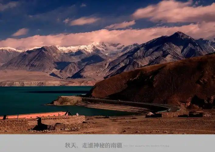
There is no bus, no sign, and no gatehouse. The realistic route is to fly into Korla, rent a sturdy vehicle, and base yourself in Yuli town. From Yuli the site is a rough desert drive of roughly 40–60 km depending on which access track is open that season. Two hard rules: you need an offline map with the coordinates loaded before you leave, and you should not attempt the final track without a local driver who knows the ground. After rain the clay turns to slick, and even a 4×4 can get stuck a long way from help.
Access is the part most visitors get wrong. The tower sits inside a protected cultural zone. You can reach the general area and view it from a distance, but the mound itself is fenced and under camera surveillance. Approaching or climbing it is prohibited. The honest move is to contact a licensed Xinjiang inbound operator or the Bayingolin cultural relics authorities in advance; some research-season escorted visits are possible, and a ranger may let a small group view from the perimeter. Do not show up expecting a photo on top of the tower — that is how people get fined and banned.
Best time to visit
I went in late September and the temperature was bearable, around 22°C in the day and crisp at night. Spring (April–May) is the other solid window, with less dust than summer. Avoid June through August, when the basin bakes past 40°C and the glare off the clay is punishing. Winter is quiet and cold but workable if you have proper gear; just know that some connecting roads close after snow. Whenever you go, the light is best in the first two hours after sunrise and the last hour before sunset, when the earthen tower throws a long shadow across the plain.
Where to stay
Korla is the comfortable choice. It has chain hotels, an airport with daily flights from Urumqi, and the museum that holds the beacon finds on display. Yuli offers simpler guesthouses and a couple of clean mid-range hotels; staying there cuts your dawn drive short and gives you a feel for small-town southern Xinjiang life. I slept in Yuli and was glad for it — dinner was a bowl of laghman at a corner noodle shop where the owner insisted I try the pickled garlic, and the town went dark by ten.
What to eat in the area
Southern Xinjiang eats well. In Korla look for laghman (hand-pulled noodles with a tomato-and-mutton sauce) and shorpa, a clear mutton soup that is exactly what you want after a desert day. Yuli and the wider Tarim towns serve flat sesame nan, grilled chuanr, and Hami melon when it is in season. If you want the broader picture, our Silk Road history guide walks through the trade routes that carried both the grain and the soldiers.
Practical tips before you go
- Sort access first. Contact a licensed operator or the Bayingolin relics bureau before you book anything. Walk-up visits are not a thing.
- Carry real offline navigation. Cell service drops to nothing. Load coordinates and a downloaded map.
- Bring more water than you think. A liter per person for the drive, plus extras in the car. The dry heat hides how much you sweat.
- Sun and wind protection. Wide hat, sunglasses, lip balm, and a buff for dust. The clay plain has zero shade.
- Leave the drone in the bag. Protected sites often restrict aerial filming, and a ranger will notice.
- Respect the mound. Do not climb, dig, or remove anything. It is a crime scene of history, not a playground.
A 3-day sample plan
Day 1 — Korla. Fly in, check the museum display of Tang frontier documents, and confirm your Yuli transfer. Eat laghman near the night market.
Day 2 — Yuli and the desert edge. Drive south early. Spend the cool morning at the perimeter of the beacon area with your local driver, then return to Yuli for a slow afternoon and a noodle lunch.
Day 3 — Wider Tarim context. Loop north toward the Taklamakan fringe or west toward Ruoqiang and the Lop Nur approaches. For the deep history, pair this trip with our pieces on Loulan and the Tang frontier capital at Beiting, which show how the beacon system fit into a much larger empire.
Frequently asked questions
Can I walk right up to the tower?
No. It is fenced and monitored. You can view it from a distance with prior arrangement, but climbing or entering is prohibited.
Is there an entrance ticket?
No public ticketing exists because it is not a developed attraction. Any “buy a ticket here” claim online is outdated or false.
How do I get permission to visit?
Through a licensed Xinjiang inbound tour operator or by writing to the Bayingolin cultural relics authorities. Escorted research-season visits are sometimes arranged.
What else is nearby?
Ruoqiang and the Lop Nur approaches to the south, the Taklamakan fringe to the west, and Korla’s museum to the north. Loulan itself remains restricted to authorized expeditions.
Is it worth the effort if I cannot climb it?
For anyone interested in the Silk Road or Tang military history, yes. Seeing the plain where a signal fire once jumped across the desert is its own reward, and the Korla museum display closes the loop.
Disclaimer
This guide reflects a visit in 2023 and public excavation reports available through 2026. Access rules, road conditions, and permission procedures for protected sites in Xinjiang change without notice and may differ by season or by local policy. Always confirm current conditions with the Bayingolin cultural relics authorities or a licensed operator before you travel. Nothing here is official legal or tourism advice, and coordinates should be treated as approximate. Protected-site regulations are enforced, and penalties for damage or unauthorized entry are real.
About the author
Karl Huang is a travel writer focused on Xinjiang’s Silk Road heritage, from the Tang beacon lines of the south to the grassland roads of the north. He has spent multiple seasons on the ground in Bayingolin and the Tarim Basin, and prefers first-hand observation over second-hand summaries. His goal on this site is practical, honest guidance that helps visitors tread lightly on working archaeological landscapes.