Published: October 13, 2026 | Author: Karl Huang
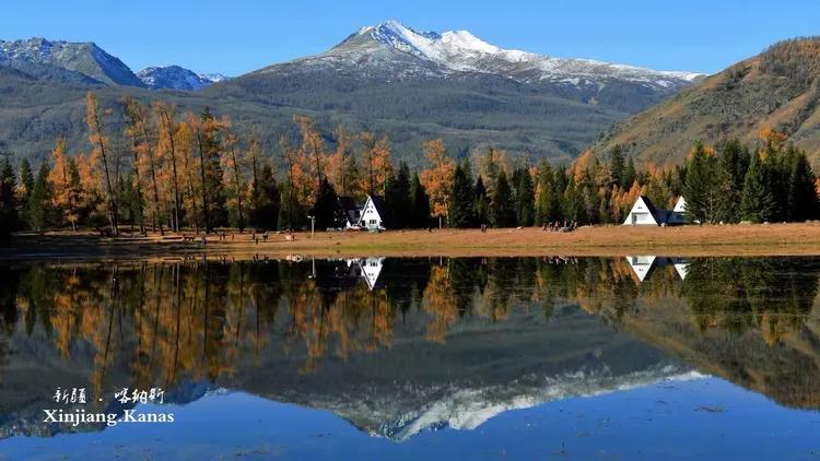
Most visitors come to the Altai mountains for Kanas Lake or a Hemu sunrise. We went looking for something older. The Dundebulak petroglyphs, scratched into a rock face above a side valley in Qinghe County, are among the clearest proof that people hunted—and skied—across this range long before the first ski resort opened. If you care about the deep human layer beneath Xinjiang’s famous landscapes, this gallery is worth the rough drive.
| Field | Detail |
|---|---|
| Location | Foothills southeast of Qinghe Town (Qinghe County), Altay Prefecture, Xinjiang |
| Main subject | Human figures on skis, archers, deer, elk, horses, and abstract lines |
| Estimated age | Commonly placed in the late Paleolithic to early Neolithic, roughly 8,000–12,000 years (scholarly debate continues) |
| Why it matters | Among the earliest known depictions of skiing anywhere in the world |
| Access | Unpaved mountain road from Qinghe; a local guide helps |
| Best season | Late May through early October; snow closes the upper track in winter |
| Facilities | None on site—carry water, food, and layers |
How Dundebulak ended up in the record books
The panel that made Dundebulak famous shows a row of stick-figure people leaning forward on long, narrow skis, each holding a pole. Around them are animals and hunters with bows. Archaeologists and local cultural-relics officers read these as a winter hunting scene: people on skis driving game across snow. That single image is why Altay is discussed alongside Scandinavia and Russia’s Karelia as one of the places where skiing began.
The International Ski Federation has recognized the broader Altay region as one of the birthplaces of snow sports, and Chinese cultural-heritage records list the Dundebulak rock art among the area’s protected sites. The connection is not marketing spin—it is carved into stone. When you stand in front of the panel, the figures are unmistakable: bodies tilted, legs spread, skis drawn as two long parallel lines. Our guide, a retired forestry worker from Qinghe, tapped the rock and said the old people called this “the hunting road on snow.”
For the wider context on the region’s winter-sports claim, see our piece on Altay’s claim as the birthplace of snow sports.
What the panels actually show
The skiing scene is the headline, but it is not the whole wall. Walking the short path along the slope, we counted at least three distinct groups of carvings. One group is clearly the skiers. A second shows archers drawing bows at fleeing deer. A third is harder to read—long curving lines that some researchers interpret as rivers or migration routes, and others as ceremonial marks.
The figures are made by pecking the dark rock surface to expose a lighter under-layer, a technique archaeologists call pit-and-groove or incision depending on the panel. Up close, the contrast is better than any photo suggests; the pale figures catch the low morning sun while the surrounding stone stays in shadow.
Our day on the mountain: a first-person account
We arrived in Qinghe on a cold, clear morning in early October. The town was quiet, the kind of place where the bakery opens when the owner wakes and the noodle shop fills with men in oil-stained jackets by eight. We hired a local driver—worth every yuan, because the last stretch is a washboard track that would rattle a rental sedan to pieces—and climbed slowly into the foothills.
The site itself is not signposted the way a paid attraction would be. There is a low fence, a weathered information board in Chinese, and then the rock. My first reaction was disappointment: the carvings are small, maybe palm-sized figures scattered across a wide face. Then the light shifted, a cloud cleared, and the skiers appeared as if someone had switched on a lamp behind the stone. We spent two hours there and could easily have stayed longer.
Reading the hunters: bows, elk, and intertwined lines
What struck me, a non-expert, was how human the hunting scenes feel. The archers are not idealized—they are bent, off-balance, clearly mid-motion. The animals are recognizable: the branching antlers of deer, the heavier bodies of elk, the small stocky horses that still roam these valleys. Whoever made these was watching real animals, not copying a style.
If you have already seen the Kangjiashimenzi petroglyphs near the Junggar basin, the contrast is useful. Kangjiashimenzi’s figures are larger, more ritual in feel, and dated to a different period. Dundebulak reads as working knowledge—how to move on snow, how to corner a deer, how a group hunted together. Two sites, two very different windows into the past.
Reaching the site from Qinghe Town
Qinghe (also written Qinggil or Chingil) is the base. It sits on the eastern edge of Altay Prefecture, close to the border with Mongolia, and it is reachable by road from Altay City and via the G216 corridor. From the town center the petroglyphs are a half-hour to forty-minute drive under good conditions, but the final few kilometers are rough. We would not attempt it without a high-clearance vehicle and a driver who knows the track.
There is no ticket booth and no staff. Treat the place as a protected archaeological site, not a park. Our Qinghe travel guide covers where to fuel up, where to eat, and how to arrange a local guide before you set out.
When to go: light, snow, and the closed months
Late spring through early autumn is the window. May and June bring green valleys and manageable tracks; September and early October give cold, clear light that makes the carvings pop and thin crowds. We went in October and had the place to ourselves.
Winter is a different story. Snow covers the upper road from roughly November to April, and the rock face itself ices over, making both the visit and the carvings hard to read. Unless you are with a specialist expedition, plan for the snow-free months.
Where we stayed and what we ate in Qinghe
Qinghe has a handful of no-frills hotels along its main street; we stayed in a clean, heating-equipped place for about 200 yuan a night and slept well despite the altitude chill. Book ahead in the October holiday period, when domestic travelers fill the smaller towns.
Food was the easy part. Hand-pulled noodles with mutton, steamed buns stuffed with chopped lamb and onion, and the dairy products—clotted cream, dried curd—that herding families have eaten here for generations. At a roadside spot we tried horse sausage, a local specialty that divides visitors but is worth one bite. None of it is fancy, and all of it is filling after a morning on a mountain.
Four practical things I wish I’d known
First, there is no shade, no toilet, and no shop at the site—carry water and use the facilities in town first. Second, the carvings face a direction that only lights up at certain hours; mid-morning worked for us, so don’t arrive at noon glare. Third, a local guide turns a confusing rock into a story—ask at your hotel or the county cultural office. Fourth, respect the stone: do not trace the figures with chalk or stand on the panel to get a photo. It is protected, and it is older than any building you will see on the trip.
A two-day Altai rock-art loop
Dundebulak rarely justifies a trip on its own, but it fits a wider Altai route. We built a loose two-day loop: day one in Qinghe with the petroglyphs and the county museum; day two driving west toward Koktokay’s granite valleys or north to Altay City’s skiing heritage sites. That pairing—ancient rock and living winter-sports culture—is the real draw of this corner of Xinjiang.
Questions travelers actually ask
Can I visit Dundebulak on my own? Technically yes, but the rough access road and lack of signage make a local driver or guide the sensible choice, especially if you don’t speak Chinese.
Is it worth it if I’ve seen Kanas? They are different experiences. Kanas is scenery; Dundebulak is history you read off a rock. Pair them if your route allows.
How old are the carvings, really? Estimates put the skiing scene in the late Paleolithic to early Neolithic range, but dating rock art is genuinely hard. Treat any single number as a scholarly best guess, not a fact etched in stone.
Is there an entrance fee? No formal ticket at the site itself. Budget instead for transport and a guide.
A word on dating and interpretation
Rock-art dating is contested science. Methods like micro-erosion analysis and stylistic comparison give ranges, not birth certificates, and different researchers publish different figures for Dundebulak. This article follows the commonly cited late Paleolithic–early Neolithic estimate and the broader Altay skiing-origin narrative, but readers should know the debate is live. Where I describe what a figure “shows,” that is my reading of a widely accepted interpretation, not a settled translation.
Before you set out
This article is based on a personal visit and publicly available heritage information; it is not an official source. Access roads, site conditions, and local guidance change, and border-area travel in Altay Prefecture can carry permit or seasonal restrictions. Confirm current access and any required permits with the Qinghe County cultural-relics office or a licensed tour operator before you go. The author and publisher are not responsible for changes to site access or for any issues arising from travel to the area.
About the writer
Karl Huang is a Xinjiang-based travel writer who has spent more than a decade driving the province’s back roads, from the Kashgar oasis to the Altai timber line. He focuses on the practical, first-hand details that guidebooks miss, and he has visited the Dundebulak site personally. His work on XinjiangAttractions.com aims to help independent travelers see the region responsibly and well.