Published: 20 August 2026 | Author: Karl Huang
Most visitors to Xinjiang’s far north stop at Koktokay geopark for the emerald lake and the famous bell-shaped peak. The Irtysh Grand Canyon is the part they walk past without realizing it is the whole point. It is a granite gorge carved by the Irtysh River, the only river in China that drains northward all the way to the Arctic Ocean. We spent two days there in early October and came back convinced it is the most underrated walk in the Altai.
This page is built from our own trip notes, not a brochure. I will tell you what the boardwalk is actually like, where we slept, the mistake we made with the light, and the one thing about the river that still surprises people who have lived in Xinjiang for years.
Quick reference: Irtysh Grand Canyon at a glance
| Item | What we found |
|---|---|
| Location | Fuyun County (富蕴县), Altai Prefecture, about 50 km from the county seat |
| Part of | Koktokay National Geopark (可可托海国家地质公园) |
| The river | Irtysh (额尔齐斯河), China’s only Arctic-bound river |
| Best light | Morning, roughly 09:00 to 11:00 Beijing time in October |
| Walk time | 2 to 4 hours one way along the riverside boardwalk |
| Entry | Combined Koktokay geopark ticket; shuttle from the gate |
| Our season | Early October, cold mornings, clear afternoons |
Why this gorge stuck with us
We arrived the first afternoon around 16:00, tired from the drive, and the canyon looked flat. The granite walls were in shadow and the river was a thin grey line. We walked ten minutes, took a few polite photos, and almost turned back. The next morning we came back at 09:30 and it was a different place. Sun came over the ridgeline and hit the rock face first, so the cliffs lit up orange while the river stayed blue in the shade. That one change told us more about the Irtysh Grand Canyon than any guidebook line.
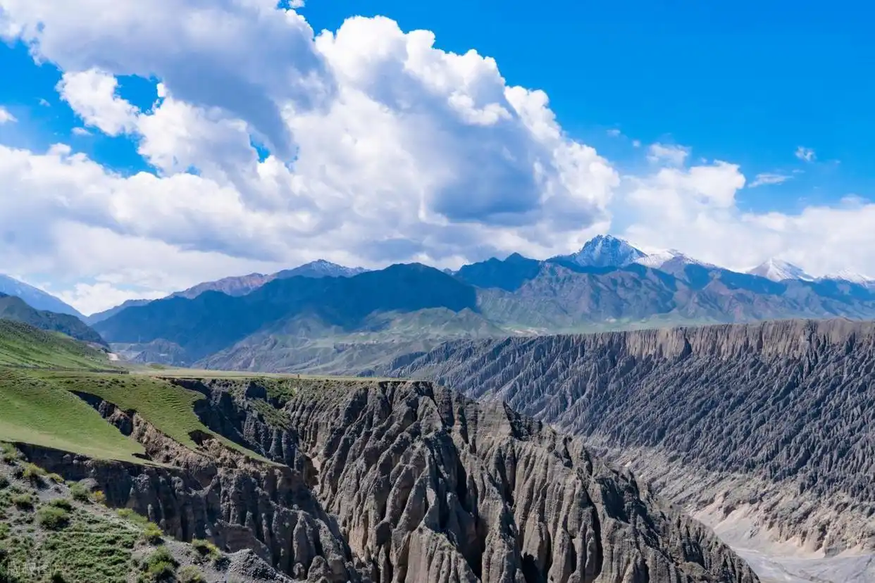
We later learned the granite here is part of a much older story. The Altai range was pushed up by colliding plates, and the Irtysh has been cutting downward through that granite ever since, leaving these near-vertical walls. Standing at the base, with the rock rising straight above the water, you understand why locals gave the big bell-shaped peak its name; from the right angle it really does look like a giant struck bell half sunk in the earth.
The path runs mostly along a wooden boardwalk above the water, with side steps that drop you to smooth river stones. We counted at least six named granite formations on the map, but the unnamed ones were better. One looked like a tilted stack of pancakes; another had a single birch growing out of a crack thirty metres up. We found a quiet stretch where the only sound was water moving over pebbles, and we sat there longer than we planned.
Getting to the Irtysh Grand Canyon
The canyon has no separate entrance. You buy the Koktokay geopark ticket, take the park shuttle from the gate to the riverside section, and walk in from there. From Urumqi we drove north on the G216, a long but straightforward run through the desert edge and into the Altai foothills. If you would rather not drive, the car rental option in Xinjiang is worth comparing against the train plus a local transfer.
From Urumqi the drive is long, but you barely notice the first half, because the road leaves the city and crosses open desert before climbing into green. We stopped once at a roadside spot where a vendor was selling melons and dried apricots, and the contrast between the dry plain and the cold river we would reach that evening was the kind of thing you only get by driving rather than flying. A railway now reaches Fuyun as well, so you can take a train and arrange a car at the station, which cuts the road time if you would rather not sit behind the wheel for the whole way.
When we went, and what the water did
October was a good call for colour. The birch and larch along the gorge turn yellow and the granite behind them stays grey, so the contrast does the work for your camera. The downside is cold: our first morning started near freezing, and the wind coming off the water cut through a light jacket. By midday it was comfortable in a long sleeve.
The colour window is narrower than people expect. The birch turns fast once the cold nights arrive, and a warm spell can drop the leaves in a week. We got lucky with the first cold snap of October; a friend who came two weeks later said the hills were already bare. If the yellow matters to you, aim for the first half of October and check a weekly forecast rather than a monthly one. Summer is greener and warmer, and the river runs fuller, but the canyon walls throw shade early, so mornings still win. We would avoid the midday window in any season; the light flattens and the tour groups thicken.
A half-day on the boardwalk
The walk is not hard. It is graded, mostly flat, and there are benches. We treated it as a slow half-day rather than a hike, stopping for the formations and the open river beaches. The far viewpoint, where the gorge opens and you can see the bell-shaped peak that Koktokay is famous for, was about two hours out at our pace with lots of stopping. Turning back, we realized we had taken almost no “arrival” photos and far too many of small details, which is usually the sign of a good walk.
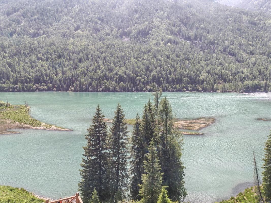
About halfway in, the boardwalk meets a wider beach where the river bends. We took our boots off and stood in the shallows; the water was numbingly cold even at noon. A park warden told us, in broken Mandarin, that the river keeps flowing all winter and that the ice only forms at the edges. That stuck with us, because it is the same river that ends up in the Arctic, thousands of kilometres north. You stand in Xinjiang and your feet are in water that will eventually reach the sea by way of Russia.
Where we slept
We stayed in Fuyun town, not inside the park. The county seat has ordinary mid-range hotels, hot water, and food that opens early, which matters when you want to be at the gate at opening. Staying inside the geopark is possible at the holiday cabins, but they book out in peak season and cost more for less comfort. For us the town was the smarter base, and the 50 km drive each morning was an easy warm-up.
What we ate in Fuyun
Fuyun is not a food destination, but it fed us well. Breakfast was laghman at a corner noodle shop, the broth salty and the noodles pulled thin, exactly what you want before a cold walk. In the evening we found a small grill doing lamb skewers and a flatbread that came to the table blistered and hot. If you are coming from Burqin, the food scene there is louder and bigger, but Fuyun was calmer and cheaper, and we slept better for it.
Practical things nobody tells you
Bring a layer you can zip. The temperature swing between the sunny boardwalk and the shaded river bank is real, and the wind is cold even when the sun is warm. The shuttle from the gate runs on the park’s clock, not yours, so plan the return before you start the walk. Phone signal is patchy in the deeper parts of the gorge, so download your maps. Drones are restricted across the geopark, and the wardens enforce it, so leave the aircraft in the car.
Carry some cash. The small vendors at the gate and the noodle shops in Fuyun do not all take phone payments reliably, and an ATM in the county seat can run dry on a busy weekend. For photos, a wide lens flattens the gorge; we got better results stepping back and letting the river lead the eye toward the peak. And watch your step on the boardwalk after rain, the wood gets slick.
One more: the Irtysh Grand Canyon is only one section of a large geopark. If you have a second day, the lake and the mining-history exhibits are worth it, and our full Koktokay travel guide lays out how to string them together without rushing.
A two-day plan from Urumqi
Day one: drive or train north to Fuyun, check in, eat early. Day two: gates open, boardwalk in for the morning light, back for lunch, then either the lake section or the drive south. If you are comparing gorges, the Tianshan Grand Canyon near Urumqi is red and close, while this one is grey granite and far; they are not interchangeable, and seeing both in one trip is a fair bit of driving.
Frequently asked questions
Is the Irtysh Grand Canyon the same as Koktokay?
Not exactly. Koktokay is the whole geopark; the canyon is the granite river section inside it. Most people visit both on one ticket.
Can I swim in the river?
We would not. The water is cold, the current is stronger than it looks, and there are no lifeguards. Wading at the edges is fine for photos.
Do I need a guide?
No. The boardwalk is signed and the shuttle is run by the park. A guide helps if you want the geology explained, but it is not required.
Is it worth it in winter?
The snow makes the granite dramatic, but the road and shuttle can close in heavy snow, and it is brutally cold. We would only go in winter with a local driver and a weather check.
Disclaimer
This account is based on a single October visit by the author and reflects conditions on those days. Opening hours, ticket prices, shuttle times, and road access in the Altai change with season and weather. Confirm the current details with the official Xinjiang tourism site and the park before you travel. We are not responsible for changes to access, costs, or conditions after publication.