Published: October 14, 2026 | Author: Karl Huang
Most visitors come to Koktokay for the birch forests and the granite bell mountain along the Irtysh River. We came for something stranger: a hole in the ground. The Koktokay No. 3 pit is a terraced open mine carved into a mountainside in Fuyun County, in China’s far north, and for half a century the ore pulled from it helped keep a young country solvent. Standing at the rim, you understand why locals still call it the “meritorious mine.”
The No. 3 Pit in Numbers
| Item | Detail |
|---|---|
| Location | Koktokay Town, Fuyun County, Altay Prefecture, Xinjiang |
| Elevation of the rim | about 1,200 m (1,208 m at the pit) |
| Dimensions | roughly 250 m long by 240 m wide |
| Depth below the rim | about 140 m to the water line |
| Spiral haulage levels | 13 concentric benches |
| Mining span | 1950 to 1999 (closed) |
| Minerals present | about 86 of the 140 known in nature |
| Claim to fame | covered a large share of a 1960s Soviet debt |
Those figures are easy to rattle off, but they do not explain why a pit in the Altai Mountains ended up in textbooks about the early People’s Republic. The short version is debt, and the longer version is worth the walk down.
The Pit That Repaid a Nation’s Debt
When we first read the plaque at the viewing platform, the number that stuck was not the depth. It was the share of a foreign debt. In the early 1960s, after the Sino-Soviet split, China owed the Soviet Union a substantial sum carried over from earlier loans and aid. According to accounts published by regional government and geology bodies, the ore shipped from the No. 3 vein covered on the order of 40 percent of that debt. Figures vary between roughly 38 and 47 percent depending on the source, but the point lands the same way: this one mountainside did real macroeconomic work.
The same lithium, beryllium, tantalum, niobium and cesium also fed the “two bombs and one satellite” program. Beryllium from here went into the first atomic bomb in 1964, lithium into the hydrogen bomb in 1967, and cesium into the Dongfanghong-1 satellite launched in 1970. You will see the timeline laid out in the exhibition hall a few hundred meters away, and it reads less like tourism copy than like a personnel file.
How a Mountainside Became a Mine
Geologically, the No. 3 vein is a pegmatite: a coarse-grained igneous rock where rare elements accumulate in unusual concentration. Prospectors flagged the area in 1935, and extraction at the No. 3 vein began in 1950. What started as a hill rising more than 200 meters above the valley floor was, over nearly fifty years of work, leveled and then dug downward into the spiral pit you see today. Mining ran until the vein was closed in 1999.
The numbers geologists quote are almost comic in their abundance. Of the roughly 140 minerals known to occur in nature, about 86 turn up in this single deposit, and rare metals make up more than 90 percent of the ore body. Beryllium reserves here rank first in China, and the display cases back at the hall show why the pit earned its “natural museum” label.
Standing on the Rim: What We Saw
We arrived in late September, the week the birches turn. From the guardrail at the top you look down a terraced bowl roughly 250 meters long and 240 wide, the benches stepping inward like a stadium built by subtraction. The floor sits about 140 meters below the rim, and because the pit was dug below the level of the Irtysh, groundwater now pools at the bottom as a still, mineral-colored lake. On the day we visited the surface was the pale green of old copper; the far wall, in shadow, read almost black.
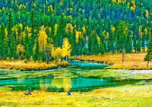
There is no scrambling down. The rim is fenced, and a short walkway takes you along the north edge where the spiral haulage road is easiest to read. Thirteen concentric levels were cut into the rock so trucks could circle from top to bottom, and from above the whole thing looks less like a mine than like a giant’s spiral staircase frozen mid-stride.
The Spiral Ramp and the Levels Below
What the rim does not show is the scale of the labor. Before the big machines arrived, almost all of this was moved by hand and by animal. The exhibition hall keeps a black-and-white photo of the mountain before it was opened, a rounded granite dome, and the contrast with the current pit is the kind of thing that makes a person quiet. We spent twenty minutes watching the light move across the benches. The place carries a weight that does not need narrating.
The Rare Stone Museum Across the Road
A few hundred meters from the pit, in a Soviet-style building from the 1950s, the Koktokay Geology Exhibition Hall holds more than a hundred mineral specimens pulled from this and neighboring veins.
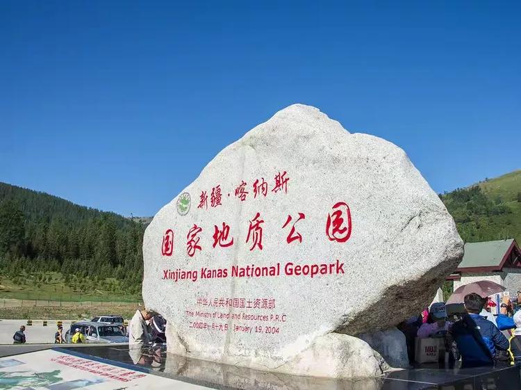
The labels are in Chinese, but the stones speak for themselves: columns of smoky aquamarine, plates of mica you could read a newspaper through, and a lump of “black gem” tantalum-niobium crystal that looks like nothing so much as cooled tar. Allow an hour. It is the single best place to understand what came out of the ground you just looked at.
Getting to Koktokay from Urumqi
Koktokay sits about 480 to 520 kilometers north of Urumqi, in Fuyun County. The most common route is the drive north on the G216 through the Junggar Basin, which takes roughly six to seven hours with stops. If you would rather not drive, there is a small airport at Fuyun, the Fuyun Koktokay Airport, with flights from Urumqi; from there it is about an hour by car into the valley. A train also reaches the area, though schedules are thinner than the road, so most travelers we met either drove or flew and rented a car locally. For the overland approach, our G216 Junggar-to-Altay drive guide covers the road in detail.
When to Visit
The pit is open year-round, but the experience changes sharply with the season. Late September to early October is our pick: the birch belt around the valley goes gold, the light is low and warm, and the tourist numbers thin after the National Day week. Summer is mild and green and good for the riverside walks. Winter is a different contract entirely. Koktokay sits at around 1,200 meters and ranks among the coldest inhabited places in China, with lows that have been recorded well below minus forty. The pit under snow is dramatic, but only if you are dressed for it and your car is.
Tickets, Guides, and the Walking Route
The No. 3 pit is part of the Koktokay Mining Park, which bundles the pit, the Ayguz mine tunnel, and the geology hall on one combined ticket. Expect the combined ticket to sit in the low triple digits; prices shift from year to year, so confirm the current rate on the park’s official channels or at the gate rather than trusting any number you read here. A guided walk of the rim and hall takes about two hours. The Ayguz tunnel, an 800-meter adit opened for visitors in 2015, is cold and damp even in summer, so bring a layer. Inside, reconstructed scenes show miners working by lamp, and the temperature stays near freezing year-round by design.
Where to Sleep in the Valley
Most people stay in Koktokay Town, about a kilometer from the pit, or push on to stay near the main Koktokay scenic area along the Irtysh. Options range from basic guesthouses to a few newer hotels built since the geopark draw grew. We stayed in town and ate early; the evenings are quiet and the stars are aggressive. If you want the fuller Koktokay experience, including the Holy Bell Mountain granite peak and the river gorges, plan a second night and treat the pit as one stop on a wider loop. The Koktokay overview guide maps that wider loop.
Tea Houses and Noodles in the Old Mining Town
The town wears its mining past openly. Along the main street you will find small halal restaurants serving laghman noodles pulled to order and the usual northern Xinjiang roster of grilled mutton and flatbread. We ate at a corner place where the owner’s father had worked the mine, and the talk drifted, as it does, to the old days. Nothing fancy, but the mutton needed no seasoning beyond salt and fire.
What the Minerals Actually Were
For the curious, a quick translation of the names on the display cases: beryllium is a light, stiff metal used in aerospace and nuclear work; lithium needs no introduction now but was strategic then; tantalum and niobium go into electronics and alloys; cesium, the metal in that first satellite, is used in atomic clocks and drilling fluids. What makes the No. 3 vein unusual is the density of these elements packed together in clean, mineable bands, which is why geologists call it a natural museum rather than just a mine. The Irtysh Grand Canyon near Fuyun shows the same granite country from a different angle.
A Half-Day Route for the Pit and Museum
If you have only half a day, do this: arrive at the pit when it opens, walk the rim walkway north to south (forty minutes), cross to the geology hall (one hour), then loop to the Ayguz tunnel if the cold does not put you off (forty-five minutes). That leaves time for lunch in town before the afternoon light on the benches fades. We did it in reverse, hall first, and wished we had saved the rim for last when the sun was low. Either order works; just do not try to rush the pit. It rewards a slow circuit.
Common Questions About the No. 3 Pit
Can you go down into the pit? No. The rim is fenced and the floor is a water-filled, unstable bowl. The viewing walkway is the experience.
Is it the same as the Koktokay scenic area? No. The scenic area with Holy Bell Mountain and the Irtysh gorges is separate; the Mining Park with the pit, tunnel, and hall is its own ticket and its own gate.
How cold does it get? Genuinely cold. Winter lows have been recorded below minus forty Celsius. Dress for a mountain even in summer, when the tunnel stays near freezing.
Worth it if I only like nature? The pit is industrial heritage, not wilderness, but the valley around it is real Altai mountain country, and the contrast is part of the appeal.
A Note on Visiting Responsibly
The figures in this article about debt repayment and mineral output come from regional government releases and geology publications, and they vary between sources; we have used the most commonly cited ranges and flagged where they differ. Ticket prices, flight schedules, and opening hours change, so treat anything specific here as a starting point and verify before you travel. The pit is a site of real historical sacrifice, not a theme park. Keep to the walkways, do not climb the benches, and leave the displays to the next visitor. This is not a sponsored post; we paid our own way and the links below are editorial.
About This Guide’s Author
Karl Huang is a travel writer focused on Xinjiang’s less-trodden corners, from Cold Pole towns to working river ports. He has driven most of the G216 and prefers a slow rim walk to a fast checklist. He writes for Xinjiang Attractions, where the goal is practical, first-hand detail rather than brochure polish.