Published: November 6, 2026 | Author: Karl Huang
Most travellers blow through Wusu (乌苏) without a thought. It sits on the G30 about 260 kilometres northwest of Urumqi, and the highway signs point elsewhere — to Yining, to the ports, to the mountains. We almost did the same. Then a local at a roadside noodle stop told us the ridge behind the town hides a mountain shaped like a sleeping Buddha, and that the world’s largest wild saxaul forest grows an hour west. That was enough to make us slow down, and Wusu turned out to be one of the more surprising overnights of our northern Xinjiang loop.
| Item | Detail |
|---|---|
| Where | Northern foot of the Tianshan, southwestern Junggar Basin, Tacheng Prefecture |
| Area | About 20,700 km² (city administers a 300 km-long strip) |
| Population | ~230,000 permanent residents; 24 ethnic groups |
| From Urumqi | ~260 km by road, ~2.5 h by train |
| Best for | Overnight before the Duku Highway; forest park, mud volcanoes |
| Top sights | Foshan National Forest Park, Ganjiahu saxaul reserve, Baiyanggou mud volcanoes |
| Best season | June–September (Duku Highway seasonal, ~June–early Oct) |
How Wusu first appeared on our route
We came to Wusu by accident, really. Our plan was to reach the Duku Highway’s northern entrance at Dushanzi before noon, but a blown tyre in the night left us rolling into the “golden triangle” of Wusu, Kuytun and Dushanzi around mid-morning with no hotel booked. What we found was a proper oasis — poplars and canals, a real downtown, and a municipal park where old men played xiangqi under the trees. The city sits at the foot of the Tianshan with the Junggar Basin opening up behind it, and that position is the whole story of the place.
Where the northern Silk Road actually bends
Wusu’s old name was Kur Kara Usu — “black water” in the old Mongolian and Manchu records — and it was no backwater. On the northern branch of the Silk Road it was the post where caravans turned: south to cross the Tianshan toward the Tarim, west toward the Ili and the ports, east to control Beiting. The geography forced the bend. The mountains rise sharply here, and the only gentle grade through them runs right past what is now the city. Today the same logic holds: this is where the G30, the G217 and the railway all converge, and where the road to the Duku Highway begins. We found the history readable in the layout of the town itself — a long thin strip pressed against the hills, the modern transport corridors running straight through it.
Wusu is among the Xinjiang cities officially opened to foreign visitors, and the bilingual tourist material reflects it. If you are building a northern Xinjiang loop, treat it as a hub rather than a pass-through.
An oasis squeezed between mountain and basin
The numbers are strange for a county-level city. Wusu administers roughly 20,700 square kilometres — a 300-kilometre strip from the Tianshan snow line down to the Junggar Basin, with a vertical drop near 5,000 metres. About 230,000 people live in the city proper, drawn from 24 ethnic groups including Han, Kazakh, Hui, Uygur and Mongol. Three rivers — the Kuitun, the Sikeshu and the Gurutu — carry the Tianshan’s meltwater out across the plain, and that water is why an oasis exists here at all.
We visited in early autumn and the contrast was the point: orchards and cotton fields green at the town’s edge, then ten minutes south the road starts climbing into spruce and the air gets thin. The best time to travel Xinjiang for this corner is roughly June through September, when the high forest roads are open and the basin heat is bearable.
The three roads that meet here
Wusu’s modern identity is as a junction. The G30 Lianhuo Expressway runs east–west across the top of the province; the G217 and the the Duku Highway run south through the Tianshan; and the Northern Xinjiang Railway (part of the Eurasian Land Bridge) puts Urumqi about two and a half hours away by train. The city is also the western anchor of the “golden triangle” with Kuytun and Dushanzi, a ten-minute drive between each. Within 400 kilometres are five land ports — Khorgos, Alashankou, Baktu, Jeminay and Dulate — which is why the logistics parks on the edge of town are stuffed with cold-storage trucks.
For the independent traveller the practical takeaway is simple: if you are driving the Duku, Wusu is the last real city before the climbs begin, and a far easier place to stock up and sleep than the small towns further south. The northern 91 kilometres of the Duku fall under Wusu’s jurisdiction.
Snow Buddhas, saxaul and mud: what’s actually worth seeing
This is the part that surprised us most. Wusu is not a headline destination, but it has four genuinely unusual sights.
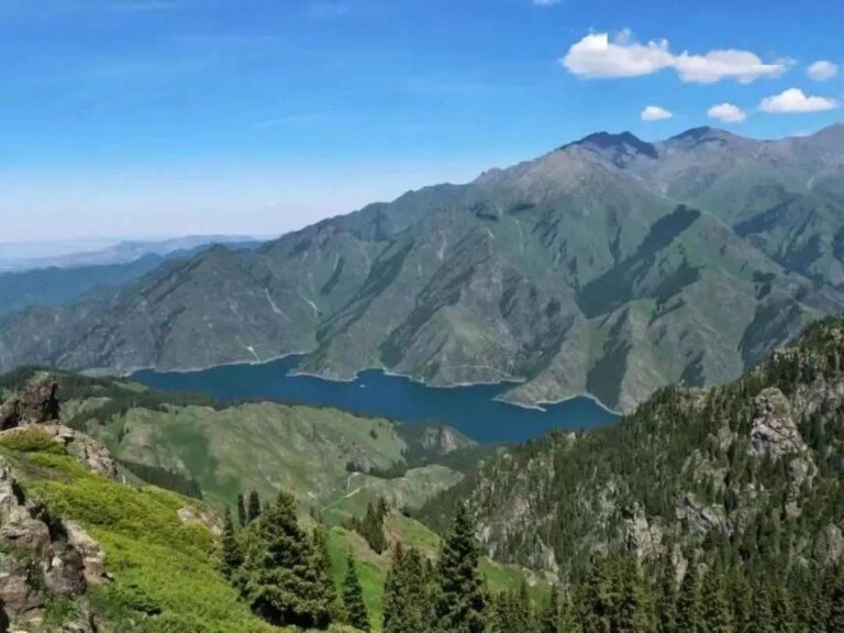
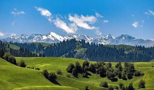
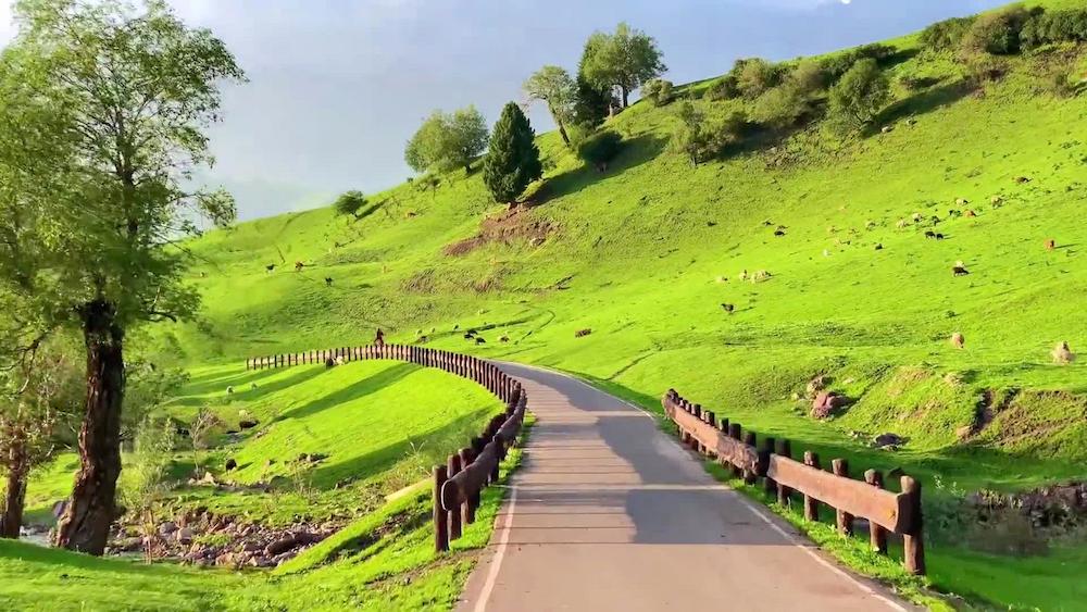
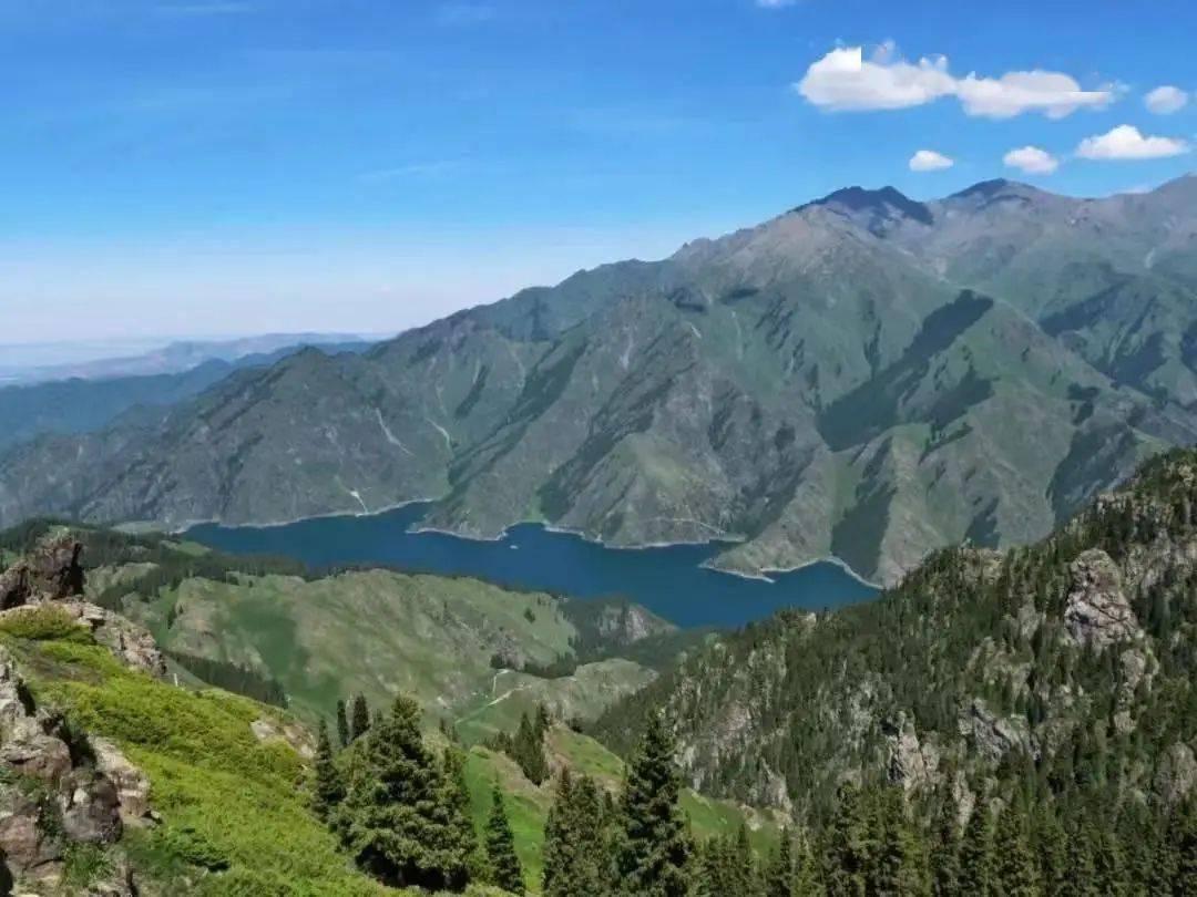
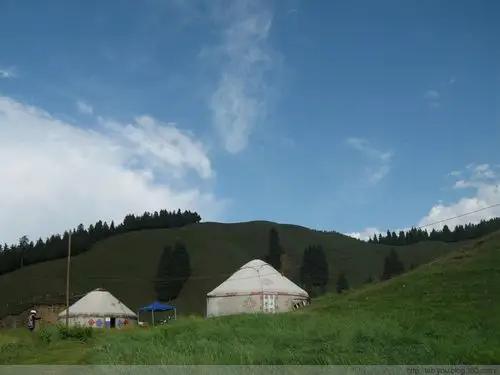
The Foshan National Forest Park. Approved as a national forest park in 2008, it covers about 37,000 hectares across three areas — Daifuseng, Bayingou and Wulan Saduke Lake. The Daifuseng area is famous for a mountain that, viewed from any angle, reads as a giant reclining Buddha; locals call it the “natural snow-mountain Buddha.” We drove up in about forty minutes from the city and walked among old spruce at something over 2,000 metres, with the plain spread out below. Tickets for the Daifuseng area run around 38 yuan.
The Ganjiahu saxaul forest. West of the city, straddling Wusu and Jinghe, lies a national nature reserve protecting the white saxaul — a grey-green desert shrub that looks unremarkable until you learn it is the largest primitive saxaul forest of its kind in China, the only temperate-desert saxaul reserve in the country. The Sikeshu River threads through it. We did not go deep (the reserve is protected and access is limited), but even the edge, with the desert wind and the lone river, explained why botanists care about the place.
The Baiyanggou mud volcanoes. About 42 kilometres south of the city, this is reckoned to be Asia’s largest active mud-volcano group — dozens of slow, cold vents pushing grey clay to the surface. It is weird and a little otherworldly, and it costs nothing to wander. Bring old shoes.
The Wusha–Anjihai Grand Canyon. One of the larger canyons in Xinjiang, known for sheer, colourful walls; self-drivers photograph it from the rim.
When the weather makes sense
Wusu gets a continental climate with real winters. Snow can close the upper forest roads from late October; the mud volcanoes and the canyon are year-round but best in dry weather from May to September. We caught the tail of September and had clear, cool days — ideal for the high forest without the July crowds. If your goal is the Duku Highway, remember the road itself is seasonal (typically June to early October), so plan Wusu as the northern bookend of that window.
Beds for a one-night halt
You are not coming to Wusu for the hotels, but you will sleep well. The city centre has a spread of mid-range business hotels in the 200–350 yuan range, clean and dull, plus a few newer places near the highway interchange. We stayed central, walked to dinner, and were on the road by eight. If you want something quieter, the forest-park area has basic guesthouses, though we would only book those in summer. Book ahead in July and August, when domestic road-trippers fill the triangle.
Eating in a transit town
Wusu eats like northern Xinjiang eats: hand-pulled banmian, lamb polo, grilled skewers, and the local speciality people kept pointing us to — jiaohao fish. The “Wusu three delicacies” (三鲜) is a loose term for a local cold-mezze plate; ask at your hotel which stall does it best, because the answer changes by season.
And yes, the beer. Wusu is the birthplace of Wusu Beer, the strong lager northern Xinjiang drinks more of than anywhere else, and the town behind Xinjiang’s famous beer deserves its own read. A cold bottle after a day on the forest road hits differently in the place that makes it. Eat at the night-market strip near the new district; the prices are honest.
Things we wish we’d known
- Fill the tank and the water bottles before leaving town — south of Wusu the services thin out fast.
- The forest park is high; even in summer bring a layer. We underestimated the drop in temperature at 2,500 metres.
- Cash is useful at the smaller roadside stops; the mud-volcano village had patchy card signal.
- If you are headed to the Duku, check the opening date first — it varies by snow and is announced each spring.
- Wusu is a real city with real traffic; the ring is easy to miss if you are navigating by phone alone.
A half-day loop from the highway
If you have only a morning, do this: leave the G30 at the Wusu exit, breakfast on banmian in the centre, drive 40 minutes south to the Daifuseng area of the Foshan park for a short walk among the spruce, then continue to the Baiyanggou mud volcanoes (another hour) before looping back for lunch. That is roughly five hours with stops, and it gives you the two sights that best explain the place — the green mountain and the grey mud, the forest and the desert, both held in one small county. From there the Duku is a straight shot south, or Tacheng lies a few hours northwest if your route bends that way.
Frequently asked questions
Is Wusu worth a stop, or just a drive-through?
For most travellers it is a practical overnight before the Duku. If you have a half-day free, the forest park and mud volcanoes make it worthwhile; if you are racing the clock, fuel up and go.
How do I get to Wusu?
By train from Urumqi (about 2.5 hours) or by car on the G30 (about 3 hours). The city is also on the Northern Xinjiang Railway, inside the Kuytun–Dushanzi–Wusu triangle.
Can foreigners visit Wusu?
Yes. Wusu is on the list of Chinese cities approved for foreign visitors, and the tourist services we used were set up for international travellers.
Before you go (a note on accuracy)
This article is based on our own visit in September 2026 and on public information from the Wusu municipal government and park notices current at the time of writing. Opening dates, ticket prices and access rules for the nature reserves change, and some areas are protected with limited entry. Confirm the specifics with the official Wusu government or your hotel before you set out, especially for the Duku Highway season and the Ganjiahu reserve.
About the author
Karl Huang is a Xinjiang-based travel writer who has spent the last decade driving the province’s mountain and desert roads. He writes practical, first-hand guides for foreign visitors at Xinjiang Attractions, focusing on places that reward slowing down. His work favours real overnight stops and honest logistics over highlight-reel sightseeing.