Published: August 11, 2026 | Author: Karl Huang
Shipton’s Arch is not a place you stumble across by accident. It sits in a remote corner of the Kizilsu Kirghiz Autonomous Prefecture, roughly 60 km southwest of Kashgar, where the last folds of the Tian Shan meet the arid badlands that lead toward the Pamir. Local people call it Tushuk Tash — literally “stone with a hole.” Westerners know it as Shipton’s Arch, named after British explorer Eric Shipton, who photographed it during a Royal Geographical Society expedition in 1947.
I visited the arch on a clear morning in late April, after two failed attempts the previous autumn when flash floods had turned the approach wadi into a river. This guide is based on what I learned during those trips: how the road really is, what the scramble involves, and why the arch is worth the effort despite the hassle.
Quick Reference
| Location | Akto County, Kizilsu Prefecture, Xinjiang, ~60 km southwest of Kashgar |
| Local name | Tushuk Tash (石拱门) |
| Height | Estimated ~300 m from base to crest; span roughly 65–75 m |
| Best months | April–June and September–October |
| Getting there | 4WD via G3013 / rural roads, then 1.5–2 hr hike/scramble |
| Permits | None required for the arch itself; passport check possible near border zone |
| Difficulty | Moderate; loose rock, exposed scrambling, no shade |
| Entry fee | Free (no ticket booth as of 2026) |
What Shipton’s Arch Actually Looks Like
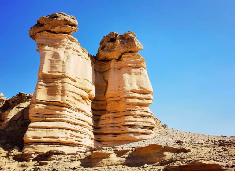
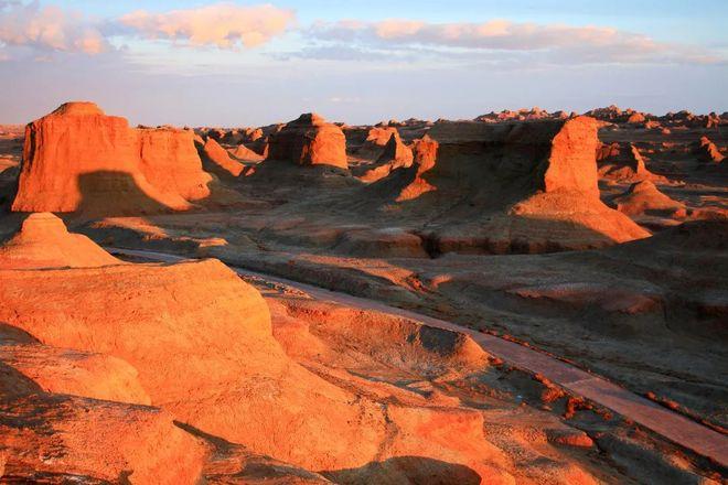
Photos do not prepare you for the scale. The arch rises from a dry ravine like a broken window cut into a cliff of red-brown sandstone. From the viewpoint directly below, the sky shows through the opening as a thin blue slit. When the sun is low, the underside glows orange and the surrounding towers throw long shadows across the wash.
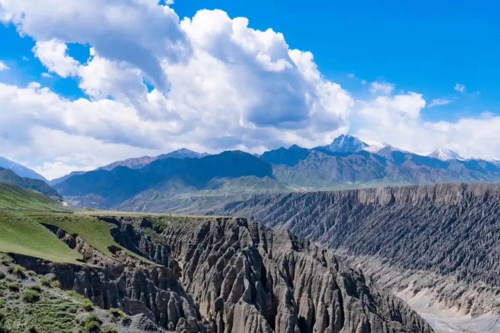
The approach is what surprised me most. You do not see the arch until the final ten minutes. For most of the hike you are walking up a dry riverbed between walls of banded rock, stepping over stones that have been polished round by flash floods. The canyon narrows, turns, and then suddenly opens into an amphitheater with the arch overhead. I actually swore out loud when I saw it.
How the Arch Formed
The rock here is a mix of Mesozoic sandstone and conglomerate laid down when this part of Central Asia was still a low basin. Over millions of years, tectonic uplift raised the layers above the surrounding plain, and seasonal streams began cutting downward. Wind, frost, and flash floods did the rest, scouring weaker layers until a hole opened through the ridge. The same process carved the surrounding pinnacles and side canyons, which is why the approach to Shipton’s Arch feels like walking through a half-finished sculpture garden.
Geologists I have spoken with emphasize that the arch is not stable forever. Erosion continues, and blocks periodically fall from the underside. That is another reason to keep your distance and to avoid the temptation to climb. What you see today is a snapshot of a very slow collapse.
What to Pack
- Footwear: Approach shoes or light hiking boots with sticky rubber soles. The rock is slick in places.
- Water: Three liters per person in summer; two liters is enough in spring or autumn.
- Sun protection: Wide-brimmed hat, SPF 50 sunscreen, and sunglasses. The canyon reflects light.
- Food: Something salty and something sweet. I carried flatbread, tomatoes, dried apricots, and peanuts.
- First aid: Blister plasters, gauze, and tweezers for thorns.
- Navigation: Offline maps and a power bank. Phone signal disappears once you drop into the wadi.
- Camera: Wide-angle lens and a tripod if you want clean shots at dawn or dusk.
My Experience Getting There
We left Kashgar at 7:15 a.m., aiming to beat the afternoon wind. The first hour is straightforward asphalt on the G3013 toward Shufu and Artux. After that, the road turns to gravel, then to something that barely qualifies as a track. We passed a Kyrgyz herder moving sheep and a single concrete bridge that looked like it had been repaired more than once. The final 8 km took nearly 45 minutes.
Our driver, a Han man from Kashgar who had been to the arch twice before, parked where the ravine becomes too narrow for vehicles. From there we walked. The route is not marked, but the wadi is the trail: stay in the dry riverbed and follow it upstream. At two points we had to climb around pour-offs using loose goat paths on the right bank. One of our group turned back there because of a fear of heights.
We reached the arch at 11:40 a.m. The light was already harsh, so the best photos came from inside the canyon looking up, where the shadows were deep enough to show texture. We stayed two hours, ate flatbread and tomatoes under the arch, and were back at the car by 3 p.m. That evening in Kashgar, my knees hurt more than my memory of the scramble.
How to Get to Shipton’s Arch
There is no public transport. Your options are a private 4WD from Kashgar or joining a small tour that includes the arch as part of a wider Pamir Plateau circuit.
A reasonable day-trip rate for a Toyota Land Cruiser with driver from Kashgar is ¥1,200–1,600, depending on whether fuel is included. Do not try this in a regular sedan. The final approach crosses loose gravel beds and rocky ramps that require clearance. If you are renting a car in Xinjiang, check that your contract allows off-pavement driving; many agencies forbid it.
The hiking section is not a trail in the conventional sense. Bring sturdy boots with ankle support, trekking poles for the loose descent, and at least 2 liters of water per person. There is no phone signal once you leave the main road. I downloaded offline maps on Gaode beforehand, but the wadi is simple enough to follow if you pay attention.
Best Time to Visit
Spring and autumn are the only sensible windows. In July and August, midday temperatures in the canyon exceed 40 °C and there is no shade. Winter is cold but possible if the access road is dry; ice can make the pour-offs dangerous. I would avoid the arch during or immediately after rain because the dry wadi can flood without warning.
For photography, arrive before 10 a.m. or after 5 p.m. The arch faces roughly east–west, so morning light illuminates the opening from the front and evening backlights the rim. A wide-angle lens is essential; I used 16 mm on a full-frame camera and still could not fit the whole arch in one vertical frame from the base.
Where to Stay
Most visitors base themselves in Artux or Kashgar. Artux is closer, but Kashgar has far more accommodation and better food. I stayed at a mid-range hotel near Kashgar’s Id Kah Mosque and left early each morning. If you want to combine the arch with the Pamir Highway, plan an overnight in Wuqia or Tashkurgan.
What to Eat Nearby
There are no facilities at the arch. Pack lunch, snacks, and more water than you think you need. Back in Kashgar, eat at the night market near the old city for lamb kebabs, laghman noodles, and fresh naan. The kebab stalls west of Id Kah Mosque open around 7 p.m. and are cheap enough that you can try three different vendors. I liked the fatty lamb shoulder skewers from the stall second from the corner.
Practical Tips
- Bring cash. Mobile payment works in Kashgar, but the villages along the way may not accept it.
- Carry your passport. Police checkpoints are routine in southern Xinjiang, including on roads toward the border zone.
- Wear long trousers and sleeves. The canyon has thorny scrub and the sun is unforgiving.
- Do not climb onto the arch. The rock is brittle and the drop is fatal. Keep a safe distance.
- Take all rubbish out. There are no bins and no one cleans the canyon.
- Hire a local driver who has been before. The turnoff is easy to miss and GPS can be misleading.
Suggested Itinerary
One day from Kashgar: Leave at 7 a.m., reach the trailhead by 9:30, hike to the arch, return by 3 p.m., back in Kashgar for dinner. This is what I did and it works, but it is a long day.
Two days with the Pamir: Day 1 — Kashgar to Shipton’s Arch, then continue to Akto or Wuqia for the night. Day 2 — drive the Karakoram Highway toward Tashkurgan, stopping at Baisha Lake and Karakul Lake.
Frequently Asked Questions
Is Shipton’s Arch really the tallest natural arch on Earth?
It was long considered the tallest by span and height combined, though Dean Potter’s 2009 measurements of Shipton’s Arch and newer surveys of other arches have complicated that claim. What is undisputed is that it is one of the largest natural arches in the world and the most impressive in Central Asia.
Can beginners do the hike?
Anyone with basic fitness can manage the walking, but the two scramble sections require confidence and good footwear. If you are uncomfortable on loose, exposed rock, this is not the hike for you.
Is it safe?
The main risks are dehydration, flash floods, and falls on loose rock. There is no crime issue at the site because almost no one goes there. Travel in a group and tell someone your plan.
How does it compare to other arches?
It is far wilder than Arches National Park or Rainbow Bridge. There is no boardwalk, no ranger, no gift shop — just the arch, the canyon, and a lot of silence.
Disclaimer
This article reflects my personal experience and the conditions I observed in 2026. Road quality, access rules, and local conditions can change. Always check current travel advisories, weather forecasts, and local regulations before visiting remote areas in Xinjiang. The measurements given are estimates based on published sources and should not be treated as survey-grade data.
About the Author
Karl Huang is a travel writer and photographer based in China. He has visited Xinjiang multiple times for hiking, road trips, and cultural research. His articles are written from first-hand experience unless otherwise stated. Find more of his Xinjiang guides here.