Published: July 16, 2026 | Author: Karl Huang
The first time I stood at the edge of Dushanzi Grand Canyon, the wind took my words before I could say them. Below me the earth opened into a wound of grey and rust-coloured rock, cut hundreds of metres deep by a river I could barely hear. Our driver, a quiet man from Karamay, just said: “This is where the road begins.” He meant the Duku Highway, whose zero-kilometre marker sits a few minutes from the canyon rim. That detail stuck with me more than any postcard view — Dushanzi Grand Canyon is not a destination you plan a week around. It is the raw, unguarded first act of a much longer journey through the Tianshan.
I write this as someone who has now crossed the canyon twice: once in late June with the steppe still green, once in early October when the light turned the cliffs the colour of old copper. What follows is based on those trips, on conversations with park staff, and on the official notices posted at the gate. I have not been paid to describe any service, and where I am unsure I say so plainly.
Quick Reference: Dushanzi Grand Canyon at a Glance
| Item | What you need to know |
|---|---|
| Location | Dushanzi District, Karamay City, northern slopes of the Tianshan; about 25 km south of Dushanzi town centre, beside the G217 (Duku Highway) starting point. |
| Distance from Urumqi | Roughly 250 km; 2.5 to 3 hours by car via the G30 Lianhuo Expressway. |
| How it formed | The Kuitun River cut down through the sedimentary layers over millions of years, exposing banded cliffs up to 200 m deep. |
| Best months | May through October. Facilities and the full walkway usually run from late April; winter access is limited and wind is severe. |
| Ticket | Published gate price is around 30 RMB in the season I visited; shuttle and adventure rides are priced separately at the site. |
| Time needed | 2 to 3 hours for the rim walk and viewing platforms. Add more if you try the glass bridge or swing. |
| Facilities | Parking, a visitor centre, food stalls, restrooms, and paid cliff-edge activities. |
What It Actually Feels Like Standing There
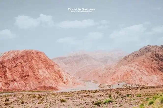
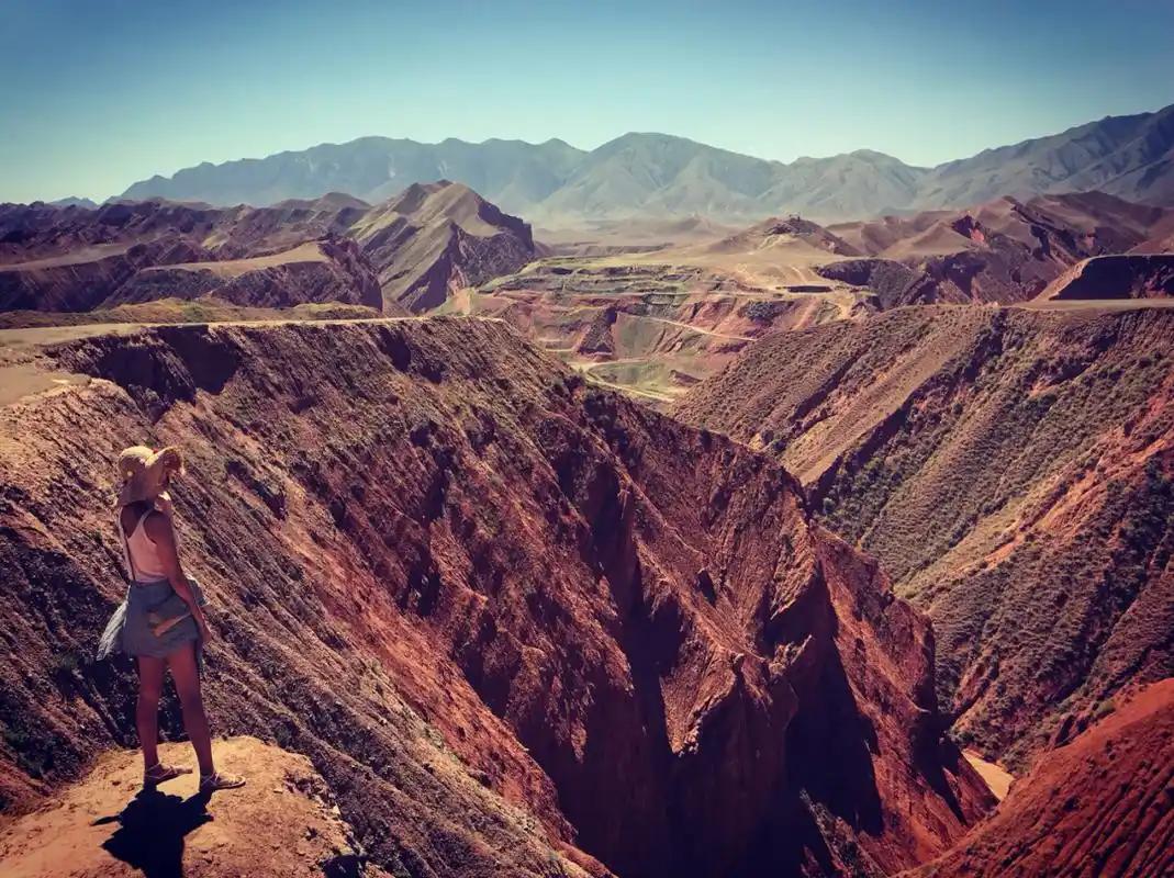
Most photos show the canyon from one polished angle: a clean slice of layered rock against a blue sky. The real place is wider and stranger than that. The rim is not a single viewpoint but a long, fenced walkway that follows the edge for several hundred metres, and at each gap in the fence the ground drops straight away. The rock reads like stacked sediment — pale tan, then a band of darker red, then grey — and the river at the bottom is a thin thread that looks harmless until you remember how far down it is.
On our June visit a cold wind came off the mountains even though it was warm in town. By October the same wind had teeth, and the few other visitors were bundled in jackets by mid-morning. The site has leaned into that drama: there is a glass-floored platform that juts over the void, a pendulum swing bolted to the cliff, and a rope bridge nicknamed “step by step, heart pounding.” I walked the glass platform. My companion did the swing. We agreed the swing was the better story and the platform the better photo.
If you want a sense of scale, bring binoculars or just squint. The far wall shows shallow caves where the softer rock washed out, and in the right light the whole canyon looks sculpted rather than eroded — as if someone pressed a thumb into wet clay and left it to dry for a few million years.
Getting to Dushanzi Grand Canyon
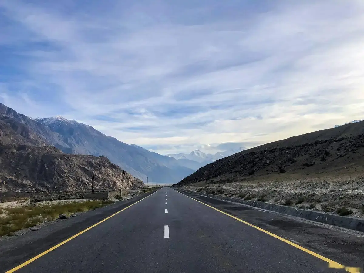
The canyon is easiest if you already have a car or a driver, because public transport drops you in Dushanzi town, not at the rim. From Urumqi, take the G30 expressway west toward Shihezi and Karamay, then follow signs for the Duku Highway (G217) south. The turnoff to the canyon is well marked, and the final stretch is paved. A private car or a chartered van from Urumqi runs 2.5 to 3 hours each way, which makes a long day trip but a very doable one.
If you are relying on trains, the Xinjiang high-speed rail network gets you to Shihezi or Wusu efficiently, but you will still need a local driver for the last 40 to 60 km. Many travellers instead fold the canyon into a longer Duku Highway drive toward Kuqa, spending the morning at the canyon and the afternoon climbing into the Tianshan passes. That is the version I would repeat.
Best Time to Visit
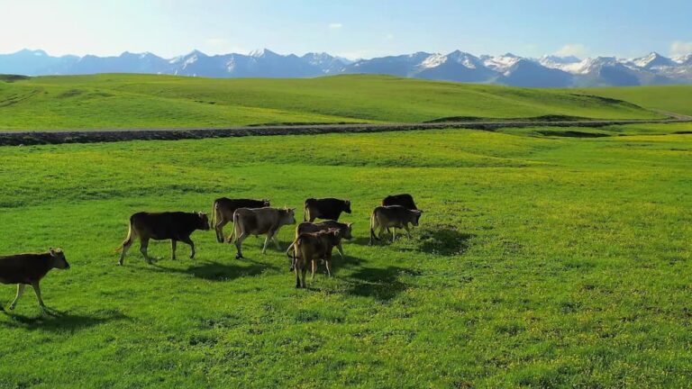
May to October is the window when everything is open and the weather behaves. Late spring and early summer (May to June) gave us green steppe beside the road and mild temperatures on the rim. July and August are hot in the lowlands but pleasant up on the plateau edges, and they are the busiest months. September and early October were my favourite: fewer people, cooler air, and a low sun that lit the cliff bands without bleaching them.
Avoid planning around winter unless you are a landscape photographer who enjoys fighting the wind. When we asked a ranger about December, he laughed and said the walkway stays open but most visitors last ten minutes. Snow can close the upper Duku sections entirely, which matters if you intend to continue south the same day. For a broader picture of regional weather patterns, the Bosten Lake guide covers the southern Xinjiang timing that pairs well with a northern loop.
Where to Stay
You have three reasonable choices. The simplest is to stay in Dushanzi District itself — a quiet industrial town with clean, affordable hotels and a few decent restaurants, about half an hour from the rim. The second is Karamay City, roughly 90 minutes north, which has more hotel variety and the Karamay travel base for exploring the surrounding oil country and the Ghost City beyond. The third, and the one I keep coming back to, is to sleep in Urumqi and make the canyon a long day out, since the expressway makes the return easy even after dark.
Book ahead in July and August, when domestic tourism peaks and the better hotels in Karamay fill early. I have never had trouble finding a room in the shoulder months.
What to Eat Nearby
Dushanzi and Karamay share the no-nonsense road-food culture of northern Xinjiang. Expect generous dapanji (big-plate chicken with noodles), hand-pulled laghman, and chuanr skewers cooked over open coals at small night-market stalls. At the canyon gate itself the options are limited to snack stalls — grilled corn, dried fruit, instant noodles — so eat properly before you drive in or after you come out.
One meal stands out in memory: a roadside place in Dushanzi where the owner insisted we try his wife’s cold liangpi noodles with a vinegar-chili dressing, then pressed a slice of local melon on us because, as he put it, “the road is long.” That kind of hospitality is the real flavour of the region, and it costs almost nothing.
Practical Tips Before You Go
- Wind is the boss. Bring a windbreaker even in summer. The rim has no shelter, and the gusts are strong enough to make the glass platform wobble.
- Wear closed shoes. The walkway is solid, but the approach paths are loose gravel. Sandals will annoy you within five minutes.
- Go early. We arrived around 9:30 and had the first viewpoints to ourselves. By noon tour buses had filled the platforms.
- Charge your phone. There is signal, but the photo opportunities come fast and the battery drains in the cold wind.
- Do not cross the fences. The drop is real and unforgiving. Rangers patrol, and the fines are the least of your problems if you slip.
- Cash helps at the stalls. Cards and Alipay work in town, but the small vendors at the gate sometimes prefer cash for small purchases.
Sample Itinerary
One-day version from Urumqi: Leave Urumqi at 7:30, reach Dushanzi around 10:30, drive to the canyon by 11:00. Walk the rim, try the glass platform, eat in Dushanzi at 13:30, and either return to Urumqi by 17:00 or push south onto the Duku Highway for an hour before turning back.
Two-day version with the Duku drive: Day one, morning at the canyon and afternoon climbing toward the Tianshan hiking country or a grassland stop; sleep in a county town along the route. Day two, continue south to Kuqa or loop back via a different pass. This is the trip that made the canyon feel like a beginning rather than a box to tick.
Frequently Asked Questions
Is Dushanzi Grand Canyon the same as the Tianshan Grand Canyon?
No. They are separate sites. Dushanzi (also called the Kuitun Canyon) sits at the northern foot of the Tianshan near Karamay, while the Tianshan Grand Canyon south of Urumqi is a different formation. Both are worth seeing, but they are not the same ticket or the same drive.
Can I visit in a regular car, or do I need a 4×4?
A normal sedan or SUV handles the paved road to the rim without issue. The 4×4 talk matters only if you continue deep into the Duku Highway in wet or snowy conditions.
How long should I budget?
Two to three hours covers the walkway and one or two paid activities. Add travel time from your base separately.
Is it suitable for children or older travellers?
The rim walkway is flat and fenced, so it is manageable for most fitness levels. The adventure rides are optional. Keep a close hand on small children near the open gaps.
Can I camp at the canyon?
I would not. There is no proper camping setup at the rim, and the wind and cold make it uncomfortable. Stay in Dushanzi or Karamay and come back fresh.
Disclaimer
This article reflects personal visits in 2025 and 2026 and information gathered at the site. Ticket prices, opening dates, and the availability of adventure rides change, and the Duku Highway closes seasonally for snow. Confirm current conditions with the official park channel or a licensed local operator before you travel, and adjust your plans to the weather and your own comfort with heights. I am not a geologist, and where I describe how the canyon formed I am repeating the accepted explanation given at the visitor centre, not original research.
About the Author
Karl Huang is a travel writer who has spent several seasons exploring Xinjiang by road, from the Pamir Highway in the south to the Duku route in the north. He prefers long day drives, local food over hotel buffets, and honest notes about what a place actually costs and feels like. He has no commercial relationship with the attractions described here.