Published: July 22, 2026 | Author: Karl Huang & the Xinjiang Travel Desk
Why you can trust this Xinjiang 10 day itinerary
A Xinjiang 10 day itinerary is the shortest window that lets you see both the green, lake-studded north and the desert-and-oasis south without burning half your trip on buses. We drove this exact loop in a rented SUV in September 2025, covering about 2,800 km from Urumqi to Kashgar. Everything below comes from that trip: the towns we actually slept in, the checkpoint delays we hit, and the meals we paid for ourselves. No agency brochure, no recycled blog text.
At a glance
| Item | What to expect |
|---|---|
| Total driving | Roughly 2,800 km, one-way north to south |
| Regions covered | North (Urumqi, Altai, Ili) and South (Kuqa, Aksu, Kashgar) |
| Best months | June (lavender, open passes) and September (golden forests) |
| Start / end | Urumqi in, Kashgar out (fly home from Kashgar) |
| Key road | G217 Dushanzi–Kuqa, the mountain link over the Tianshan |
| Realistic budget | ¥4,500–7,500 per person, shared car costs |
How the loop actually works
Most first-timers picture Xinjiang as one place. It is two. The Tianshan range splits the region into very different halves. The north (Bei Jiang) holds the alpine lakes, Kazakh and Mongol pastures, and most of the rainfall. The south (Nan Jiang) is the Tarim Basin, a desert ringed by oasis cities that grew on the Silk Road. A 10-day loop strings them together by climbing over the mountains on the G217 and dropping down into the south. We ran it diagonally and ended in Kashgar, which has a busy airport with direct flights back to Urumqi and most major Chinese cities.
Our experience on the road
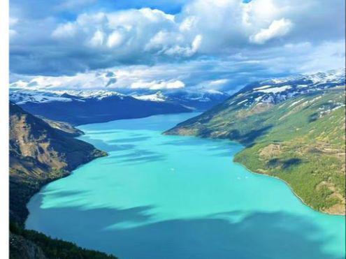
We landed in Urumqi on a Tuesday and picked up the car at the airport counter. Our first mistake was thinking we could reach Kanas the same day. Six hours of good road turns into eight once you hit the final valley approach, where private cars stop and you transfer to park shuttles. We arrived at dusk, missed the evening light on the lake, and paid more for a last-minute guesthouse. If we did it again, we would sleep in Burqin and enter Kanas fresh the next morning.
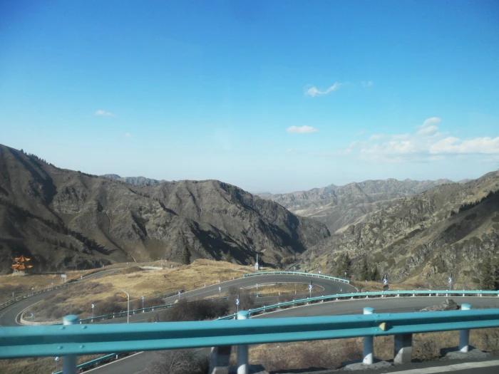
The single best moment of the trip was not a headline sight. It was the G217 descent from the snow tunnel above Dushanzi: red canyon walls on one side, green pasture on the other, then the long straight into Bayanbulak. We pulled over for twenty minutes just to let it sink in. That road is seasonal, so check the opening dates before you build the plan around it.
Getting around
A self-drive SUV is the only way to follow this loop on your own schedule. We paid about ¥480 per day for a compact SUV, plus roughly ¥1,300 in fuel across the ten days, split between four people. If you would rather not drive, the realistic mix is: train or flight Urumqi–Burqin, organized day tours inside Kanas, and an overnight sleeper or flight for the long southern hops. Note that Kashgar is about 460 km from Kuqa by road; most people split that with a night in Aksu rather than grinding it out in one go.
Flights inside Xinjiang are cheap and frequent in season. Urumqi–Kashgar one-way ran us ¥1,050 booked two weeks out; a same-day ticket costs more. The railway between the two cities takes 24 to 30 hours, so we flew.
When to go
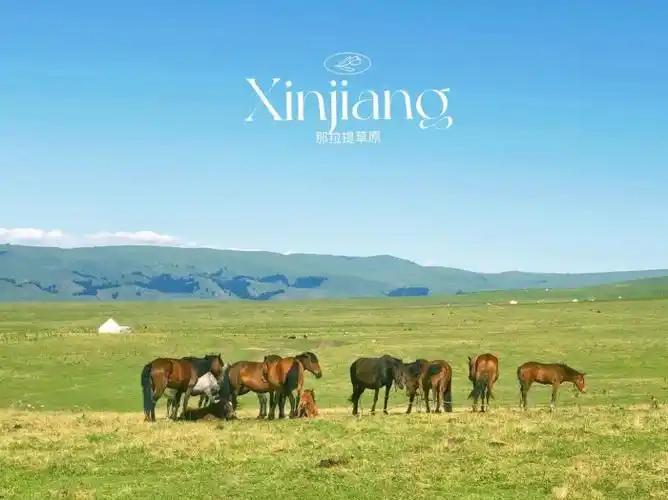
June and September are the two windows that actually make this route work. In June the Ili Valley turns purple with lavender and the G217 passes are open after the spring snow. In September the poplar and birch forests around Kanas and Hemu go gold, and the crowds thin after the summer holidays. We avoided July and August on purpose: hotel prices climb and the parks get crowded. The National Day week (early October) is the worst for both cost and crowds, so steer clear if you can.
Where to sleep
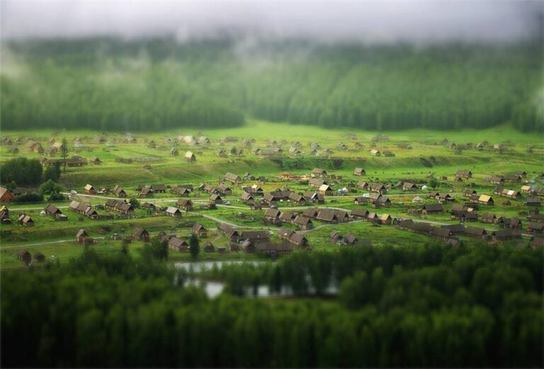
Inside Kanas and Hemu, guesthouses run ¥300–600 a night for a basic room, and they sell out in peak season, so book before you leave home. City hotels in Urumqi, Yining, Kuqa and Kashgar are comfortable and fair at ¥250–450. We liked staying inside Hemu village for the sunrise over the wooden houses, even though it cost more than the Burqin option. In Kashgar, the old town has restored courtyards that put you within walking distance of the Sunday market.
What to eat
You will eat well and cheaply. A plate of dapanji (big-plate chicken with wide noodles) fed two of us for ¥68. Polo (Uyghur pilaf with lamb and carrot) is a ¥25 lunch; samsa baked in a tandoor make a good road snack at ¥6 each. In Kashgar we found the best kawap (lamb skewers) at the night market near the Id Kah Mosque, around ¥3 a stick. Vegetarians do fine on laghman noodles, flatbreads, and the melon and tomato salads sold at every bazaar in summer.
Practical tips before you leave
- Bring your passport everywhere. There are police checkpoints on the main roads, and hotels scan it at check-in. Foreign visitors also need the Xinjiang travel permit, and border areas like Tashkurgan require an extra permit.
- Download offline maps before you go. Baidu and Amap work; Google Maps is unreliable here, and signal drops in the mountains.
- Carry some cash. Small-town noodle stalls and roadside fruit stands often do not take cards.
- Pack for two climates. It was 28°C in Turpan-style heat one afternoon and near freezing at the Bayanbulak pass (about 2,500 m) the next. Layers win.
- Sun is fierce and dry. We went through sunscreen and lip balm faster than expected.
Is this Xinjiang 10 day itinerary too rushed?
For the headline sights, no. Ten days is enough to touch Urumqi, Kanas, Sayram, Nalati, Kuqa and Kashgar without feeling like you lived in the car. It is not enough to go deep: you will skip the Pamir extensions and the long Tarim desert drives. If you want those, add a week. If you only have a week, cut the south and run the 7-day itinerary through the north instead.
Day-by-day: the North and South loop
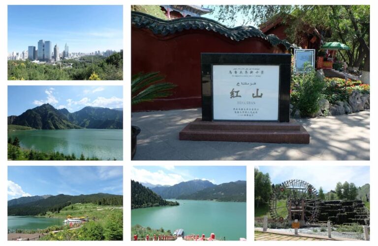
Day 1 – Urumqi and Tianchi. Arrive, rest, then take the shuttle up to Tianchi Lake for the afternoon. Sleep in Urumqi.
Day 2 – Urumqi to Burqin (about 580 km). Long but easy highway. Stop in Karamay for lunch, reach Burqin by evening, walk the riverside night market.
Day 3 – Burqin to Kanas (about 140 km). Enter the park, walk the lakeside boardwalk, then move on to Hemu village for sunset. Use the Kanas Lake travel guide for shuttle times.
Day 4 – Hemu sunrise, then south over the Tianshan. Drive the G217 toward Dushanzi. If the pass is closed (off-season), reroute via Urumqi–Korla. Overnight Karamay or Dushanzi.
Day 5 – Dushanzi to Bayanbulak and Nalati. Cross the snow tunnel, see the swan lake, then continue to Nalati Grassland for the night.
Day 6 – Nalati to Sayram Lake (about 320 km). Cross the Guozi Valley Bridge, reach Sayram Lake for sunset. Sleep in Yining or at the lake guesthouses.
Day 7 – Yining and the Ili Valley. Morning bazaar, lavender fields in June, then a relaxed drive. Overnight Yining.
Day 8 – Yining to Kuqa via Korla (about 560 km). A big driving day; if time allows, visit the Kizil Grottoes before Kuqa.
Day 9 – Kuqa and on to Aksu. Morning at the Tianshan Mysterious Canyon and the Kuqa palace, then drive to Aksu (about 260 km).
Day 10 – Aksu to Kashgar (about 460 km). Arrive in time for the old town; if it is Sunday, hit the Tashkurgan gateway market. Fly out from Kashgar.
Frequently asked questions
Can I do this without renting a car? Yes, but slower. Combine trains and flights with local day tours. You will drop the G217 experience, which is the best part of the drive.
When is the Dushanzi–Kuqa road open? Roughly June 1 to September 30, weather permitting. Snow can close it early. Always confirm the week you travel.
Do foreign tourists need permits? Yes. You need the Xinjiang travel permit for the region, and an additional border permit for Tashkurgan and the Khunjerab side. Apply through your hotel or a licensed agency in Kashgar.
Is 10 days enough? For the highlights, yes. For the Pamir or deep desert routes, add a week.
What should I budget? About ¥4,500–7,500 per person, sharing car costs, mid-range hotels, and eating local.
Disclaimer
Road openings, checkpoint rules, permit requirements, and prices change often in Xinjiang. The distances and costs above reflect our September 2025 trip and are meant as planning guidance, not a guarantee. Always confirm the current G217 status, border-permit rules, and your own visa or permit situation with official sources before you travel. This article is independent and not affiliated with any tour operator. Respect local laws, customs, and private land at all times.
About the author
Karl Huang runs the Xinjiang Travel Desk, a small team that builds practical, first-hand itineraries for independent travelers. He has driven the northern and southern routes himself and prefers writing from what actually happened on the road over repeating guidebook lines. Questions about the loop are welcome through the contact page.