Published: August 7, 2026 | Author: Karl Huang
Why you can trust this guide
Most travel writing about Xinjiang circles the same dozen names — Kanas, Sayram, the Duku Highway. The Anjihai Grand Canyon rarely makes the list, which is a pity, because it might be the only major gorge in the region you can stand at the edge of without buying a ticket or walking an hour uphill. I first saw it by accident in late June, pulling off the G30 on a drive from Urumqi toward Kuitun, and the view stopped me mid-sentence. Everything below comes from that trip and two later passes, plus conversations with a Shawan-based driver who knows the pull-off by heart. Where I am guessing, I say so.
Anjihai Grand Canyon at a glance
| Location | Shawan County, northern foot of the Tianshan, northern Xinjiang |
|---|---|
| How the gorge formed | The Anjihai River cut red and ochre sediment layers over millions of years |
| Entry fee | None — it is a roadside viewpoint, not a gated scenic area |
| Getting there | Private car or hired driver via the G30 Lianhuo Expressway; no public bus runs to the edge |
| Best light | Late afternoon, roughly 5–7 pm in summer, when the west wall warms up |
| Nearest beds | Shawan County (20 min) or Kuitun city (40 min) |
| Facilities | Almost none at the viewpoint — bring water and a hat |
What it actually looks like
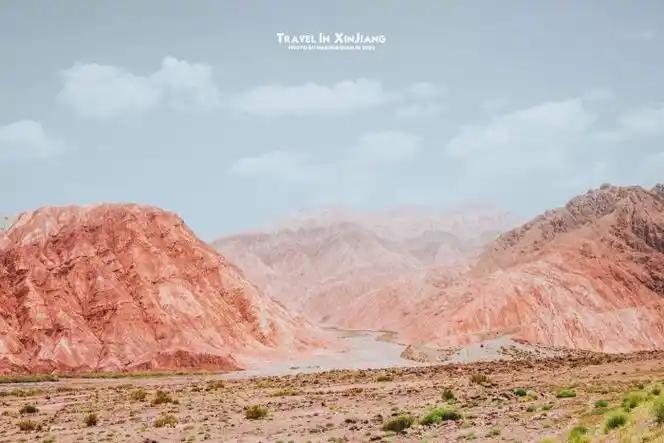
Picture a wide, shallow bowl where the land simply drops away. The cliffs are not the deep, shadowed walls you get at Wensu Grand Canyon or the famous Kuqa gorge further south. They are lower, broader, and striped — rust, burnt orange, and pale yellow bands stacked like a badly built layer cake. At the bottom a thin green ribbon of the Anjihai River snakes through, and the whole thing sits about fifty meters from the roar of the expressway. That proximity is the whole point: you do not hike in, you pull over, walk a few steps, and there it is.
The scale is harder to read than you expect. From the road the bowl looks maybe twenty meters deep; walk to the rim and it opens to closer to sixty, the lower walls near-vertical where the river undercuts them after each spring flood. On my second visit a small landslide had reshaped one corner of the east wall since the year before — the place is still actively eroding, which is part of why no one has built a boardwalk. What you see is the raw edge of the northern Tianshan’s alluvial fan, cut open and left alone.
The first time I visited, a retired couple from Shihezi had set up folding chairs ten meters back from the rim and were eating sunflower seeds while watching the light move across the rock. That is the atmosphere — casual, local, unhurried, nothing like a ticketed attraction.
Getting to the viewpoint
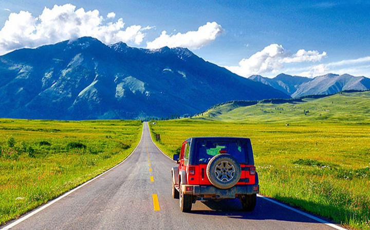
Anjihai is not a dot you can search on every map app and expect a parking lot. From Urumqi, take the G30 west; the drive is about two and a half to three hours depending on the inevitable road works. The viewpoint sits near Shawan County, on the north side of the highway. You will see a rough pull-off where local drivers already stop. Walk past the guard rail (note: there is no rail at the actual edge) and pick your spot.
The G30 Lianhuo Expressway itself is worth a word: it runs over 4,200 kilometers from Lianyungang on the coast to Khorgos at the Kazakh border, and the Shawan stretch is one of the few places where a world-class gorge sits right against the tarmac. That is what makes Anjihai different from every other canyon in Xinjiang — the infrastructure already brings you to the door. If you would rather not self-drive, hiring a car with a driver in Urumqi runs roughly 600–900 yuan a day and solves the navigation problem. Our Xinjiang driving distances guide covers the realistic daily ranges and where the police checkpoints slow you down. The same trip pairs naturally with the start of the Duku Highway, whose northern gate at Dushanzi is less than an hour west — many travelers fold both into a single day.
When to go
Late May through early October is the safe window. In summer the days are long and hot on the plain, but the canyon faces west, so the rock catches the best color after 5 pm. I went once in mid-July and the heat at the rim was unpleasant by noon; an evening visit was a different, gentler place. Spring brings meltwater and a greener riverbed; autumn (September) is my favorite — cooler, clearer, and the surrounding Junggar Basin scrub turns gold. Winter closes the matter: snow and ice make the pull-off slick and the wind cuts straight through you. Skip it from November to April unless you are a documented local.
Where to stay
There is no lodging at the canyon. Two practical bases:
- Shawan County — 20 minutes east. A working county town with clean chain hotels (Hanting, Jinjiang-style properties) in the 150–280 yuan range, plus a proper dinner street. Good if you want an early start.
- Kuitun city — 40 minutes west, larger, more hotel choice, and a better launch point if you are continuing to Dushanzi and the Duku Highway the next morning.
Urumqi works as a same-day round trip if you leave by 8 am, but that makes for a long, tired day behind the wheel.
What to eat nearby
Shawan does not trade on one signature dish the way, say, Turpan trades on grapes, but the county dinner street delivers the northern Xinjiang staples reliably: dapanji (big-plate chicken with wide noodles), hand-pulled laghman, and grilled mutton skewers that taste of nothing but salt, fat, and smoke. A bowl of shorpa (mutton soup) after a windy canyon visit is exactly the right kind of warming. Prices are gentle — a filling plate of dapanji for two rarely tops 60 yuan. If you want a cold drink and a clean table, the newer hotpot and barbecue places near the Kuitun hotel strip are the safest bet after a long drive.
Practical tips from someone who tripped once
- The edge has no fence. This is the single most important point. The drop is steep and the soil crumbles. Stay at least three meters back, especially after rain. A tourist fell here in 2019; locals still mention it.
- Wind is real. The plain funnels gusts that snatch hats and phones. Hold your gear.
- Bring your own water and toilet paper. There is no shop, no toilet, no shade at the rim.
- Drones: Northern Xinjiang is sensitive airspace. Register and check current rules before flying — our Duku Highway piece links the broader drone guidance we wrote separately.
- Go with a driver who knows the pull-off. The unmapped spots change as the shoulder erodes. A local will drop you at the safe, scenic angle.
- Time the road works. The G30 near Shawan gets lane closures for resurfacing most summers. Leaving Urumqi before 9 am usually beats the worst of it.
A simple one-day plan
Morning: Leave Urumqi by 8 am on the G30. Stop in Shawan for a late breakfast of laghman.
Mid-afternoon: Reach the Anjihai pull-off around 4 pm. Walk to the rim, shoot the wide shots, sit with the retirees.
Evening: Drive to Kuitun (40 min), check in, and eat dapanji.
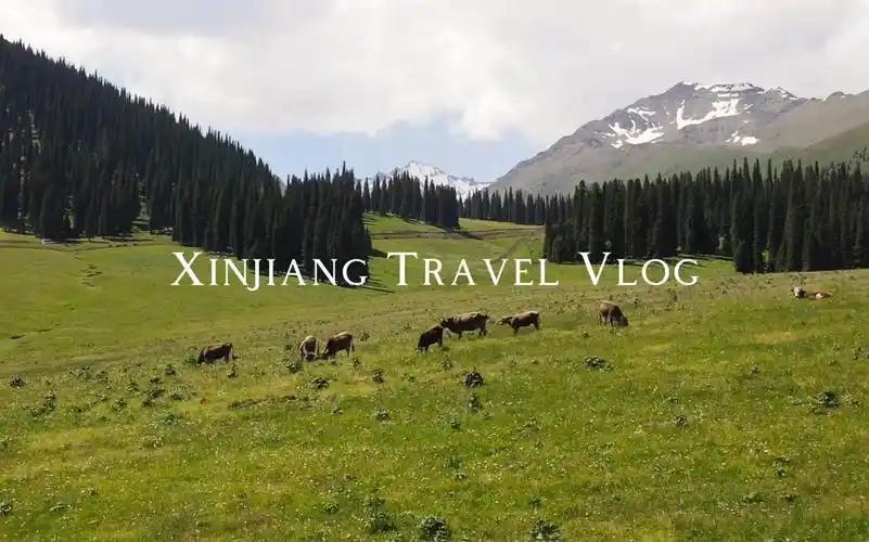
Next day: Continue to Dushanzi and climb the Duku Highway — the red gorges give way to spruce and snow within an hour.
Frequently asked questions
Is Anjihai Grand Canyon free?
Yes. There is no gate, no ticket, and no official operator. You are standing on public roadside land. That also means no staff, no rescue, and no facilities — the freedom cuts both ways.
Can I get there by bus or train?
Not to the rim. High-speed rail gets you to Shawan or Kuitun, but the final few kilometers need a car or a hired motorcycle taxi from town. Plan private transport.
Is it safe for families with kids?
Only with close supervision. The unfenced edge makes it risky for small children who run. Hold hands, keep everyone well back, and consider it a look-don’t-wander stop.
How is it different from Kuqa or Wensu canyons?
Those are ticketed scenic areas with trails, shuttle buses, and defined walkways — deeper, more dramatic walls. Anjihai is free, shallow, broad, and roadside. Think of it as the honest, unmanaged cousin. If you want the postcard depth, see our Wensu Grand Canyon write-up.
What should I photograph?
The west wall at golden hour, the river’s green line against red rock, and the odd contrast of the expressway in the background. A wide lens and a polarizer help cut the haze. Bring a light tripod if you stay for blue hour — the rim is flat enough to set one up safely well back from the drop.
Disclaimer
This guide reflects conditions during visits in 2024–2026. Road alignments, the condition of the pull-off, and local access rules change. The unfenced edge is genuinely dangerous; the author and publisher accept no responsibility for injury, loss, or changes to access. Verify the current situation with a local driver or the Shawan tourism office before you go, and never cross a barrier or stand past the obvious safe line.
About the author
Karl Huang is a travel writer who has driven more than 8,000 kilometers across northern Xinjiang, from the Gobi edges of the Junggar Basin to the spruce forests above Tekes. He prefers ungated, local viewpoints over ticketed scenic areas and writes practical guides aimed at independent travelers. He has contributed destination writing to several regional tourism outlets and maintains a focus on responsible, low-impact travel in remote parts of western China.
For background on the region and the highway that makes this stop possible, see the G30 Lianhuo Expressway and the general Xinjiang overview.