Published: 5 November 2026 | Author: Karl Huang
Most travellers who reach the Ili valley stop at Nalati and turn back. We did exactly that on our first visit, then returned a year later and drove another forty minutes west into the Gongnaisi River valley. There we found Gongnaisi grassland, a forest-steppe where walls of spruce close in on both sides, the air carries the smell of resin and wet earth, and the only crowd for kilometres is a band of horses. This guide is built from two summers spent on that road, the notes we took in yurt kitchens, and the mistakes we made with weather and timing. It is not a repackaged tour leaflet.
| Quick reference | What to expect |
|---|---|
| Where it sits | Gongnaisi River valley, Ili Kazakh Autonomous Prefecture, northern Xinjiang |
| Valley floor altitude | Roughly 1,600 to 2,000 metres |
| Best window | Late May to early September; wildflower peak is late June through July |
| How to arrive | G218 west from Yining and Xinyuan, or the Duku Highway (G217) climbing from the south |
| Nearest air link | Nalati Airport (NLT), about one hour east by road |
| Why bother | Spruce forest, alpine meadows, Alxian hot springs, and working Kazakh herder camps |
What the valley felt like on our first morning
We rolled in just after sunrise, the kind of light that turns the grass the colour of old gold. The Gongnaisi River was running high from snowmelt, loud enough that we could hear it through the closed car windows. A herder on a chestnut horse rode past without a word and nodded; his two dogs ignored us completely. That small moment told us more about the place than any signboard could. This is a working landscape, not a stage set.
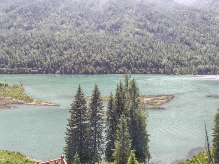
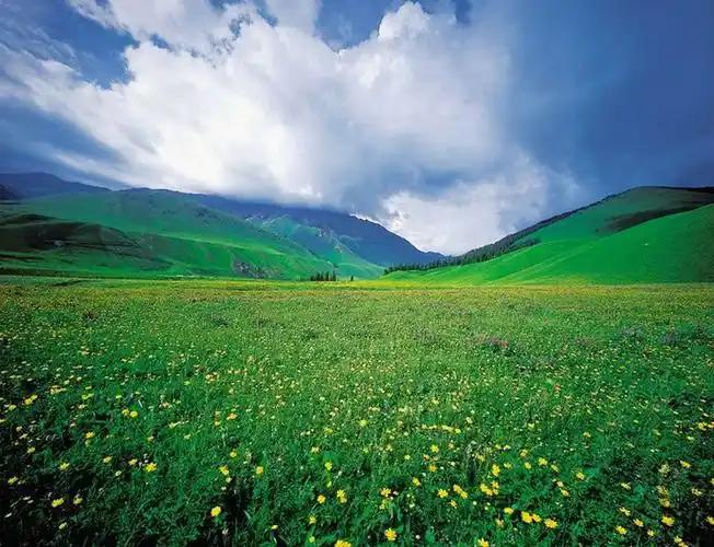
The name Gongnaisi is usually traced to a Mongolian phrase for a green valley, and the description still fits. Unlike the broad, tourist-busy sweep of Nalati to the east, the Gongnaisi belt is narrower and quieter. Spruce runs right down to the road in places, and the meadows between the tree lines are stitched with forget-me-nots, wild iris and a low yellow flower the locals call mountain buttercup. By July the whole floor is a soft, uneven carpet.
On the second morning we walked up a side draw and surprised a red deer, a stag with a velvet rack, before it melted into the trees. Later, near the hot springs, our host pointed out a snowcock on a rock and laughed at our excitement. These are not zoo animals; they belong to the valley the way the road does, and that is the point of coming here instead of staying at the fenced scenic area.
Getting to the Gongnaisi valley
Most visitors approach from Yining, the main city of the Ili valley. From there you take the G218 east. The road climbs through the Guozigou gorge, a section of cliff and bridge that deserves its own stop, then drops toward Xinyuan and continues west into the Gongnaisi River corridor. Budget around three to four hours of driving with breaks, and remember the gorge gets busy on summer weekends.
The second route is the famous Duku Highway, the G217 that crosses the Tianshan from Kuqa in the south. If you come up from Korla or Aksu, the Duku brings you over high passes and delivers you to the northern Tianshan within reach of Gongnaisi. It is a longer, more dramatic drive and it is seasonal, normally open from June to early October depending on snow. Either way, a private car or a hired driver makes the trip far easier than chasing scattered buses.
We once tried to do it on public transport and learned the hard way that the valley has no real station. A car, whether your own or a charter, is the practical choice. The Yining travel guide covers the city-side logistics in more detail, including where to rent a car and how long the airport transfer takes.
When the Gongnaisi grassland turns green
Timing decides everything here. The valley shakes off snow in late April and stays brown through May. By early June the first green pushes up, and from late June to mid July the wildflowers are at full strength. That six-week window is when the photographs people chase actually happen. August stays green but the flowers thin out, and September paints the birch and poplar edges gold before the cold shuts the road.
We prefer late June. The meadows are dense, the river is full, and the herders have moved their camps up to the summer pastures, so you actually meet people. If you want solitude over flowers, early September is calmer and the light is kinder, though some guesthouses start closing. The broader Xinjiang summer guide explains how heat in the basins and cool in the mountains shape the same season across the region, which helps if you are stringing several stops together.
The forest that holds the valley together
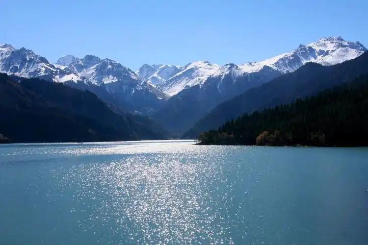
The spruce here is Schrenk spruce, the same mountain spruce that covers much of the northern Tianshan. It grows in tight dark walls, and because the trees hold snow and slow the melt, they are the reason the meadows stay green deep into summer. This montane forest is part of the Tianshan ecosystem that UNESCO inscribed as a World Heritage property in 2013, and you can read the official description at the UNESCO Tianshan listing. Standing inside one of those groves, with the floor soft underfoot and the light coming down in shafts, is the part of Gongnaisi we remember best.
Where to stay
Options split into two kinds. Inside the valley itself you can sleep in a Kazakh yurt camp or a small forest guesthouse run by the local forestry community. These are basic but warm: a real bed, a shared bathroom block, and a kitchen that turns out more food than you can finish. We paid around 150 to 250 yuan a night for a yurt on our last trip, the price moving with the season and the crowd.
If you want a proper hotel, a hot shower you can set a clock by, and restaurants that stay open past nine, base yourself in Xinyuan or at the edge of Nalati and make the drive in. The Nalati grassland guide lists lodging on the busier eastern side if you want to compare the two experiences. We did both and liked splitting the stay: two nights in a yurt, one night in town to reset and wash clothes.
What we ate with the herders
Food in the valley is plain and good. Breakfast was always milk tea, a slab of naan, and thick yoghurt with a spoon of jam. Lunch and dinner centred on lamb, either boiled with carrot and onion into a pilaf, or roasted over open coals until the fat crisped. One evening our host pulled mushrooms he had picked that morning from the spruce floor and fried them with chili and garlic; the taste was clean and a little sweet, unlike anything from a city market.
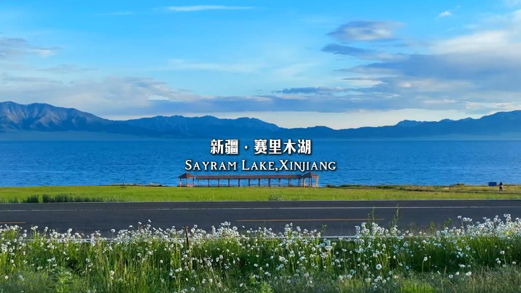
Do try the kumis if your stomach allows. It is fermented mare’s milk, faintly sour and lightly fizzy, and it is the drink of the summer pasture for a reason. We are not heavy drinkers and still finished the bowl. Later in the season the bushes along the river carry sour little berries that the children pick by the handful; we were offered a handful and found them sharp and refreshing after a hot walk. Sayram Lake, a few hours north, sits in the same mountain system and makes an easy pairing if you want water with your grasslands.
Practical notes before you drive up
Bring layers even in July. The sun is strong and the wind off the snow line is not, and the gap between the two can be twenty degrees in an afternoon. A light rain shell and a warm mid layer earned their place in our bag every single day. Mosquitoes appear with the flowers, so a small repellent helps more than you would expect this far north.
Cash still matters in the valley. The yurt camps and roadside stalls often run on WeChat Pay or cash, and card readers are rare. The Alxian hot springs, a cluster of sulfur springs at the foot of the range, take cash and get busy on weekends. Mobile signal is patchy once you leave the main road, so download your maps before you set off. Altitude is mild here, but if you are coupling this with Bayinbulak or the Duku passes you will go higher later in the same trip, so pace the first day.
Do not plan to drive the G218 after dark. The road is narrow in stretches, livestock cross without warning, and there is no lighting outside the towns. We made that mistake once and pulled over at Xinyuan rather than risk it. Also, the meadows are someone’s summer pasture; close gates behind you, ask before walking through a camp, and keep drones low or packed near the frontier.
A three-day Gongnaisi loop
Day one: leave Yining after breakfast, stop at the Guozigou gorge, reach Xinyuan for lunch, and roll into a Gongnaisi yurt camp by late afternoon. Walk the river, eat lamb, sleep to the sound of water.
Day two: spend the morning in the meadows and the spruce edge, then drive the short way to the Alxian hot springs to soak. In the afternoon, if the road is open, push south toward the Bayinbulak plateau for a taste of higher Tianshan country, then return to the valley for the night.
Day three: break camp and head north via the G218 and Guozigou toward Sayram Lake, or continue east to Nalati if you want the famous viewpoint. Either way you end the loop back in Yining with a full memory card and aching legs, and a fair claim that you saw the Ili valley most day-trippers miss.
Questions travellers ask
Is Gongnaisi grassland the same as Nalati? No. Nalati is a managed scenic area to the east with ticket gates and tour buses. Gongnaisi is the wider river valley and forest belt, quieter and less fenced. Many people see both on one trip.
Do I need a permit? The valley itself does not require a special permit for normal visits. The Duku Highway and certain border zones nearby do have seasonal checks, so carry your passport or ID and expect a checkpoint or two.
Can I visit in winter? Not really. Snow closes the higher roads from around November to April, and most camps shut. Come in the warm half of the year and you will have the best of it.
Is it worth skipping Nalati for this? If you want photographs without tour buses, yes. If you want full facilities and signed trails, Nalati serves that better, and the two are close enough to combine.
A straight word before you go
This guide reflects our own visits and the conditions we met; prices, road openings and camp availability change year by year, and the Duku Highway in particular closes without much notice after early snow. We have not been paid by any guesthouse or driver mentioned, and we have tried to keep every claim checkable. Treat the timing and the logistics as a strong starting point, then confirm the current status with your hotel or the local tourism line before you commit to a long drive.
About the writer
Karl Huang is a Xinjiang-based travel writer who has driven most of the region’s mountain roads over the past decade. He prefers working valleys like Gongnaisi to staged viewpoints, and he writes from notes taken on the ground rather than from second-hand summaries. When he is not on the road he maintains this site’s guides to the Ili valley and the Tianshan corridor, and he returns to Gongnaisi whenever the wildflowers are due.