Published: August 7, 2026 | Author: Nina Ostrowska, Beijing-based road-trip writer | Drove the Panlong road in June 2023 and again in September 2025
Thirty kilometres does not sound like a day out. That is the whole length of the Panlong Ancient Road, the switchback climb hidden in Wacha township in Tashkurgan county, and when I first traced it on a map I assumed we would be done before lunch. We were not. The driving takes under an hour; the permit, the fuel stop, the one-way rule and the thin air at the top are what fill the day.
Why you can trust this guide
I have driven this road twice, in early summer and in late September, both times in a rented sedan out of Kashgar on a converted mainland licence. The numbers below come from my own logs and from signage at the entrance, cross-checked with the traffic police at the Tashkurgan end. Where local sources contradict each other, I say so rather than picking the tidier answer. I have no arrangement with any rental company, guesthouse or operator mentioned here.
Quick reference: the numbers that matter
| Item | Detail |
|---|---|
| Where | Wacha township, Tashkurgan Tajik Autonomous County, Kashgar Prefecture |
| Length | About 30 km, reservoir to township |
| Bends | 639 by the most-quoted local count |
| High point | Around 4,200 m at the Heiyangling pass |
| Surface | Sealed asphalt throughout, paved 2019 |
| Gradient | Up to roughly 9 per cent |
| Traffic | One-way control in force; no overtaking, no stopping in lane |
| Speed limit | 30–40 km/h, average-speed enforcement over the full length |
| Driving time | 40–50 minutes one way |
| Vehicles | Under 7 seats only; no motorhomes, no coaches |
| Season | June to October reliable; closed by snow roughly November to April |
| Permit | Border zone permit required |
| Drones | Not permitted anywhere along the road |
| Last fuel | Tashkurgan town |
The word “ancient” is doing a lot of work
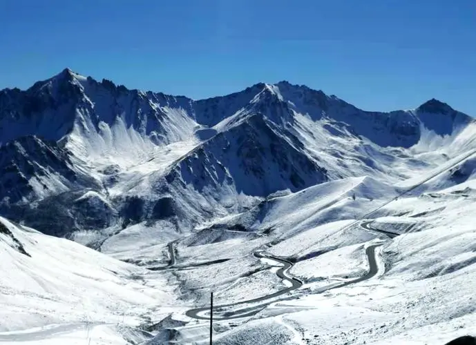
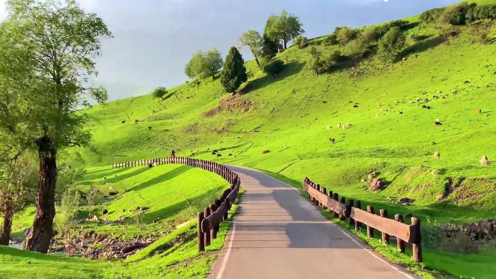
Nothing you drive on here is old. The alignment follows a corridor herders and traders used for a very long time, but the road under your tyres was only finished in asphalt in 2019. That matters for planning, because photographs from before then show a dirt track and a completely different kind of trip. What exists now is a well-built mountain road with tight geometry: not rough, just relentless. Drivers who finish it repeat a line printed on the boards at the top, roughly “today I have driven every bend there is, so the rest of life will be straight.” By the two hundredth turn it feels earned.
Where it starts and where it puts you
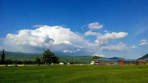
The climb runs between the Xiabandi reservoir area, sometimes written Bandi’er, and Wacha township. On the map it is a connector: at one end it meets the G314 corridor that carries everyone from Kashgar up to Tashkurgan, at the other it feeds the old Tashkurgan-to-Yarkand mountain route. Almost nobody uses it as a through road. It is driven as an out-and-back from Tashkurgan town, and there is no reason to sleep in Wacha. Because it is a spur rather than a shortcut, it is easy to underestimate. Budget the full day, not a slot between two other things.
639 bends, and why nobody agrees on the number
Local signage splits the road into a larger upper section and a shorter lower one, quoting more than 600 turns for the first and more than 300 for the second. That adds to well over 900, yet the figure printed almost everywhere, including on the boards at the viewpoint, is 639. I have never found an official reconciliation of the two.
Treat 639 as branding rather than survey data. The practical point is that the turns are continuous, with no straight section long enough to relax in. That is why thirty kilometres takes fifty minutes.
The one-way rule decides your day
This is the detail that catches people, and it is the one thing I would check before anything else. Traffic on the climb is directionally controlled rather than free-flowing, and when the control is active you cannot simply turn around and come back the way you came. On both of my visits the managed flow ran from the Tashkurgan side, and officers at the entrance were strict about it: no overtaking, no reversing, no parking in the running lane for a photograph.
Direction and hours are set locally and shift with roadworks or weather, so ask at your Tashkurgan guesthouse the evening before, or at the traffic post on the way out. Turning up and improvising is how people lose three hours.
Cameras run the entire length
Average-speed enforcement covers the road end to end, with a posted limit of 30 to 40 km/h. You cannot bank time on the open bits and crawl through the tight ones; the system reads total elapsed time between points. Anyone used to slowing only where a camera is visible will get a surprise in the post. In practice the limit is not the constraint, the corners are. On my first run I tried to hold a rhythm and gave up within ten minutes, because the radius on the tighter hairpins is short enough that a sedan needs most of its lane to get round cleanly.
What I got wrong the first time
Two things. First, brakes. Coming down I drove as I would on a motorway descent, riding the pedal and scrubbing speed corner to corner. Two thirds of the way down the pedal went soft and the cabin filled with a hot metallic smell. We sat in a widened section for twenty minutes with the bonnet up, which felt stupid because it was avoidable. Second time round I put the automatic in L at the top and barely touched the brake. Manual drivers should be in second and stay there.
Second, timing. We reached the viewpoint at two in the afternoon, into flat backlight, and the sweeping curve everyone photographs looked like grey corrugation. Nothing was wrong with the road. We had turned up at the wrong hour.
The viewpoint, and when the light works
There is one proper stop: a signed platform with a timber walkway near the first big curve on the reservoir side, two minutes on foot from the car park. It is the vantage point behind most photographs of the road. Morning gives front light across the switchbacks; by mid-afternoon you shoot into the sun and the layers flatten.
Everywhere else, stopping is either prohibited or a bad idea: short pull-outs, poor sightlines round the bends, and a parked car on a 9 per cent gradient helps nobody.
The blue reservoir at the bottom
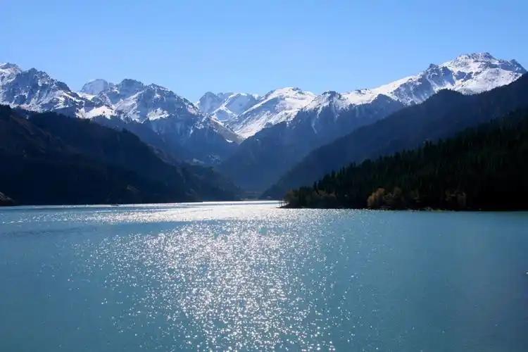
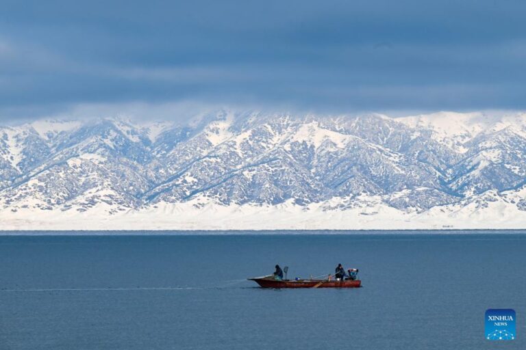
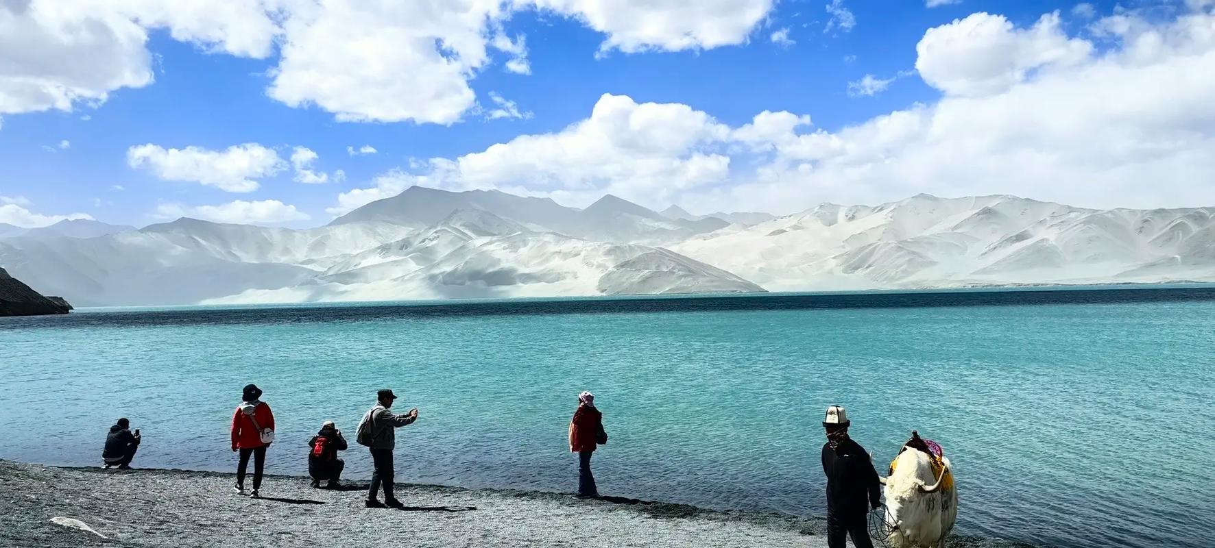
At the foot of the climb sits the Xiabandi reservoir, which locals call the blue lake. Mineral content gives it a hard turquoise cast against ochre slopes, and in September it was the most saturated thing I saw all week. Shoot it from the marked pull-out; the banks below drop away steeply.
Four thousand two hundred metres, in about an hour
Tashkurgan town already sits above 3,000 m and the pass tops out near 4,200 m. You gain that in under an hour of driving, a faster ascent profile than anyone manages on foot. I felt it both times: a dull frontal headache within twenty minutes of the top, and heavier breathing walking the fifty metres from the car to the viewpoint railing.
If you came up from Kashgar the same day, you are stacking one rapid gain on another. Sleep in Tashkurgan first. Our altitude sickness guide covers acclimatisation and warning signs, and is worth reading before you commit to a 4,200 m day rather than after you feel unwell at the pass.
The permit, and why the drone stays packed
Wacha lies inside a border management zone, so a border permit is required and it must list Tashkurgan county. Get it in Kashgar or in Tashkurgan town before you set off; there is no facility to sort it out at the road. Foreign passport holders should read the process in our Xinjiang visa and permits guide, because the paperwork chain is not the same as it is for domestic travellers.
Drones are a firm no along this corridor because of the border. Asking politely will not help and it does not matter what registration you hold. If you are planning aerial work elsewhere in the region, our guide to Xinjiang drone rules explains where the hard boundaries sit. Here the answer is no, and most of the aerial-looking photographs you have seen were taken from that walkway.
Fuel, water and the signal gap
Fill the tank in Tashkurgan. It is the last real supply point; Wacha has small shops and a canteen but no fuel. Carry more water than you think you need, take food, and download offline maps before leaving town, because coverage disappears for most of the route and only flickers back near the pass on one network.
What you are allowed to drive
Access is limited to vehicles under seven seats. Motorhomes and coaches are turned away at the entrance, worth knowing if you are a group of eight assuming one van will do. Sedans are fine; an SUV buys clearance you will not need on sealed asphalt. What matters is brake condition and knowing how to use engine braking on a long descent.
When the road is open
June through October is the dependable window: dry surface, snow visible on the peaks, and long enough daylight to drive in the morning and still get back for dinner. Early April brings apricot blossom in the Wacha valleys, which is lovely and also a gamble, since late snowfall at that altitude can close things at short notice. From November to April the high sections ice up and the road is effectively shut. Do not try to force it.
In July and August rockfall after rain is the seasonal hazard. Check the forecast, and if it has been wet, do not linger under the cut slopes.
Wacha at the top, and the drive home
Wacha itself is unremarkable in the best way: Tajik homesteads, low walls, poplars, kids who wave at cars. There is nothing to tick off. In early April the apricot trees in the side valleys flower at the same time as those in the better-known villages further north, with a fraction of the visitors.
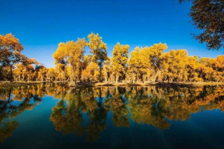
On the way back, the Tashkurgan wetland is worth the five minutes it costs. Late light turns the grass gold and, on a still evening, the peak reflects in the channels.
How I would plan the day
Sleep in Tashkurgan and treat this as a half-day drive with a generous margin. Confirm the direction of traffic control the night before. Leave around eight, fuel up, and reach the viewpoint while the light is still behind you. Allow an hour at the platform and the reservoir, continue to Wacha, stop for tea and turn for home. You should be back by mid-afternoon with the wetland still ahead of you.
For where to base yourself, what the town offers and how the border formalities work locally, our Tashkurgan travel guide is the companion piece to this one. If you are fitting the Panlong road into a longer loop out of Kashgar, the staged route in our Pamir Plateau circuit shows where it sits relative to Karakul Lake and the border road.
Frequently asked questions
Can I do it as a day trip from Kashgar? Physically yes, sensibly no. Kashgar to Tashkurgan is a long mountain drive on its own, and adding a 4,200 m climb to the end of it is asking for a bad night.
Is it safe for a nervous driver? It is well surfaced and slow-speed, but the drops are real and barriers are patchy. If steep exposure bothers you, hire a local driver in Tashkurgan rather than talking yourself into it.
Will I get carsick? Quite possibly. Continuous turning for fifty minutes affects passengers more than drivers. Bring tablets and take them before you start, not halfway up.
Can I fly a drone if I stay low? No. Treat the entire corridor as closed to drones.
Disclaimer
This reflects my own drives in June 2023 and September 2025, plus signage and local guidance current at those times. Traffic direction, control hours, speed enforcement, permit procedures, vehicle restrictions and seasonal closures are set locally and change without notice, sometimes mid-season. Verify the current position through official channels or your accommodation in Tashkurgan before travelling, follow the instructions of officers at the entrance, and treat nothing here as a guarantee the road will be open on your dates. Altitude affects people unpredictably; this is not medical advice.
About the author
Nina Ostrowska writes about long-distance driving in western China and has held a converted mainland driving licence since 2019. She keeps a written log of fuel stops, elevation gain and road conditions on every trip, and has driven in Kashgar Prefecture in four different seasons.