Published: July 27, 2026 | Author: Oliver Nash, overland desert-travel writer
I have crossed the middle of the Taklamakan twice, once north to south on the old Tarim Desert Highway and once on the newer Yuli–Qiemo road, and both times the same thought stuck with me: Tarim Basin travel is less about ticking off sights and more about respecting a landscape that does not care whether you make it or not. This is the largest sand desert in China wrapped inside a ring of oasis towns, and getting the logistics wrong here is a real problem, not an inconvenience. What follows is what I wish someone had told me before my first crossing in 2019.
Why trust this Tarim Basin guide
I am not writing this from a hotel lobby in Urumqi. I drove the Lunmin (Luntai–Minfeng) highway across the sand in 2019 with a hired driver, and returned in 2023 to run the Yuli–Qiemo route that opened in mid-2022. Between those trips I spent nights in oasis guesthouses in Kuqa, Aksu, Hotan and Qiemo, refuelled at the lonely staffed water-and-fuel stations that keep the highway alive, and learned the hard way that phone signal disappears for long stretches. Everything below is field-tested, and where I am unsure I say so.
Quick reference
| Detail | What to know |
|---|---|
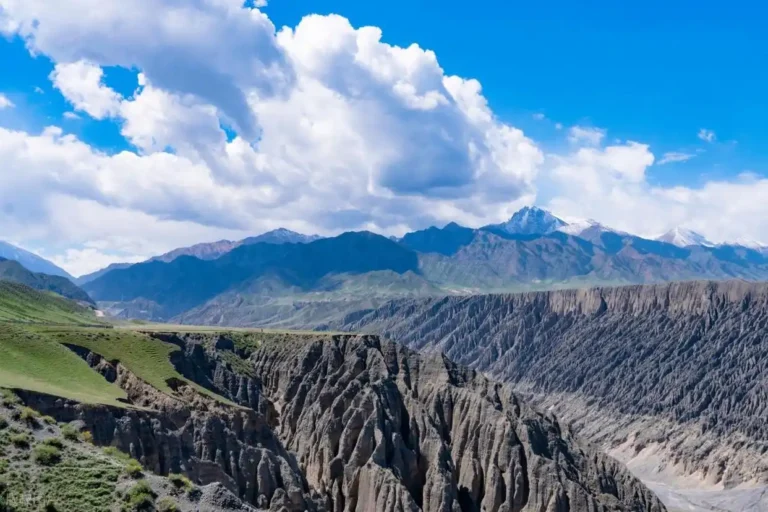
| Where it is | Southern Xinjiang, ringed by the Tian Shan (north), Kunlun (south) and Pamir (west) |
| Core feature | Taklamakan Desert; the Tarim River threads its northern edge |
| Cross-desert roads | Tarim Desert Highway (Luntai–Minfeng, ~446 km) and Yuli–Qiemo Highway (opened 2022) |
| Best months | Late September to early November; April–May also workable |
| Gateway cities | Korla, Kuqa, Aksu, Kashgar, Hotan (all with airports) |
| Getting around | Hired car with driver is by far the most practical |
| Signal & fuel | Patchy signal on the crossing; fuel stations are spaced but reliable |
What it actually felt like to cross
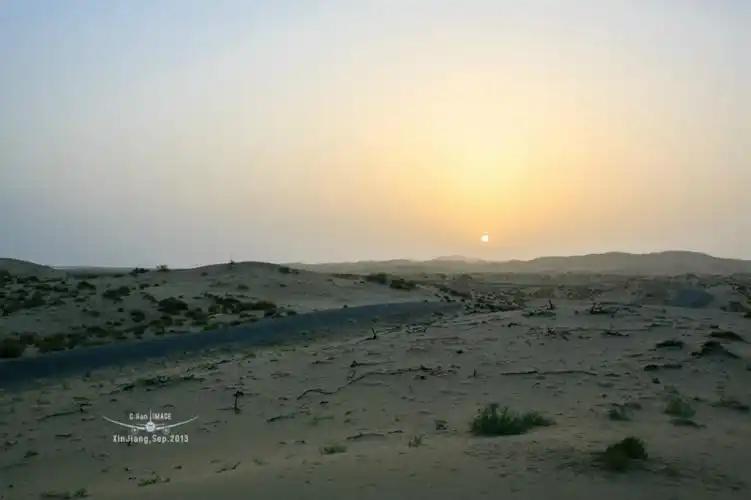
The Tarim Desert Highway surprised me. I had pictured emptiness, and there is plenty of it, but the road is lined for its entire length with a thin green shelterbelt of tamarisk and reeds, watered by a chain of small wells and pumphouses. Someone lives in most of those little stations, tending the plants that keep the dunes from swallowing the asphalt. On my first crossing we passed one such couple hanging laundry between two water tanks in the middle of nowhere, and it reframed the whole desert for me. It is not empty. It is quietly, stubbornly maintained.
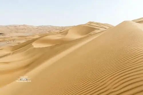
Midway the shelterbelt thins and the true dunes press in on both sides, ridge after ridge in a colour that shifts from pale gold at noon to a deep apricot near sunset. We stopped, walked twenty minutes off the road, and the silence was total. No wind that afternoon, no insects, nothing. If you have never stood inside that kind of quiet, it is worth the drive alone.
Getting there and getting across
You do not casually wander into the Tarim Basin. Plan the entry and exit points first, then fill in the middle.
- By air: Fly into Korla, Kuqa, Aksu, Kashgar or Hotan. I usually start from Korla in the northeast because it links neatly to the Tarim Desert Highway. See the Korla travel guide for the northern gateway.
- The desert crossing: The Luntai–Minfeng highway is the classic route and takes most of a day with photo stops. The newer Yuli–Qiemo road is shorter and less trafficked but has fewer services, so top up fuel before you commit to it.
- Hire a driver: Public transport does not cross the sand. A car with a local driver for the crossing is standard, and a good driver knows exactly where the fuel and rest stops are. Agree the route and price before you set off.
- Self-drive: Possible with a proper vehicle, a full tank and offline maps, but I would only recommend it if you are comfortable with long empty stretches and no signal.
Best time to go
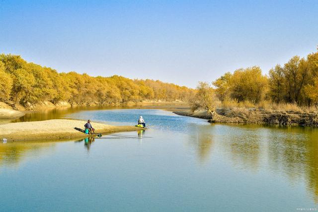
My honest pick is the second half of October. The heat has broken, the light is long and warm, and the desert poplars (Populus euphratica) along the Tarim River turn a fierce gold that photographs like nothing else. That is a narrow window, roughly mid-October to early November depending on the year, so build in a day or two of flexibility if the poplars are your priority.
Spring, around April and May, is the quieter alternative with mild days and thinner crowds, though the light is flatter and the poplars are just green. Avoid July and August unless you tolerate extreme heat well; daytime temperatures on the sand routinely climb past anything comfortable, and I found even short walks draining. Winter is cold, clear and empty, which some travellers love, but services shrink.
Where to sleep
There are no hotels in the middle of the desert, so accommodation means the oasis towns on the rim. Plan your day so you finish the crossing at a town rather than gambling on distance.
- Korla and Kuqa: The best range of comfortable mid-range hotels on the northern side. Good places to rest before or after the crossing.
- Hotan (Khotan): Solid hotels and a natural base for the jade markets and southern loop.
- Qiemo and Minfeng: Simpler guesthouses and small hotels. Clean and functional rather than fancy. If you exit the desert here, do not expect much choice, so book ahead in peak weeks. See Minfeng (Niya) and Qiemo for the desert-edge towns.
What to eat
Oasis food is one of the quiet joys of this region. In Kuqa I ate the best big flatbread nan of my life, blistered and sesame-crusted, straight off the clay oven wall. Expect hand-pulled laghman noodles, cumin-heavy lamb skewers, and pilaf (polo) rich with carrot and mutton fat. Hotan is famous for its walnuts and for a sweet, dense local nan. Melons and grapes in season are extraordinary, and the region’s dried fruit is worth carrying home; my dried fruits and nuts guide covers what to buy and how. Drink far more water than you think you need.
Practical tips I learned the hard way
- Carry water and snacks in the car. Distances between towns are long and the crossing has few services beyond fuel.
- Download offline maps. Signal drops out for hours. I mark fuel stops in advance.
- Sun and dust protection. Sunglasses, a scarf or buff, high-SPF cream and lip balm. Fine sand gets into everything, so a dust cover for cameras helps.
- Start early. Begin the crossing in the morning so you reach an oasis town before dark. Driving the sand at night is not fun.
- Fuel discipline. Fill up whenever you can rather than when you must, especially on the Yuli–Qiemo road.
- Permits and access. Border and access rules in southern Xinjiang can change. Check current requirements before you travel and keep your ID and any permits handy.
A realistic southern Xinjiang loop
This is the seven-day southern Xinjiang loop I would run again, balancing the desert crossing with the oasis culture that makes it worthwhile.
- Day 1: Arrive Korla, rest, stock up on water and supplies.
- Day 2: Korla to Kuqa. Explore Kuqa’s old town, mosque and bazaar; eat the nan.
- Day 3: Drive the Tarim Desert Highway to Minfeng, stopping to walk into the dunes and photograph the Tarim River poplars.
- Day 4: Minfeng to Hotan. If ruins interest you, the region around the Niya Ruins gives context to how these buried Silk Road towns lived and died.
- Day 5: Hotan jade markets, silk workshops and the Sunday bazaar if timing allows.
- Day 6: Head west toward Kashgar, or loop back north. The nearby Yutian (Keriya) oasis is a fine slower stop.
- Day 7: Fly out from Hotan or Kashgar.
If you are still weighing north against south, my north vs south Xinjiang comparison lays out the trade-offs. The Tarim Basin is firmly the south: drier, older, more Silk Road than alpine.
Frequently asked questions
Is it safe to cross the Taklamakan? The highways are well maintained and used daily by trucks and cars. The main risks are heat, breakdowns and running low on fuel, all of which you manage by preparing properly and travelling with a competent driver.
How long does the desert crossing take? The Luntai–Minfeng highway takes most of a day with stops; allow 6 to 8 hours of driving. The Yuli–Qiemo route is a bit quicker but has fewer services.
Can I do this without a car? Not the crossing itself. You can reach the rim towns by bus or plane, but the sand routes need a private vehicle.
Will my phone work? Expect long dead zones on the crossing. Signal returns near towns and staffed stations. Offline maps are essential.
Is one crossing enough? For most people, yes. One full desert crossing plus a couple of oasis towns gives you the essence without repeating the same landscape.
Disclaimer
Travel conditions, road openings, fuel availability, permit rules and prices in southern Xinjiang change over time and by season. This article reflects my own trips in 2019 and 2023 and is intended as general guidance, not a substitute for current official information. Please verify access requirements, road status and safety advice from official sources close to your travel dates.
About the author: Oliver Nash is an overland travel writer focused on the deserts and oasis routes of Central Asia. He has crossed the Taklamakan twice, on the Tarim Desert Highway (2019) and the Yuli–Qiemo road (2023), and has spent several weeks staying in the oasis towns of southern Xinjiang. He writes about practical logistics for independent desert travellers.