Published: September 15, 2026 | Author: Karl Huang
Most travellers who cross the Tarim Basin have never heard of Taitema Lake, and until 2000 there was little reason to. The lake at the end of the Tarim River had been dry since 1972, a pan of cracked clay where the highway kept vanishing under blown sand. There is open water there again now, along with reeds and birds. This guide comes from two drives along the G218 in Ruoqiang County, one in August 2024 and one in August 2025, together with the water-transfer records published by the Tarim River Basin Authority and reporting from Xinhua and CCTV. Where I am giving an impression rather than a measured figure, I say so.
Taitema Lake at a glance
| Where | Ruoqiang (Charklik) County, Bayingolin Mongol Autonomous Prefecture, southeast Tarim Basin |
| What it is | Terminal lake of the Tarim River, also fed by the Qarqan (Cherchen) River |
| From Ruoqiang town | About 55 km north along the G218, near Luobuzhuang |
| Entry | Free. An undeveloped ecological reserve, not a ticketed scenic area |
| Best months | June to September, with the ecological releases arriving July to September |
| Water area | Peaked near 511 km2 in 2022, with roughly 223 km2 of wetland around it |
| Depth | 0.4 to 0.6 m on average, about 2 m at the deepest point |
| Facilities | None at the lake. Fuel, food and beds are in Ruoqiang town |
| Time needed | Two to three hours at the water, half a day with the drive |
How a terminal lake disappeared, and came back
Taitema is the terminal lake of the Tarim, the low point where the river finally stops. It sits in the southeast of the Tarim Basin in Ruoqiang County, and it is also fed by the Qarqan, or Cherchen, River. Historically it was one of three lowlands in the old Lop Nur region, alongside Kara-Koshun and Lop Nur itself. In 1959 it covered about 183 square kilometres. Then upstream irrigation, reservoirs and a growing population took the water. By 1972 the channel below the Daxihaizi Reservoir had stopped flowing, and the lake dried out.
The consequences were blunt. Poplar and tamarisk along the lower river died, the Taklamakan and the Kumtag began to close on each other, and drifting sand repeatedly buried the G218.
In 2000 the Tarim River Basin Authority started releasing water down the dry channel. By 2025 the authority had run 26 such transfers, sending roughly 10.2 billion cubic metres downstream from Daxihaizi, with the leading edge of the water reaching Taitema 19 times. The lake came back, and it peaked at about 511 square kilometres in 2022.
The recovery shows up in the numbers. Plant species recorded in the lake area rose from 17 to 46. In a one-kilometre belt along the lower river, groundwater rose from 8 to 12 metres below the surface to 2 to 4 metres, and salinity fell from 4 to 5 grams per litre to 1 to 2. Downstream vegetation cover grew from about 830 square kilometres in 2000 to roughly 1,790 by 2023. Sand-affected ground shrank by 854 square kilometres and vegetation added 362.
One thing to understand before you go: this is a shallow lake, 0.4 to 0.6 metres on average and about 2 metres at its deepest. Evaporation here runs near 2,900 millimetres a year, so managers keep the core to somewhere between 30 and 110 square kilometres. The shoreline is a moving target, and in a dry winter much of the water is simply gone.
What it is like on the ground
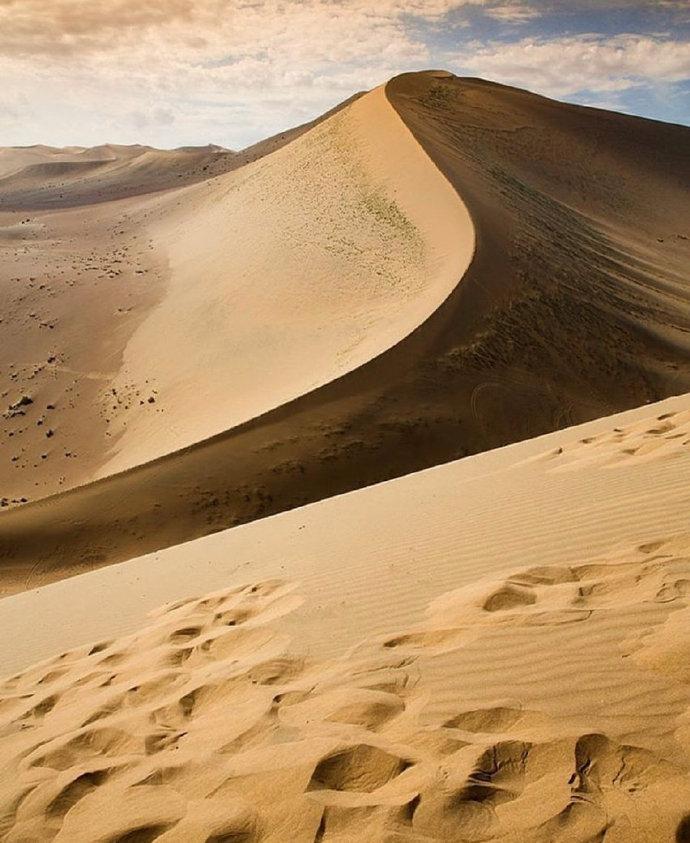
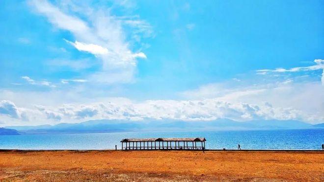
We left Ruoqiang a little after seven, heading north on the G218. For the first forty minutes the road runs through jujube orchards and bare gravel, then it narrows between low dunes and there is nothing on either side but sand and a thin line of poles. Just past the fifty-kilometre mark a strip of blue appears at the horizon, low and flat, and you understand that the desert here has a bottom.
We parked in a gravel pull-off, well clear of the carriageway, and walked in. The reeds were chest-high and dry at the top, the water warm and no deeper than my knees. Egrets worked the shallows and the wind never stopped. There is no visitor centre, no shade and no toilet, so the place asks something of you: either you know the story or you see only a wet field.
A maintenance worker at a small station told us his team patrols about 400 kilometres of channel, from Daxihaizi down to the lake, every month. He showed us photos of the same spot in 2019, bare salt crust crossed by tyre tracks, then waved at the water behind him. That contrast is the whole reason to come.
Getting to Taitema Lake from Ruoqiang
The lake lies roughly 55 kilometres north of Ruoqiang (Charklik) town along the G218, near the settlement of Luobuzhuang. Ruoqiang is the base for the trip and is worth more than a fuel stop. It is the largest county in China by area, and the town has hotels, restaurants and a small museum devoted to Ruoqiang and the Lop Nur wilderness.
By car the drive is simple but easy to overshoot, because there is no large sign and the pull-offs are unmarked gravel bays. From Korla the route runs south on the G218, and the Yuli to Ruoqiang section has been rebuilt as expressway, about 365 kilometres, which makes for a five to six hour drive. From Urumqi, take the G0711 Wuruo Expressway to Korla and then the G218 south; that is a long day, and most people break it in Korla.
By rail, the Golmud to Korla line has a station at Ruoqiang, so you can arrive by train and then charter a car or join a local guide for the final stretch. No public bus runs to the water. Whatever your transport, check the road conditions in town before you set out.
When to go
June to September is the window. Daytime temperatures sit between 15 and 30 degrees, the water is at its highest because the ecological releases run during the July to September flood season, and the reeds and birdlife are at their best. Late August and September add two things: softer light and the start of the Ruoqiang jujube harvest.
Two cautions. Summer afternoons are hot and the wind moves sand across the road, so start early. Winter is not the season here: the water can shrink and freeze, and the birds leave.
Sunset in summer comes late, generally between nine and ten in the evening by Beijing time, which is a gift if you want photographs and a problem if you still have to drive afterwards. Decide whether you are staying for the light or leaving before it goes.
Where to stay
There is no lodging at the lake, and camping is not set up. Everyone sleeps in Ruoqiang town, about 55 kilometres south. The town is compact and has a handful of small hotels, mostly in the 150 to 300 yuan range, with a few better rooms if you book ahead. In the October holiday and during the jujube festival the town fills, so reserve before you arrive.
Use the afternoon for the Loulan Museum, which explains the basin’s hydrology and the Silk Road towns that depended on it, and for a walk through the jujube market. Some travellers instead stage in Yuli or Korla, though that makes for a very long day.
What to eat
Ruoqiang calls itself the jujube capital of China, and the local dried dates are the town’s pride; there is more background on Ruoqiang’s jujube trade if you want it. Fresh jujubes appear in September and are sold by the bag in the market.
For meals the town does the usual southern Xinjiang repertoire well: lamb kebabs, hand-pulled laghman, samsa, pilaf and fresh naan. It is simple food and it is good. For the lake itself, bring everything you need. There is no shop, no stall and no water for 55 kilometres once you leave town, so a full tank and a full bottle are both part of the plan.
Practical tips
Fuel up in Ruoqiang before you leave. Distances between stations in this part of the basin are long and there is no fuel on the G218 stretch you are driving.
Download offline maps. Phone signal around the lake is weak, and the turn-off is easy to miss in either direction.
Leave the drone at home. The lake sits inside a protected ecological area where drone flight is restricted, and some nearby zones have rules of their own. Check current notices instead of assuming.
Do not stop on the G218 carriageway, and do not walk out onto the undeveloped wetland. The bottom is soft and uneven and the mud does not announce itself. Keep your distance from the birds as well, since this is a habitat that is still recovering rather than a zoo.
Carry out every piece of rubbish. The straw checkerboards and the saxaul and black goji plantings around the lake are working sand-control measures, not scenery, and they are easy to trample without meaning to.
Pack for sun, wind and dust rather than for heat: sunscreen, sunglasses, a hat and a windproof layer, even in July. Bring more water than feels necessary, and allow half a day.
A simple two-day plan
Day one is Ruoqiang. Arrive, check in, spend the afternoon in the Loulan Museum to get the hydrology straight, then walk the jujube market and eat an early dinner. Sleep in town.
Day two is the lake. Leave by seven, drive north on the G218 for about an hour, and give the water two to three hours: walk the pull-off area, watch the birds, and sit with the fact that this was salt crust two decades ago. On the way back, if time allows, detour east of Ruoqiang to the Miran ruins, a Han and Tang era site on the old Silk Road. From there you can return to town or push on to Korla in the afternoon.
If you are crossing the basin rather than circling it, the lake fits neatly into a longer route. You can continue south and east toward Qiemo, or link up with the Tarim Desert Highway if you are heading north to Luntai and its poplar forest. Either way, Taitema is a stop rather than a destination, and that is the right way to treat it.
Frequently asked questions
Is Taitema Lake worth a special trip on its own?
Probably not on its own. It is a shallow, undeveloped lake with no facilities, and an hour is enough to see it. As a stop on a G218 crossing, though, it is worth planning around, because it is the clearest place in Xinjiang to see what a quarter century of ecological water transfers actually produced.
Can I camp or swim there?
Camping is not set up and is not encouraged. Swimming is a bad idea: the water is shallow, the bottom is soft and uneven, and the site is a restored wetland rather than a swimming hole. Treat it as day use only.
How big is the lake, and will the water be there when I arrive?
It varies a lot. It reached about 511 square kilometres in 2022, but because evaporation is extreme, managers keep a smaller core most of the time. Go after the summer releases, and accept that a dry winter shoreline can look very different from the photographs you have seen.
Do I need a permit?
No ticket and no permit are needed for an ordinary visit to the lake. That is not true of everything nearby: the Lop Nur core area and the Loulan site are restricted and require special approval, so do not assume you can simply drive on.
A note on accuracy
Distances, access rules and water levels in this corner of Xinjiang change with the season, with road works and with local policy, and the lake itself shifts with every release. Check current conditions in Ruoqiang before you commit to the drive, and treat Taitema as a fragile restoration site rather than a scenic park. I paid my own way and received nothing for writing this.