Published: 28 October 2026 | Author: Karl Huang
Most first-time visitors to Xinjiang imagine one long, dry plain, and then they reach Kashgar, point a car toward the Pamir, and feel their pulse pick up at dinner on the first night. That leap between expectation and reality is the entire subject of Xinjiang altitude. I have driven the Kashgar to Tashkurgan corridor more than once, slept at 3,100 metres, and watched travellers who pushed the climb in a single day spend a wretched, sleepless night. This is the map I wish someone had put in my hand first: not a medical leaflet, but a straight answer to one practical question. Which places in this region actually go high, and what does that mean for the way you plan a trip?
The Xinjiang altitude paradox: a flat basin with a high roof
Xinjiang is the driest part of China, yet it is far from uniformly low. Two enormous basins sit in the middle. The Tarim in the south and the Junggar in the north both sit between roughly 300 and 1,500 metres. The Turpan Depression actually falls to 154 metres below sea level, the lowest point in the country, where you can stand and feel no altitude at all. Almost every city where you will spend the night is comfortable. The twist is the roof. The Tianshan range runs east to west and splits the region in two, while the Pamir plateau presses against the western border with Tajikistan, Afghanistan and Pakistan. That is the zone where the numbers climb past 3,000 metres and altitude stops being an abstract worry.
The elevation map: where Xinjiang actually climbs
The single most useful thing you can carry is a short list of real elevations. I have kept the ones travellers actually ask about, measured in metres above sea level:
| Place | Elevation | What it means for you |
|---|---|---|
| Turpan | −154 m | Below sea level. Altitude is a non-issue; summer heat is the real concern. |
| Karamay | ~300 m | Flat northern oil city. No altitude effect. |
| Urumqi | ~800 m | Comfortable. Most people feel nothing. |
| Kashgar | ~1,280 m | The natural launch pad for the Pamir. A gentle starter. |
| Hotan | ~1,382 m | Southern Tarim city. Comfortable. |
| Heavenly Lake (Tianchi) | ~1,980 m | A Tianshan day-trip lake. Usually fine for a few hours. |
| Sayram Lake | ~2,070 m | A high mountain lake in the north. Most visitors are unaffected. |
| Nalati grassland | ~2,000–2,300 m | One of the high pastures of the Ili valley. |
| Bayinbuluke | ~2,500 m | The first genuine altitude zone most travellers reach. |
| Tashkurgan | ~3,100 m | Real altitude. Plan to acclimatise before sleeping here. |
| Karakul Lake | ~3,600 m | Beautiful but thin. Better as a day visit than a night. |
| Muztagh Ata base | ~4,400 m | Expedition territory, not a casual stop. |
| Khunjerab Pass | 4,693 m | The highest paved border crossing on earth. Day trip only. |
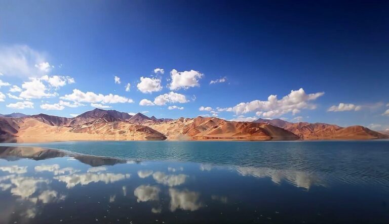
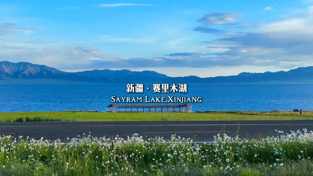
Sayram Lake sits at just over 2,000 metres in the mountains north of the Ili valley, and on a calm morning the water is a deep, cold blue that surprises people who expected only desert. The lake is high enough to feel crisp but rarely high enough to cause trouble.
What the thin air felt like at 3,100 metres
The first time I slept in Tashkurgan I had driven up from Kashgar in one push, eaten a large dinner, and gone straight to bed, exactly the routine you are told to avoid. I woke around three in the morning with a hammering headache and a heart that would not slow down. The second time, I treated the climb as something to be respected: a rest day in Kashgar, a slow drive with stops, and an easy first evening on the plateau. I slept through. The difference was not luck. It was the rate of ascent, and almost nothing else.
What I tell every traveller now is that the Pamir is not dangerous in the way headlines suggest. It is demanding in a quiet, manageable way, and the people who struggle are almost always the ones who tried to beat it in a day.
Getting to the roof: the Kashgar to Pamir corridor
The Karakoram Highway, known in China as the G314, is the road that does the climbing. From Kashgar at 1,280 metres it runs southwest, narrows into the Sarykol valley, and keeps rising until Tashkurgan town at about 3,100 metres. The distance is roughly 300 kilometres and the drive takes four to five hours once you add the police checkpoints, which inspect the border permit from the first outpost. You need that permit sorted in Kashgar before you leave, because the Pamir gates will turn you back without it.
Karakul Lake sits near 3,600 metres along the way, beneath the snow pyramid of Muztagh Ata, and most drivers pause there for photographs. Tashkurgan itself is the logical base, and from there a further push reaches the Khunjerab Pass at 4,693 metres, the highest paved international border crossing in the world. You do not sleep at the pass. You climb, look, and come back down.
If you would rather not self-drive, a Tashkurgan travel guide lays out the permit and transport steps in more detail, and the Khunjerab Pass guide covers the season and the border formalities.
When the high passes open and the air thins
Timing matters more on the roof than almost anywhere else in Xinjiang. The Pamir winter is long and ferocious; snow can close the higher stretches of the G314 from late autumn into spring, and the Khunjerab crossing keeps shortened operating months. The reliable window runs from roughly May through October, with the clearest, warmest conditions in July and August, also the peak for the snow-avalanche shows on the nearby ice mountains.
The same logic applies to the high Tianshan. The Duku Highway, which crosses the range between northern and southern Xinjiang, climbs to around 3,400 metres at its highest pass and is closed through the winter, usually opening only in early June. Our month-by-month guide breaks down when each corridor is open if you are building a longer route.
Where to sleep without climbing higher
The principle that saved my second Pamir trip is simple: climb high, sleep low. Kashgar at 1,280 metres is your buffer. Tashkurgan at 3,100 metres is the lowest comfortable bed on the plateau and the right place to spend the night. Karakul Lake at 3,600 metres is better as a daytime stop than a place to book a yurt, unless you are already well acclimatised. For the Khunjerab push, go up and return to Tashkurgan the same day rather than camping at the top.
This is also why flying straight into Tashkurgan’s own airport, which opened in late 2022 at close to 3,100 metres, deserves respect. You skip the gradual road climb entirely, so your first day on the plateau should be quiet: hydrate, walk slowly, and resist the urge to sprint up the first hill.
Eating on the plateau without worsening the headache
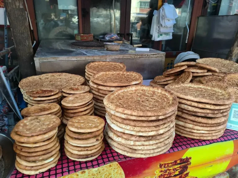
Food on the Pamir follows the same logic as the climbing. Carbohydrate-heavy meals, laghman noodles, pilaf, steamed bread, sit better than heavy meat feasts, and the local salty butter tea is genuinely useful because it replaces both salt and fluid. Alcohol, which thins judgement and worsens dehydration, is the one thing worth skipping for the first couple of nights. Plenty of small restaurants in Tashkurgan serve simple, warming food; the point is not the menu but the portion and the pacing. Eat, then rest.
Practical habits that keep altitude mild
None of this requires special gear, only consistent small behaviour. Drink more water than feels necessary; the plateau air is dry and hides dehydration, which amplifies every symptom. Move slowly on the first day and skip strenuous walks. A routine painkiller such as ibuprofen takes the edge off a mild altitude headache, though it does not cure the underlying adjustment. Learn the one line that matters: a bad headache that will not ease, vomiting, confusion, or breathlessness at rest mean descend, even a few hundred metres helps, and both Tashkurgan and Kashgar have medical help. The Pamir rewards patience and punishes vanity.
A four-day route that paces the climb
For travellers who want the high country without the misery, this is the rhythm I now recommend.
Day 1 — Kashgar. Arrive, do nothing strenuous, sort the border permit, and drink water. Treat the city as acclimatisation, not a sightseeing sprint.
Day 2 — Kashgar to Tashkurgan. Drive the G314 with stops at Baisha Lake and Karakul Lake on the way. Sleep in Tashkurgan at 3,100 metres, early to bed.
Day 3 — Karakul and the high pastures. Return to Karakul Lake for a longer look, then back down to Tashkurgan. Climb high, sleep low.
Day 4 — Khunjerab or descend. If the season and your body agree, push to the Khunjerab Pass and return the same day. Otherwise, begin the descent toward Kashgar and lower, kinder air.
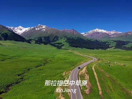
The same pacing applies if your high point is the Tianshan instead. Bayinbuluke at 2,500 metres is a gentler introduction than the Pamir and a good place to learn the climb-sleep-low habit before anything higher. The Tianshan pastures such as Nalati sit around 2,000 metres and give a taste of high-country travelling without the Pamir’s edge.
Questions travelers ask about Xinjiang’s altitude
Will I feel altitude in Urumqi or Kashgar? Almost certainly not. Both sit under 1,300 metres, below the threshold where most people notice anything.
Do I need medication like Diamox? Some travellers use acetazolamide to speed adjustment, but it is a personal medical decision. Discuss it with a doctor before the trip rather than buying it on the road.
Can older travellers or children go to the Pamir? Yes, with the same pacing. The risk is the rate of ascent, not age itself; families who sleep low and climb slowly do fine.
Is flying into Tashkurgan a problem? It removes the gradual climb, so take the first day easy. The airport has operated since 2022 and is the one scenario where you arrive high without earning it.
What if I feel unwell on the plateau? Mild headache and poor sleep are normal. The danger signs, confusion, vomiting, breathlessness at rest, mean descend immediately.
A straight note on health and responsibility
This article is built from field experience and cross-checked against published travel and altitude references, not from medical training. It is not a substitute for a doctor’s advice, especially if you have heart or lung conditions. Medication, including acetazolamide, should be discussed with a professional before you travel. Altitude illness can turn serious; if symptoms escalate, descend and seek care. Road and border conditions on the Pamir change with the season and with no notice, so confirm permits and closures locally before you set out.
About the writer
Karl Huang is a Xinjiang travel specialist who has driven the region’s high corridors from the Pamir to the Tianshan. He writes practical, first-hand guidance for independent travellers and contributes to several Xinjiang travel publications. When he is not on the road, he focuses on turning hard-won field notes into plans other people can actually use.