Published: July 20, 2026 | Author: Liam Foster
Why you can trust this Guozi Valley Bridge guide
You will not find a ticket booth for the Guozi Valley Bridge, and that is the first thing worth knowing. It is a working section of the G30 Lianyungang–Khorgas expressway, not a museum piece you queue to enter. I have crossed it three times: once eastbound in late June with a local driver named Tursun, once westbound in early October, and once in a rare February snow. Everything below comes from those drives, the notes I scribbled at the Sayram Lake rest stop, and conversations with people who live in the Ili valley. Where a number depends on the season or on a price that moves, I say so plainly instead of guessing.
Guozi Valley Bridge at a glance
| Location | Huocheng County, Ili Kazakh Autonomous Prefecture, Xinjiang |
|---|---|
| What it is | Cable-stayed bridge carrying the G30 expressway over the Guozigou gorge |
| Deck height | Roughly 200 meters above the valley floor |
| Towers | Two, each rising more than 200 meters |
| Opened | 30 September 2011 |
| Best for | Road-trip photography, the Sayram Lake–Yining crossing |
| Cost to see it | Free to drive across; standard expressway tolls apply on the G30 |
What crossing the bridge is actually like
The first time, we had spent the morning circling Sayram Lake in a wind that tasted of ice. The road climbs out of the lake basin and the gorge begins quietly: pine on the slopes, a river far below, then the asphalt lifts onto the bridge and the whole valley opens under you. Tursun slowed to about 60 km/h — the limit drops there on purpose — and pointed at the fog pooling between the towers. “On a clear day you see the Ili valley,” he said. “Today you see nothing, which is also beautiful.” He was right. The bridge is 700-odd meters of steel strung across a cut in the Tianshan, and the drama is not the structure alone but the fact that the road simply refuses to stop being scenic.
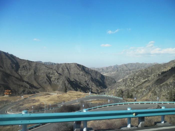
There is a service area on the gorge side where you can pull over, walk to a railing, and actually look back at the span. I ate a cold naan there watching the clouds pour over the ridge. It is the one spot where you are allowed to stop and gawk without blocking traffic, and on busy summer weekends it fills fast.
How to get to the Guozi Valley Bridge
You cannot book a “bridge tour,” so the question is really how to be on the G30 between Sayram Lake and Yining.
- Self-drive or private car from Urumqi. It is about 6.5 to 7 hours of mostly fast highway, with the gorge roughly two hours before Yining. Hiring a driver for the day costs more but spares you the long haul and the toll math.
- Train to Yining, then a car. The high-speed rail gets you to Yining comfortably; from there a local driver can take you west to Sayram Lake and back across the bridge in a single loop.
- Tour bus. Most Ili-bound coaches use the same expressway, so you will cross it whether you plan to or not. Sit on the right going east for the better view.
The bridge sits between two gates: the east gate of Sayram Lake to the west, and the open Ili plain to the east. Plan your day so the crossing happens in daylight.
Best time to cross
Late May through June is my favorite window. The snow has pulled back from the lower slopes, wildflowers carpet the gorge edges, and if you time it with the Huocheng lavender fields (usually mid-June) the whole approach smells of it. September and October bring golden light and far thinner crowds; the first frost often paints the poplars along the river. Winter is striking — the towers in rime, the valley hushed — but ice closures on the G30 are real, and you should check the road status the morning you leave.
Where to stay
Two sensible bases bracket the bridge. West, the Sayram Lake guesthouses and yurt camps let you catch the bridge at first light. East, Yining is the comfortable choice — real hotels, night markets, and a 90-minute hop to the gorge. Khorgos, at the Kazakh border, works only if you are already heading that way. In peak summer the Yining hotels near Six Star Street sell out, so book a few days ahead.
Food along the route
The Ili valley eats well, and the stretch east of the bridge is where it starts. Look for smoked horse sausage (kazı), hand-pulled laghman with a vinegar-garlic kick, and polo studded with carrot and raisin. In Yining I gravitate to the hole-in-the-wall near the Russian church for kvass and fresh naan, then walk Six Star Street for grilled things I cannot always name. Dairy is everywhere — thick yogurt, salty milk tea, the faintly fizzy kumis in summer. If you are looping onward to the Nalati grassland, the Kazakh yurt stops serve the same food with a better view.
Practical tips
- Drive it in daylight. The fog and the drop-off are half the experience, and you want to see both.
- No stopping on the deck. It is a live highway. Use the service area instead.
- Carry cash and a card. Tolls are automated but the odd machine jams; having a backup saves a queue.
- Layer up. Sayram Lake can be 15°C colder than Yining ten miles away. A windproof shell earned its place in my bag every time.
- Drones. The Ili border region is sensitive. Assume you need a permit and ask locally before flying anywhere near the gorge.
- Fuel up in Yining or at the lake. Service stations inside the gorge are sparse and busy on weekends.
A simple 3-day Ili crossing
- Day 1 — Urumqi to Sayram Lake. Long drive, late-afternoon arrival, walk the east shore, sleep at the lake.
- Day 2 — the bridge and Yining. Cross Guozi Valley Bridge after breakfast, pause at the service area, reach Yining by lunch, spend the afternoon on Six Star Street and the night market.
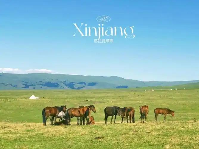
- Day 3 — grassland loop. Day-trip to Nalati or the lavender fields (June), then train or drive back.
Frequently asked questions
Can you walk across the Guozi Valley Bridge?
No. It carries expressway traffic and there is no pedestrian path. The service area on the gorge side is the closest you can safely stand and look.
Is there a toll just for the bridge?
There is no separate bridge fee. You pay normal G30 expressway tolls for the section you drive, the same as any other stretch of that road.
How long is the gorge drive?
The Guozigou scenic stretch is roughly 30 kilometers end to end, with the bridge near the Sayram Lake (western) end.
Is it safe in winter?
The bridge itself is well maintained, but the whole G30 corridor can close temporarily for snow and ice. Always check road status before a winter crossing.
Where are the best photos?
The service area railing, the Sayram Lake east gate approach, and (with a long lens) from a safe pull-off on the Yining side. Our Xinjiang photography guide has timing notes for the gorge light.
Disclaimer
This guide reflects personal travel experience and was written to help you plan, not to replace official sources. Bridge details, toll rates, train schedules, and road conditions in Xinjiang change, and border-region rules around drones and permits shift without notice. Confirm current information with the expressway operator, your accommodation, or local tourism offices before you travel. I have not been compensated to mention any business here, and distances are approximate.
About the author
Liam Foster is a travel writer who has spent eight years documenting China’s western roads, from the Karakoram Highway to the G30 corridor through the Tianshan. He crosses the Guozi Valley Bridge whenever an Ili trip is on the calendar and prefers the June crossing for the light.