Published: October 22, 2026 | Author: Karl Huang
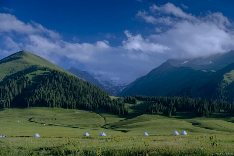
Most Xinjiang itineraries mention Hejing County only as a waypoint. You read “drive on to Bayinbulak,” and Hejing is the blurred dot you pass through. I did exactly that on my first trip, and I was wrong to. On a late-September return I spent two nights in the county seat and a full day threading its northern valleys, and I left convinced that the county — not just the famous grassland it administers — is the better story. Hejing is a county so large it straddles the Tianshan twice, it cradles the headwaters of a river that never reaches the sea, and it holds the homeland of the Torgut Mongols. This guide is built from that trip and checked against figures published by the Hejing government and regional travel authorities, so you can judge whether to stop, and what to actually do if you do.
A county the size of a small country
Figures in this section draw on the Hejing County government and regional statistical releases; they are rounded and may shift as boundaries are adjusted.
Hejing sits in the centre of Xinjiang, on the southern side of the Tianshan, inside Bayingol Mongol Autonomous Prefecture. The number that stopped me was the area: close to 40,000 square kilometres, which puts it among the largest county-level units in China by land mass. To make that concrete, the county is roughly the size of the Netherlands, yet it holds well under 150,000 permanent residents. The county government also notes that Hejing borders 15 other county-level jurisdictions — a tally that has been recognised as the most of any county in the country.
What makes the geography stranger is the ridge running through it. Hejing is the only county in Xinjiang that lies on both flanks of the Tianshan, so its north drains one way and its south another. When our driver pointed at a single hillside and said “that side feeds the north, this side feeds the Tarim,” I thought he was simplifying. He wasn’t.
Hejing by the numbers
| Fact | Detail |
|---|---|
| Location | Central Xinjiang, southern Tianshan, Bayingol Mongol Autonomous Prefecture |
| Area | Just under 40,000 km² (one of China’s largest counties) |
| Population | About 139,000 residents, excluding XPCC settlements |
| Ethnic make-up | Han ~36%, Uyghur ~36%, Mongol ~22%, plus Hui and others |
| County seat | Hejing Town, 87 km north of Korla, ~456 km from Urumqi |
| Rivers | 26 rivers; annual runoff around 5.8 billion m³ (“Xinjiang’s water tower”) |
| Famous for | Bayinbulak grassland, swan lake, Torgut heritage, Baluntai Yellow Temple |
Our first morning in the county seat
We rolled into Hejing Town the night before and woke to a place that felt more inland-China than frontier. The main drag has proper street lighting, a handful of mid-range hotels, and a row of noodle and barbecue joints that do not close early. By 8 a.m. the bus station was already loud with vendors selling dried fruit and paper-wrapped fenggan rou (air-dried beef).
What I did not expect was how matter-of-fact the Mongol identity is here. The Torgut return is not a museum piece; it is in the language on shop signs, the Janggar epic recited at festivals, and the older residents who still trace family lines back to 1771. Standing in the county seat, you are already inside the story the grassland is famous for — you just have not climbed to it yet.
Two rivers, two deserts: how Hejing splits Xinjiang
The county government frames Hejing as “Xinjiang’s water tower,” and regional tourism material describes the Bayinbulak basin as the source of the Kaidu system (Xinjiang government tourism page). For a plain-language overview of the grassland and its river, China Daily’s profile is a useful read.
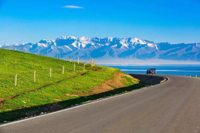
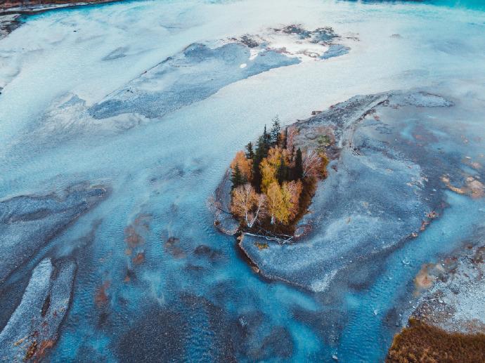
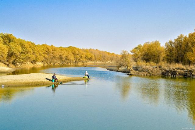
Here is the fact I wish more guides led with. The Kaidu River, the wide, slow water that bends into the famous “nine turns” at Bayinbulak, rises in the Tianshan inside Hejing. It flows out of the alpine basins northeast into Bosten Lake, and Bosten’s only outflow is the Peacock River, which runs south-east across the Taklamakan’s edge toward the dried bed of Lop Nur. In other words, the water that starts as snowmelt in Hejing never reaches an ocean — it dies in the desert, exactly as it has for millennia.
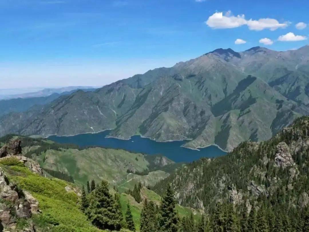
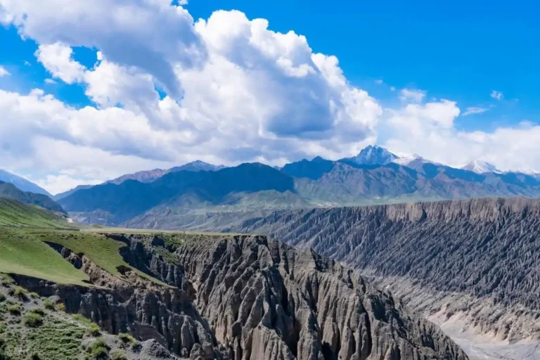
Meanwhile the southern part of the county, tilted away from the range, drains toward the Tarim system. So a single county is the watershed divide between two great endorheic basins. For a traveller, that means the north of Hejing is cool, green and pastoral, while a few hours south the same administration touches the dry margin of the world’s second-largest shift-sand desert. You can taste the difference in the air on the same day.
Baluntai Yellow Temple and the Torgut heartbeat
If you take one side trip north from the seat, make it the Baluntai Yellow Temple (Baluntai Huang Miao). Built in the late 1880s by the Torgut Mongols, it is described as the largest Tibetan-Buddhist (Gelugpa) monastery in Xinjiang, and it remains a living place of worship rather than a staged set. We arrived mid-morning as an elderly couple lit butter lamps; the smell of juniper smoke followed us up the staircase.
The temple ties directly to the county’s defining event. In 1771 the Torgut leader Ubashi led his people back from the Volga region to Qing China, and the Yulduz (Jultus) basin — today’s Bayinbulak — became their granted pasture. Hejing carries the name “homeland of the eastern return” for exactly this reason, and the temple is where that memory is kept warmest. The broader Torgut Mongols of Bayingolin is worth reading before you go.
The railway that finally reached the heart
For years the only practical way in was a long road haul. That changed with the Golmud–Korla railway, which opened in December 2020 and put Hejing on a through rail line for the first time. Hejing Station now sits on a route that links Qinghai to the southern Tarim, and for travellers coming from Korla or further afield it removes most of the old friction.
A second project is the G0711 Urumqi–Ruoqiang expressway, which bores under the Tianshan through the roughly 22 km Shengli Tunnel — one of the longest road tunnels of its kind anywhere. Sections have been opening in stages, and once complete it will pull the county within a few hours of the regional capital by car. I would not plan a trip around it yet, but it explains why road signs around the seat look newer than the towns. Drivers coming over the range from the north will also meet the Duku Highway, which shares this corner of the mountains.
Two climates, two calendars
Because the county climbs from desert floor to alpine basin, there is no single “best time.” The county seat and the southern road are comfortable from April to October, with summer hot and dry. The northern pasture around Bayinbulak, sitting near 2,500 metres, keeps a short cool summer (roughly June to August) and a long, hard winter when the road can close.
My rule of thumb: if you want the county’s own towns, markets and temple, May to early October is generous. If you also want the high grassland, tighten to July and August, and check pass conditions before you commit — the same storm that misses the seat can shut the northern gate for a day. For region-wide timing, our best time to visit Xinjiang piece covers the trade-offs month by month.
Base camp: the county seat, not the plateau
Most visitors sleep up at Bayinbulak to catch sunrise on the nine-turn river. That is reasonable, but it leaves the county seat underused. Hejing Town has the better range of hotels, the only real hospitals, and the food. I would base here for one night, do the temple and forest as loops, and only push north if the weather holds.
Practical note from our stay: book the county seat in advance during the July–August peak, when grassland tourists fill every room on the way through. Off-peak, you can usually walk in. Either way, ask for a room off the main road — the night market is lively until midnight.
What the county seat puts on the table
Hejing eats like a crossroads. Alongside the usual Xinjiang chuan (skewer) barbecue and hand-pulled noodles, look for Torgut-Mongol dishes: boiled lamb with little more than salt, fenggan rou dried in the autumn wind, and milky salted tea that tastes better than it sounds after a cold morning drive. The surrounding orchards and the nearby Korla melon belt mean fruit is cheap and good from August.
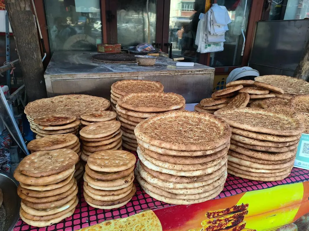
We ate one memorable dinner of shou zhua rou (hand-grabbed mutton) followed by wedges of cold melon, all for less than a mid-range hotel room. The point is not the price but the mix: this is a place where Mongolian, Uyghur and Han tables borrow from each other without ceremony. If the high pasture is on your list, the Bayanbulak grassland is the one to read, and our gateway-to-Bayanbulak guide walks the logistics in detail.
Things I wish the guidebooks mentioned
A few honest warnings. Fuel is sparse once you leave the seat and head north, so top up in town. Mobile coverage thins out in the alpine basins, and the high road gets slick after the first snow, often earlier than the forecast implies. Altitude at Bayinbulak is real — near 2,500 metres — so if you are coming straight from the plains, take the first day slow.
Also, Hejing is big enough that “the county” and “the grassland” are not the same stop. Treating them as one destination on a map will burn a half-day you did not budget. Plan them as two legs.
A 48-hour loop that skips the grassland
If your time is tight and you would rather not chase the famous plateau, here is a county-only loop we ran:
Day 1 (afternoon): Arrive in Hejing Town, walk the evening market, eat skewers and naan. Day 2 (morning): Drive north to Baluntai Yellow Temple (about 1.5–2 hours), then continue to Gongnaisi National Forest Park on the northern slope for spruce woodland and a riverside lunch. Day 2 (late): Return to the seat; if energy allows, visit the local Torgut culture exhibits. Day 3 (morning): Head south toward Korla, or north only if the pass is clear and you have added the grassland to your plan.
This loop gives you the culture, the forest and the town without the crowds and the altitude gamble of the high pasture. Save Bayinbulak for a trip that has a night to spare.
Frequently asked questions
Is Hejing County the same as Bayinbulak? No. Hejing is the county; Bayinbulak is the alpine grassland it administers in the north. You can visit the county seat without going up to the plateau.
Can I reach Hejing by train? Yes. The Golmud–Korla railway serves Hejing Station, connecting the county to Korla and the Qinghai line since late 2020.
Do I need a permit for the county seat? The town itself needs no special permit for foreign visitors beyond standard Xinjiang hotel registration. Some remote northern areas and the grassland have their own entry rules, so check when you book.
When is the temple open? Baluntai Yellow Temple follows local visiting hours and can close on certain monastic days; mornings are your safest bet, and dress modestly.
Disclaimer
This article is based on a personal visit in late September 2026 and on publicly available information from the Hejing County government and regional tourism sources at the time of writing. Opening hours, train schedules, road and permit conditions change, and the northern pass can close on short notice for weather. Confirm current details with your hotel or the local tourism office before you travel, and respect all posted rules at religious and protected sites.
About the author
Karl Huang is a Xinjiang-based travel writer who has spent nine seasons on the road across the region, from the Ili valleys to the Tarim edge. He focuses on practical, first-hand guidance for independent travellers and writes for Xinjiang Attractions. He can be reached through the site’s editorial team.