Published: September 8, 2026 | Author: Karl Huang | Category: Xinjiang Cities
Maralbexi Xinjiang rarely gets more than a fuel stop on the drive between Kashgar and the desert highway, and after several passes through the county I understand why: nothing here announces itself. But the whole place is really an argument about a river. The Yarkand, the longest headwater of the Tarim, comes down from the Karakoram, drifts past Yarkant, and then, for reasons both natural and very human, swings north across Bachu instead of rolling on southeast. The county’s two names sum up what that water built. Uyghur speakers say Maralbeshi, deer head; the Chinese name Bachu is short for Balchuq, which a Qing-era dictionary glossed as “a place that has everything, rich in water and grass.” This page follows the river itself: where it turns, where it gets stored, the garrison city it abandoned, and what you can actually see in a day or two.
Maralbexi Xinjiang: why the Yarkand turns north here
The river rises on the north face of the Karakoram, in glacier country below the K2 massif, and runs about 1,281 kilometers before its water ever gets counted as the Tarim. For most of that distance it behaves like a mountain river. The change happens where it leaves the Kokshaal front near Kaqun in Yarkant county. Past that gorge the gradient collapses, the river dumps its silt across the Shache plain, and the bed has risen so high over the centuries that the surrounding land sits below the waterline in flood years. From the early 1900s, canals cut into the north bank pulled flow toward the lower ground around Bachu. The northward lean started as physics; people finished the job.
The Yarkand at Maralbexi, in numbers
Before the personal stuff, the figures that explain why hydro engineers treat this county as a case study.
| Item | Figure |
|---|---|
| Yarkand River, source to the Tarim confluence | About 1,281 km |
| Distance the river covers inside Bachu | Roughly 250 km (near 340 km counting branches) |
| Average annual runoff at the Kaqun gauge | 6.73 billion m³ (1956-2015) |
| Highest recorded flood peak | 6,270 m³/s on 4 September 1961 |
| Lowest recorded winter flow | 30.7 m³/s, January 1979 |
| Xiaohaizi Reservoir storage / surface | About 700 million m³ / near 150 km² |
| Share of the Tarim’s water supplied by the Yarkand | About 6 percent |
| County basics | 21,741 km²; near 60 mm of rain a year; mean 12.1°C |
What a morning at Xiaohaizi actually looks like
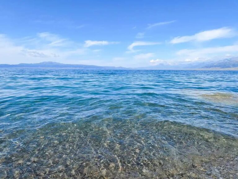
Nineteen kilometers southeast of the county seat, the floodplain stops looking like land and starts looking like an inland sea. Xiaohaizi holds around 700 million cubic meters behind low earthen dikes, which makes it the largest plain reservoir in northwest China, and on a still October morning you can stand on the western shore and fail to see the far side. The name is a Mandarin softening of the Uyghur Xiao Kule, alkaline pit, which tells you the first settlers were not romantic about it. Herons work the reed lines, and the dunes of the Taklamakan start almost at the water’s edge. One practical note: the dams themselves are working infrastructure run by the Third Division, so you view from designated shores rather than wandering onto the embankments.
How 1961 bent the river for good
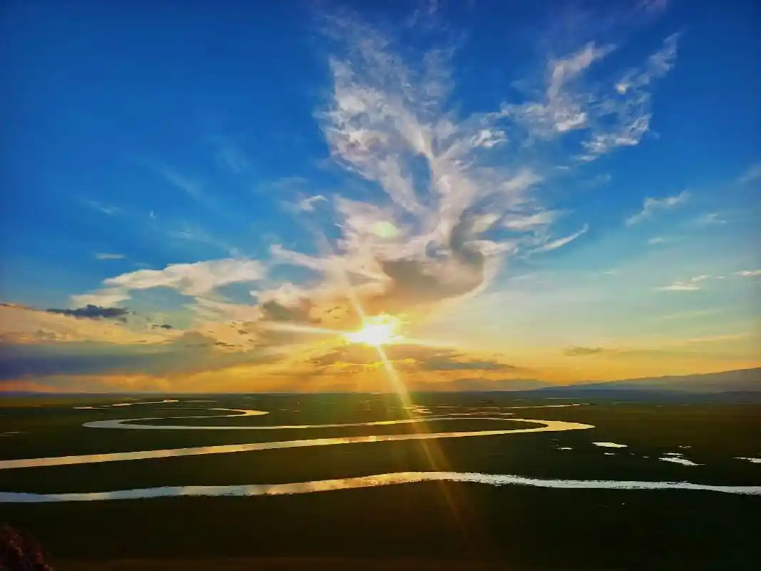
The northward turn I mentioned is not entirely geological. After Xiaohaizi and its regulating neighbor Yong’anba were finished in 1961, engineers used the Kudelik dam to steer most of the dry-season flow into storage, and the river’s old channel below the dam has essentially run dry ever since. Downstream, the Yarkand now reaches the Tarim mainly in wet years, supplemented by planned environmental transfers of a few hundred million cubic meters. Stand at Kudelik and you are looking at one of the few places in China where you can see, with your own eyes, a decision from 1961 still redirecting a river sixty years later.
Three rivers, one Tarim
The Tarim proper is born at Xiaojiak in Awat county, where the Yarkand finally meets the Aksu and Hotan rivers. The proportions surprise most visitors: the Aksu contributes roughly two-thirds of the flow, the Hotan about a quarter, and the Yarkand barely six percent, because so much is held back in these plain reservoirs. The Kashgar River, which gives northern Bachu its second green stripe and runs about 150 kilometers inside the county, no longer reaches the Tarim at all; it ends in the reservoir system’s north-gate canal. We cover the downstream side in our piece on Awat County, which sits right at the confluence.
Tangwangcheng, the city the old channel left behind
About 60 kilometers northeast of the county seat, just north of Tumxuk, a line of eroded walls runs along the Tokkuz-sarai hills. Locals call it Tangwangcheng, the Tang King’s city, because firewood cutters kept digging up Kaiyuan coins; Uyghur speakers say Tokkuz-sarai, nine halls. Both are late guesses at something older. This was the seat of the Han-era Weitou kingdom and, under the Tang, the garrison town of Jushide, which the monk Wukong passed through in the eighth century and recorded by name. The site stacks four concentric walls and around eleven suspected gates over some 1.1 million square meters, and it has been a national key heritage site since 2001. Excavations in 2022 found the city gate, the main street, a Zoroastrian temple and 515 objects, including Tang coins and a clay shard stamped with the Chinese character for door bolt, proof that the garrison’s clerks kept their records in Chinese. The walls, as far as excavators can tell, went up before the An Lushan rebellion broke the dynasty’s western reach. The neighboring city’s story continues in our guide to Tumxuk.
Getting in: the Kashgar train and the 314
Most people arrive from the west. The Southern Xinjiang railway, fully open since 1999, stops at Bachu station 4.5 kilometers from downtown, and the daytime trains from Kashgar are slow, cheap and agreeably sociable. By road the expressway makes it about two and a half to three hours from Kashgar, which pairs nicely with a first morning in the old city; our Kashgar guide covers that end. Fly-in options improved recently: Tumxuk Tangwangcheng Airport, about 70 kilometers from Bachu’s county town, has daily Urumqi flights and passed 400,000 annual passengers in 2024. It is a small terminal, so book cars ahead rather than counting on a taxi rank.
Month by month on the water
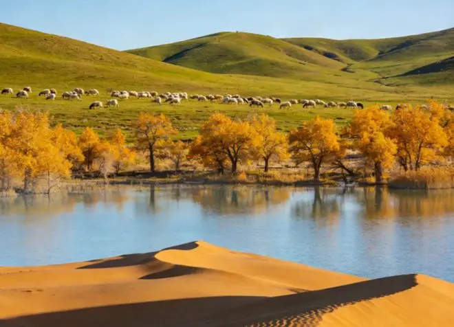
Timing here is really about the flood pulse. June through August delivers roughly two-thirds of the year’s runoff, the river runs silt-brown and occasionally dangerous, and July and August have produced more flood disasters since 1949 than any other stretch of Xinjiang river country. September settles down. October is the month I would pick: the poplar forest along the old channels turns gold in the second half of the month, with the reliable viewing window running from about October 16 to November 15. Winter has its own show, when wild swans gather by the hundred on the wetland inside the Honghai scenic area and the county seat drops to around minus six. Spring is windy and dusty; I skip it.
Where to sleep near the water
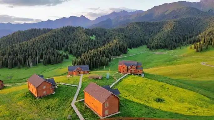
The county seat’s business hotels are functional and cheap, usually somewhere between 120 and 200 yuan, and we name names in our earlier Maralbeshi guide so I will not repeat the list here. The more memorable option is inside the Honghai scenic area: a row of timber cabins on the shore of the Golden Poplar Island zone, where the evening soundtrack is wind in the leaves instead of truck horns. Book ahead for October weekends, when Xinjiang tour groups strip the cabins out months in advance. Tumxuk, one hour away, adds a couple of newer mid-range hotels if you plan to fly out of Tangwangcheng Airport.
Roast fish, pilaf and the taste of reservoir water
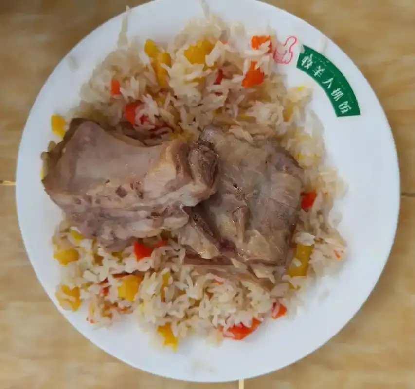
Bachu eats like a reservoir town, because it is one. The signature dish is roast fish, whole carp from the reservoirs, split and pinned on red-willow branches and cooked slow over open coals; the technique is registered as county-level intangible heritage, and roadside grills on the Honghai road do the honest version. Pilaf appears at every lunch counter, heavy on carrot and lamb fat in the way southern Xinjiang does it.
The other local specialty you will not find elsewhere is Bachu mushroom, a wild fungus that fruits in the poplar forests after summer floods and sells dried in the county markets at prices that climb every year. Buy it sealed, not loose, and declare it if your home country’s customs cares about soil traces.
The unglamorous part: checkpoints, cash and phones
Police checks on the 314 are routine, so keep your passport in reach and expect the car to slow to walking pace twice between Kashgar and town. Foreign travelers visit independently; nobody will ask for a guide. Payment is almost entirely by phone in town, but keep some cash for roadside grills and fuel stops, where cards fail. Fuel stations require the driver’s passport to enter. Download an offline map before the Xiaohaizi shore road, because coverage thins out fast past the last villages, and the desert side of the county has few landmarks to navigate by.
Two days following the water
Day one: morning train or car in from Kashgar, lunch on roast fish, then the Honghai loop twelve kilometers out of town, staying for the noon gate-opening ceremony at the Weitou Isle entrance and the 38-kilometer circuit if you have a car. Sleep in the county seat or the island cabins. Day two: west shore viewpoints at Xiaohaizi in the early light, then Tangwangcheng’s walls before the afternoon heat, and either the evening train out or a continuation upstream to Yarkand, which makes a natural second chapter since it sits on the same river a few hours southwest.
Questions travelers ask about the river
Can you take a boat on the Yarkand itself? No. The river is a flood torrent in summer and a trickle much of the year. Boating happens on the reservoirs inside the Honghai scenic area, and that is plenty.
Is the poplar gold really better than Luntai’s? Different flavor. Bachu’s forest hugs water channels and dunes together, so you get reflections in the same frame, and the crowds are thinner than at Luntai’s park gates.
Can visitors approach the Xiaohaizi dams? The embankments are working facilities with restricted access, but the western shore viewpoints give you the full inland-sea effect without any paperwork.
How many nights do I need? One if you only want the scenic area, two if you add Tangwangcheng and a slow morning at Xiaohaizi, which is the version I recommend.
How this page was checked
River and reservoir figures come from the Bachu county government portal, the Ministry of Water Resources’ 2018 river sediment bulletin, and China News Service reporting on the 2022 Tangwangcheng excavation. Ticket prices, train details and hotel ranges reflect visits in 2019, 2021 and 2024 and will drift, so treat every number as a snapshot. Nothing on this page is sponsored, and no business named here knew it would be mentioned.
About the author
Karl Huang has traveled in Xinjiang every year since 2016 and writes this site’s Xinjiang Cities series. He keeps a running list of rivers he has followed end to end, and the Yarkand is the only one where the interesting part turned out to be a reservoir built in 1961.