Published: July 25, 2026 | Author: Dr. Ravi Menon, physical geographer and Tarim Basin field researcher
Almost nobody stands on the actual floor of Lop Nur in Xinjiang, and that is exactly why the name pulls at people. It is a lake that moved, shrank, dried, and finally vanished into a cracked salt plain in the eastern Tarim Basin. I have spent parts of six field seasons working along the desert margins of Ruoqiang and Hami, sampling old shorelines and talking to the potash-mine drivers who are among the few who go deep inside. This guide is honest about one thing from the start: the core of Lop Nur is a restricted, genuinely dangerous zone, and most of what a traveler can responsibly experience happens on its edges.
Lop Nur in Xinjiang at a glance
| Detail | What to know |
|---|---|
| Location | Eastern Tarim Basin, Bayingolin Prefecture, southeast Xinjiang |
| What it is now | A dry salt-crust lakebed; the famous “great ear” is visible only from satellites |
| Elevation | Roughly 780 m; one of the lowest inland points in the basin |
| Access | Core zone restricted (permits, escorts, industrial roads); casual entry not allowed |
| Safe base towns | Ruoqiang (Charklik) and Korla for logistics and history context |
| Best months | Late October to April; summer heat is life-threatening |
| Time needed | 2-3 days from a base town for the museum, shoreline and desert-edge sights |
Why you can trust this Lop Nur guide
My work is dull compared with the legends: I measure ancient beach ridges, log salt-crust thickness, and cross-check old Swedish and Chinese survey maps against modern imagery. That work forces a plain view of the place. Lop Nur is not a hidden oasis you can drive to for a selfie. It is a scientific and industrial landscape wrapped in real history, and treating it casually gets people hurt. I will separate the myth, the geography, and the small slice you can actually reach.
My own experience on the edge
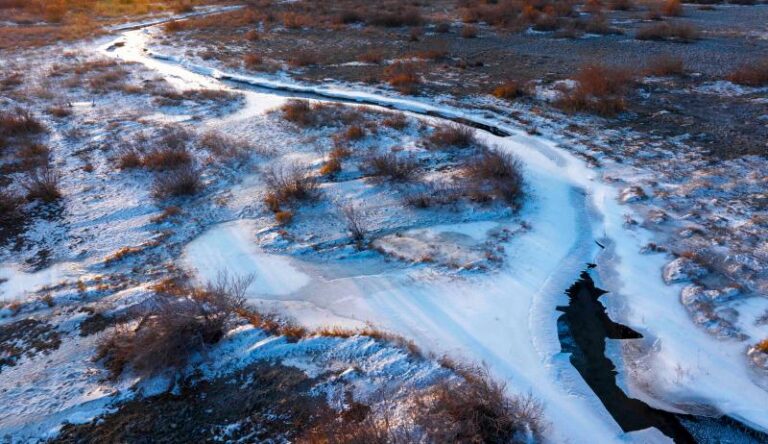
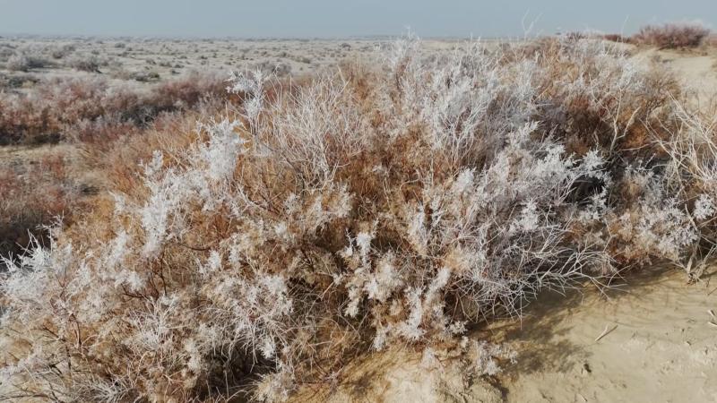
The closest I have come to the true lakebed was a November morning north of Ruoqiang, on a hardpan flat where the ground rang like tile under our boots. Our driver, Kurban, refused to go past a line of low salt ridges. He had hauled equipment for a mining crew years earlier and told me the crust looks solid but hides brine pockets that swallow a wheel to the axle. We drank tea from a thermos while the wind carried a fine grey dust that got into the tea, the camera, everything. There was no birdsong, no insects, just the click of cooling metal on the truck. I understood then why old caravans spoke of the “Sea of Death.” It does not feel empty. It feels emptied.
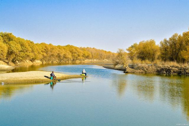
That trip taught me the useful lesson for any visitor: you do not need to reach the geometric center to feel Lop Nur. The margins, the museum finds in Korla and Ruoqiang, and the poplar corridors of the lower Tarim carry the story better and far more safely.
The history that made the legend
Lop Nur was once fed by the Tarim and Konqi rivers, and its water shifted position over centuries as those rivers wandered. The Swedish explorer Sven Hedin argued in the early 1900s that it was a “wandering lake” that swung between basins on a long cycle. Along its ancient shores rose Loulan, a Silk Road city that controlled a key desert crossing before it was abandoned as the water retreated. When irrigation upstream expanded through the twentieth century, the remaining inflow collapsed, and by around 1972 satellite images showed the lake fully dry.
Two modern stories keep the fear alive. The scientist Peng Jiamu disappeared here in 1980 while leading an expedition and was never found. The explorer Yu Chunshun died attempting a solo summer crossing in 1996. Both cases are sobering rather than romantic. They are the reason local authorities and researchers are strict about who goes in and with what support.
Access, permits and safety (read this part twice)
The Lop Nur core is not an open tourist site. Much of it sits within restricted areas linked to the large potash operation at Lop Nur town, and roads there are industrial, gated, and monitored. Independent driving into the lakebed is not permitted, and attempting it without authorization is both illegal and extremely dangerous. Specialist scientific or documentary trips run only with official permits, satellite phones, convoys of two or more vehicles, and experienced desert crews.
For a normal traveler, the realistic and legal options are the desert-edge experiences near Ruoqiang, the Tarim poplar corridors, and organized desert programs elsewhere in the basin, such as a guided Taklamakan camel trek. Do not treat social-media clips of vehicles on the salt crust as an invitation; many were shot on permitted industrial access, not open roads.
Best time to go
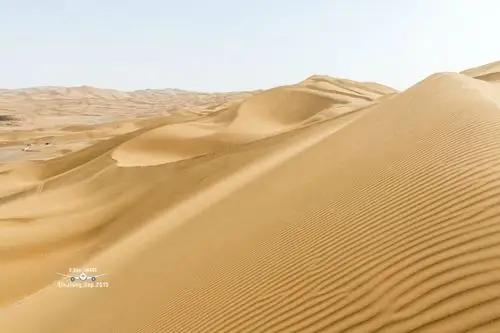
Season decides everything out here. From late October to April the air is cold but survivable, and the light on the salt flats is clean and low. Summer, roughly June to August, is the opposite of survivable: ground temperatures soar, water needs are enormous, and a breakdown becomes an emergency within hours. If you are timing a wider eastern-Xinjiang trip, check my Xinjiang weather by month guide and aim for the shoulder seasons. Spring can bring sudden sandstorms that erase the horizon, so build slack days into any desert-edge plan.
Where to stay
There is no lodging at Lop Nur itself. Base yourself in Ruoqiang (Charklik), the closest real town, which has simple business hotels and guesthouses used to hosting drivers and the occasional researcher. Korla, the regional hub, offers more comfortable chain hotels and better transport links if you want a softer base and a day of museum context before heading south. For anyone continuing along the desert rim, Minfeng (Niya) makes a logical next stop.
What to eat
Ruoqiang eating is honest oasis food. Look for hand-pulled laghman noodles, cumin-heavy lamb kebabs, and big-plate chicken shared at a low table. The town is known for its jujubes (red dates), which grow well in the dry heat and turn up in tea, rice, and snacks; a bag of them travels well. Carry more water than you think you need whenever you leave town, plus salty snacks, because the dry air pulls moisture out of you faster than you notice.
Practical tips from the field
- Fuel up completely in Ruoqiang or Korla. Stations thin out fast once you leave the oasis belt.
- Never rely on a single vehicle for any desert-edge driving, and tell someone your route and return time.
- Download offline maps. Mobile signal disappears within a short drive of town.
- Pack layers. A November day can swing from sunburn heat at noon to below freezing after dark.
- Respect closures and signage. Restricted means restricted; fines and rescue costs are real.
- Bring eye protection and a buff for dust; the fine salt grit finds every gap.
A realistic 3-day edge itinerary
Day 1: Fly or take the train to Korla. Visit the regional museum for context on Loulan and the lower Tarim, then drive toward Ruoqiang, stopping at Tarim poplar stands if the light is good.
Day 2: From Ruoqiang, arrange a licensed local driver for a desert-edge morning on the accessible hardpan and old shoreline flats north of town. Return by early afternoon before the wind builds. Rest, then walk the town’s date orchards at dusk.
Day 3: Choose your onward thread: continue the ruins route toward Loulan-related exhibits and Miran, or turn back to Korla for onward travel. Keep a buffer day for sandstorms.
Frequently asked questions
Can I visit the actual Lop Nur lakebed? Not casually. The core is restricted and tied to industrial and scientific use. Legal access needs permits, escorts, and serious desert logistics.
Is Lop Nur worth the trip if I cannot enter the center? Yes, if you enjoy history and stark landscapes. The edge flats, the poplar corridors, and the museum story deliver the meaning without the danger.
Why is it called the wandering lake? Because its rivers changed course over centuries, moving the water body between basins before it dried out entirely by about 1972.
How dangerous is it really? Very, in the core and in summer. Experienced people have died here. Heat, no water, hidden brine, and no signal make small mistakes fatal.
What is the nearest town with services? Ruoqiang (Charklik) is closest; Korla is the larger hub with flights, trains, and better hotels.
Disclaimer
Access rules, permit requirements, and road conditions around Lop Nur change and are enforced. Nothing here is a permit or an invitation to enter restricted areas. Always confirm current regulations with local authorities and use licensed operators. Prices and services in nearby towns vary by season. This article reflects field experience from 2019 to 2025 and is for general planning only.
About the author
Dr. Ravi Menon is a physical geographer who has carried out shoreline and salt-crust fieldwork across the eastern Tarim Basin, including seasons based out of Ruoqiang, Korla, and Hami. He writes about desert landscapes with an emphasis on safety and accurate context rather than thrill-seeking.