Published: July 25, 2026 | Author: Callum Fraser, overland & mountain-travel writer
Most people who end up in Yecheng are on their way somewhere bigger. I was too, the first time. This Yecheng travel guide comes out of two long drives down the G219 — once in the summer of 2022 heading for Ali in western Tibet, and again in 2024 when I helped sort out ground logistics for a small team walking in toward the north side of K2. Both trips started with a night in this dusty, walnut-scented town at the foot of the Kunlun, and both taught me things I wish someone had told me before I arrived.
Yecheng, known in Uyghur as Kargilik, is not a place you visit for its own monuments. It is a launch pad. But if you understand what it is a launch pad for, and you give it a day instead of an hour, it turns into one of the more interesting stops in southern Xinjiang. Let me clear up a common confusion first, because it matters.
Is Yecheng really the Karakoram Highway starting point?
Here is the honest version, and it is the reason I trust travellers to make their own plans rather than repeat marketing copy. The road most people mean by “Karakoram Highway” — the paved route from China into Pakistan — runs from Kashgar up through Tashkurgan on the Pamir plateau to the Khunjerab Pass. That road does not pass through Yecheng at all.
What Yecheng actually anchors is the northern “zero kilometre” of National Highway G219, the Xinjiang–Tibet Highway, which climbs into the Karakoram and Kunlun ranges on its way to Ali. It is also the practical staging town for expeditions toward Mazar and the northern approaches to K2. So Yecheng is a gateway to the Karakoram mountains and the great trans-Tibet road, not to the China–Pakistan highway. Book your trip around the correct road and you will avoid a lot of grief. If a Pakistan crossing is your goal, read my notes on Xinjiang border crossings instead.
Quick reference: this Yecheng travel guide at a glance
| Detail | What to know |
|---|---|
| Uyghur name | Kargilik (Qagiliq) |
| Location | Kashgar Prefecture, ~250 km south of Kashgar city |
| Town elevation | Around 1,350 m (the passes beyond climb well past 5,000 m) |
| Best time | Late September to October for walnuts and clear Kunlun views |
| Famous for | G219 zero-kilometre marker, walnut orchards, Kunlun foothills |
| How long to stay | Half a day in town; one full day if you drive up toward Kunlun viewpoints |
| Getting there | Bus or train from Kashgar (3–4 hrs); station on the Kashgar–Hotan line |
What it was actually like
We rolled in from Kashgar late on a June afternoon, tired and hungry. My driver that year, a Yecheng local named Abdurahman, insisted we stop at a roadside stand before the hotel. He handed me a fresh walnut, cracked it in his fist, and peeled off the papery skin so the nut would not taste bitter. “This is why people know Yecheng,” he said. He was not exaggerating. The county is genuinely famous across China for its walnuts, and in autumn the orchards along the approach roads are heavy with them. If you have read my piece on Xinjiang walnuts and pomegranates, this is the source region for a lot of what you buy in the big bazaars.
The town itself is workmanlike rather than pretty. There is an old quarter with a Friday-market rhythm, a scatter of Uyghur restaurants where the pilaf comes out of enormous cast-iron pots, and a lot of trucks. What lingers with me is the light in the evening, when the Kunlun turned copper behind the last row of poplars and the muezzin and the honking of overloaded lorries somehow shared the same air. It is not a postcard. It is a real working town on the edge of some of the emptiest terrain on the planet, and that is the whole appeal.
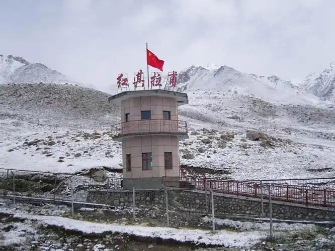
On the second trip we drove out to the zero-kilometre monument for G219 at dawn. Standing there with a thermos of tea, watching a convoy of Tibet-bound Land Cruisers pull away, I understood why so many Chinese road-trippers treat this spot as a rite of passage. From that marker the road does not really relax until Lhasa.
Getting to Yecheng
Nearly everyone arrives via Kashgar, which is the regional hub with the airport and the largest bus station. From Kashgar it is roughly 250 kilometres south. You have three realistic options:
- Long-distance bus: Frequent departures from Kashgar’s regional bus station, about 3–4 hours. Cheap and easy, but timings can be loose.
- Train: Yecheng sits on the Kashgar–Hotan railway, so slow trains stop here. Comfortable and scenic, though less frequent than the bus.
- Private car or hired driver: The most flexible option, and essential if you plan to continue up G219 or out toward the mountains. This is the route I always take now — see my broader notes on self-driving Xinjiang for vehicle and paperwork realities.
One firm warning: going beyond Yecheng toward Tibet, or into the sensitive high country near the Kunlun passes, requires permits and often a registered vehicle and guide. Border and military-zone rules here change without much notice. Do not assume you can just point the car south. Sort permits before you leave Kashgar, ideally with help from a licensed local guide.
Best time to visit
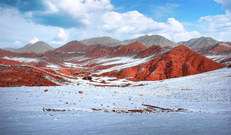
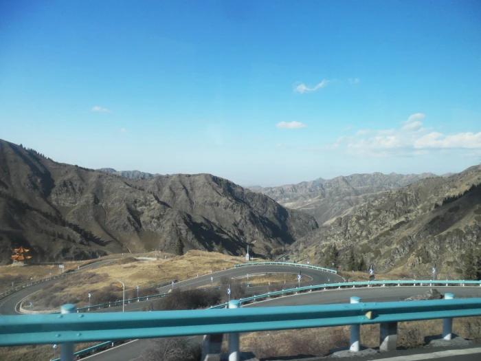
For the town and its orchards, late September into October is the sweet spot. The walnut harvest is in, the heat has broken, and the Kunlun stands out sharp and snow-dusted on clear mornings. Summer is workable but hot and hazy on the plains. If your real plan is G219 toward Ali, the driving window is roughly June to early October; the high passes hold snow the rest of the year and can close abruptly even in shoulder season. Anyone heading up should read my guide to altitude sickness in Xinjiang first — from Yecheng you can be above 4,000 metres within a few hours, which is a serious jump.
Where to stay
Yecheng has a handful of business hotels near the centre and along the main road, plus cheaper guesthouses. Nothing is luxurious, and English is rare, but rooms are clean and inexpensive, usually well under 200 CNY. On both my trips I booked a mid-range place with parking, because an early G219 start meant leaving before any breakfast was served. If you are only here to break the Kashgar–Hotan journey, one night is plenty. If you are staging a mountain trip, budget an extra day to buy supplies and confirm your driver and permits, because there is almost nothing to buy once you are past the last checkpoints.
What to eat
This is Uyghur food country, and Yecheng does the classics well. Look for lagman hand-pulled noodles, samsa baked in a tandoor, and the local polo (pilaf) that Abdurahman rated above Kashgar’s, though I stayed diplomatically neutral. And walnuts, obviously — buy them raw from the market rather than pre-packed, and get the vendor to crack one so you can taste before committing. Prices are a fraction of what you pay in Urumqi. A big lunch for two rarely cost me more than 60 CNY.
A sensible one-day plan
- Early morning: Drive to the G219 zero-kilometre monument for photos and the convoy atmosphere before the heat.
- Mid-morning: Wander the old town and the market; taste and buy walnuts and dried fruit.
- Lunch: A Uyghur restaurant in the centre — lagman or polo.
- Afternoon: If you have a car and permits, drive a short way up toward the Kunlun foothills for the views, then return before dark. If not, rest and prep for the next leg.
- Evening: Sunset over the mountains from the edge of town, then an early night before the road.
Practical tips from two trips
- Carry cash. Mobile payment works in town, but the moment you head into the mountains it is useless.
- Fuel up in Yecheng and carry extra if you are going up G219 — stations thin out fast.
- Bring warm layers even in summer. It can be 30°C in town and below freezing on the passes the same day.
- Keep your passport and any permits on you at all times; there are frequent checkpoints south of town.
- If Kashgar is your next stop, spend a couple of days there — my Kashgar Old City guide covers the essentials.
Frequently asked questions
Is Yecheng worth visiting on its own?
Honestly, not as a standalone destination. It shines as a stop on a bigger journey — the Kashgar–Hotan loop, or the start of a G219 mountain drive. Treat it that way and you will enjoy it.
Can I drive from Yecheng into Tibet?
You can, but only with the right permits, usually a registered vehicle, and often a guide. Arrange everything before you arrive. Rules change, so verify current requirements close to your travel date.
How many days do I need?
Half a day for the town. One to two full days if you are staging a mountain trip or want to explore the Kunlun foothills.
Is it safe?
The town is calm and ordinary. The risk is the terrain beyond it — altitude, weather, and remoteness — not the place itself. Prepare properly and respect the checkpoints.
What should I buy here?
Walnuts, first and last. Also dried apricots and other Kunlun-foothill produce, all cheaper than in the big cities.
A final word
Yecheng rewards travellers who know what they came for. Arrive expecting a scenic town and you will leave underwhelmed. Arrive understanding that you are standing at the foot of one of the world’s great mountain roads, in the heart of walnut country, and it becomes a genuinely memorable night on the way to something extraordinary.
About the author: Callum Fraser is an overland and mountain-travel writer who has driven the G219 Xinjiang–Tibet Highway twice and organised ground logistics for treks toward the north side of K2. He has spent parts of six years travelling in western China and the Karakoram.
Disclaimer: Details such as transport schedules, hotel prices, permit rules, and road-access status change frequently and vary by season and border-zone policy. Prices quoted reflect 2022–2024 and are indicative only. Always verify current permit requirements and road conditions with local authorities or a licensed guide before travelling beyond Yecheng, especially toward high passes and border areas.