Published: August 7, 2026 | Author: Karl Huang
Most travellers who plan a trip to Xinjiang stop at the headline names — Kanas, Sayram Lake, the Duku Highway. I almost did the same. Then a Kazakh driver in Yining told me about Kuerdening Valley, and it ended up being the quietest, greenest corner of Ili I walked all summer. This guide is built from that trip, plus the practical details I wish I had before I went.
Why you can trust this guide
Everything below comes from a personal visit, not a brochure. I slept in a family guesthouse at the reserve gate, hiked the main ridge trail on my own feet, and asked the locals the questions the official signs don’t answer. Where I quote a price or a distance, I flag it as a check-on-arrival figure, because Xinjiang’s park rules shift from one season to the next. My goal is a guide you can actually use, not one that oversells the place.
At a glance: Kuerdening Valley quick facts
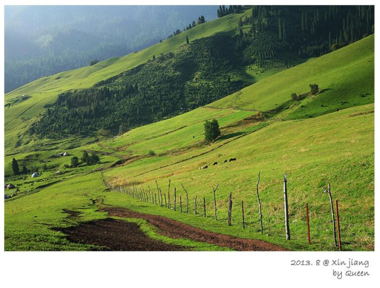
Kuerdening (库尔德宁) lies in Gongliu County in the Ili Kazakh Autonomous Prefecture, in China’s far northwest. It forms part of the Xinjiang Tianshan UNESCO World Heritage property, inscribed in 2013, and it shelters the largest remaining tract of Schrenk spruce (Picea schrenkiana) in the country — some of these trees are more than 300 years old and top 50 metres. Below the treeline the valley opens into alpine meadow; above it, bare Tianshan granite. That single vertical slice, from flower meadow to old-growth forest to snow ridge, is the whole point of the place.
| Detail | What to expect |
|---|---|
| Location | Gongliu County, Ili Prefecture, Xinjiang |
| Distance from Yining | About 150 km, roughly a 3-hour drive |
| Elevation | Valley floor ~1,500 m; surrounding ridges up to ~3,000 m |
| Status | National nature reserve; core zone of Xinjiang Tianshan UNESCO site (2013) |
| Best months | Late May–early June (wildflowers); late Sept–early Oct (autumn) |
| Entry & shuttle | Park ticket plus internal shuttle; budget around 60–100 RMB, confirm on site |
| Nearest hub | Yining city, with flights and the wider Ili grassland network |
What it actually feels like: our days in the valley
We arrived in the late afternoon after a long drive from Yining. The first thing that hits you is not a view but a smell — cold resin from the spruce, mixed with cut grass. The road climbs slowly, and the forest closes in on both sides until the sky is just a strip above the trees.
We stayed two nights in a small guesthouse run by a Kazakh family just outside the reserve gate. Mornings started with fog sitting in the valley and lifting by nine. I spent one whole morning on the trail to the Qimengde viewing platform, where the whole drainage opens up: a green floor of meadows, a wall of dark spruce behind it, and bare Tianshan ridges above. No railings, no crowds, just a wooden marker and wind.
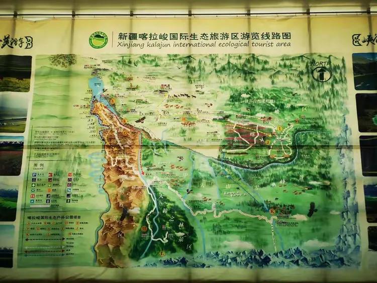
The neighbouring Kalajun grassland shares the same mountain system and is often paired with Kuerdening on a two-day loop. Where Kalajun is open and rolling, Kuerdening is enclosed and vertical. Seeing both in one trip is the best way to understand why this stretch of the Tianshan earned UNESCO status.
On the second morning we followed a side path toward what locals call the King Spruce, a single trunk said to be the oldest in the reserve. The trail faded after a switchback and we backtracked twice before a herder on horseback pointed us the right way with a laugh and a handful of dried apricots. That small wrong turn is exactly why I tell people to start early and not trust the phone map past the first kilometre.
One thing I did not expect: the silence. With no road cutting through the middle of the reserve, the only sounds are wind in the needles and the occasional bell on a grazing horse. By the third evening it felt less like a scenic spot and more like someone’s backyard mountain.
Getting to Kuerdening Valley
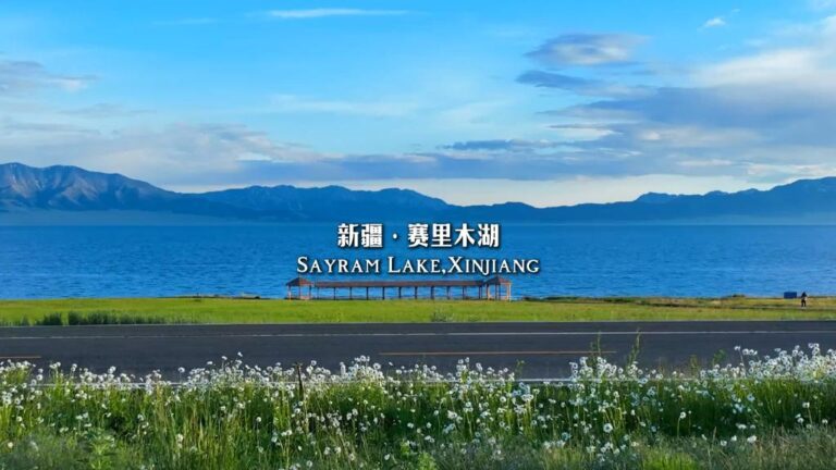
Most visitors begin from Urumqi, Xinjiang’s capital. From there you can fly to Yining (IATA: YIN) in about an hour, or take the faster train-and-bus combination, then handle the final 150 km by road. Flying saves a full day; the overland route is longer but lets you break the journey at places like Sayram Lake. Either way, the last leg to the valley gate needs a car you control, because scheduled transport into Gongliu County thins out and stops altogether at the reserve entrance.
Self-driving is the most flexible option if you are already on a longer Xinjiang loop. Many people reach the valley from the Duku Highway by cutting west through the Tekes basin, which also puts you within reach of Kalajun and the famous Nalati grassland. Once inside the park there is a shuttle that runs the main access road, so you can leave the car at the gate. Public buses reach Gongliu town, but from there you will need a local taxi or a pre-arranged driver, and that final hop is not something I would leave to chance in peak season.
Best time to visit
Kuerdening has two windows, and they could not be more different. Late May to early June is flower season: wild iris and tulips carpet the meadows before the grass grows tall, and the air stays mild. Late September to early October is the one I would pick. The spruce keeps its dark green while the birch and steppe turn gold, and the contrast against a clear Ili sky is the reason photographers make the trip. If you want to see how that light behaves across the wider region, our Xinjiang autumn photography guide goes deeper on timing and gear.
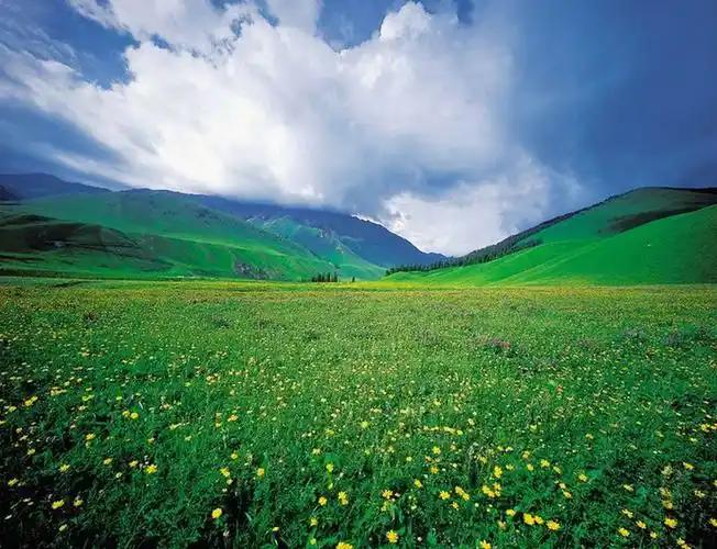
Between the two windows, autumn wins for me. The colour peak lasts only about ten days in late September, and once it passes the meadows brown out fast. Miss that window and you still get good Ili hiking in June, but you trade the colour for mud and more mosquitoes. I would not plan a first trip for July or August: the meadows are at their tallest and the afternoon thunderstorms are frequent enough to ruin a hike. Winter closes most of the access road.
Where to stay
Inside the reserve there is a small cluster of guesthouses and yurts near the entrance, plus a basic hotel attached to the park. They are simple — shared bathrooms in the yurts, limited hot water, no air conditioning because you will not need it. We booked ours through a guesthouse owner we found on a travel forum a week ahead; in June that was enough, but for the October peak I would reserve earlier.
If you prefer real beds and a wider choice of food, stay in Gongliu town or push on to Yining and do Kuerdening as an overnight day trip. Yining also lets you combine the valley with Sayram Lake on the way north, which is what we did on the back end of the trip.
Food on and around the valley
Meals are hearty and meat-forward. Expect hand-pulled laghman noodles, manty (steamed dumplings), plenty of lamb, and fresh yoghurt from the herders’ flocks. The Kazakh family we stayed with served us naan straight off a saj griddle and a bowl of milk tea at six in the morning before our hike. If you have dietary restrictions, tell your host the night before — vegetable-only options are possible but not assumed, and a remote guesthouse is not the place to discover that at dinner.
Practical tips before you go
- Bring layers. At 1,500 m the nights drop cold even in July, and the spruce shade keeps the trails cool.
- Download offline maps. Cell coverage inside the reserve is patchy at best.
- Carry cash. The entrance, shuttle, and small guesthouses do not all take mobile pay reliably.
- Respect the reserve. It is a protected core zone; stay on marked trails and pack out what you pack in.
- Start hikes early. Afternoon clouds build fast and the light goes flat by four.
A simple two-day sample itinerary
Day 1: Drive Yining to Kuerdening (3 hours). Check in, walk the lower forest loop before dinner, eat with a local host family.
Day 2: Sunrise at the valley floor, hike to the Qimengde viewing platform (3–4 hours return), picnic lunch, then drive to Kalajun or back toward Yining via Sayram Lake.
Frequently asked questions
Is Kuerdening Valley worth visiting if I have already seen Kanas?
Yes, for a different reason. Kanas is a lake drama; Kuerdening is a forest one. The spruce here is older and the crowds far smaller. If you are choosing between regions, our Ili vs Altai comparison breaks down the trade-offs.
Can I visit independently without a tour?
You can, provided you have your own transport or a driver. There is no requirement to join a group, but public transport to the gate is thin, so plan the last leg carefully and book a return ride in advance.
How long should I spend?
One full day covers the main viewpoints; two days lets you hike properly and add Kalajun. I would not give it less than a day and a half.
Is it suitable for children or older travellers?
The entrance area and lower loops are easy. The climb to Qimengde is a steady uphill on a rough path, so judge that against your group’s fitness and turn back if the weather turns.
Disclaimer
This article reflects a single personal visit and information gathered from official park signage and local hosts. Opening times, ticket prices, shuttle routes, and road conditions in Xinjiang change often, and some areas may be temporarily closed for weather or management reasons. Always confirm current details with the reserve, your accommodation, or a licensed local operator before you travel, and check the latest official travel advisories for the region.
About the author
Karl Huang is a travel writer who has spent multiple seasons exploring Xinjiang’s Ili region on his own wheels. He focuses on first-hand, practical guides for independent travellers and contributes to several Xinjiang travel resources. He has walked the trails of Kuerdening, Kalajun, and Nalati personally and prefers slow, local stays over packaged tours.