Published: August 17, 2026 | Author: Karl Huang
Why you can trust this comparison
Deciding between Nalati vs Bayanbulak is the question most travelers in northern Xinjiang eventually hit. Both are grasslands, both sit in the Tianshan, and both land on the same “must-see” lists. They are not interchangeable, though, and picking wrong can cost you a long, cold drive for a view you never really came for.
I ran this comparison the hard way. In July 2025 my partner and I drove from Yining to Nalati, then took the Duku Highway south to Bayanbulak, and looped back out through Korla. We slept in a yurt at 1,800 meters and shivered at a 2,500-meter swamp at midnight. Everything below comes from that week plus the paperwork we collected: ticket prices, shuttle times, and the official notices we had to check before leaving.
Where I cite figures, they reflect what we paid or were quoted in 2025. Park fees and shuttle routes change almost every season, so I have flagged the ones worth reconfirming. For the latest, check the Xinjiang Department of Culture and Tourism and the individual park pages before you book.
Nalati vs Bayanbulak at a glance
| Factor | Nalati | Bayanbulak |
|---|---|---|
| Location | Xinyuan County, Ili (north Tianshan) | Hejing County, Bayingolin (south Tianshan) |
| Elevation | ~1,800 to 2,200 m | ~2,500 m |
| Signature sight | Rolling green “air grassland” and Kazakh camps | Swan Lake and the nine bends of the Kaidu River |
| Development | High: cable cars, boardwalks, frequent shuttles | Low: long shuttle ride, few services |
| Best for | Families, first-timers, culture | Photographers, solitude, road-trippers |
| Peak ticket (2025) | ~95 RMB plus ~40 RMB shuttle | ~65 RMB plus ~90 RMB shuttle |
| Drive from nearest hub | ~3.5 h from Yining | ~5 h from Korla, or via Duku South |
The short version: Nalati is the easier, greener, more social grassland. Bayanbulak is higher, colder, wilder, and built around two specific spectacles rather than endless meadows.
Our week on the two grasslands
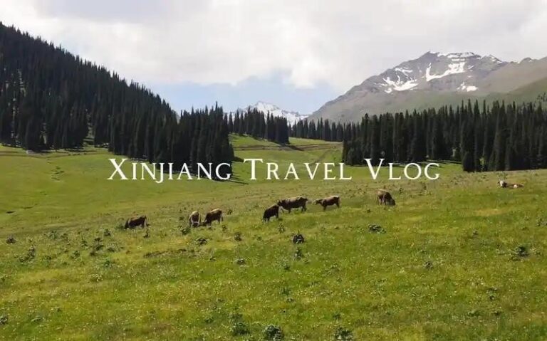
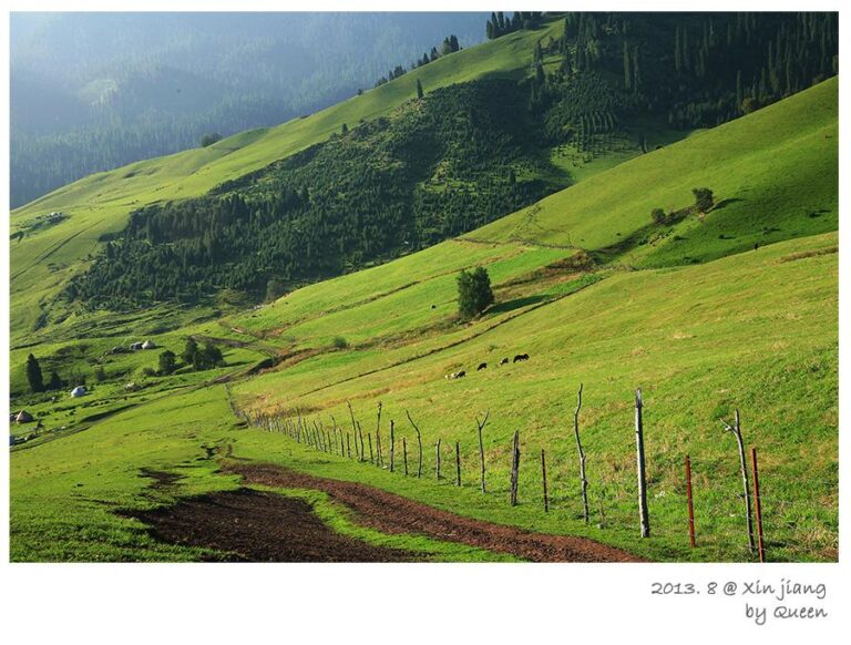
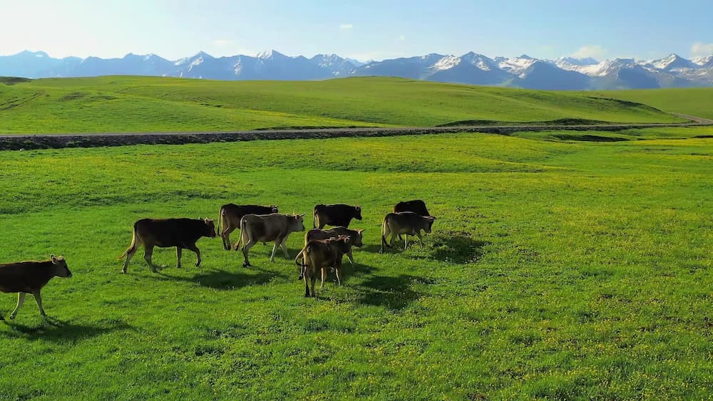
We reached Nalati from Yining on a Tuesday morning after a 250-kilometer drive that took closer to four hours than three because of the fruit-stand stops in Gongliu. The “air grassland” (kongzhong caoyuan) zone delivered what the brochures promise: wide slopes striped with snowmelt streams, herds of sheep moving like spilled rice, and Kazakh herders who invited us for milk tea without a hint of a sales pitch. We waited about 25 minutes for the upper transfer bus, shared the bench with a family from Urumqi, and watched the mist lift off the ridge all at once.
That night we slept in a yurt inside the scenic area. The experience was memorable and the walls were thin; at 3 a.m. the temperature dropped and the only bathroom was a shared block a two-minute walk away across wet grass. Worth it once. The next night we moved to a proper hotel in Nalati town and slept properly for half the price.
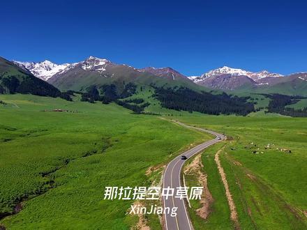
Bayanbulak was a different animal. After two nights in Ili we joined the Duku Highway south. The road climbs past snow fences and switchbacks, and by the time we dropped toward the Bayanbulak basin the temperature had fallen about twelve degrees. The grassland here is flat and enormous, a drained lake bed really, and the draw is not the grass but the water. The Kaidu River curls across it in loops so tight that at sunset the low sun multiplies into nine reflections along a single bend. Bayanbulak sits in Bayingolin, the same prefecture that holds Bosten Lake, and the whole southern basin feels like its own quiet country.
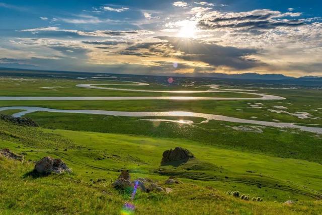
We stayed near the swamp edge and walked out at 8 p.m. for the sunset. It was 9 degrees and windy in late July. The swans were there in numbers, but the real crowd-puller was the light show on the water, and it only appears on clear evenings in summer. We counted three distinct reflected suns before the light went.
How to get to each
Nalati. Most people base in Yining and drive or take a bus roughly 250 km east; summer tourist shuttles run direct from the city. Inside the park, buses run from the gate to the valley and aerial zones, and the aerial grassland needs a separate transfer with a short cable-car option if your legs protest. A private car from Yining runs 350 to 500 RMB for the day depending on the season.
Bayanbulak. Two realistic routes. From the north, the Duku Highway drops you at the north gate in a single dramatic day. From the south, you climb from Korla through Hejing, about five hours. Inside the park the shuttle to the nine-bend platform is long (plan 1.5 to 2 hours each way) and the last bus leaves well before sunset, so coordinate your return with the driver before you ride up.
Both grasslands are natural stops on a longer northern Xinjiang loop, and the Duku Highway is the thread that ties them together.
Best time to visit
Nalati greens up from late May and stays lush through September. July and August are peak and crowded; June and early September are quieter with good weather and lower prices. Bayanbulak’s swans nest roughly April to October, but the meadows and the nine-bend sunset read best from late June to August, when the grass is high and the evenings are clear. Both sit at altitude, so even summer nights are cool, and October brings early closures as the first snows arrive on the passes.
If you are weighing the wider region, our Ili vs Altai breakdown helps you decide which northern pocket deserves your time.
Where to stay
At Nalati you can sleep inside the scenic area in a yurt or a fixed cabin, or stay in Nalati town just outside the gate where hotels are cheaper and the hot water is more reliable. Yurts with a real bed ran us about 300 to 500 RMB a night in peak season; a clean town hotel was 200 to 400 RMB. Bayanbulak has far fewer beds. The township near the gate has a handful of guesthouses at 200 to 350 RMB and one or two larger hotels above 400 RMB. Book ahead in July and August or you will be driving out to Hejing in the dark. There is no real camping setup for casual travelers, and the wind makes tents miserable anyway.
Food on the grasslands
Expect lamb, noodles, and dairy. At Nalati the Kazakh settlements serve naan with fresh cream, hand-pulled laghman for about 25 to 35 RMB a bowl, and whole lamb cooked over open fire if you order ahead by the jin. Bayanbulak, being Mongol-run, leans into dairy: salted milk tea for 10 RMB, dried curd, and beef stews. Neither place is vegetarian-friendly, and both cost more than the cities because everything is trucked in. Bring snacks and water for the long Bayanbulak shuttle, where the only food is a single kiosk near the platform.
Yining, your likely launch point for Nalati, is worth a meal or two on its own; the Yining travel guide covers where the locals actually eat.
Practical tips before you go
- Altitude. Bayanbulak sits around 2,500 m. If you felt fine in Lhasa you will be fine here, but the cold and wind tire you faster than the number suggests.
- Book tickets online during July and August. Both parks cap daily entries and on-site sales can sell out by noon.
- Layer up. A July afternoon at Nalati can hit 28 degrees; the same evening at Bayanbulak can drop below 10. Pack a fleece and a wind shell regardless of season.
- Time the nine bends. The multi-sun reflection needs a clear sky and low sun, about an hour before sunset. Arrive early to claim a spot on the platform.
- Cash and cards. Small vendors at both grasslands often take only cash or a specific payment app. Carry a few hundred RMB in small notes.
- ID checks. Standard Xinjiang checkpoints apply on the approach roads; keep your passport or residence permit handy.
A sample 4-day loop
This is the route we actually drove, trimmed to the grassland core:
Day 1, Yining to Nalati. Morning drive of about four hours with a stop in Gongliu. Afternoon in the valley grassland zone, light walk, yurt dinner.
Day 2, Nalati aerial grassland. Full day on the upper slopes, cable car optional, afternoon transfer back to Yining or onward to the Duku approach.
Day 3, Duku Highway south to Bayanbulak. One of the best driving days in China. Arrive early enough to catch the late light on the basin, sleep in the township.
Day 4, Bayanbulak sunrise and nine-bend sunset. Daytime swamp walk for swans, rest, then the evening platform. Exit south to Korla or north back the way you came.
If you want more green country nearby, the Kalajun grassland above Tekes is an easy add to the Ili side of this loop.
Frequently asked questions
Can I see both Nalati and Bayanbulak in one trip?
Yes, and the Duku Highway makes it logical. Budget at least four days and accept that Bayanbulak is the more remote, weather-dependent half.
Which is better with kids?
Nalati. Shorter transfers, more facilities, and yurts-with-beds options. Bayanbulak’s long shuttles and cold evenings test small children.
When are the Bayanbulak swans there?
Swans nest from roughly April to October, but the grassland looks its best and the sunset reflection is reliable from late June through August.
Is Bayanbulak really that cold?
About 10 to 15 degrees cooler than Nalati on the same day, with wind that cuts through a light jacket. We wore fleeces in late July.
Do I need a special permit?
No border permit for either grassland, but routine Xinjiang ID checks apply on the roads. Foreign travelers should carry a passport at all times.
Disclaimer
The prices, shuttle times, and opening dates in this article reflect our July 2025 visit and official notices available at that time. Xinjiang’s scenic areas adjust fees, quotas, and road access frequently, and the Duku Highway closes for weather without much warning. Always confirm current details with the official park and tourism channels before you travel. This is a first-hand account, not a booking guarantee, and we are not responsible for changes that occur after publication.
About the author
Karl Huang is a travel writer who has driven the Duku Highway twice and spent two summers documenting Xinjiang’s grasslands and Silk Road towns. He prefers yurts with thick walls and always packs a wind shell. His work focuses on practical, on-the-ground information for independent travelers, and he has contributed route planning and field reports to several Xinjiang travel guides.