Published: July 25, 2026 | Author: Marta Keller, botany-trained travel writer
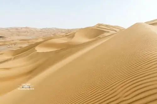
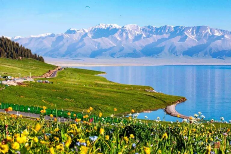
The first thing my driver said when I asked about the Gurbantunggut Desert was, “Which part? It’s bigger than Switzerland.” He was not exaggerating by much. At roughly 48,800 square kilometres, this is China’s second-largest desert, filling most of the Junggar Basin between the Tianshan and Altai ranges. Yet almost nobody outside China has heard of it, because its famous southern cousin, the Taklamakan, absorbs all the attention. I have crossed it twice on Highway G216, once in late April 2023 for the spring bloom and again in January 2025 to see the snow dunes, and I keep telling people the same thing: this is the desert you can actually enjoy without an expedition budget. On the western edge of the same basin the ground lifts into open pasture around Hoboksar, a Mongol autonomous county that almost nobody schedules a stop in.
A word on the nickname. Some Chinese travel writing calls the Gurbantunggut a “sea of sorrow,” a moody echo of the Taklamakan’s “sea of death.” I asked three drivers and a reserve ranger about it; none of them used the phrase. Locals just say shamo, desert, and Kazakh herders who winter their sheep inside it would find the label odd, since for them the desert is a pantry, not a grave. I use the nickname in the title because you will meet it in brochures, but do not let it colour your expectations. This is a gentler place than its press.
Quick reference: Gurbantunggut Desert at a glance
| Item | Details |
|---|---|
| Location | Junggar Basin, northern Xinjiang, between Urumqi and Altay |
| Size | About 48,800 km²; China’s second-largest desert |
| Type | Largest fixed and semi-fixed dune desert in China; dunes anchored by saxaul shrubs |
| Main road access | G216 (Urumqi–Altay) crosses the eastern side; G217 skirts the west near Karamay |
| Entrance fee | None for the open desert; nature reserves and scenic areas nearby charge separately |
| Best months | Late April–May for ephemeral flowers; September for mild light; December–February for snow dunes |
| Base towns | Urumqi, Fukang, Wujiaqu, Karamay, Beitun |
| Nearest airports | Urumqi (URC), Karamay (KRY), Altay (AAT) |
Why you can trust this guide
I trained as a botanist before I started writing, and the Gurbantunggut was on my list for one specific reason: it is one of the best places on earth to see spring ephemerals, those short-lived desert plants that sprint through an entire life cycle in six weeks of snowmelt moisture. I spent five days along G216 and the Kalamaili reserve fringe in April 2023 with a local driver, and returned for four winter days in January 2025. Prices, road conditions and access rules below are what I personally encountered, cross-checked against the reserve’s posted regulations. Where something may have changed, I say so.
What makes this desert different
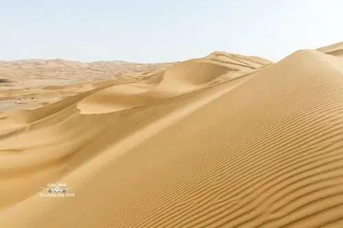
Most people picture a desert as bare, mobile sand. The Gurbantunggut breaks that picture in three ways.
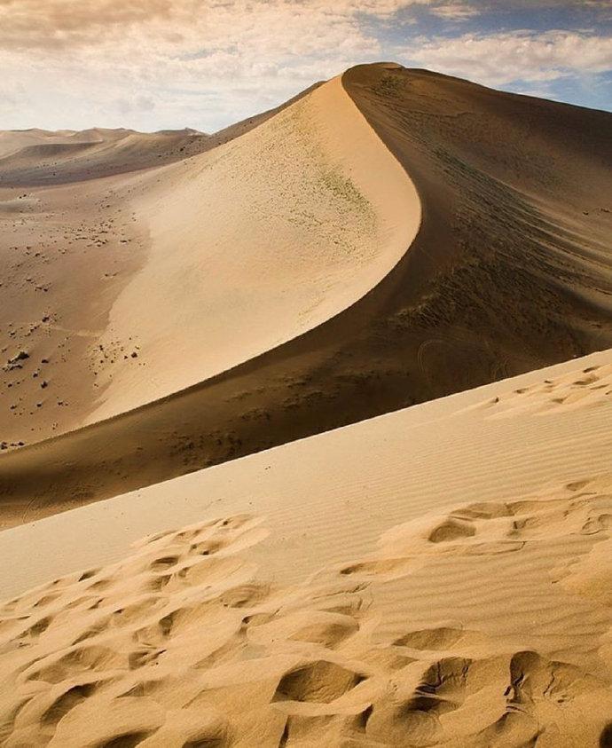
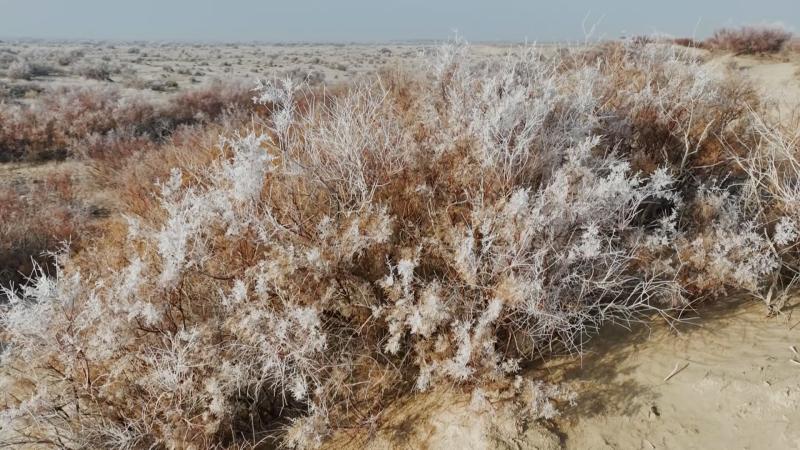
First, the dunes barely move. Over 95 percent of them are fixed or semi-fixed, held in place by saxaul, white saxaul and a living skin of biological soil crust, a dark, crunchy layer of cyanobacteria, lichens and mosses. My April guide, a Kazakh man named Erbol, made me kneel and look at it with a hand lens. “Step on it and it takes twenty years to heal,” he said. He was quoting the reserve signage almost word for word, and the science backs him up. This is why driving off-road here is both prohibited in protected zones and genuinely destructive everywhere else.
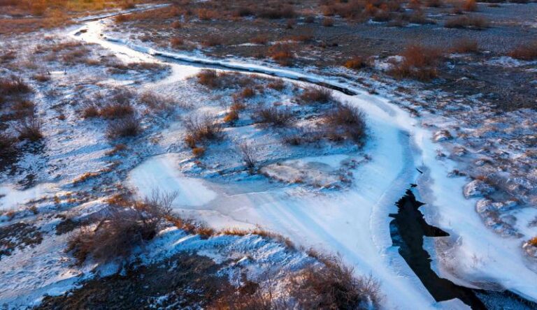
Second, it snows. Unlike the Taklamakan, the Gurbantunggut sits far enough north to collect a stable winter snow cover, usually twenty to thirty centimetres. The snow insulates the plants, feeds the spring bloom, and lets Kazakh herders drive tens of thousands of sheep into the desert each winter, a migration that has run for generations because the animals can eat snow instead of needing wells. In January 2025 I watched a flock string across a white dune field near the G216 kilometre markers north of Cainan, and the scene looked more like Lapland than Central Asia.
Third, you are standing at the far end of the earth from the sea. The Eurasian pole of inaccessibility, the point on the continent farthest from any ocean, lies in this basin, roughly 2,500 kilometres from the nearest coastline. There is no monument you can easily visit, and the exact coordinates are debated, but the bragging rights are real: nowhere on the planet’s largest landmass is more inland than here.
Getting to the Gurbantunggut Desert
The desert has no gate, so “getting there” means choosing a road that crosses or skirts it.
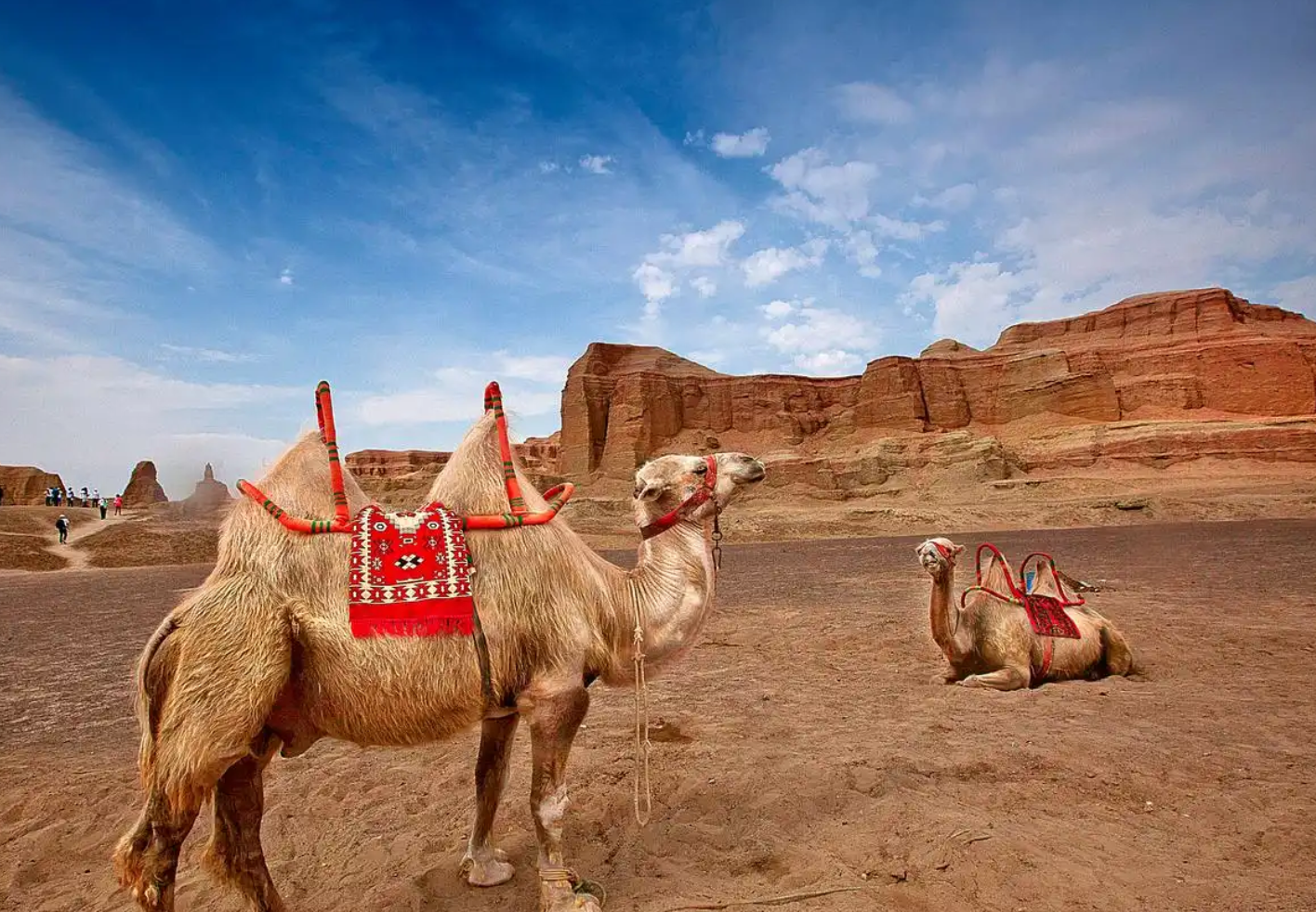
Highway G216 is the classic approach. It runs north from Urumqi through Fukang, brushes the Wucaiwan area with its burnt-orange badlands and hot spring, then cuts through the desert’s eastern flank toward Beitun and Altay. Long stretches have protective grass grids beside the tarmac and camel-crossing signs that are not decorative; I had to brake for a Bactrian pair in April. Driving time Urumqi to Beitun is six to seven hours without stops.
Highway G217 serves the western side via Karamay, useful if you are combining the desert with the oil-town sights and the Urho “ghost city” wind-eroded landforms.
Public transport exists but is blunt: buses and trains link Urumqi with Beitun, Altay and Karamay, and you will see plenty of desert from the window, but you cannot stop. To actually stand on a dune, hire a car with a driver in Urumqi (I paid 900 CNY per day in 2023, fuel included) or join a northern-loop tour. If you plan to drive yourself, read our Xinjiang self-drive planning guide first; distances and fuel gaps up here punish improvisation.
Wildlife: the Kalamaili factor
Along the desert’s eastern edge, the Kalamaili Ungulate Nature Reserve protects one of China’s best big-mammal shows. This is where Przewalski’s horses, the world’s last truly wild horse species, have been reintroduced since 2001 after going extinct in the wild. From the G216 corridor in January I counted eleven of them, stocky and buff-coloured against the snow, plus a line of khulan, the Mongolian wild ass, and scattered goitered gazelles. You are not allowed to leave the road inside the reserve, and rangers do patrol, but the animals often graze within binocular range in winter when they descend to lower ground. Bring optics; do not bring a drone, which is banned in the reserve.
Best time to visit
Late April to mid-May is my favourite window and the reason a botanist crosses the world for a desert. After snowmelt, ephemerals like desert tulips, wild irises and dozens of tiny crucifers rush into flower between the saxaul bushes. The bloom is subtle, not a carpet, and it rewards people who walk slowly and look down. Daytime temperatures sit around 15–22°C.
September brings stable weather, warm light and none of the summer haze. Summer itself, July and August, is workable, hot at 30–35°C but far less brutal than southern Xinjiang; carry water and avoid midday walks.
December to February is for the snow-dune photographs and the wildlife. Expect minus 15 to minus 25°C, roads that are ploughed but icy, and short days. Check conditions month by month in our Xinjiang weather guide before committing to a winter run. The desert’s dark, clean skies also make it a serious option for astronomy; see our Xinjiang stargazing field guide for how the Junggar Basin sites compare.
Where to stay
There is no accommodation inside the desert, and camping in protected zones is not permitted, so you sleep in the ring of towns around it. Urumqi has the full range and is the practical start point. Fukang, ninety minutes out, works for an early G216 departure; I paid 260 CNY for a clean business hotel in 2023. Karamay is the comfortable western base with surprisingly good hotels thanks to the oil economy. The Wucaiwan hot spring hotel beside G216 lets you soak after a dusty day, though standards are provincial; manage expectations. In the north, Beitun and Burqin connect the desert leg to the Altay lakes, and if you continue that way our Fuhai and Ulungur Lake guide covers a stop most tourists skip.
What to eat
Food along the desert margins is herder food, and it is better than it has any right to be. In Fukang I ate a lamb-and-yellow-carrot pilaf for 32 CNY that I still think about. Roadhouse kitchens on G216 do big-plate chicken and hand-pulled noodles; portions assume you are a truck driver. In winter, Kazakh households near the reserve sell smoked horse sausage, kazy, and hot milk tea with salt, which sounds wrong and tastes exactly right at minus twenty. Karamay has proper restaurants including decent Sichuan. Carry snacks and two litres of water per person regardless of season; shops are ninety minutes apart on the desert stretches.
Practical tips
- Stay on roads and established tracks. The soil crust is fragile, off-road driving is banned in the reserve, and rescue in soft sand is expensive and slow.
- Fuel up at every opportunity. Stations on G216 exist but can be 100+ kilometres apart, and some close in deep winter.
- Phone signal is decent along highways, absent between them. Download offline maps.
- Foreign passports are fine for the open desert and G216, but hotels in smaller towns may take time with registration. Arrive before evening.
- In winter, carry emergency layers in the car, not the boot: if you stop for photos at minus 22, you want the down jacket within reach.
- Spring flower-hunting is best on foot within 200 metres of the road; you do not need to go deep, and the bloom is often thickest where snowdrifts lay longest, on north-facing dune toes.
- If you would rather have logistics handled, a driver-guide changes everything out here; our guide to hiring a local guide in Xinjiang explains costs and how to vet one.
A sample two-day desert loop
Day 1: Leave Urumqi by 8:00, coffee stop in Fukang, then north on G216. Late morning at the Wucaiwan badlands for the ochre and rust rock. Picnic lunch, then the desert crossing proper: pull-offs for dune walks, saxaul close-ups and, in spring, flower stops every few kilometres. Reach the Kalamaili corridor by late afternoon, when wildlife moves. Overnight in Beitun, about 620 kilometres total.
Day 2: Sunrise back at the reserve fringe for horses and khulan in low light. Return south with a soak at the Wucaiwan hot spring, or continue north instead to the Altay lakes if you have more days. This loop slots neatly into a wider northern itinerary; our north versus south Xinjiang comparison helps you decide how much time the Junggar side deserves.
FAQ
Is the Gurbantunggut Desert worth visiting compared to the Taklamakan?
They do different jobs. The Taklamakan is the epic, hostile one; the Gurbantunggut is accessible, alive and cheap to see. If you are already doing a northern Xinjiang loop, crossing it costs you nothing but a day.
Can I camp in the desert?
Not in the Kalamaili reserve or other protected zones. Elsewhere it is a grey area; most drivers will discourage it, and I did not. The town-based approach works fine.
Do I need a permit?
No special permit for the highways or roadside desert as of my January 2025 visit. Reserve interior access requires permission that ordinary tourists will not get.
Will I see wild horses for certain?
No. Winter sightings from G216 are common, summer sightings patchier because animals disperse. Eleven horses in one morning was luck plus a driver who knew the water points.
Disclaimer
Prices, road conditions and reserve rules reflect my visits in April 2023 and January 2025 and may have changed. Winter travel in the Junggar Basin involves genuine cold-weather risk; check forecasts and road status locally before departure. This article contains no political commentary and describes conditions as I personally observed them.
About the author: Marta Keller is a Zurich-based travel writer with a degree in botany. She specialises in arid-land ecosystems and has reported on deserts in Central Asia, North Africa and the American Southwest. Her two Gurbantunggut trips were self-funded, with no sponsorship from any tourism body.