Published: September 13, 2026 | Author: Karl Huang
Mazar Tagh is not an easy place to write about honestly, so here is what I did: I have driven the Aral-Hotan desert highway twice and turned off toward the ridge once with a Hotan driver who knew the tracks. We reached the foot of the red bluff and read the garrison from below without climbing to it. The figures below come from the Chinese Academy of Sciences field account, the national heritage listing and a 2025 NASA note on the ridge. Where something is uncertain, I say so.
Quick reference: Mazar Tagh at a glance
| Item | Detail |
|---|---|
| Other names | Hongbaishan, “Red-White Mountain” |
| Meaning | Uyghur mazar (shrine, tomb) plus tagh (mountain) |
| Location | West bank of the lower Hotan River, Karakax (Moyu) County, Hotan Prefecture |
| What it is | A fault-block cuesta of red sandstone and pale dolomite marooned in the Taklamakan |
| Length / width | About 100 to 145 km long, 1 to 3 km wide |
| Highest point | 1,570 to 1,635 m depending on the survey; roughly 200 m above the dune field |
| From Karakax county seat | About 164 km north |
| From Hotan city | Roughly 180 to 230 km, depending on the track |
| Heritage status | Sixth batch, national key protected heritage sites (2006, no. VI-219) |
| Water | Hotan River, seasonal. Flood season June to August |
| Facilities | None. No fuel, water, shade, shop, toilet or mobile signal |
| Entry fee | None posted |
What Mazar Tagh, Xinjiang, actually is
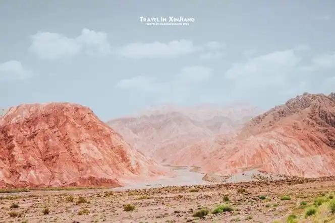
Picture the Taklamakan as a bowl of sand with a ruler laid across its southern half. That ruler is Mazar Tagh. It runs east to west for 100 to 145 km, stands one to three km wide, and rarely rises more than about 200 m above the dunes because most of its relief is buried. The Chinese name, Hongbaishan, describes what you notice first: at the eastern end the ridge splits into two crests, one pale and one rust red.
The northern crest is dolomite banded with gypsum, which is why it reads silver-white from a distance. The southern crest is brown-red sandstone and mudstone, and its iron content gives the ridge its colour in satellite imagery. The block is faulted along its north side and tilted southwest at around 30 degrees. At the eastern end it runs into the Hotan River and stops.
The morning the ridge stopped being a mirage
We left Hotan at 06:40, before the sun had any weight. For two hours the desert highway looks almost genteel: asphalt between green walls of tamarisk and saxaul planted to hold the sand back. Around the 200 km mark the shelterbelt thins and a smudge appeared on the northern horizon.
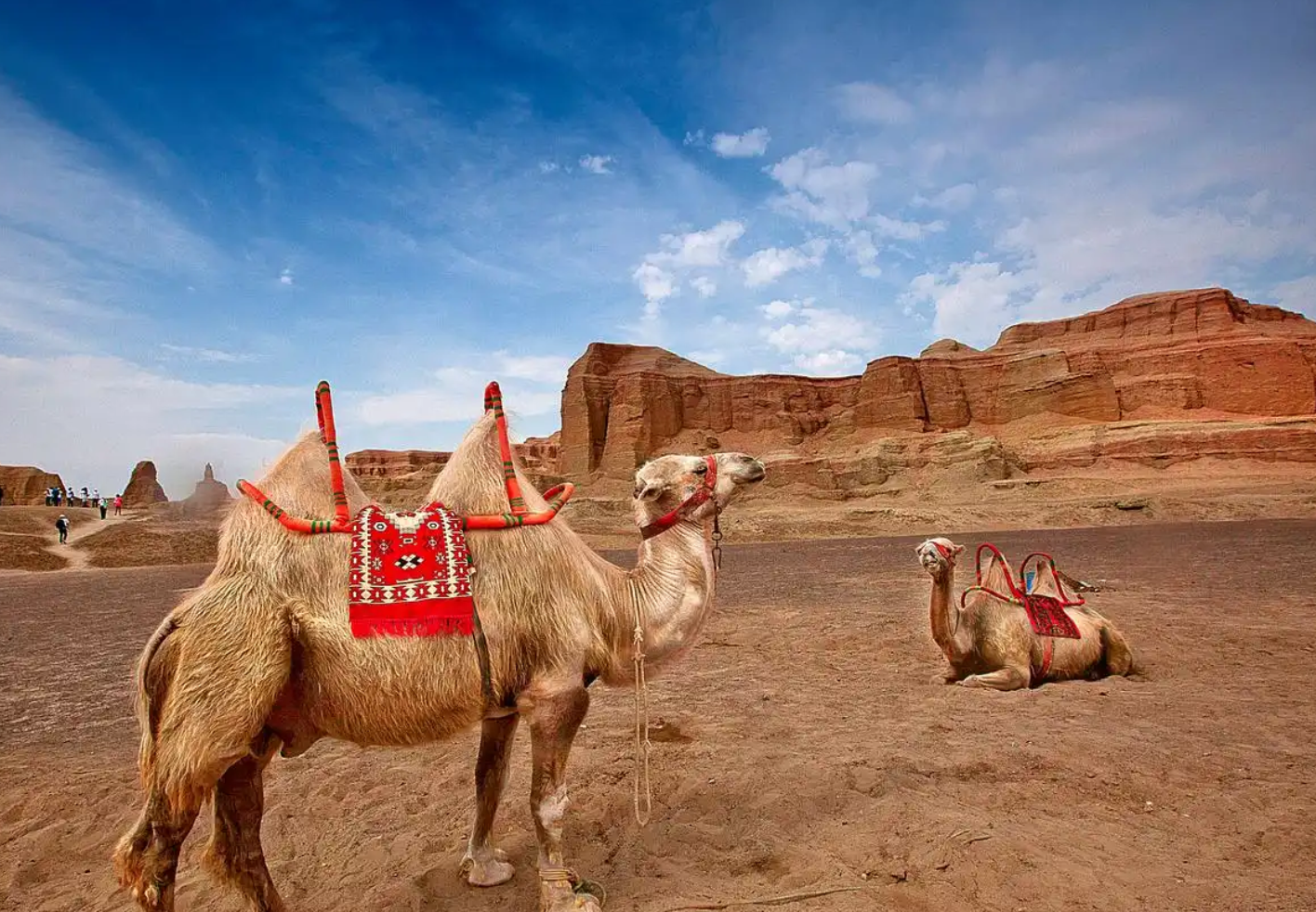
Our driver refused to confirm it. Heat throws up false ridges all morning out here. We drove another forty minutes before the smudge held still, and then it did something no mirage does: it split into two crests with a notch between them. The Academy of Sciences party who crossed this country in the 1980s described the same doubt and finished their last water when the shape stopped moving.
The ridge that fences a desert
Mazar Tagh changes how the desert behaves on either side of it. NASA’s Earth Observatory published a Landsat 9 image of the ridge in September 2025 describing it as a barrier that traps sand and stops dunes marching south under the basin’s prevailing northeasterly winds. Work by Hu and colleagues puts numbers on that: the ridge blocks roughly 62 percent of the sand moving toward it and cuts north-to-south drift potential by about 13 percent. North of it, sand piles into barchans and star dunes. South of it, starved of supply, the field switches to long linear ridges.
Sea floor, fossils and a pavement of agate
The rock is young and was laid down in water. The pale beds hold gypsum and calcareous sandstone of the kind that forms in shallow lake water; the red beds are iron-rich sandstone and mudstone from an arid setting. Mid-ridge, a Paleogene conglomerate weathers into what people call the agate gobi, with carnelian and opal fragments left on the surface as the softer rock blows away. Shells turn up in the lower beds too, gastropods and ostracods among them, which is the plainest evidence that the middle of the Tarim was sea floor during the Paleogene. One warning, because it matters here: this is a national protected heritage site, and picking anything up is off limits.
The garrison on the red bluff
The listing comes down to the fort on the red crest. Mazar Tagh garrison site stands north of Tuzluktak village in Kawa township, on the eastern section of the ridge about 164 km from the Karakax county seat, and the State Council added it to the sixth batch of national key protected heritage sites in 2006, number VI-219.
What survives is a walled enclosure and a beacon tower 60 m apart. The beacon is roughly square, about 7 m along the base and around 6 m high, raised in loess blocks with tamarisk and poplar reinforcement. The fort covers between 1,100 and 1,640 square metres depending on whether the outer enclosure counts, and three building phases have been identified from the brick sizes alone. A temple terrace survives 20 m northeast, and a cave below the southern cliff carries Chinese and Old Tibetan inscriptions.
The identification that matters most is this: the site is generally taken to be Shenshan fort of the Tang. The Xin Tangshu traces the road from today’s Aksu south and east, across the Chihe, then southwest through Shenshan, Suiyang and Jianpo, some 930 li to Khotan. Whoever held this bluff held the shortcut between the north and south rims of the Tarim.
What Stein carried away, and what came after
Aurel Stein dug here on his second and third Central Asian expeditions and took out several hundred documents and wooden slips in Chinese, Old Tibetan, Khotanese, Old Uyghur and Arabic, the Tibetan material the most numerous. Coins came with them, including Qianyuan Zhongbao and Dali Yuanbao issues. Two finds stay with me: reed pens with split nibs, and scribes practising their characters by copying the Lantingjiu preface.
The record does not stop there. Huang Wenbi reached the site in 1929 and recorded the cave inscriptions. A Hotan valley survey visited in 1984, the second national heritage survey catalogued it in 1991, and a joint Xinjiang Institute and British Library team went in during November 2008.
The river that crosses the whole desert
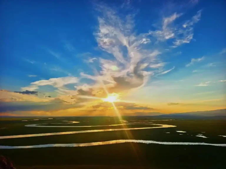
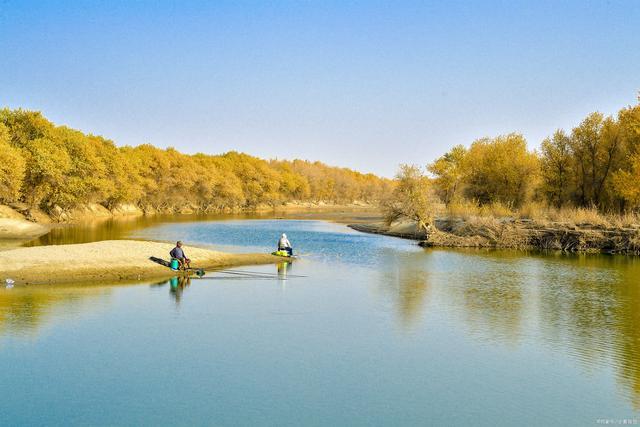
The Hotan River runs past the eastern end, and it is the only river that carries water across the interior of the Taklamakan rather than dying at its edge. It forms where the Karakax and Yurungkash meet at Koshlash, runs 806 km in total, and spends more than 400 km of that inside the sand. For nine or ten months of the year the bed below Hotan is dry and walkable; in flood it can be 5 km wide.
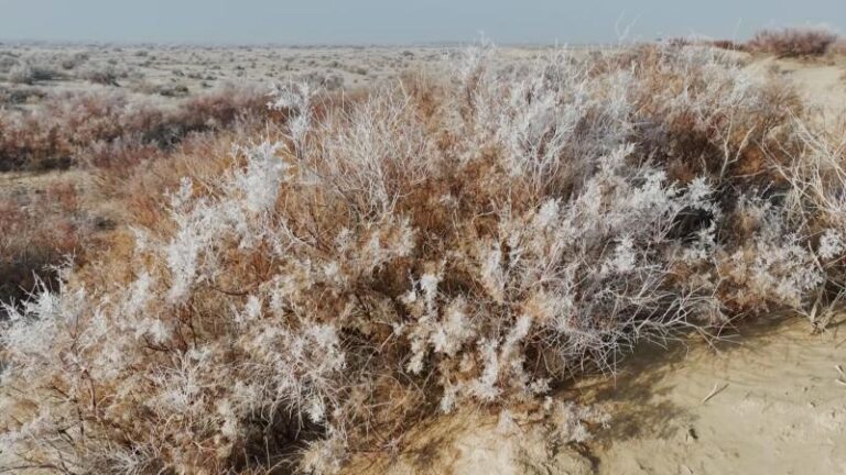
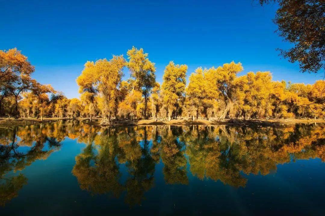
The floods keep the green corridor alive: grey poplar, tamarisk and reed, with goitred gazelle and Tarim hare moving through it. The gravels carry nephrite too, which is why jade has been picked off these bars for a very long time. If that is your interest, read our piece on hunting for Yurungkash River jade first.
No, you cannot see Muztagh Ata from here
Worth saying plainly, because the confusion comes up in trip planning: Muztagh Ata is a 7,546 m Pamir summit in Akto County and has nothing to do with this ridge beyond a shared syllable. The two sit between 380 and 450 km apart, and two summits at 1,635 m and 7,546 m stop seeing each other at roughly 450 km once the curvature of the earth is counted. Geometry is the least of it. Between here and there lies several hundred kilometres of Tarim dust haze and ground shimmer that eats the horizon. I have never met anyone who claims to have seen it.
The moment people actually want happens on the other side of the province, where the peak comes into view above Karakul Lake as the Karakoram Highway climbs out of the Gez canyon.
Getting there: the desert highway and the last stretch
Everything starts in Hotan. The road north is the Aral-Hotan desert highway, the second crossing of the Taklamakan, built to grade-2 standard with about 407 km of its 424.7 km on sand. Work began in June 2005 and it opened to traffic on 2 November 2007, cutting the Aksu to Hotan distance by roughly 430 km.
The turnoff is the easy part. What follows is not: firm sand, saline flats and tracks that move after every storm. Two vehicles, a driver who has been in before, offline maps, and no expectation of a signal. The Hotan River gas field, on the flank of this same ridge and producing since November 2004, runs on water trucked 200 km from Karakax and talks to the outside world by satellite phone. In flood season the channel below the bluff is a hundred metres of fast water over quicksand. Do not drive into it.
When to go
Late September to late October is the window I would take. The summer floods have passed, the poplars along the river have turned, and daytime heat is tolerable rather than punishing. April works too, though spring is when the dust events start and the light goes flat for days.
June to August brings the river to life, but surface temperatures on the sand pass 70 Celsius and the interior is no place for a breakdown. Winter is colder than most expect, with January means around minus 6 at the county seat, but the ground is firm and the air clear. Check the wind forecast, not the rain.
Sleeping and eating when there is nothing there
There is no accommodation, no shop and no shade. Most people treat this as a long day trip and sleep in Hotan or Karakax, which is what I would do. Camping in the lee of the ridge is possible, but you carry in every drop you drink plus spare for the radiator, and carry out everything else.
Buy food in Hotan the night before: naan, fruit, a thermos of tea. Anything needing refrigeration is a mistake.
Practical tips that matter more here than anywhere else
- Never one vehicle. Two minimum, with recovery boards, a tow rope and spare tyres.
- Fill up in Hotan or Karakax and treat the highway fuel stops as the last ones.
- Ten litres of water per person per day in warm months, plus spare for the vehicle.
- Download offline maps. A satellite messenger is worth the rental fee out here.
- The garrison is a protected national site. Do not climb the walls, dig or collect.
- Leave your route and return time with someone in Hotan.
- If the river is running, turn around. It is not a ford.
A two-day plan from Hotan
Day one, leave Hotan by 06:30 with a full tank and breakfast in the car. Three hours north puts you at the turnoff; allow another ninety minutes on tracks. Spend the late morning at the base of the bluff reading the fort from below, and be back on asphalt by 16:00 so nothing goes wrong in the dark.
Day two, stay on pavement. Karakax (Moyu) has mulberry paper workshops, an old town that sees few foreign visitors, and a wetland on the oasis edge.
Mazar Tagh FAQ
Can I visit the fort itself?
You can reach the foot of the bluff. The garrison is a national protected site and the walls are fragile, so treat it as something to look at rather than walk on. There is no ticket office and no staff.
How long does the trip take from Hotan?
Budget a full day, nine to eleven hours door to door, three to four of them off pavement.
Is Mazar Tagh connected to Muztagh Ata?
Only by a similarity in transliteration. They are about 400 km apart in different mountain systems, and you cannot see one from the other.
Disclaimer
This guide reflects conditions as we found them and the survey work available in 2026. Track conditions, access rules and checkpoint requirements in the Taklamakan change without notice, and nothing here grants permission to enter a protected site. Distances and elevations vary between sources; where they disagree I have given the range. Confirm locally in Hotan before setting out and travel with a licensed driver.
About the author
Karl Huang researches and writes about travel in Xinjiang for this site, with a focus on places that get one paragraph in most guidebooks. He has driven the desert crossings of the Tarim basin, the Duku Highway and the Karakoram Highway, and works from Chinese-language survey reports, heritage listings and his own field notes. Where a claim needs a specialist, the article names its source instead.