Published: August 14, 2026 | Author: Karl Huang, Xinjiang Attractions
I once paid for a guesthouse in Kuqa that I never reached. The booking was for June 2, the plan was to cross the Tianshan in a day, and I had convinced myself that “early June” meant the road would be open. It wasn’t. A man at the rental counter in Dushanzi looked at his phone, then at my luggage, and said the snow gate was still down at Haxilegen. That trip cost me a wasted night and a 900-kilometre detour, and it taught me that Xinjiang road closures are not a footnote in an itinerary. In this region they decide the itinerary. This guide collects what I have learned across five driving seasons here, cross-checked against the closure notices published each spring by the regional transport authority and the scenic-area operators.
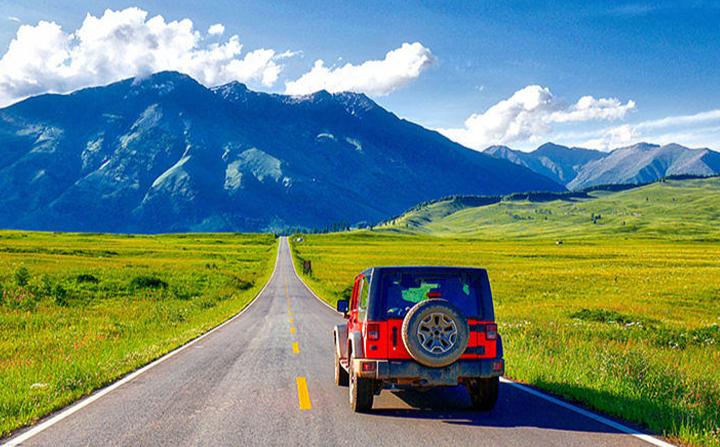
Three mountain systems cut through the region: the Altai in the north, the Tianshan through the middle, and the Kunlun and Pamir along the southern and western rim. Every high road over those ranges has a season. Some have a gate and a published date. Others simply turn dangerous without anyone announcing it, which is arguably worse.
Quick reference: which Xinjiang passes close and when
| Route or pass | Highest point | Usually shut | Usually reopens | Notes |
|---|---|---|---|---|
| Duku Highway (G217, Dushanzi–Kuqa) | Haxilegen, about 3,400 m | Mid-October | Early to mid-June | Formal gate and an annual announcement |
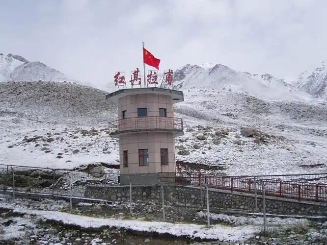
| Panlong Ancient Road (Tashkurgan) | About 4,200 m | Snow spells, Nov–Mar | April onward | Often no gate; black ice is the real hazard |
| Karakoram Highway to Tashkurgan (G314) | Khunjerab, 4,733 m | Short weather closures | Open most of the year | The Pakistan border itself shuts in winter |
| Torugart Pass (to Kyrgyzstan) | About 3,750 m | Weekends, holidays, blizzards | Weekdays, best May–Oct | Transport must be arranged on both sides |
| Irkeshtam Pass (to Kyrgyzstan) | About 2,900 m | Weekends and holidays | Weekdays, most of the year | Lower and far less snow-sensitive |
| Xiata / Muzart route (Zhaosu) | Above 3,500 m | October–June | July–September | Glacier terrain, licensed guide required |
| Wusun Ancient Road (trek) | About 3,500 m | October–June | Mid-June–September | River crossings run highest in July |
| Bayanbulak via Hejing (S301) | About 2,500 m | Brief snow closures Nov–Apr | Open most of the year | Grass season is June–August |
| Guozigou / Fruit Valley (G30) | About 1,800 m | Blizzard closures Dec–Mar | Reopens within hours or days | Expressway, so closures are short but total |
| Kanas inner scenic road (Altai) | About 1,400 m | Private cars restricted year-round | Shuttles run through winter | Access rules change with the season |
Treat every date above as a pattern, not a promise. In a warm spring the Duku gate has opened in late May. After a heavy winter it has slipped past June 20.
What “closed” actually means here
There are four different things a local might mean when they say a road is shut, and confusing them wastes days.
The first is a seasonal gate. A physical barrier goes across the road, staff go home, and nothing passes until an official reopening. The Duku Highway works this way, and so do most high scenic-area roads.
The second is a temporary weather closure, usually written on an LED board as a wind, snow or fog alert. These last from two hours to two days. Traffic police physically hold cars at a toll plaza or a checkpoint until it clears.
The third is a vehicle-class restriction. The road is open, but not to you. Large coaches, trailers and sometimes any vehicle without four-wheel drive get turned back while sedans continue. I have watched this happen at the foot of the Tielimaiti tunnel section in June.
The fourth is unofficial and catches foreign drivers most often. Nobody has closed anything. The road is simply glazed with ice at 3,000 metres and the only people on it are locals who know every bend. Legally you may proceed. That does not make it sensible.
The Duku Highway opening date, and why it moves
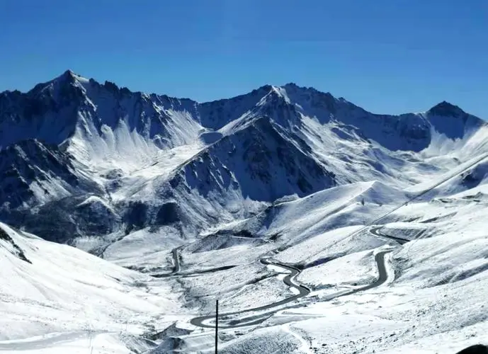
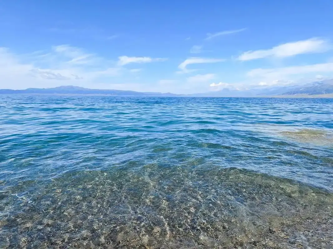
The Duku Highway opening date is the single most-searched piece of road information in Xinjiang, and for good reason. The 561-kilometre run from Dushanzi down to Kuqa crosses the Tianshan through a series of dabans, the local word for a high pass, and roughly a third of the route sits above 2,000 metres. Snow accumulates in the avalanche corridors near Haxilegen and Yuximolegai and does not clear on its own.
In practice the road shuts around the middle of October and the reopening lands somewhere in the first three weeks of June. The decision is not made by calendar. Crews assess snow depth in the chutes, avalanche risk on the upper slopes, and the state of the road surface after a winter of freeze and thaw. The announcement then comes out days, not weeks, in advance, published through the regional highway administration and shared through local traffic-police accounts.
What this means for planning is uncomfortable but simple. If your trip falls before June 20, build the Duku into your route as an option rather than a fixture. Have the alternative ready: the Sayram Lake and Guozigou corridor on the G30 to reach Ili, or the long southern swing through Korla and Kuqa. I have used both. Neither is a hardship, and the second one gave me the best noodle bowl of that entire trip in a truck stop outside Luntai.
One more detail people miss. The Duku reopening is staged. The northern section from Dushanzi to Nalati may clear before the southern descent toward Kuqa, so the road can be technically “open” while the through-route is not. Ask specifically whether you can drive it end to end.
Weather that closes roads without any snow
Snow gets the attention. Wind causes more disruption on the routes most travellers actually use.
The corridor from Turpan through Dabancheng to Urumqi funnels air between two mountain ranges, and the gusts there are strong enough to stop expressway traffic and, historically, to derail trains. Closures cluster from February through May. I sat out a four-hour hold at a toll gate near Dabancheng in April, watching lorries queue while sand moved across the tarmac like water.
Spring sandstorms do something similar in the Tarim Basin, dropping visibility on the desert crossings to a few dozen metres, and autumn brings dense morning fog to the irrigated belt around Shihezi and Changji. None of these are seasonal shutdowns. They are unpredictable half-days, so leave slack in the schedule instead of booking a flight for the evening you plan to arrive.
How to check a route before you commit
My routine has four steps, and it takes about ten minutes.
Start with the mapping apps. Amap and Baidu Maps both overlay live closure and restriction data, and they are far more current for Xinjiang than any English-language source. If a section is barriered, the route simply will not generate.
Second, call the transport service hotline on 12328 or the highway emergency line on 12122. Both are staffed and both will tell you the state of a named road. A translation app on speaker is usually enough.
Third, ask your accommodation the night before. Guesthouse owners in Nalati, Tashkurgan and Hemu know before the apps do, because their guests are the ones getting turned around.
Fourth, if a scenic area is involved, check its own channel. Kanas, Bayanbulak and the Pamir sites publish separate opening notices, and those dates are independent of whether the road is drivable.
For distance and surface expectations on the sections that are open, our guide to Xinjiang driving distances and road conditions covers realistic timings, which are always longer than the app suggests.
Getting to the passes without your own car
Self-driving gives the most control, and a rental from Urumqi, Yining or Kashgar is straightforward if your paperwork is in order. Sort the licence question before you land, because a Chinese licence or a temporary permit is not optional at the counter.
Without a car, long-distance coaches run the lower routes year-round and are unbothered by anything short of an outright closure. For the high scenic roads, a hired driver for the day is the usual solution, and rates in Ili and the Pamir are reasonable split between four people. Trains cover the Urumqi–Turpan–Korla–Kashgar spine reliably and are the closure-proof backbone of any southern loop.
Best time to go if passes matter to you
Mid-June through September is the only window when nearly everything is open at once. Late June and early July give you the Duku with snow still on the shoulders and grassland at its greenest. September is my own preference: the crowds thin after the summer holiday, the light gets long and clean, and the poplars start turning by the third week.
May and early October are gambles. Beautiful, quiet, cheaper, and roughly a coin flip on whether the high roads cooperate. Anything from November to April means planning around the lower routes and treating a high pass as a bonus if the weather hands you one.

Where to stay when a road defeats you
Plan your overnight stops at the towns that sit below the passes rather than beyond them. On the northern side of the Tianshan, Dushanzi and Kuytun have plain business hotels that will take a walk-in. On the southern side, Kuqa is the natural base. For the Pamir, Tashkurgan has both hotels and guesthouses, and it is the right place to sleep before attempting the Panlong Ancient Road rather than pushing up from Kashgar in one go.
Book with free cancellation from May to June. I now hold two rooms on opposite sides of a range and drop one in the morning once I know what the road is doing.
Eating on a closure day
Road towns feed drivers, so the food is fast, filling and cheap. Laghman, hand-pulled and stir-fried with peppers and mutton, is the default. Big plate chicken is a Shawan speciality and a reasonable thing to be stranded near. In Kuqa the small round naan comes out of the pit oven all afternoon and travels well in a rucksack.
Pack more water than you think you need. A four-hour wind hold at a toll plaza has no facilities, and the service-area shop is picked clean by the second hour.
Practical tips from five seasons of getting this wrong
Carry a paper map or download offline tiles, because coverage drops in the valleys. Keep the tank above half; stations thin out badly above 2,000 metres, and our piece on Xinjiang fuel stations explains the registration ritual you will face at each one. Bring a warm layer even in July, since a pass at 3,400 metres can sit fifteen degrees below the valley floor. Never overtake a queue of stopped trucks on a mountain road; they are stopped for a reason you cannot see yet. And if you are heading for the border, remember that a crossing has opening hours and rest days of its own, which our Karakoram Highway guide sets out in detail.
A five-day loop that works whether or not the Duku is open
Day 1. Urumqi to Dushanzi. Short drive, easy start, check the Duku status that evening.
Day 2. If the road is open, drive the northern Duku section to Nalati. If not, take the G30 west to Sayram Lake and sleep at the shore.
Day 3. Grassland day either way, at Nalati or Bayanbulak from the east, or in the Ili valley from the west.
Day 4. Continue south over the pass to Kuqa, or loop back through Guozigou toward Yining.
Day 5. Fly out of Kuqa, Yining or Urumqi depending on which branch you took. Book this flight late.
Frequently asked questions
When exactly does the Duku Highway open? There is no fixed date. Expect the first three weeks of June, announced only days ahead. Late May happens in mild years, and after a heavy winter it can slip toward the end of June.
Can I drive to Tashkurgan in winter? Usually yes. The G314 from Kashgar stays open through the cold months with occasional short weather closures. The border onward to Pakistan is a separate matter and shuts for the winter.
Are the border passes to Kyrgyzstan open at weekends? No. Both Torugart and Irkeshtam operate on working days and close for Chinese and Kyrgyz public holidays. Build a buffer day into either crossing.
Will a closure ruin my trip? Only if your route has one option. Xinjiang has enough parallel corridors that a shut pass costs you a change of plan rather than the holiday.
Do I need four-wheel drive? Not for the paved routes in summer. For high roads in shoulder season, or for the Panlong road at any time, higher clearance and proper tyres genuinely matter.
Disclaimer
Opening and closing dates here describe typical recent patterns and are not official notices. Snow, avalanche risk and administrative decisions shift these dates every year, sometimes at a few days’ notice. Verify conditions with the regional highway authority, the 12328 transport hotline, or the relevant scenic-area operator immediately before you travel. Border crossing hours and entry requirements are set by the authorities of both countries and can change without notice. The decision to drive any mountain road in marginal conditions is yours alone.
About the author
Karl Huang writes the road and logistics coverage for Xinjiang Attractions. He has driven the Tianshan and Pamir routes across five travel seasons, including two trips where the pass he wanted was shut and one where it opened the morning he gave up. He still books cancellable hotels on both sides of a mountain.