Published: August 31, 2026 | Author: Karl Huang | Last updated: August 31, 2026
If you are planning spring travel in Xinjiang, the phrase Xinjiang sandstorm matters more than any single attraction. I have been on the ground during three major dust events since 2018. One cancelled a Hotan flight, another turned a Kashgar-to-Kuqa bus window into a sepia filter, and a third gave me the clearest possible lesson: the dust is predictable if you know where to look. This guide explains how to read Xinjiang’s dust forecasts, what the warning colours mean, and how to adjust your itinerary without abandoning the trip.
Quick reference: Xinjiang dust weather at a glance
| Dust type | Visibility | Where it hits hardest | What to do |
|---|---|---|---|
| Floating dust | Less than 10 km | Hotan, Minfeng, Ruoqiang, Kashgar | Wear a mask, avoid long outdoor exposure |
| Blowing dust | 1–10 km | Tarim Basin edge roads, Tazhong | Drive with lights on, close windows |
| Sandstorm | Less than 1 km | Southern Xinjiang oases | Stay indoors, delay flights/roads |
| Severe sandstorm | Less than 500 m | Hotan Prefecture, Taklamakan hinterland | Shelter in place |
| Extreme sandstorm | Less than 50 m | Rare but documented in Minfeng | Emergency shelter only |
Why Xinjiang’s dust is worth tracking before you book
The Tarim Basin is one of the world’s largest dust sources. Academic records from stations around the basin show an average of about 60 dust days per year, but Hotan and Minfeng can see well over 150 dust days annually, with some years pushing 230. The basin holds vast areas of loose desert soil, and when spring low-pressure systems roll in, that soil lifts. The result is not always a dramatic wall of sand. Most days, it is a pale floating haze that dulls the sky and coats cameras, sunglasses, and throats.
What surprised me most was how localised the problem is. On one April morning in Urumqi I had blue sky and snow-capped mountains. The same afternoon, a friend in Hotan sent a photo of a street lamp glowing orange behind a curtain of dust. The two cities are on opposite rims of the same weather system, and that difference is what lets you plan around the dust rather than cancel because of it.
What the warning colours actually mean
China’s national meteorological service issues sandstorm warnings in three tiers. The official standards are based on expected visibility within a set time window:
- Yellow: possible sandstorm within 12 hours, visibility below 1,000 metres.
- Orange: possible severe sandstorm within 6 hours, visibility below 500 metres.
- Red: possible extreme sandstorm within 6 hours, visibility below 50 metres.
Yellow is the most common alert in southern Xinjiang during spring. Orange happens several times a season, especially around Hotan and Tazhong. Red is rare but not unheard of; the historical May 1993 “Black Wind” event across Xinjiang, Gansu, and Inner Mongolia dropped visibility to near zero.
How to read PM10 and the air-quality apps
Besides the colour-coded warnings, I check the hourly AQI and PM10 readings. During a typical floating-dust day in Hotan, PM10 can sit above 1,000 micrograms per cubic metre for hours. I have seen severe events push hourly readings past 4,000. The official AQI scale in China maxes out visually at 500, but the actual concentration can go far higher.
The apps I use most often are the national weather app, Weather China, and the Air Matters widget. Both show station-level data for Urumqi, Kashgar, Hotan, Korla, Aksu, and Turpan. For a road trip, I look at the trend, not just the number. If PM10 is climbing through the afternoon and a cold front is forecast overnight, I expect the next morning to be worse, not better.
When Xinjiang sandstorm season peaks
Spring is the main window. Station data show roughly 45 percent of the Tarim Basin’s annual floating-dust days fall between March and May. April is the peak month for many southern stations, while March can bring the strongest single events. Summer still sees dust, especially around the desert hinterland, but the events are usually shorter and less intense.
Autumn and winter are generally clearer. If you want to photograph the Pamir Highway or the desert highway without haze, October and November are safer bets. I photographed the Tarim Desert Highway in late October once and had sharp morning light and a dust-free horizon.
How dust affects flights
Southern Xinjiang airports are the most vulnerable. Hotan, Kashgar, and Aksu can delay or cancel departures when visibility drops below landing minima. Urumqi is less affected because it sits on the northern rim, but a strong system can still send haze northward and disrupt connections.
My practical rule: if Hotan or Kashgar is on orange alert, assume afternoon flights will slip. I now book morning departures when dust is in the forecast and leave a buffer day before any international connection. The Hotan travel guide covers backup plans for the oasis towns in more detail.
Road conditions during a dust event
Driving in blowing dust is harder than flying through it. On the G314, G219, and the Tarim Desert Highway, visibility can drop from clear to a few hundred metres within minutes. Traffic slows to a crawl, and trucks pull onto the shoulder. The surface can also become slick where fine dust mixes with dew or light rain.
I keep headlights on low beam, windows sealed, and the air conditioning set to recirculate. If visibility falls below 100 metres, I stop at a service area or a wide lay-by rather than push on. Petrol stations and service areas are spaced out on the desert routes, so I refuel before conditions deteriorate.
Where to go when the south is dusty
The good news is that Xinjiang is huge. When the Tarim Basin is under dust, the Ili Valley, Altay, and northern Tianshan often stay clear. On one April trip I abandoned a planned loop to Hotan and drove north to Yining instead; the sky was blue and the grasslands were greening. The month-by-month weather guide shows which regions escape the worst of the spring dust.
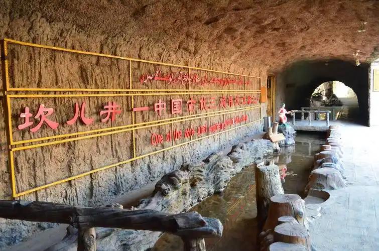
If you are already committed to southern Xinjiang, schedule the dustiest days for indoor or shorter activities: museums, bazaars, tea houses, and covered karez sites. A dust day can be a good day to visit the ancient irrigation tunnels in Turpan rather than a wide-open desert viewpoint.
What to pack for dust season
A proper mask beats a souvenir scarf. I bring a KN95 or equivalent for dust days, plus preservative-free eye drops and a small bottle of saline nasal spray. Camera gear needs extra protection: a blower brush, lens cloths, and a rain cover work better than a plastic bag in wind. Sunglasses with a close wrap help keep grit out of your eyes.
Skin gets dry and irritated quickly. Lip balm and a thin moisturiser go further than you expect. The seasonal packing list has the full kit I carry on spring trips.
Health tips: do not tough it out
Dust is not just an inconvenience. High PM10 can trigger asthma, sinus issues, and eye infections. Children, older travellers, and anyone with respiratory conditions should limit outdoor activity during orange or red warnings. I always keep a stash of bottled water in the hotel room because tap water taste changes when dust settles into open storage tanks.
If you develop a persistent cough or sore eyes, local pharmacies in Urumqi, Kashgar, and Korla are well stocked, but language can be a barrier. The health and medical guide explains what to ask for and how to describe symptoms.
Sample 10-day spring itinerary with dust contingencies
Here is how I would build an April trip that absorbs two or three dusty days without collapsing the schedule.
- Days 1–2: Urumqi. Use as a buffer and weather-check hub.
- Days 3–4: Turpan. Visit karez systems, ancient cities, and markets. If dust arrives, move indoors.
- Days 5–6: Kashgar. Old City and bazaars are mostly sheltered; keep the Pamir Highway flexible.
- Day 7: Optional Hotan. Only lock in if the forecast is clear for 48 hours.
- Days 8–9: Fly or drive north to Yining or Altay as a clean-air escape.
- Day 10: Return via Urumqi.
This loop accepts delays rather than fighting them. For more on the shoulder-season trade-offs, see the April and November off-season guide.
FAQ
Is it safe to visit Xinjiang during sandstorm season?
Yes, with planning. Most dust events are floating haze, not dangerous storms. Stay indoors during warnings, carry a mask, and keep your itinerary flexible.
Which city in Xinjiang has the most dust days?
Hotan and Minfeng in the southern Tarim Basin record the highest number of dust days, often over 150 per year.
Can you still drive the Tarim Desert Highway in spring?
You can, but check the forecast before setting out. Morning departures are usually calmer than afternoons, and fuel stops should be planned.
Do sandstorms reach Urumqi?
Occasionally, but Urumqi is far less affected than southern cities. When it is hit, the event is usually milder and shorter.
What month should I avoid in southern Xinjiang?
April has the highest dust frequency. If dust is a serious concern, travel in late October or November instead.
Disclaimer
This article reflects personal travel experience and publicly available meteorological guidance. Dust forecasts change quickly. Always check current official warnings from the China Meteorological Administration and your airline or ground operator before travelling.
About the author
Karl Huang has travelled through Xinjiang on multiple spring, summer, and autumn trips since 2017. He writes practical destination guides based on first-hand route research, local transport experience, and up-to-date weather data.