Published: July 21, 2026 | Author: Liam Foster
Planning routes around Xinjiang hiking trails can feel overwhelming at first. The region spans the Tianshan, the Altai, and the Pamir, and each range has its own season, permit rules, and terrain. This guide pulls together what I have learned on foot over four summers so you can pick a walk that matches your fitness and the time you have. Prefer wheels to boots? Several of these same valleys link up into a long-distance ride, which we mapped out in our Silk Road cycling route.
Why you can trust this Xinjiang hiking guide
I have spent the better part of four summers walking Xinjiang’s ranges, and the notes below come from those trips rather than a brochure. My first real multi-day trek was the Kalajun–Koksu loop in Ili back in June 2023, with a Kazakh guide named Askar who kept us on the right sheep track when the fog rolled in. Since then I have day-hiked above Tianchi, walked the ridgeline near Koktokay, and made two attempts at the Muztagh Ata glacier trail on the Pamir. I am not a mountaineer, just someone who likes a long day on foot and learned the hard way what to pack. Where I quote rules or prices, they come from my own visits or signage I photographed. Treat them as a starting point and confirm locally, because things change.
Xinjiang hiking trails at a glance
| Trail / Area | Region | Difficulty | Best months | Approx. altitude |
|---|---|---|---|---|
| Kalajun–Koksu grassland | Ili (Tianshan) | Moderate | Jun, Sep | 2,000–2,600 m |
| Tianchi back-mountain | Urumqi (Tianshan) | Easy–Moderate | Jun–Sep | 1,910–2,800 m |
| Tianshan Grand Canyon (Banfanggou) | Urumqi | Moderate | Jun–Oct | 1,500–2,400 m |
| Koktokay granite peaks | Altay | Moderate | Jul–Sep | 1,200–1,800 m |
| Karakul–Muztagh Ata glacier | Pamir (Tashkurgan) | Hard | Jun–Sep | 3,600–4,500 m |
My experience on the Kalajun meadows
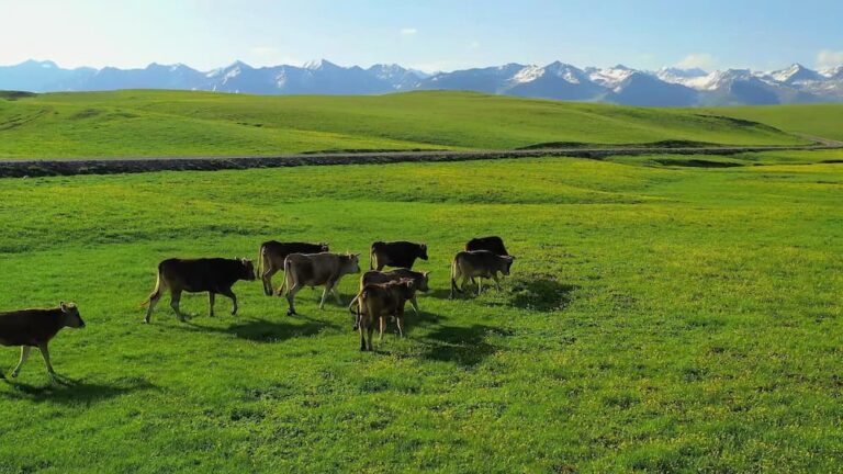
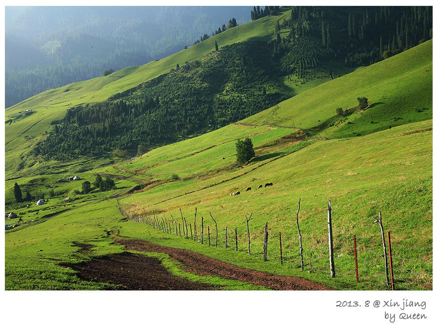
The morning we set out from the Kalajun cable-car top, the grass was still wet and the air smelled of wild thyme. Askar told me to watch the curve of the hill. Locals call it the “human-body grassland” because from the falcon-watching terrace the slope looks like a reclining figure. We walked the planked path toward the Koksu River, about 14 km that day, and camped on a flat above the water where a herder’s yurt smoked in the distance. At dusk the temperature dropped fast, and I was glad for the thermal layer I had been told to bring. The next morning a Kyrgyz family invited us for milk tea before we crossed the river on horseback. That slow, social style of walking is what I remember more than any summit.
How to get to the trailheads
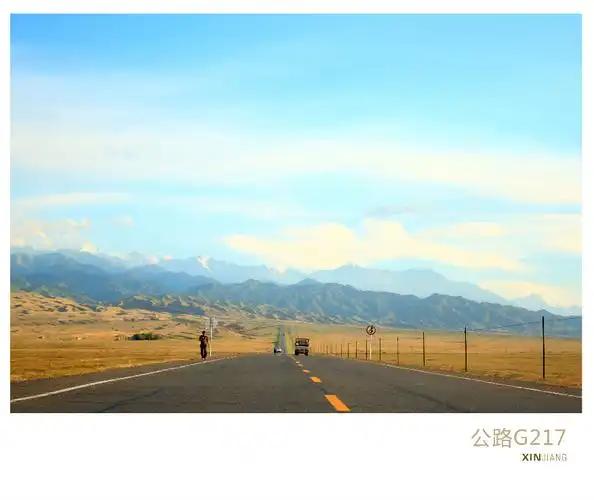
Most Xinjiang hiking starts from a city you can reach by air or train. Urumqi is the hub. Tianchi is about 90 minutes by bus or hired car northeast of the city, and the Tianshan Grand Canyon scenic area (Banfanggou) sits roughly 20 km further along the same road. For the Ili grasslands, fly to Yining. The high-speed rail network also reaches Yining from Urumqi in around 10 to 11 hours if you would rather watch the landscape roll by. Kalajun is a 2.5-hour drive south from Yining. The Pamir trails need a flight or long drive to Kashgar, then the G314 highway south to Tashkurgan. That road itself is half the adventure, and the Tianshan Grand Canyon guide has the details on the Urumqi-side walks.
Xinjiang hiking trails: best time to go
Timing matters more than gear here. The Ili meadows turn green and flower-filled in late May and June, then go golden again in September. July and August are fine up high, but the low valleys get hot and the occasional afternoon thunderstorm rolls in. The Pamir is a short window, roughly June through September, because snow blocks the higher trails the rest of the year and the border road can close in winter. Altay (Koktokay) is strictly a July-to-September walk. I avoid the national holidays in early October. The scenic areas fill with domestic crowds then, and the quiet I came for disappears.
Where to sleep
On marked scenic-area trails you usually stay in park lodges or yurts run by local families. On the Kalajun loop we slept in a rented yurt one night (around 80 to 120 yuan a head with dinner) and a tent the next. Bring your own sleeping bag even if you book a yurt, because the felt walls do not hold much heat after dark. Around Tianchi and Koktokay there are proper hotels at the base. On the Pamir, Tashkurgan has decent guesthouses and Karakul Lake has summer yurt camps, but they close once it snows. I have never had trouble finding a bed in season. The trick is booking the night before, because mobile signal fades fast once you leave town.
What to eat on the trail
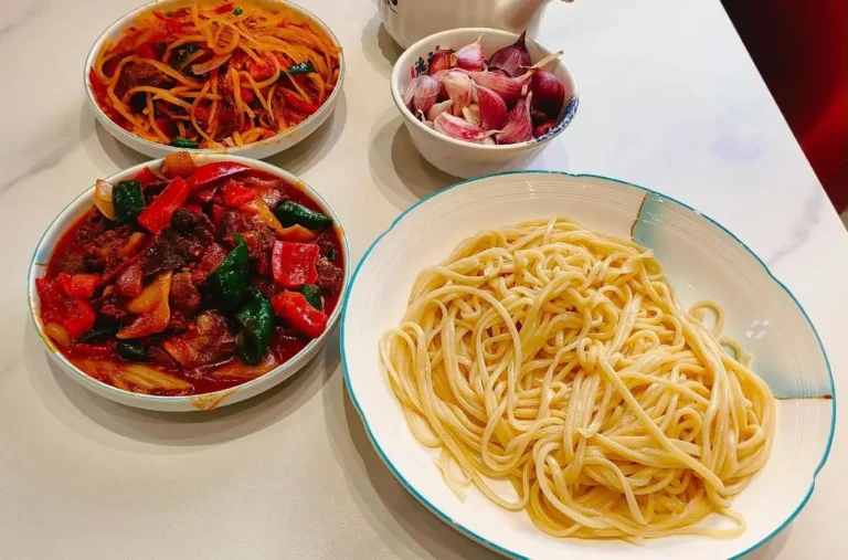
Carry more water and snacks than you think you will need. On the Kalajun and Pamir walks, herders sell laghman (hand-pulled noodles) and shorpa (mutton soup) at their yurts for roughly 25 to 40 yuan a bowl, and the milk tea is usually free if you are a guest. I pack naan, dried apricots, and walnuts from the Urumqi bazaar as backup. Above 3,500 m your appetite drops, so salty, calorie-dense food helps. One lesson from the Pamir: do not count on buying anything once you pass the last village. The Karakul campsite shop sold out of everything by mid-afternoon.
Practical tips before you lace up
- Altitude is the real constraint on the Pamir. If you have never been above 3,000 m, read up on altitude sickness prevention and plan a night in Tashkurgan (about 3,100 m) to adjust before the glacier walk.
- Offline maps: Gaode (Amap) works in towns but often blanks out on the open grassland. I download Maps.me regions before leaving Wi-Fi.
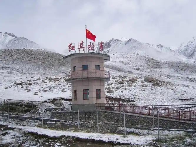
- The Pamir is a border zone. You need the border permit (边境管理区通行证), which most travelers get through their Kashgar hotel or the local PSB. Without it, the G314 checkpoint south of Bulunkou will turn you back.
- Layers beat bulk. A 20°C swing between noon and night is normal. Sunscreen and a brimmed hat are non-negotiable. The UV at altitude burned my ears on day one.
- Trekking poles saved my knees on the Koksu descent. If you are doing the glacier trail, ask a local guide. The crevasse fields are no place to navigate alone.
A six-day Tianshan-to-Pamir sampler
Day 1: Fly into Urumqi, sort gear, sleep low.
Day 2: Tianchi lakeside and the back-mountain trail (easy day hike, about 12 km), back to Urumqi.
Day 3: Morning flight to Yining, transfer to Kalajun, short meadow walk to acclimatize.
Day 4: Full Kalajun–Koksu trek (about 14 km), camp or yurt stay.
Day 5: Fly Yining to Kashgar, drive south on the G314 to Tashkurgan, overnight.
Day 6: Karakul Lake to Muztagh Ata glacier viewpoint day hike (about 10 km), return to Kashgar.
This is a lot of moving in a week, so cut a day if you would rather linger. The Tianchi guide and the Koktokay write-up have more on those two stops, and the Karakul Lake page covers the Pamir side in detail.
Frequently asked questions
Do I need a guide for Xinjiang hiking trails?
For marked scenic-area loops, no. You can follow the signs. For backcountry routes like the full Kalajun–Koksu or the Muztagh Ata glacier, a local guide is strongly recommended and often required for permits and safety.
Is the altitude dangerous?
The Tianshan walks stay below 3,000 m and are fine for most people. The Pamir glacier trail starts at 3,600 m and climbs higher, so take acclimatization seriously and watch for headache or nausea.
Can I camp wherever I like?
Not really. Scenic areas have designated sites, and the Pamir is restricted. Wild camping is tolerated on some grassland routes if you leave no trace and register with your guide, but never near a border checkpoint.
What is the one thing you would pack again?
A lightweight down jacket. It weighs nothing and turned three cold evenings into comfortable ones.
Are there bears or dangerous animals?
Wolves and the occasional brown bear live in the remote ranges, but they avoid people. The bigger risk is weather and getting lost, not wildlife.
Disclaimer
This guide reflects personal visits between 2021 and 2025 and is for planning only. Trail access, permits, prices, and weather change without notice. The Pamir is a regulated border region. Always carry valid ID and the required border permit, and confirm current rules with local authorities or a licensed operator before you set out. Nothing here is professional mountaineering advice. For technical climbs, hire a certified guide.
About the author
Liam Foster is a travel writer who has spent four hiking seasons in Xinjiang, from the Ili meadows to the Pamir glaciers. He prefers slow, locally-guided walks and writes practical, first-hand guides for the Xinjiang Attractions site. When not on a trail, he is usually arguing with his map app in a Urumqi guesthouse.