By Karl Huang · Last updated 25 August 2026 · Field-checked on a July 2024 drive along the S101
Most travellers who ask about Kangjiashimenzi petroglyphs have never heard the name before they land in Xinjiang. I hadn’t either, until a retired archaeology lecturer in Urumqi drew a rough map on a napkin and told me to skip the crowded lake tours for one morning. He was right. These carvings, scratched into a red sandstone cliff in the Tianshan range above Hutubi County, are the oldest large-scale rock art in Xinjiang, and almost nobody outside the province knows they exist. This guide is the one I wish I’d had before I went: how to reach the site, what you’ll actually see, and the small mistakes that cost me an hour of backtracking.
Kangjiashimenzi petroglyphs at a glance
| Detail | What to expect |
|---|---|
| Location | Hutubi County, Changji Hui Autonomous Prefecture, northern slope of the Tianshan |
| Distance from Urumqi | About 75 km to the cliff; roughly 2.5–3 hours by car via the S101 |
| Age | Scholars date the main panel to roughly 3,000 years ago (late Bronze–early Iron Age) |
| Scale | Over 300 figures on a cliff face about 14 m wide and 9 m tall |
| Entrance | Modest ticket, around 20 RMB; site opens approximately 10:00–20:00 in season |
| Best months | June to August, when the mountain pass road is clear and the light is workable |
| Signal | Weak to none along the S101; download offline maps before you leave the city |
What I found on the cliff
I arrived mid-morning after an early start from Urumqi, fuelled by a stop at the Urumqi International Bazaar the evening before to buy water and dried apricots. The approach road climbs steadily into the Tianshan, and the last stretch is unpaved in places. When the cliff finally appeared, it wasn’t the dramatic canyon I’d imagined. It’s a long, weathered wall of reddish sandstone, and the carvings sit high enough that you read them as a kind of frozen crowd.
The figures are mostly human, and they are unmistakably about fertility: rows of figures with exaggerated limbs, the largest around two metres tall, the smallest no bigger than a hand. There are also smaller animals, and a few ambiguous shapes that archaeologists still argue about. What struck me was the organisation. This isn’t random graffiti; it’s a composed scene repeated across the rock, which is why researchers read it as a ritual site tied to birth and abundance rather than a casual marking.
The story the carvings tell
Stand close enough and a pattern emerges. At the centre of the panel is a tall male figure, clearly the focal point, surrounded by rows of smaller figures with raised arms. Many of the women are shown with children, and the repeated motif of a large figure flanked by smaller ones reads, to most scholars who’ve published on the site, as an invocation for healthy offspring and plentiful herds. This is not unique to Xinjiang. Fertility rock art turns up across Inner Asia, but the scale and preservation here are unusual. The carvers worked the soft sandstone with stone tools, pecking rather than cutting, which is why the lines are shallow and the relief is low. After three thousand years of freeze-thaw, some figures have faded into the rock, and the site’s keepers keep visitors behind a barrier precisely so the remaining detail survives.
How the site was found and protected
The cliff was recorded systematically in 1987, when a team from the Xinjiang Institute of Archaeology surveyed the area. Before that, local herders knew the “picture stone” but it had no formal study. Once its age and significance were established, the site was placed under state protection, and in 2013 it was listed among the nationally protected cultural relics of China. For a visitor that means two practical things: there is a ticket office and a viewing platform, but there is also a real prohibition on touching or tracing the rock. The protection status is why you’ll see a fence and a caretaker rather than an open hillside you can wander freely.
Getting to Kangjiashimenzi
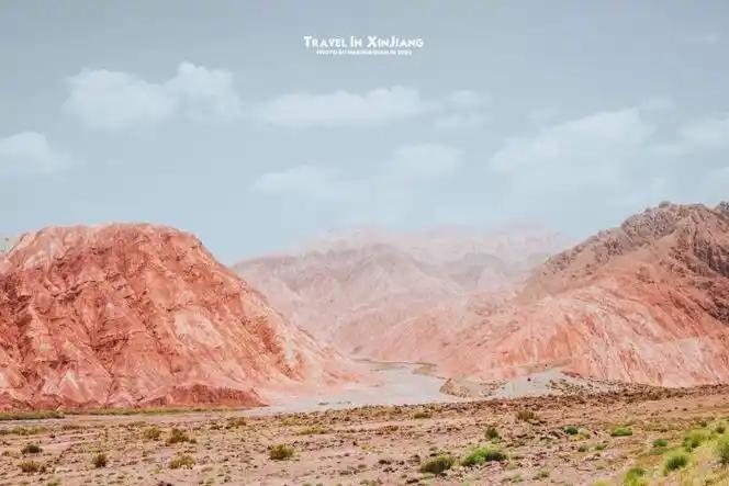
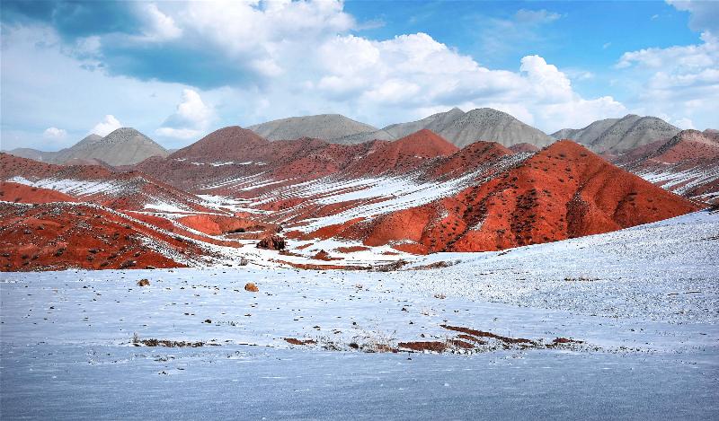
There is no train to the cliff and no tour bus I’d trust to show up on time. Self-driving or hiring a car from Urumqi is the realistic option. Take the G216 north, then branch onto the S101, the old “national defence” highway that runs along the northern Tianshan and is itself a worthwhile drive for the danxia formations. A 4G signal drops out for long stretches, so load the route on an offline map app before you leave. I also carried a paper note of the county name in Chinese (呼图壁县 康家石门子), which helped when I needed to ask a road worker for the final turn.
If you’re building a longer northern Xinjiang loop, the site pairs well with a stop in Hutubi itself. The county seat is a low-key farm town with good noodle shops and a relaxed pace that’s a relief after Urumqi’s traffic.
Best time to go
July and August are the safe window. Snow can close the higher sections of the S101 well into late spring, and autumn brings cold nights that make the exposed cliff uncomfortable. I went in early July and the weather was warm but not punishing; the only drawback was the midday glare on the red rock, which flattened the carvings. Morning light, before about 11:00, gave me the clearest photographs. If you’re serious about shooting the panel, check the local sunrise and sunset times and plan to arrive as the sun clears the ridge.
Where to stay
There’s no lodge at the site. The practical base is Urumqi (2.5–3 hours away), where you’ll find the full range of hotels and the airport. Hutubi town has a few basic hotels if you’d rather cut the drive short and start early. I stayed in Urumqi and treated the petroglyphs as a long day trip, which left energy for the bazaar and a proper laghman dinner afterwards.
Food on the route
Pack your own water and snacks. There are no stalls at the cliff, and the nearest reliable food is back in Hutubi or Urumqi. On the drive I relied on dates, sunflower seeds, and the apricots I’d bought the night before. In Hutubi, look for ban mian (board-pressed noodles) and freshly baked nang; both are cheap, filling, and far better than anything you’ll find at a highway service area. In summer, roadside stalls near Hutubi sell melons and cherries, and a trusted vendor is worth a stop on the drive back.
Practical tips that saved me time
- Download offline maps. The S101 kills your signal. I lost navigation twice and had to reverse to a junction I recognised.
- Bring cash. The ticket window may not take foreign cards, and there’s no ATM nearby.
- Wear real shoes. The path to the viewing area is loose gravel and scree; trainers with a thin sole will tire you fast.
- Respect the rock. Don’t chalk, trace, or climb the panel. The site is protected, and a few careless visitors have already damaged less-known carvings elsewhere in the region.
- Carry ID. Remote Tianshan roads carry checkpoints. Keep your passport or residence permit handy. See our note on Xinjiang checkpoints and ID checks so nothing catches you off guard.
A half-day sample itinerary
07:30: Leave Urumqi with a full fuel tank and downloaded maps.
09:00: Brief stop in Hutubi for breakfast noodles.
10:00: Arrive at the cliff; walk to the viewing platform while light is good.
11:30: Drive a short stretch of the S101 danxia road for photos.
13:00: Lunch back in Hutubi, then return to Urumqi by mid-afternoon.
Frequently asked questions
Are the Kangjiashimenzi petroglyphs real and old?
Yes. The site was formally recorded by the Xinjiang Institute of Archaeology in 1987 and is listed as a major protected cultural relic. The carvings are genuinely ancient, not a modern recreation, and the cliff is fenced and monitored.
Can I touch the carvings?
No. The panel is behind a barrier and is a protected monument. Viewing is from a set distance; bring a zoom lens if you want detail shots.
Is it worth the drive from Urumqi?
If you’re interested in prehistoric art, Xinjiang rock art, or just want a quiet Tianshan morning away from the tour buses, yes. If you only have two days and have never seen Kashgar or the big lakes, prioritise those first.
How does this relate to the Silk Road?
The petroglyphs pre-date the Silk Road by more than a millennium, but they sit in the same cultural landscape. For the longer arc of the region’s past, our Silk Road history timeline fills in what came after the carvers.
A note on accuracy
Dates, distances, and ticket information in this article come from on-site observation and publicly available heritage records. Opening hours, road conditions on the S101, and entrance fees change, and the mountain weather can close the pass without warning. Treat the practical details as a starting point, confirm them locally before you travel, and don’t rely on this guide alone for safety decisions in remote terrain.
About the author
Karl Huang is a Xinjiang-based travel writer who has driven most of the northern Tianshan back roads over the past five years. He prefers slow, first-person reporting to resort summaries and revisits sites when conditions change. His work focuses on the places that don’t make the standard brochures.