Published: September 9, 2026 | Author: Karl Huang | Category: Xinjiang Cities
Most guidebooks skip Hutubi Xinjiang on the way from Urumqi to Shihezi, and the G30 gives you no reason to second-guess that. I drove past the exit three times before I turned off, and the third time was the charm: a 258-km county running from 5,290 m of Tianshan ice down to 360 m of Gurbantunggut dune, with one of China’s largest underground gas stores under the wheat, the only state-level nursery market in the northwest, and a 3,000-year-old rock carving 75 km up a mountain road. This Hutubi Xinjiang guide comes from four trips in different seasons, cross-checked against the county’s own numbers, the Baidu entries for 呼图壁县 and 呼图壁站, the 2024 and 2025 statistical communiques, and a long evening with a herder in Shitizi who set me straight on the grass.
Hutubi Xinjiang in one table: the numbers behind the name
A few figures I re-checked against the county’s official releases and the national statistics:
| Item | Detail |
|---|---|
| Name | 呼图壁, from Mongolian 胡图克拜, ‘auspicious’; English Hutubi, sometimes transliterated as Kutubi |
| Prefecture | Changji Hui Autonomous Prefecture, Xinjiang |
| Area | 9,516.67 sq km: 31.6% mountains, 43.2% plains, 25.2% desert |
| Shape | 258 km N–S by 52 km E–W, the longest single strip of county land in the Changji corridor |
| People | 207,000 (mid-2025), 25 ethnic groups; six towns and one township (石梯子哈萨克族乡), plus three XPCC farms |
| County seat | Hutubi town, 锦华大道33号, 68 km from central Urumqi on the expressway |
| Main river | 呼图壁河, 258 km, 4.6 bn cu m annual runoff, fed by 239 glaciers above 3,140 m |
| Second river | 雀尔沟河 (军塘湖河), 86 km, 324.5 m cu m, joins at 军塘湖 |
| Climate | Continental semi-arid; plains average 6.7°C, plain precipitation 167 mm, mountain precipitation 289.8 mm |
| Forest cover | 16.93% county-wide; urban green coverage above 40% |
| Transport | 312国道, G30 连霍高速, 兰新铁路 (passes, no scheduled passenger stops), 201省道 south to S101 |
| Famous ‘three zi’ | 奶子 (Xinjiang’s largest milk base), 苗子 (only state-level nursery market in NW), 曲子 (a Qing-era ballad form) |
| Under the ground | 呼图壁储气库, China’s largest underground gas storage, 10.7 bn cu m working capacity |
| Best months | May to early June, then mid-September to mid-October |
| From the airport | 30 min drive to Urumqi’s Tianshan International Airport, 60 min to the international rail freight centre |
A 258-kilometre county, from ice field to dune
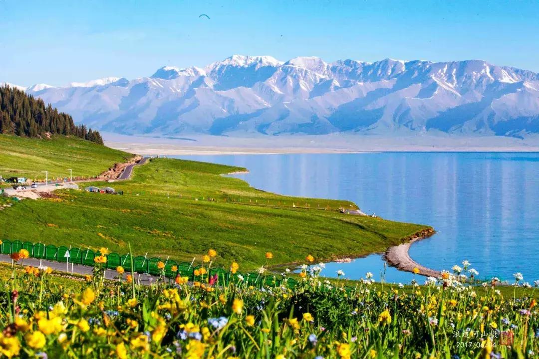
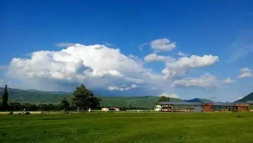
The county is shaped like a ribbon, 258 km end to end, the elevation running almost the full vertical span of northern Xinjiang. The southern border sits on the Tianshan crest above 5,000 m for most of its length, with 239 glaciers above 3,140 m storing 21.18 bn cu m of ice. The middle band is 4,058 sq km of irrigated cotton, wheat and seed-maize. The northern third is Gurbantunggut desert, ground flattening at 360 m. South to north in one county is a study in microclimates: spruce and snow at 3,500 m in late May, dry-farmed wheat at 800 m, desert at 400 m. Cross-province drivers who only see the expressway section have no idea any of this exists; the wider belt is in our Changji guide.
Milk, saplings and Quzi opera: what the county actually sells
Stop for ten minutes at the highway service area west of the county exit and Hutubi introduces itself. The slogans in the parking lot, the milk cartons and the local TV weather all use the same three characters: 奶子, 苗子, 曲子. Three industries, three audiences. The 奶子 piece: the 呼图壁种牛场 has run a Simmental breeding operation here since 1955, earning twenty consecutive national high-yield dairy awards. 西域春, the brand on supermarket milk in Urumqi, is bottled at the county plant. The 苗子 piece: 呼图壁 runs the only state-level nursery market in the northwest, with a 50-km belt of planted saplings lining the highway. By 2025 annual sales were around 150 million saplings and 1 bn yuan, to all 87 counties of Xinjiang and 12 other provinces, plus exports to Kazakhstan. The 曲子 piece is a Qing-era ballad form brought by Hunan garrison soldiers, still sung by village troupes and the centre of an annual Xinjiang Quzi festival in 呼图壁. A November trip timed to the festival is one of the more curious things in the prefecture.
The wheat field that sits above China’s biggest gas store
Drive fifteen minutes south toward 大丰镇 and the wheat fields around you sit on top of 10.7 bn cu m of working gas storage, China’s largest underground gas facility. Developed from a depleted gas reservoir in the 2010s and part of the West-East gas pipeline, it cycles gas in summer and out in winter, with a daily handling capacity of 30 m cu m, enough to back up a winter week for a province-sized grid. Visible infrastructure is muted, just wellheads and a flare stack; the rest is under farmland. The county’s winter air-quality bonus is partly because so much of the gas other prefectures burn was once stored under your hire car. The brief lists the 储气库 as the single biggest industrial asset.
A bus stop, a defunct station, a brand-new motorway: getting in and out
No passenger train has called at Hutubi station since the early 2010s; the 兰新铁路 still cuts through the county and the station is 4 km from the seat, but the platform is freight-only. From Urumqi’s 北郊客运站, a 呼图壁 shuttle runs every 30 to 60 minutes 08:00 to 20:00, the 76 km in 75 to 100 minutes, fares 25 to 30 yuan. Self-driving: exit the 连霍高速 at 呼图壁 (3,650 km mark from Lianyungang), follow the county road 7 km into town, and the trip from central Urumqi runs about 75 minutes outside rush hour. If you want to come by train, ride to Shihezi (next station west with regular stops) and continue by bus; a planned 乌鲁木齐-奎屯 high-speed line (250 km/h, feasibility in 2025) will add a station here.
The three faces of the month: when the Tianshan and the plain line up
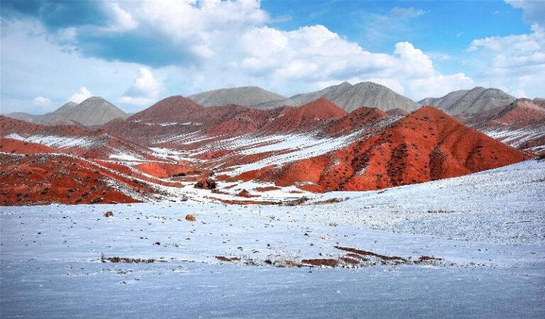
The county surprises by season. May to early June: snow on the 4,000-metre ridges, meltwater high, flower flush along S101, the 百里丹霞 ridges warm, the road in still quiet. July and August are the heat, plain daytime often above 38°C, the southern valleys cool enough for overnighting. September and October are the harvest and the photographic window: cotton and dairy at peak, mountain ash and birch turning along S101. November to February is the cold window, record low -36.7°C (25 December 1984), a typical December night around -15°C. Snow on the 百里丹霞 is what my winter photo is from. March, April, November and December are the dust-prone months.
Where to actually sleep in a place no one stops in
Hotels within walking distance of 锦华大道 and the bus station run 130 to 280 yuan for a clean double in 2026, the better places (西域春宾馆, 锦华大酒店, 呼图壁迎宾馆) 180 to 280, the chains (Hanting, 7 Days) below 200. International apps list the bigger hotels but inventory is small, so call ahead. No guesthouse or hostel scene. For the southern road, the only in-county options are the 翁巴郎驿站 and 赤壁天湖驿站 along S101, both simple rest houses with hot water, a 炕 bed, a shared meal and a sky of stars; the same驿站 is the closest pre-dawn start for the petroglyphs.
Eating like the locals: dairy first, then noodles
Two rules. Drink the milk: 西域春 is processed in town, and the fresh milk and yoghurt sold in any small shop is the same batch that goes to Urumqi’s supermarkets, the plain yoghurt at 7 yuan a litre one of those small Xinjiang things you cannot get outside the county. Eat the noodles: the local 呼图壁拌面 is hand-pulled and tossed with diced tomato, green pepper, garlic shoots and a thin layer of lamb fat, 18 to 28 yuan. Round out with 馕 from the bakery on 西市路, a skewer of 红柳烤肉 (5 to 8 yuan) and a small plate of 凉皮 (8 to 12 yuan). For breakfast, 油茶 and 烤包子, the 烤包子 usually sold out by 09:30. Restaurants do not run English menus; see our Shihezi on foot guide for more on the Changji food scene.
South on S101: the 百里丹霞 stops without the traffic
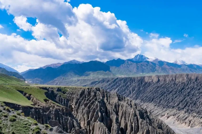
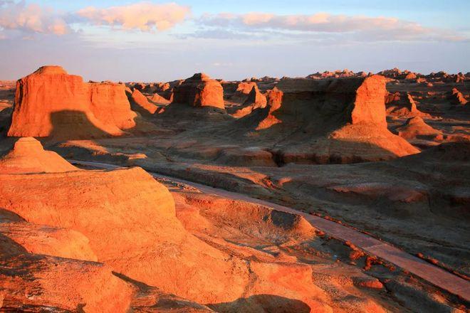
S101 pulls it together. The road runs 146 km from 昌吉市硫磺沟 to 玛纳斯县肯斯瓦特水库, the southern half crossing Hutubi county. The 百里丹霞 is a 146-km belt of red Jurassic sandstone across three counties, about a third in Hutubi. A chain of five tourist驿站 runs along the Hutubi stretch, 七彩天山, 赤壁天湖, 翁巴郎, 江山多娇 and 锦绣河山, each with a paved car park, a viewing platform and a basic canteen. 赤壁天湖驿站 sits inside the 石门水库 gorge, where the 呼图壁河 has cut a 30-metre channel through red sandstone; 江山多娇驿站 is the panoramic Danxia overlook, the best single view of the layered ridges. The road is sealed but winding and narrow; allow a full day, start 08:00, be off S101 by sunset, and fill the tank the night before, since the驿站 are not fuel stops.
Kangjiashimenzi and the cliff that took 3,000 years to carve
Most visitors cite the 75-km drive south to 康家石门子岩画 as the reason to turn off the expressway. The carvings sit on a Jurassic sandstone cliff 10 m above a dry stream bed, in the 百里丹霞 belt, around 1,500 m elevation, chipped by Saka people in the late first millennium BC. The main panel is 14 m wide and 9 m high, with around 300 human figures, mostly women, several with explicit sexual imagery, dating anchored at about 3,000 years old, confirmed in the late 1980s by the joint Sino-Japanese expedition. The site is on the seventh batch of national key cultural relic protection units (2013). Tickets are 20 yuan for adults, 40 for a couple, opening hours 10:00 to 20:00 in summer, the cliff walk about 20 minutes on a graded path. The cliff is in active erosion, half the panel unreadable, accessed by a 10-metre ladder bridge; the road is shared with S101驿站 traffic, so the same drive that takes you to 江山多娇 takes you to the carvings. Pair with a Shawan detour if continuing west.
The Kazakh south: Shitizi and Queergou
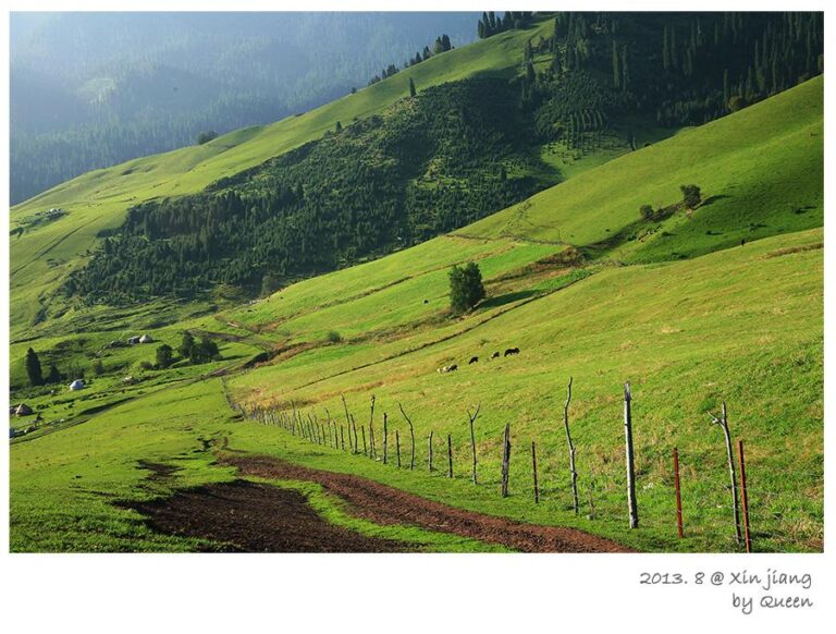
S101’s upper stretches are mostly Kazakh, and 石梯子哈萨克族乡 is one of two officially designated Kazakh townships in the prefecture, centred on a single ridge. In summer the grasslands above 1,800 m fill with yurts, horses and small flocks, and the herders run a quiet homestay circuit. In winter the same land is cold-season pasture, the snowline low enough to close the S101 pass to ordinary cars. Neighbouring 雀尔沟镇 covers the upper 呼图壁河 watershed and the 纳扎尔古墓群, late-medieval Kazakh burial mounds reachable by 4WD in dry weather. With a Chinese phone number and a couple of days, a family stay in 石梯子 is the most memorable thing here.
Honglian Shan and the three gardens at the county seat
Honglian Shan (红莲山) is a 954-metre red sandstone ridge 36 km south of town, off the 312国道 near 大丰镇, part of the 霍尔古斯断裂带 used to study active faulting. The ridge has ten named formations, a small 观音寺 and a half-hour loop, a good 90-minute morning stop. In town, 世纪园, 如意园 and 锦华园 are the three park cores of the county’s 50-km green corridor; 世纪园 is the largest, with the 锦华大道 axis running through it. Both 4G and 5G cover the seat; coverage drops to 4G-only inside 百里丹霞.
Two ways to spend eight hours off the expressway
Two short itineraries, both starting from the 呼图壁 exit. Option A, a day on the 百里丹霞 with the petroglyphs: 08:00 leave the county seat; 09:00 enter S101 at the 七彩天山 turn-off; 10:30 walk the 赤壁天湖 platform; 12:00 lunch at 翁巴郎驿站; 13:30 see the 江山多娇 panorama; 15:00 reach Kangjiashimenzi; 16:30 back on S101; 18:00 dinner in town. Option B, a slow county-town morning: 08:00 油茶 and 烤包子 on 西市路; 09:30 walk 世纪园; 11:00 呼图壁储气库 exhibition hall (advance booking, free); 12:30 拌面 lunch; 14:00 drive to Honglian Shan, 90 minutes up and back; 16:30 milk-and-noodle shop; 18:00 G30 back to Urumqi. The two routes combine in a long day; a relaxed county morning plus a Danxia afternoon is my preferred mix.
Frequently asked questions
Is Hutubi Xinjiang worth stopping at? With a hire car, yes, the 百里丹霞 alone justifies the detour. How far from Urumqi? 68 to 76 km by expressway. Petroglyphs in winter? The cliff is open year-round but S101 access is restricted by snow. Is there a passenger train? No, since the early 2010s; nearest passenger stations with regular stops are Shihezi west and Urumqi east. Best month for the Danxia? Late September to mid-October, for light and colour. Drones at the petroglyphs? National protected unit, permit needed from the county culture and tourism bureau, application takes a working week. Visit the 储气库? Indirectly; the bureau runs occasional open days, otherwise you only see surface infrastructure from the public road.
Disclaimer
Verified against the 呼图壁县人民政府 gazette at htb.gov.cn, the Baidu entries for 呼图壁县 and 呼图壁站, the 2024 and 2025 county statistical communiques, the Changji tourism portal, and on-the-ground visits in 2024, 2025 and 2026. Timetables, road access, ticket prices, opening hours and the petrol-station status of the 百里丹霞驿站 change often. Always confirm via the county culture and tourism bureau before a long drive. The author has no commercial relationship with any business mentioned.
About the author
Karl Huang is a Xinjiang-based travel writer who has covered the northern prefecture belt for over a decade and lives in Urumqi. The Hutubi Xinjiang guide is part of his series on the small towns and roadside stops between Urumqi and the Ili border.