Published: September 29, 2026 | Author: Karl Huang
Most travelers meet the Tarim river Xinjiang by accident. They cross one of its bridges on the way to somewhere else, glance at a thin line of water between poplar trees, and keep driving. We did that in 2021, and it nagged at us for years. A river whose Uyghur name means roughly “unbridled horse”, one that knots together four mountain ranges and the driest desert on the continent, deserved more than a sidelong look.
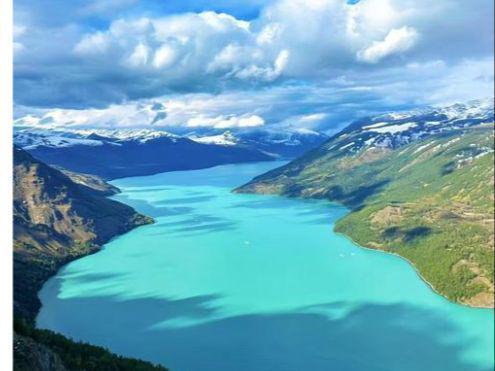
So in autumn 2024 we set aside nine days and followed it on purpose, from the jade headwaters off the Kunlun to the revived lake of Taitema that the river only reaches because engineers send water down deliberately. This is what we learned, including what did not go to plan.
Why we set out to follow the Tarim river Xinjiang
Guidebooks treat the Tarim as a geography fact, not a place to visit. That is half right. The “river” is a knot of glacier and snowmelt streams that lose themselves in the Taklamakan before any single channel reaches the end. What pulled us in was the contradiction: the Tarim is China’s longest inland river, yet in dry years you can stand on its lower bank and see no water at all.
We are not hydrologists, just two people who have driven the region’s southern half many times. Following the thread that links Hotan’s jade creeks, Korla’s pears, and the lonely reed lake at the map’s edge forced us to slow down, take the small roads, and ask locals where the water ran that season.
The Tarim river in Xinjiang, in brief
If you only remember a few numbers, these reframed the trip for us:
| Fact | Figure |
|---|---|
| Total length (sources to lake) | about 2,486 km; main stem from the confluence roughly 1,321 km |
| Where the main stem begins | Xiaojake, Awat County, where the Aksu, Yarkand and Hotan rivers meet |
| Where it ends | Taitema Lake, Ruoqiang County, via the Daxihaizi Reservoir |
| Who feeds it | Aksu ~72%, Hotan ~22.5%, Yarkand ~5.5% |
| The “four sources, one trunk” system | Hotan, Yarkand, Kashgar and Aksu rivers |
| Signature tree | Populus euphratica, the desert poplar (胡杨) |
| Best window to drive it | late September to mid-October |
The jade rivers: where the Tarim is born
The “jade rivers” are the two creeks that build the Hotan River, the southernmost source of the Tarim. The Yurungkash, or White Jade River, and the Karakash, the Black Jade River, both drop off the Kunlun northwest of Hotan city, and where they join, the Hotan River begins. For centuries those grey-green flows carried the nephrite boulders that made Hetian jade famous, and they still do, though commercial mining is now tightly restricted.
We spent a morning on the northern edge of Hotan watching the Yurungkash run low and opaque after storms. It is not a pretty river, just a working one, brown and pushy, and it is humbling to realize this modest current becomes the Tarim hundreds of kilometers north. Our longer notes on the Yurungkash River and Hotan jade cover where the stones come from and what a visitor can do there.
Our morning at the river’s official start
Maps say the Tarim begins at Xiaojake in Awat County, where the Aksu, Yarkand and Hotan rivers meet into one named channel. We drove there at a cold October dawn. No monument, just a bend in the land and a clutch of old poplars, a stretch of water that looks ordinary until you remember nothing upstream of this point is called the Tarim.
Awat is cotton and rice country, and its poplar groves are among the most cared-for because teams flood-irrigate them each autumn to keep old trees alive. Our piece on Xayar and Awat on the Tarim explains that work and the odd logic of a river town that tends trees like livestock.
How we traveled the river road
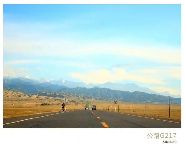
A practical word on movement. The Tarim is not a loop you ride by train. The spine is the G217 and G218 corridor along the basin’s edges, with the river wandering in the middle. We used a rented SUV, the only sane option for the lower reaches where buses are rare and ride-hailing does not exist.
For the upper and middle sections, rail is useful. Korla sits on the Southern Xinjiang Railway, an easy overnight from Urumqi, and Aksu and Aral both have stations. Flights land at Aksu (AKU), Korla (KRL) and Hotan (HTN), letting us skip long hauls and rent locally. South of Korla, toward Ruoqiang and Taitema, fuel and signal thin out, and carry your documents: the southern stretch sits inside sensitive border counties where checkpoints are normal.
Driving the green corridor north of the river
North of the channel runs a thin ribbon of life: Shaya, Xinhe and Aral, oasis towns pinned to the river like beads. This is the postcard Tarim, wide poplar belts and cotton fields, with the small-town calm that makes you slow the car without meaning to. Aral is the youngest city on the river, built on reclaimed land, and wears that newness openly.
We based there two nights as a launch point. Our guide to Aral, the youngest city on the Tarim covers the logistics. What we remember is the light near five in the evening, low and orange across the fields, with the river hidden behind a wall of trees you could hear but not see.
Korla and the midriver capital
Korla is the closest thing the Tarim has to a capital, the largest city on its banks and seat of the basin authority that decides where the water goes each season. We stopped for two reasons: the Korla fragrant pear, genuinely unlike any pear we have tasted, and the Peacock River branch slipping through the center.
Korla feels different from the oasis towns, a real city with traffic and a landscaped riverfront that disoriented us after days of empty road. We used it as our longest rest, resupplied, and booked the lower-river permits we needed farther south.
The poplar belt the river keeps alive
If the Tarim has one image the world knows, it is the golden poplar, Populus euphratica, that turns the banks to fire in October. The trees are not decoration. They are the river’s receipt, proof water reached this far, and where the channel shifts or dries, the groves thin within a season or two.
The Luntai section, northwest of Korla, holds the densest old-growth stand and is what most travelers aim for. We timed our pass for the second week of October and caught the canopy at its peak. Our walkthrough of the Luntai Tarim poplar forest covers entry points and the narrow window when the color holds. Arrive a week early or late and you find green or bare.
Crossing the river on the desert highways
Two roads that follow the Tarim also cross it, and the crossings are stranger than the river. The Tarim Desert Highway dives through the Taklamakan and bridges the channel near the middle, lined with watered poplars that keep sand off the asphalt. Driving it, you cross the river without quite seeing it, because the road beats the desert, not shows it.
We treated the highway as a crossing, not a destination; our notes on the Tarim Desert Highway explain the fuel rule that matters most: do not enter below half a tank, because the next pump can be hundreds of kilometers away. The windbreak you see is the same tree the river grows naturally, just planted in a line.
Reaching the end at Taitema Lake
The mouth surprised us most. Taitema Lake, in Ruoqiang County, was effectively dead by the 1970s, cut off when the lower channel was dammed. Since 2000, managed releases from the Daxihaizi Reservoir have been sent down on purpose, and the lake has returned in fits. On a windy afternoon we stood at a shallow, reed-fringed sheet that locals say was dust a generation ago.
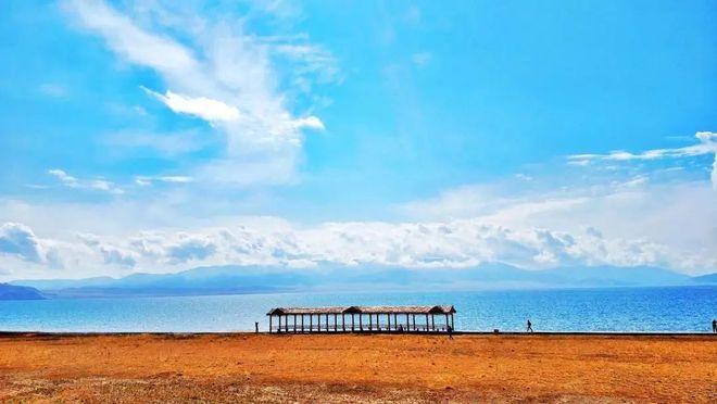
It is not a tourist site, no ticket office or boardwalk, often no other car. Our fuller account of Taitema Lake as the reborn end of the Tarim covers access from Ruoqiang and the honesty required: the lake’s size swings with each release, so what you see is a snapshot, not a fixed place.
When to time your drive along the Tarim
We would not do this in summer. The basin is among the hottest places in China, and the lower roads bake past comfort from June through August. The two windows that worked for us were late September to mid-October, when the poplars turn and the heat eases, and April to May, when the orchards around Korla blossom and the pears set.
Winter is possible and strikingly empty, but some southern access roads ice over and services thin. Whenever you go, watch the river’s own calendar over the tourist one: in dry years the lower channel carries little, and Taitema may be a wet patch rather than a lake. Ask in Ruoqiang before driving south.
Where we slept and what we ate
Sleeping is easy in the middle, hard at the ends. Korla and Aral have proper hotels; Hotan is well supplied. The southern approach to Taitema means basing in Ruoqiang and accepting basic rooms. We kept the car loaded and treated the oasis towns as real overnight stops.

Food was the easy pleasure. Around Bachu and Awat we ate reservoir roast fish cooked over coals, a local specialty tied to the river’s water. Korla gave us pears at a market stall, sweet enough to reset expectations. Elsewhere it was the dependable baseline: pilaf, naan, laghman noodles, and lamb kebabs. None of it fancy, all of it better for the driving that earned it.
What we wished we’d known before driving
A short, honest list from the hard parts. Fuel up whenever you can; the gaps south of Korla are long and the desert highway is unforgiving. Download offline maps before leaving the cities, because signal east of the river is patchy. Carry cash, since small oasis stops do not always take cards. Keep ID ready for checkpoints in the border counties, and do not photograph them.
The biggest surprise was the river’s own unreliability. In dry years whole middle sections run underground or not at all, so do not expect the blue line on the map to match the ground. Respect the fenced water-control and ecological zones; they exist because the system is still fragile. Bring more water and sun protection than feels necessary: shade is scarce and the distance real.
A five-day route we actually drove
If nine days is too much, here is the compressed version we would hand a friend. Day one, fly into Hotan and walk the Yurungkash edge. Day two, drive north to Awat, stand at the confluence, then push toward Aksu. Day three, reach Korla, see the Peacock River, eat pears. Day four, take the Luntai poplar forest and cross the desert highway. Day five, run south through Ruoqiang to Taitema and back. A hard five days, and you skip more than you see, but it traces the river’s whole logic from jade to end.
Questions people ask before driving the river
Is the Tarim one river or several? Both. One named channel from Awat to Taitema, built from four source rivers that behave differently each year.
Can you boat or raft it? Not as a visitor. The flow is shallow, interrupted, and in places dry, with large stretches inside managed or restricted zones.
Do I need a permit for Taitema Lake? The lake is open ground, but the southern counties around Ruoqiang are border areas with routine checkpoints. Carry ID, expect checks, and ask locally about any closed water-control sectors before driving in.
How long does a proper follow take? We used nine days and still skipped the Yarkand headwaters in the west; five days covers the spine, two weeks adds the Kashgar-side sources.
A few honest caveats
This is a travel account, not an official source. Distances, road conditions, checkpoint rules, and the size of Taitema Lake all shift year to year with water releases and local policy, so treat our numbers as a snapshot from autumn 2024. Before committing the southern drive, confirm current access in Ruoqiang and respect any closed ecological zones. We are travelers who got lucky with timing, not hydrologists, and the river will not apologize if you arrive in a dry year.
About the writer
Karl Huang is a Xinjiang-based travel writer who has driven the southern Tarim corridor twice, once by accident and once on purpose. He contributes route notes and first-hand accounts to Xinjiang Attractions, focusing on places that reward slowing down. He is not a geologist, and where the science matters he points to primary sources rather than guessing.