Published: November 7, 2026 | Author: Karl Huang
Most travellers blow through Toksun County at 100 kilometres an hour on the G30, eyes on the Flaming Mountains ahead or the Turpan grapes beyond, and never register that the town they just passed is one of the windiest, driest, and most strategically placed counties in all of Xinjiang. I have stopped there a dozen times over six years, usually because a spring gust closed the highway and gave me no choice, and each stop taught me something the road signs do not say. This is a Toksun County travel guide written from those unscripted hours, not from a brochure.
Why Toksun County sits where three Xinjiang regions meet
Toksun sits on the western floor of the Turpan Basin, at the foot of the red wall of the Flaming Mountains, and that location is the whole story. The basin narrows here into a natural funnel where North, South, and East Xinjiang come together. Go north and you reach Urumqi in about 160 kilometres. Go east and you are in the Gaochang district of Turpan within 50. Go south and the road drops toward Korla, roughly 300 kilometres away across the Taklamakan’s northern edge. The county is the hinge.
That hinge role is not new. Toksun was a posting station on the northern Silk Road, and the geography that made it useful two thousand years ago is the same geography that now funnels the G30 expressway, the G312 and G314 national roads, and both the Lanxin and Southern Xinjiang railways through its territory. It is a place you pass through on the way to somewhere else, and that is the point.
The numbers that define Toksun County
| Fact | Detail |
|---|---|
| Full name | Toksun County (Toksun), Turpan Prefecture |
| Area | About 16,600 km2 |
| Population | About 136,000 (2024) |
| County seat elevation | Near zero metres, on the basin floor |
| Annual rainfall | About 5.7 mm |
| Wind | Average ~8 m/s; ~209 days a year good for wind power |
| Main routes | G30, G312, G314, Lanxin and Southern Xinjiang railways |
| Distance from Urumqi | ~160 km; from Turpan seat ~50 km |
The figures come from the county government’s own 2025 profile and published gazetteers. What the table cannot show is the feeling of the place: a hard, bright, wind-scoured flatland where the horizon is a line of red and brown hills and the only trees are the ones somebody watered by hand.
What we found on the basin floor
The first time I was forced to stop in Toksun, a March gust had parked a line of trucks along the G30 and the police waved everyone into the county seat to wait it out. I expected a dusty afterthought. Instead I found a small, lively Uyghur and Han market town where the wind never fully stopped but life plainly had. Old men played cards in the lee of a wall and a stall sold roasted seeds and dried red dates. That afternoon rewired how I think about the place.
On later visits I learned to use Toksun as a deliberate break rather than an accident. The seat has proper hotels, hot showers, and restaurants that open early, which is more than you can say for some of the scenic pull-offs between Urumqi and Turpan. When the basin is calm, it is an easy, cheap, local place to reset before the Turpan crowds.
The wind that defines the county
Toksun calls itself the wind reservoir, and the name is earned. The county sits at the mouth of the Xiaocaohu thirty-li wind zone and hard against the hundred-li wind zone, two of the most notorious wind corridors in China. The Turpan government describes Xiaocaohu’s average wind speed as above 8 metres per second, with spring gusts that have topped force 14 on the Beaufort scale, the kind that lifts sand into the sky and shuts the highway. I have stood in one and understood why the railway here is lined with wind-break walls taller than a bus.
The wind is no longer only a hazard. Over the past decade it has become the county’s biggest industry. Huaneng’s million-kilowatt wind project around Xiaocaohu reached full grid connection in 2025, and row after row of white turbines now stand on the Gobi like a second crop. Turpan’s total new-energy capacity has passed nine million kilowatts. For a traveller, the lesson is practical: build flexibility around the wind, because the gusts that power the turbines can hold your car at the gate.
Roads and rails that cross here
If you are driving Xinjiang, you will almost certainly cross Toksun whether you plan to or not. The G30 Lianyungang to Khorgas expressway runs straight through, as do the older G312 and the G314 that branches south toward Korla and the Tarim. The Lanxin Railway, the main line from the interior to Urumqi, and the Southern Xinjiang Railway both pass through, with freight stations at Yugou and Wangbu. The county’s own profile lists transport as its single biggest advantage, and you feel it the moment you see how many routes converge on one small basin town.
Our Turpan city guide covers the next stop east in detail, but the honest advice is to treat Toksun as the western antechamber to Turpan rather than a detour from it.
Yardang, stone forests and the dry-river geomorphology
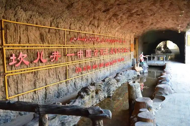
Toksun is not only wind and road. Its territory holds some of the strangest rock in the basin. The Panjir strange stone forest, or Pangjier, is a sprawl of wind-carved limestone towers in the west of the county, and the Kerjian area preserves both yardang landforms and a set of ancient rock carvings, including a carved water-system map that researchers describe as a world first. There are forty Tang-dynasty beacon towers scattered across the county, quiet evidence of just how old the Silk Road station here is.
None of these are marquee attractions with ticket gates and tour buses, and that is the point. They suit a traveller who would rather walk a dry riverbed and read the geology than queue for a photo. The Hongshan Reservoir and the Baiyang and Alagou river systems, thin as they are, are the reason any green exists here at all.
When the wind drops: Toksun’s calendar
Toksun wears its best face in spring. The county bills itself as Xinjiang’s first spring, because its basin floor warms earlier than almost anywhere else in the region, and the apricot trees around the seat burst into white and pink blossom in late March, weeks ahead of the Ili valleys to the north. The annual apricot festival draws crowds from Urumqi for exactly this reason. Summer is brutal, with basin temperatures that rival Turpan’s own and a wind that turns gritty. Autumn is the kindest season to actually move around, with the red-date and melon harvests in full swing. Winter is cold and very quiet.
If you are matching the wider region, our month-by-month guide to Xinjiang lays out the trade-offs across the whole province.
Sleeping in the county seat
The seat, Toksun Town, has the full range of rooms: budget guesthouses, mid-range business hotels, and a few newer places with reliable heating and parking. Prices stay well below Turpan city and a fraction of what you would pay at any scenic area. My habit is one night here as a buffer, especially in spring when the wind makes a fixed plan risky. Book ahead only if you are travelling on a holiday weekend; otherwise you can usually walk in.
Eating in Toksun: dates, black sheep and the noodle festival
Food is where the county quietly outperforms its size. Toksun holds the national title of home of early-ripening red dates and early apricots, and a bag of local dates from a roadside stall is the best souvenir you can carry. The Toksun small black sheep, raised on the basin’s sparse pasture, is genuinely prized across Xinjiang for its meat. The county also hosts a banmian noodle festival.
For a sit-down meal I default to a Hui-run noodle shop or a Uyghur kitchen doing lamb with naan, then buy dried fruit for the road. If you want the regional context, our page on Turpan’s grape harvest explains how the same basin climate that ripens dates here sweetens the famous vines forty kilometres east.
Practical notes for a windy stop
A few things I learned the hard way. Card and phone payments work in the seat, but small stalls and the orchard villages still like cash, so keep some. The wind closes the G30 and the railways more often than any other stretch between Urumqi and Turpan, so never schedule a tight connection through here in spring. Altitude is a non-issue on the basin floor, but if you drive west toward the Tianshan passes the number climbs fast. And the Flaming Mountains just east of town are exactly as red and as hot as the name promises, which our Flaming Mountains guide covers in full.
The oasis itself depends on the karez, the underground canal system that has drawn groundwater to the surface here for over two thousand years. Our piece on Turpan’s karez wells explains how the same engineering keeps Toksun’s fields alive in a place that sees less than six millimetres of rain a year.
A half-day and a one-night plan
This is the loop I give friends with a free day between Urumqi and Turpan.
Afternoon, arrive and look up. Drive in from Urumqi, check into the seat, and walk the main street. Eat noodles, buy dates, and watch the wind work the awnings.
Next morning, geology without the crowds. If the wind allows, head west toward the Panjir stone forest or the Kerjian carvings for a half day of wind-carved rock and old Silk Road traces. Return to the seat for lunch.
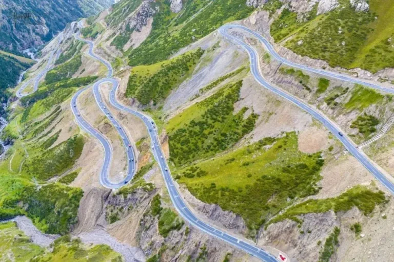
Afternoon, onward. Either continue east to Turpan and the Flaming Mountains, or turn south on the G314 toward Korla. Either way you have used the wind gap as a base instead of a blur through the window.
Questions travellers ask about Toksun County
Is Toksun worth a separate trip? On its own, probably not for a first-time visitor with two weeks. As a buffer, a food stop, or a geology half-day between bigger names, it is genuinely useful and refreshingly untouristed.
Do I need a border permit? No. The county seat and its attractions are not restricted areas. Permits only enter the picture if you push toward certain border zones elsewhere in Xinjiang.
Why is it so windy? The basin funnels air between the Tianshan to the north and the ranges to the east, and the open Gobi to the south gives that air nothing to slow it. The result is one of China’s windiest corridors.
Can I see the Flaming Mountains here? The red ridges run along the northern edge of the basin, so yes, you see them from the seat and from the G30. They are the same mountains Turpan is famous for, just at their western end.
Before you rely on this: a disclaimer
This guide is built from personal stops and public sources, not from a tour operator. Wind closures, train schedules, festival dates, and hotel openings change, and the blossom window shifts with the weather by as much as two weeks. Treat the specifics as a starting point and confirm the live details close to your travel dates. I have no commercial stake in any hotel, restaurant, or wind farm named here. The figures on area, population, rainfall, and wind come from the Toksun county government profile (2025) and the People’s Daily report on the Turpan wind base (2025), not from memory.
Who wrote this and why it’s trustworthy
I’m Karl Huang, and I have been writing about Xinjiang travel for foreign visitors since 2019, with a focus on the Silk Road corridors and the basins most tourists skip. I have driven the G30 through Toksun in calm and in gale, eaten in its noodle shops, and waited out its wind more times than I care to count. Where I cite numbers, they come from the county government and published reporting, and I keep these notes current when roads, railways, or wind patterns shift.