Published: August 10, 2026 | Author: Karl Huang
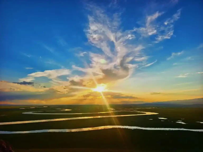
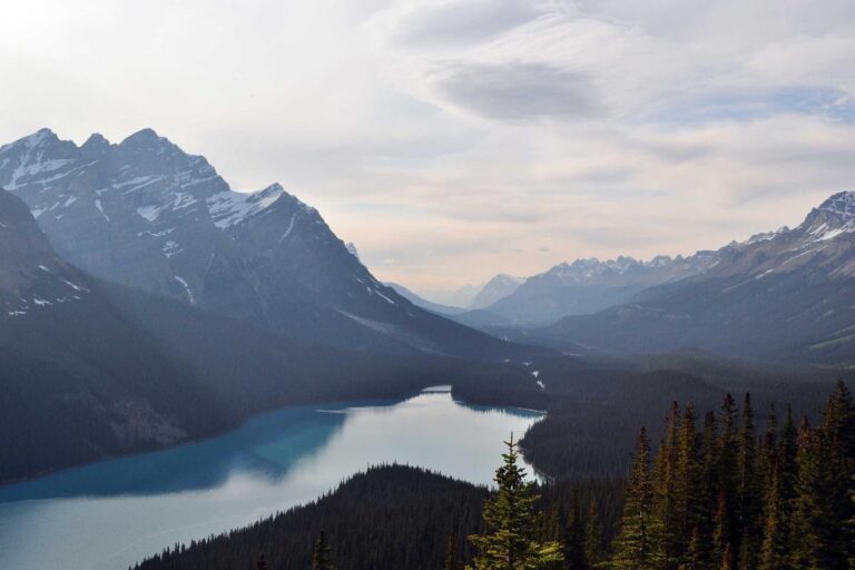
The Wusun Ancient Road is the route I keep naming when travelers ask which Xinjiang crossing actually lives up to its reputation. It runs straight through the spine of the Tianshan, joining the green river country around Tekes in Ili to the wide wetlands of Bayinbulak more than 120 kilometers to the east. I first walked a section of it in late June three summers ago, and the mix of high passes, horse trains, and open grassland camps is still the clearest sense I have of what a real cross-mountain journey here demands.
Why this old trail still carries weight
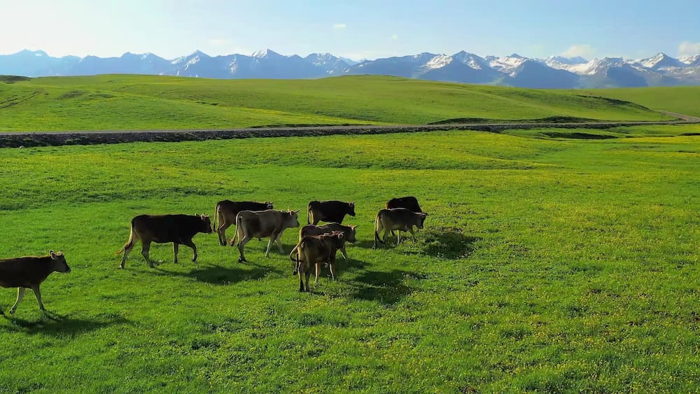
The road is named for the Wusun, a horse-raising people who moved between the Ili basin and the lands east of the Tianshan over two thousand years ago. What you follow today is not one paved line but a chain of riverbeds, switchbacks, and summer pasture that herders still use to drive sheep and horses over the same cols. That is the part no photograph shows: you are on a working landscape, not a preserved site. When our guide pointed out a cairn of white stones at a pass, he said it had been there since his grandfather’s time. I believed him.
Wusun Ancient Road at a glance
| Distance | About 120–130 km end to end |
|---|---|
| Typical duration | 6 to 8 days on foot or horseback |
| Highest pass | Around 3,600 m, snow can linger into July |
| West trailhead | Near Tekes / Kalajun, Ili Prefecture |
| East trailhead | Bayinbulak grassland, Hejing County |
| Best window | Late June to mid-September |
| Permits & guide | Required; arrange through a registered local operator |
| Difficulty | Strenuous; river crossings and altitude |
What the walking actually felt like
We left the Tekes side on a cold morning, the grass still silver with dew. The first two days climb gently along a river that thins as you rise, and the sound of it stays with you long after the water is gone. On the third day we reached the main pass. I remember stopping at the top because the wind simply would not let me talk; the bay mare our group shared just lowered her head and waited. Below us the land fell away into a different shade of green, and that was the moment the road earned its name for me.
The descent is harder than the climb. The trail becomes loose scree, then a series of short, steep pitches through spruce. Our porter horses handled it without drama, but two people in our group twisted ankles on the same afternoon, which tells you something about the footing. We camped that night beside a side stream at about 2,900 meters, and the cold came down fast once the sun dropped behind the ridge.
The hardest moment was not the pass but the river crossing on day four. The water came to mid-thigh and moved faster than it looked; our guide untied the horses and walked them across first, then came back for the people one at a time, linking arms. I had read about these crossings and still underestimated them. Keep your boots on, he said, because the round river stones will take a bare foot out from under you in a step. He was right, and I was glad to be holding the lead rope instead of guessing.
How to reach the trailheads
Most trekkers start from the Tekes side because the approach is easier to arrange. Fly into Urumqi, then take a regional flight or an overnight bus to Yining, the main city of the Ili valley, and from there it is a few hours by hired car south to Tekes. The final stretch to the trail gate is a rough county road that a normal sedan will struggle with after rain, so build the 4×4 into your booking from the start. If you would rather keep to roads, the self-drive Xinjiang guide explains how to move between the region’s towns on your own wheels. The Duku Highway runs roughly parallel to the northern edge of the range and is the usual way to reach the Bayinbulak exit by vehicle. From Urumqi you can reach both ends by long-distance bus or flight plus a hired 4×4; do not expect public transport to the actual trail gates. Plan your exit before you start, because once you are in, there is no quick way out except the way you came or a pre-arranged pickup at the far end.
Best time to make the crossing
Late June through mid-September is the only window I would recommend. Before then the high pass can hold snow and the river crossings run fast and cold; after mid-September the nights drop well below freezing and herders have already moved their animals down. July and August bring wildflowers across the middle meadows and the steadiest weather, though afternoon storms are common, so we learned to be off any exposed ridge by early afternoon.
Where you sleep on the way
There are no hotels on the route. You either camp or, on the lower sections, arrange a yurt stay with a herding family. We carried our own tents and a guide who packed cook gear on the horses, which is the standard setup for foreign visitors because it removes the need to rely on chance encounters. A good operator supplies a mess tent and a stove; that stove was the difference between a rough night and a bearable one when a hailstorm hit on day five.
Food on a multi-day trek
Plan for simple, calorie-dense food. Our cook boiled laghman over the fire and fried flatbread in a pan that saw every meal. You will not find restaurants past the first village, so carry enough for a day longer than your plan. Water is plentiful from streams, but treat or boil it; the precaution I skipped on day two left me cautious for the rest of the trip. Bring salt tablets and a real amount of snacks, because the climbing burns through you faster than it feels. Dried fruit and nuts from the Yining bazaar made up most of my trail breakfast, and a vacuum flask of milk tea at camp was worth more than any fancy ration. If your operator offers a resupply at the mid-route yurt, take it; the second half of the trail is leaner than the first.
Practical tips before you go
- Book a registered local operator at least a month ahead. Permits and a licensed guide are not optional.
- Pack for two seasons: a t-shirt for the valley, a sub-zero bag for the pass. The swing is real.
- Break in your boots before you fly. The scree sections punish new footwear.
- Carry cash. Signal disappears for days, and there is nothing to buy anyway, but your operator may need a deposit paid offline.
- Tell someone your exact plan and expected exit date. The trail is long and quiet.
A realistic 7-day sample itinerary
Day 1: Tekes to first riverside camp (2,100 m). Day 2: climb to alpine meadow camp (2,700 m). Day 3: cross the main pass and descend to spruce camp (2,900 m). Day 4: long valley walk to a herder yurt stop. Day 5: river-terrace camp after the hailstorm zone. Day 6: gentler descent toward the Bayinbulak side. Day 7: exit to the grassland and transfer out by vehicle. This is a pace for fit walkers, not a race; build a rest day if your group is mixed.
Frequently asked questions
Can I walk the Wusun Ancient Road independently? Not as a foreign visitor. Permits and a licensed guide are required, and the terrain makes solo travel unwise.
Do I need to ride a horse? No. Many groups walk and let pack horses carry loads. If your knees dislike descent, riding part of the way is a reasonable option.
How fit should I be? Comfortable with 15–20 km days and 800 m of climbing. The altitude, not the distance, is the harder part.
Is there phone signal? Sporadic at best. Expect to be offline for most of the week.
What about the Kalajun grassland I keep hearing about? It sits above the Tekes trailhead and is a common warm-up hike before the full crossing, worth a day on its own.
After the trail: recovering
Most groups end at Bayinbulak and drive out along the highway. A hot spring soak near the northern road is the traditional reward, and after a week of cold camps it felt less like a luxury and more like repair.
Disclaimer
This account is based on a single guided crossing and standard operator practice; conditions, permits, and access rules change. Verify the current permit requirement, trail status, and weather with a licensed local operator and official sources before you commit. I am not a mountaineering instructor, and nothing here replaces proper preparation, insurance, and a guide.
About the author
Karl Huang is a travel writer focused on overland and trekking routes across Xinjiang. He has walked and driven sections of the Tianshan corridor over several seasons and writes from first-hand experience rather than second-hand summaries. His work on this site aims to give independent travelers accurate, practical detail they can actually use.