Published: August 18, 2026 | Author: Karl Huang
Most travelers to Xinjiang hear about “the desert” as if it were one place you either love or skip. It isn’t. On our third Xinjiang loop we kept hitting the same planning question — Taklamakan vs Gurbantunggut — because the two largest deserts in China sit at opposite ends of the region and behave nothing alike. The Taklamakan is a closed bowl of shifting sand in the south; the Gurbantunggut is a vegetated, snow-dusted expanse in the north you can reach before lunch. We have now crossed one on a highway built through the dunes and stood in the other beside a frozen bush in February. This guide is built from those trips, including the gear we actually packed and the mistakes we made, so you can decide which desert earns a place on your route.
Quick Reference: Taklamakan vs Gurbantunggut
| Factor | Taklamakan | Gurbantunggut |
|---|---|---|
| Location | Tarim Basin, southern Xinjiang | Junggar Basin, northern Xinjiang |
| Size | ~337,000 km² (China’s largest) | ~48,800 km² (China’s second largest) |
| Sand type | Active, moving dunes | Fixed and semi-fixed, vegetated |
| Can you visit? | Only by desert highway or expedition | Drive-up fringe, easy day trips |
| Best season | October–April (avoid summer heat) | December–February for snow, Sept–Oct for color |
| Risk level | Serious; permits and support needed | Low; normal road caution |
Taklamakan vs Gurbantunggut: Which One to Visit
People ask us which is “better,” and the honest answer is that they are not the same kind of place. The Taklamakan holds roughly 337,000 square kilometers of active dunes and almost no life inside it; the Gurbantunggut covers about 48,800 square kilometers but stays mostly pinned under sagebrush, so the wind only rarely buries the road. If your trip is built around comfort and photo stops, the north wins. If you want the deep-desert experience travelers have written about since the Silk Road, the south is the one you feel in your chest. We stopped comparing them as rivals and started treating them as two different days on one long trip.
What We Found Between the Two
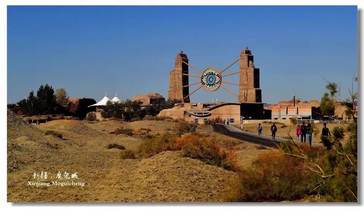
We crossed the Taklamakan on the Tarim Desert Highway from Luntai down to Minfeng — about 520 km of tarmac with a green belt of desert poplar and a piped water station every four kilometers, the whole thing built to keep the sand off the road. What caught us off guard was the silence. No town, no fuel, no phone signal for most of the way. The dunes roll on both sides like frozen surf, and the only movement is the wind redrawing the ridges. We carried 60 liters of water, a satellite phone and a second spare tire. That is not luxury gear; on that road it is the floor.
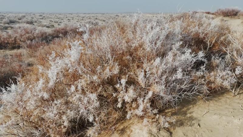
The Gurbantunggut Desert, by contrast, we reached on a normal morning out of Urumqi. We drove the northern fringe toward Karamay and pulled over where the sagebrush opened into low dunes. In February those dunes carried a thin crust of snow, and a herder passed us on a motorbike hauling fodder. We drank tea by the car and watched the light go flat and silver. The point is not that one desert is “nicer” — it is that one is a place you survive and the other is a place you linger.
Getting There
The Taklamakan is landlocked by the Tarim Basin and ringed by oasis towns: Kashgar, Aksu, Korla, Hotan, and Korla on its northern edge. The two main crossings are the Luntai–Minfeng highway running north–south and the Aral–Hotan road running east–west. Both are paved and patrolled, but you should not attempt either without a full tank and a written support plan. Driving off the highway into the basin is something we do not recommend to anyone without a registered guide.
Gurbantunggut sits north of Urumqi and wraps around Karamay and Shihezi. You reach it on the G216 or the desert roads toward Fukang and Wujiaqu. No permits, no support vehicle — just a normal car and a full day. If you want the desert feeling without the expedition logistics, this is the one to pick. We left our hotel at 8 a.m. and were standing on the sand by 9:30.
Best Time to Go
For the Taklamakan, aim for October through April. Summer surface temperatures pass 70°C and the highway shimmers with heat that fogs the camera sensors. We went in late March and had clear skies with manageable 20°C days and cold nights. The flip side is that winter crossings can drop below freezing, so pack for both. For Gurbantunggut, the standout window is deep winter — December to February — when snow sits on the dunes and the whole basin goes quiet and white. Autumn, around September and October, is also strong if you prefer the sagebrush gold to the snow.
Where to Sleep
On a Taklamakan crossing you sleep at the ends, not in the middle: a hotel in Luntai or Korla before you start, and Minfeng or Aral after you finish. The highway itself has no lodgings, only the pump stations, and those are not open to guests. For Gurbantunggut, base yourself in Urumqi or Karamay and run it as a loop; both cities have every hotel tier from hostels to international chains. We stayed in Karamay and were on the dune edge with coffee in hand by mid-morning, which tells you how little planning the north desert demands.
Food Along the Edge
The oasis towns feed you well. In Korla we ate pear-fed lamb and passed through Turpan-side stalls selling raisins and fresh naan by the road. On the Gurbantunggut side, Karamay’s night market does hand-pulled laghman and grilled chuanr that taste better for the cold air. Carry your own water and snacks for the actual Taklamakan crossing — there is nothing between the pump stations, and the distance between them is longer than it looks on a map.
Photography Notes
We shot the Gurbantunggut in January with a 35mm and barely moved — snow on low dunes and grey sage made a minimalist frame that needed no editing. The Taklamakan is harder: heat haze by day, and at the pump stations the only subject is the road itself stretching to a shimmering point. Go at first light, when the dune shadows run long and the tarmac is empty. A polarizer helps cut the glare, but nothing fixes a midday white-out, so plan the south desert around the early hours.
Practical Tips We Wish We’d Known
- Fill fuel at both ends of any Taklamakan crossing. Stations sit roughly 200 km apart and close earlier than you expect.
- Download offline maps before you leave the oasis ring. Signal dies the moment you commit to the highway.
- Carry two spare tires on the Taklamakan; thorns and heat wreck them faster than anywhere else we drive.
- For Gurbantunggut in winter, pack real cold gear — the wind cuts hard even at noon.
- Never leave the pavement in the Taklamakan without a registered guide and a permit.
Sample 5-Day Desert Loop
Day 1: Fly into Urumqi, drive to Karamay, overnight. Day 2: Morning on the Gurbantunggut fringe (snow dunes, sagebrush), afternoon back to Urumqi. Day 3: Train or flight south to Korla; overnight. Day 4: Early start on the Luntai–Minfeng highway across the Taklamakan; reach Minfeng by evening. Day 5: Explore Minfeng’s edge oases, then fly out from Hotan or return north. This gives you both deserts in one trip without rushing either, and it keeps the hard day (the crossing) bracketed by easy ones.
FAQ
Can I drive across the Taklamakan myself? Yes, on the marked desert highways, in a solid vehicle with full fuel and spares. Do not go off-road without a permit and a support team; the basin has no margin for a breakdown.
Which desert is safer for a first-timer? Gurbantunggut, without question. It is accessible, signed and close to cities. The Taklamakan is an environment, not a picnic spot.
Is the Taklamakan camel trek still running? Organized treks exist but are expedition-grade and need advance booking and permits. See our Taklamakan camel trek guide for the current operator notes and season.
When is the snow best in Gurbantunggut? January gives the deepest cover; February is reliable and a little warmer. Either month beats the summer, when the north desert is just hot scrubland with the occasional dune.
Can I see both deserts without a car? Gurbantunggut is reachable by tour from Urumqi. The Taklamakan crossing really needs your own vehicle or a booked transfer, since public transport does not serve the highway itself.
Disclaimer
This article reflects our own trips and is written for general planning only. Desert conditions, road status and permit rules in Xinjiang change without notice. Always check with local tourism offices and your embassy’s travel advice before setting out, and never rely on this guide alone for safety-critical decisions. We are not responsible for changes in access or conditions after publication.
About the Author
Karl Huang has spent eight seasons driving and guiding across Xinjiang, from the Junggar Basin to the Tarim rim. He writes the field notes for XinjiangAttractions.com from first-hand routes, checked against local tourism bureaus and park rangers. His focus is practical, experience-led travel information that helps independent visitors plan safely and realistically.